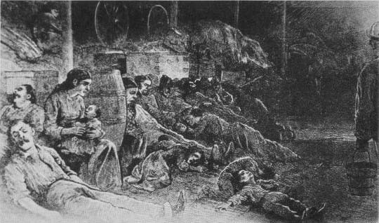
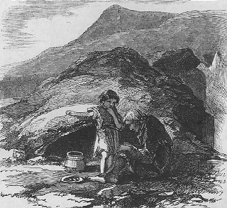
Children play with human bones, Toronto Star, May 6, 1959Children play with human bones, Toronto Star, May 6, 1959
Children play with human bones, Toronto Star, May 6, 1959
Children play with human bones, Toronto Star, May 6, 1959
A long time ago, before most of us knew anything about pandemics, social isolation (quarantine) and social distancing, Toronto knew epidemic disease too well. Travellers bought it here: some were sick when they arrived, others appeared healthy but were already infected. But these weren’t tourists or people returning home after a business trip or a holiday oversea. These were what some term “economic refugees”. They were Irish fleeing the Potato Famine, hoping to find food and a home, desperate, some already beginning to starve. There was no Canadian Border Agency to stop them. They had no visas, they just came.
The Instigator
On August 20, 1845, the curator of Dublin’s Botanic Gardens. David Moore, discovered the potato blight Phytophthora. The wind or a careless botanist carried the spores of this American mould (an oocyte, not a fungus) across the Atlantic to Europe. Since potatoes spread vegetatively, the Irish potatoes were genetically alike: clones. Several varieties of potato were grown in Ireland, and the very worst of them — lumpers — were what the peasants ate. With no genetic diversity, the lumper variety that the Irish ate had no resistance to the unknown pathogen. Potato blight withered the foliage in the field, turned the spuds in the ground into a gooey, stinking inedible mass and even rotted the tubers in storage.
The potato was the staple food for poor people across Western Europe by this time. But the Irish poor were particularly reliant on it. Potatoes provide everything except calcium and vitamins A and D, which are readily available from milk, and many Irish families kept a cow and, if a little more prosperous, a pig. A simple diet of potatoes and milk did provide a healthy diet for people with little access to other foods, such as fresh fruits and vegetables.
Potatoes are easy to grow. A large crop can be grown on a tiny plot of land. Few tools are required, just a spade and a pot and a peat fire to cook your spuds on. Potatoes produced more food per acre than any other crop Irish farmers had grown before. They produced more calories per acre. Rye was the only grain that could be depended on to ripen in the short, rainy summers of Northern Europe that extended from the North Sea to the Ural Mountains. Four times as many people could live on potatoes from the same amount of soil that produced rye. Potatoes could be planted in the fallow fields required for the cultivation of rye. One acre could feed eight people. A working man could live on three kilos of potatoes a day, supplemented by milk. He could eat 16 potatoes at a sitting.
Aerial view of the Lazy Beds on North Rona, Ireland, by Nanooki, 2016, Public Domain
Potatoes came to be propagated in lazybeds, a kind of raised row of self-draining potato hills, throughout Ireland. Lazybeds could be prepared on any type of ground regardless of stones, soil quality or even how level it was. The ridges of lazybeds show up on aerial photos of long abandoned fields in Ireland.
The Irish tenant farmer raised a pig not to be eaten but to pay the annual rent. Most tenant farmers sold other crops, such as wheat and oats, to pay the rent. Landlords had grown wealthy exporting these cash crops to England. Food exports continued without slowing throughout the Famine. The British government could have banned the export of grain during the Famine, saving many lives. They didn’t.
Only in Ireland that did the potato became the sole subsistence crop. Disaster struck Ireland in 1846 when a blight struck the potato, robbing the common people of sustenance and hope. In 1846 winter was particularly severe. This was the mid-nineteenth century Little Ice Age. Starving people foraged through snowdrifts for weeds, roots or anything edible. People stole turnips, sheep and goats. Pigs disappeared. Dogs and cats disappeared. People ate nettles and other wild plants in order to survive. Beggars wandered the roads, sleeping in ditches and under bridges, in rags. In the footsteps of famine followed cholera and typhus, sweeping millions of Irish away like a tide sweeps sand off rocks.
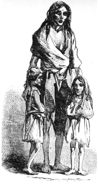
“Had only one child or a few children been so afflicted…aid would have been immediately forthcoming from relatives, neighbours, even strangers. But there were thousands of them, and they were everywhere, inside and outside hovels, in the towns and along the roads. They no longer spoke, much less cried; they just stared with a gaunt unmeaning vacancy, a kind of insanity, a stupid, despairing look that asked for nothing, expected nothing, received nothing.”
Bridget O’Donnell and her children
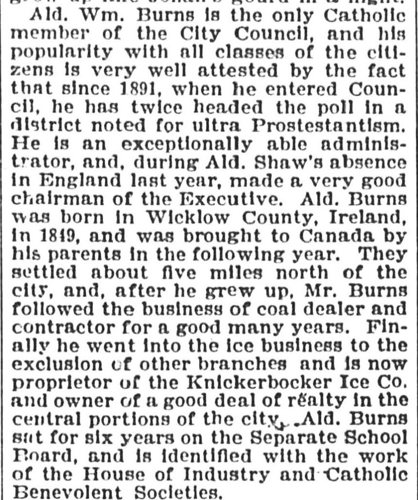
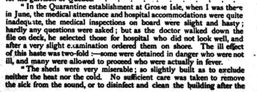
Grosse Île
Officers Quarters, Grosse Île
Nearly 30,000 came Irish came to Canada in 1845. This was more than twice those arriving in 1844.
The blight did not strike again in 1847, but by then many had nothing left. They had sold everything they had for food. They ate their seed potatoes and could not any to plant. In 1848 the blight would strike again.
The landlords were strongly motivated to send their tenant farmers to North America. If a tenant was driven into the Poor House by starvation, the landlord had to pay 12£. The landlord could put a family on a coffin ship for only 6£.
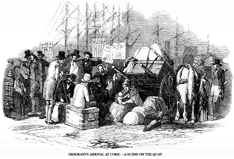
It usually took five to eight weeks to reach North America. But in 1847 late sea ice slowed the trip. Canada was not the destination of choice for most Irish Catholics. They wanted to go the U.S. But, aware of the rising tide of poor and sick Irish, the American government raised a tariff on the immigrant ships and passed a rule making the ship master responsible financially for his immigrant passengers for up to two years. So, the ships headed for Canada.
In 1847, 90,000 Irish landed at Quebec.
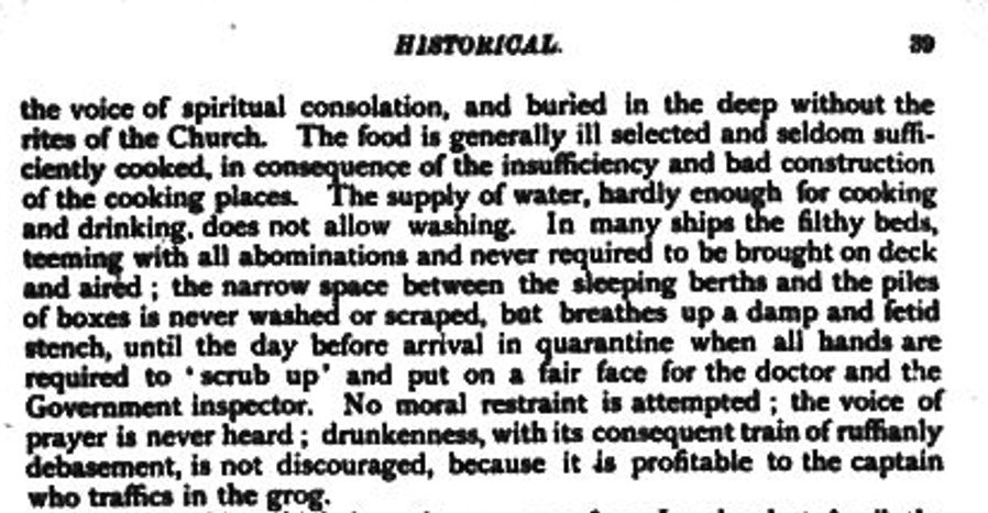
The quarantine station at Grosse Île
Ships anchored in the Gulf of St. Lawrence to drop their passengers at the quarantine station on Grosse Île. Immigrants needed a health certificate in order to go on. “Coffin ships” were hulks (“old tubs”) used in the lumber trade out of Quebec. With holds full of pine, they floated high and were seaworthy. Without lumber they were sieves.
Irish coffin ships
“The fever fleet” with Irish crowded below deck without water, food or toilets. These were the poorest of Ireland’s poor; the workhouse or the landlord paid their fares just to be rid of them. The fare was one or two pounds, but people didn’t have enough food and starved on the way or died of typhus. Many subsisted on “rat stew”. 40,000 died on the ships or shortly after debarking. Their bodies were usually thrown into the sea. Starvation, cholera, typhus and other diseases killed as many as over two million Irish. Most lie in unmarked graves, unrecorded, on the shores of the St. Lawrence, Lake Ontario or in the cities of the Great Lakes, in the lakes or in the sea itself.
Those who governed Canada was not uninformed. They knew by April of 1847, according to an article published in the Quebec City newspaper Le Canadien, that 100,000–possibly 200,000–Irish immigrants would come up the Gulf of the St. Lawrence that year, nearly two months before the first ships arrived. They knew that 28,000 Irish in absolute destitution had embarked from Liverpool and Irish ports. Yet Doctor Douglas, in charge of the quarantine station on Grosse Île, was not given the extra funds he requested. So, on May 4, 1847, he opened up his hospital with his usual staff of just three. Consequently, the hospital and the whole island was swamped by sick immigrants who died in the woods, on the beaches, in sheds and tents, virtually unattended. The Famine did not discriminate. Grosse Ile itself had a Catholic and a Protestant chapel.
Memorial cross, Grosse Île
The first Irish Memorial on the island can be seen as the boat approaches the island. The Ancient Order of Hibernians put up a 50-foot high Celtic Cross on August 15, 1909, in memory of the Irish buried on Grosse Ile. The base of the cross has inscriptions on 3 sides – in Gaelic, English and French. Both the English and French translations have a less bitter inscription than that of the Gaelic. The Inscription in both French and English read:
...to the sacred memory of thousands of Irish who, in order to preserve their faith, suffered famine and exile, and, victims of typhus, ended their sorrowful pilgrimage here, comforted and strengthened by the Canadian Priests. Those who sow in tears reap in joy.
The Gaelic inscription reads:
Children of the Gael died in their thousands on this island having fled from the laws of the foreign tyrants and an artificial famine in the years 1847-48. God’s loyal blessing upon them. Let this monument be a token to their name and honour from the Gaels of America. God Save Ireland.
The Irish Stone
The Black Rock, Irish Commemorative Stone, Montreal, courtesy of Coastal Elite from Halifax, Canada – The Black Rock: Irish Commemorative Stone, Montreal, 2017, CC BY-SA 2.0, https://commons.wikimedia.org/w/index.php?curid=90571606
At Montreal passengers changed to barges and steam ships, stopping to unload dead and dying.
In the centre of a railed-in spot of land at Point St. Charles, within a hundred yards or so of the Victoria Bridge, that wondrous structure which spans the broad St. Lawrence, there is a huge boulder, taken from the bed of the river, and placed on a platform of roughly hewn stone; and on that boulder there is this inscription:
TO Preserve from desecration THE REMAINS OF 6 THOUSAND IMMIGRANTS, Who died of Ship-fever, A.D. 1847-8, This stone is erected by the WORKMEN OF MESSRS. PETO, BRASSEY, and BETTS, Employed in the Construction of the Victoria Bridge, A.D. 1859.
As the immigrants moved up the St. Lawrence and into Lake Ontario, ports along the way tried to hustle them on. Though the Government knew in advance for several months that thousands of destitute Irish were coming, little was done. There was not enough food, beds, doctors, medicine or shelter. Saving money was more important that saving Irish lives, particularly Catholic ones. Lord Grey stressed in a communiqué to Governor General Lord Elgin said: “The importance of enforcing the strictest economy in affording such assistance, if not rigidly guarded, may have the effect of inducing the emigrants to relax in their exertions to provide for themselves.”
The Government only provided a daily ration of three quarters of a pound of bread and meat. A pound of raw beef has about 600 calories. A half pound of whole wheat bread has about 450 calories. Their diet allowed just over 1,000 calories a day. The Government also restricted shelter in the board of health immigrant sheds to a maximum of six days or even less. Many perished who might have lived had politicians and officials provided the extra funding requested by local authorities. Instead, they continuously pushed the immigrants farther up the river to no set destination.
Toronto 1847
A portrait of Michael Power, the first bishop of Toronto. This is a colourized version of a black and white portrait painted posthumously, after his death. By Good Old Pete – Own work, CC BY-SA 4.0, https://commons.wikimedia.org/w/index.php?curid=116575690
In Toronto, a Roman Catholic bishop did his best to prepare for the looming disaster. In 1841 the Catholic Church divided Upper Canada into two dioceses. Michael Power, an Irish Canadian born in Halifax, became Toronto’s first Catholic bishop. His father was a sailor; his mother kept a boarding house. He and many of his priests and parishioners as well as many other Torontonians prepared themselves to do what they could. Toronto had only 21,000 residents then. 38,560 immigrants were to come to Toronto that year.
Looking across Toronto Harbour to the City of Toronto from where the fisher folk lived on Toronto Island, Pictorial Times of London, 1846
The Jane Black was the first famine ship from Ireland to arrive in Toronto. She arrived from Limerick on May 23, 1847.
The Provincial Secretary, Dominic J. Daly, instructed Mayor W.H. Boulton to build hospitals and sheds for the migrants. He promised that the City of Toronto would be reimbursed by the Province of Upper Canada, but Daly also pointed out in his directives, on June 7, that municipalities were responsible for direct aid through their mandated Boards of Health. The Immigrant Sheds or “Fever Sheds” were near the Toronto General Hospital at King and John Streets. Even those who were very sick were only allowed to lie there for 6 days. Then they went to a convalescent home near Bathurst and Front, walked down the roads leading out of Toronto to find work and sustenance or died on the way, lying unburied in fields and under hedges.
Thus began a flood inland. Before June 7, 1847, only 2,592 migrants had landed in Toronto, less than seven percent of the season’s total migrants came to Toronto. By late June 1847, city officials knew that sick migrants were not being landed in Montreal or Kingston (or ports along the way). Instead, they were being passed on to Toronto, which one local described as “a general Lazaretto” or pest house.
On June 8, the City of Toronto landed 700 men, women, and children. Of these 250 (adults) were described as “indigent”; they arrived from Kingston at the “expense of the Government”. Local journalists noted these poorer migrants came from the south and west of Ireland. The adults in “good circumstances” came from Ulster and England.
Landing place and wharf at the foot of Simcoe Street, 1841.
Those who managed to make it to Toronto had to disembark at Reese’s Wharf, near the foot of Simcoe Street, where the Metro Toronto Convention Centre is now. Edward McElderry, the local Emigration Agent and representative of the Government of the Province of Canada and Constable John B Townsend, the Clerk of the Toronto Board of Health, processed them in a make-shift shed. Simcoe Street docks: the “quay at Toronto was crowded with a throng of dying and diseased abjects; the living and the dead lay huddled together in horrible embrace,” reported The Times of London.
They arrive here to the extent of about 300 to 600 by any steamer. The sick are immediately sent to the hospital which has been given up to them entirely and the healthy are fed and allowed to occupy the Immigrant Sheds for 24 hours; at the expiration of this time, they are obliged to keep moving, their rations are stopped and if they are found begging are imprisoned at once. Means of conveyance are provided by the Corporation to take them off sat once to the country, and they are accordingly carried off “willy-nilly” some 16 or 20 miles, North, South, East and West and quickly put down, leaving the country to support them by giving them employment….It is a great pity we have not some railroads going on, if only to give employment to these thousands of destitute Irish swarming among us. The hospitals contain over 600 and besides the sick and convalescent, we have hundreds of widows and orphans to provide for. — Larratt Smith
No one was immune. When the typhus –ridden ships arrived to disembark refugees from the Potato Famine, clergy including Catholic Bishop Michael Power and Anglican Bishop John Strachan and the rector of Little Trinity19 (who died of fever), doctors, many government officials and volunteers there for them. As the Bishops and other priests bent over to hear every word and administer the Last Rites, the fleas and lice that spread typhus moved from the dying to the living.
A Toronto doctor lamented:
“Victim after victim is offered at the shrine of duty… The physician is compelled almost to exist in an atmosphere highly impregnated with poisonous miasma; and in the discharge of a most but imperious duty, which his obligations forbid him from betraying, in innumerable instances pays for his devotion with his life…. During the imported fatal fever which has ravaged this country, we have had to deplore the decrease of many valued members of the profession.”
As June passed hundreds more immigrants came, and the Board of Health came under heavy pressure to meet the needs of the sick migrants while coming up with money for medicines, beds, and larger buildings. Infectious patients should not be admitted to the General Hospital where they could spread pestilence to Torontonians.
The City passed sanitary regulations to set up Emigrant Sheds to quarantine the victims of typhus and cholera. The Board of Health contracted the building of sheds on the grounds of the General Hospital. They were at first 50×10’ with open-side and with 2 rows of seats, “to protect the emigrants therein from the sun’s rays”. The first in the city, were established at the north-west corner of King and John for cholera. Other sheds were set up near Bathurst (site of Lamborghini dealership) for typhus.
Toronto Board of Health,
SANITARY REGULATIONS,
ADOPTED BY THE BOARD OF HEALTH,
JUNE 19, 1847.
First—That all Emigrants arriving at this Port by Steamers or other Vessels be landed at the Wharf at the foot of Simcoe-street, commonly known as Dr. Rees’ Wharf, and there only. And the Master of any Steamer or other Vessel violating this Regulation, will subject himself to the penalties prescribed by the City Law in that case, made and provided.
SECOND—That all Emigrants arriving at this Port, at the public charge except only those who come hither to join their friends or connections residing in, or in the immediate neighbourhood of this City, be forwarded to their intended destination by the very first conveyance, by land or water, which the Board of Health or the Emigrant Agent may provide for that purpose. That after the means of conveyance, as aforesaid, shall have been provided for them, no such Emigrants shall be permitted to occupy the Emigrant Sheds, or to receive the Government allowance of provisions, except only in case of sickness of the Emigrant or his family, and except in such special cases as may be sanctioned by the Board of Health.
THIRD—That provision being made for all such Emigrants during their necessary detention in the City, no such Emigrant will be allowed to seek alms or beg in the City, and anyone found doing so, will be immediately arrested and punished according to the City Laws, in such case made and provided.
FOURTH—All Tavern-keepers, Boarding or Lodging—Housekeepers, and other persons having Emigrants staying in their premises, are required to make immediate report to the High Bailiff, or other Officer on duty at the City Hall of any sick person who may be staying in their houses; and any Tavern, Boarding or Lodging-Housekeeper, who shall neglect to make such report of any sick person who may be in their premises, will, upon conviction, be fined conformably to the Law.
FIFTH—That the Medical Officer in charge of the Emigrant Hospital, be required to visit the Emigrant Sheds, morning and evening of each day, for the purpose of examining and removing to the Hospital all sick Emigrants, who may require medical treatment, and that the said officers be also required to visit all Steamers, or other Vessels which may arrive at this Port with Emigrants, immediately on the arrival of such Steamer or other Vessel, for the same purpose as above stated.
Published by Order of the Board of Health, Charles Daly, C.C.C. Clerk’s Office, Toronto, June 19th, 1847.
By the end of June, the Board of Health moved the General Hospital from King and John Streets. Its former buildings became the temporary home of the Emigrant Hospital. On July 9, 1847, the Toronto Mirror newspaper reported:
The state of the emigrants daily becomes worse and worse. On Wednesday, the Steamer Sovereign brought up 1,000 souls. This is a horrible traffic in human blood…what the ultimate results are to be, we shudder to contemplate: but if, in December such an extent of utter want of food prevails, whence is sustenance to come, in May, June and July, and should the potato no longer be looked forward to, as a means of relief? This is a question that should come home to the heart of every man who has a heart.
Forced to leave the City of Toronto, thousands of Irish immigrants spread out east along the Kingston Road, north on Yonge Street and west on Dundas Street. They found whatever help they could on their way. Some found work and stayed in the towns and villages along those roads. Others kept going until many ended up in the U.SA.
Leslieville, 1868
The Famine did not discriminate. Michael Power died on October 1, 1847 of typhus. He was 42. His grieving diocese buried him under the altar of St. Michael’s Cathedral, still under construction. In November 1847, Edward McElderry, the emigration agent who had met all incoming Irish refugees at Reese’s Wharf, died of typhus.
St. Paul’s Roman Catholic Church, built 1824, replaced in 1889. The church was on Power Street on the east side of south of Queen Street East.
To Leslieville
The Famine and Black ‘47 changed Toronto and Leslieville forever. By 1851-52 the Irish were Toronto’s largest ethnic group. Toronto had a large Irish Catholic element, but an even larger Irish Protestant contingent.
Many Irish Catholics emigrated to Leslieville during and after the Irish Potato Famine of the 1840s. The Fogartys, Finucans, Flynns, Larkins, Ryans, Hollands, Kavanaughs and others lived between Curzon and Leslie, north of the Kingston Road. Here they had small market gardens or slaughterhouses of their own, but Irish Catholics also took on the jobs no one else wanted. Working people did not put their economic security in “one basket”. The whole family worked at whatever they could find. They laboured for low wages in market gardens, cut ice, fished and did the unskilled jobs in brickyards.
St. Paul’s Church, Power Street, November 23, 1922 Roman Catholics worshipped at the first St. Paul’s Church (completed in 1826) at Queen and Power streets. This is a later building still standing today. There is a memorial to the victims of the Irish Potato Famine in front of the church.St. Paul’s Separate School, Queen Street East., south side, between Power and Sackville Street. This building was torn down and replaced by a new school on Sackville Street.SAINT MICHAEL’S CEMETERY, 1855
Toronto’s first Roman Catholic Cemetery was beside St. Paul’s Church which was established as a Parish in 1822. This cemetery was rapidly filled as a result of the many deaths following 1847 Irish potato famine. By the mid-1850’s another catholic cemetery was needed to serve the growing number of Parishes in Toronto. Purchased in 1854 by the Bishop of Toronto, Rt. Rev. Armand Francois Marie, Comte De Charbonnel, St. Michael’s Cemetery was opened in 1855 at the present location in Deer Park, then well north of the City of Toronto. His successor, Bishop John Joseph Lynch, enlarged the cemetery in 1866. To meet the needs of the growing catholic population Mount Hope Cemetery was opened in 1900 in north Toronto. Originally St. Michael’s Cemetery was administered by the Rector of St. Michael’s Cathedral. The Toronto Catholic Cemetery Association assumed the responsibility in 1961. Over the years some 29,000 were buried in the ten-acre cemetery.
Location, just off Yonge Street, south of St. Clair Avenue.
Until 1878, the Catholics of Leslieville walked down to St. Paul’s on Power Street for mass or St. Paul’s sent out priests to celebrate mass in their homes or in the Catholic school. There was only one Catholic graveyard in Toronto: St. Paul’s at Power Street and Queen. Leslieville Catholics buried their dead there until, in 1855 the graveyard at St. Paul’s became too full for even one more body and was closed. And that’s how the bones of Leslieville residents ended up in a schoolyard in Corktown.
a creek … also started near the sandpit and ran through the gardens of Cooper’s, Bests and Hunters, crossed the road by the Leslie Postoffice. Here it joined a small creek that drained the nursery, and both crossed Leslie street under a bridge that has since been filled up by intersecting sewers. The Globe, January 18, 1918
Not much left to see of the creek and most of us don’t know it was there. But like all ghosts, it still can haunt us even many years later.
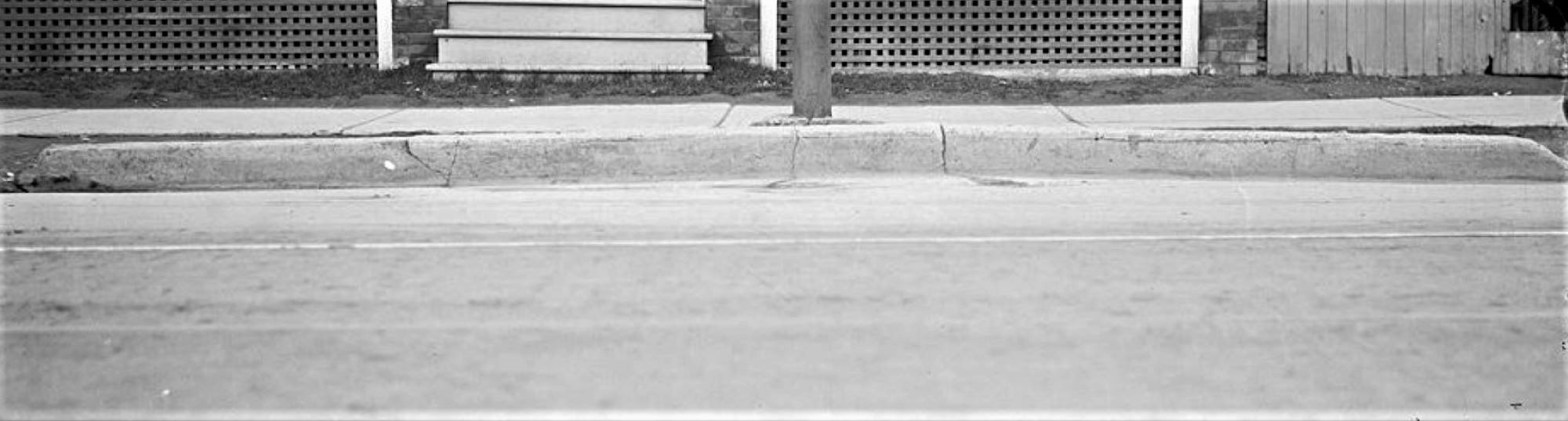
1211 Queen St. East – curb heaved up by frost and T.S.R. pole – May 4, 1915
This photo of 1211 Queen Street East shows a ghost of Leslie Creek.
Leslie Creek (now underground) crossed Queen Street and this curb was once a bridge, May 4, 1915
Leslie Creek originated in springs on the slope of the hill in the area of Strathcona Avenue and Eastview Park.
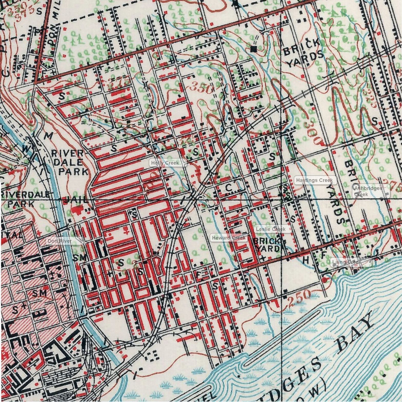
Goad’s Fire Plan, 1884, Plate 31
This was the year Riverside and Leslieville became part of the City of Toronto.Leslie Creek, 1884. Leslie Creek is on the left, Hastings Creek is on the right. Sometimes they joined before entering Ashbridges Bay and sometimes they stayed separate. Both ran into Ashbridge’s Bay where the Loblaw’s Superstore parking lot is today. It was a cove called “The Gut” where fisher folk moored their boats.
It crossed the railway tracks where Gerrard Square’s parking garage is now.
Leslieville creeks 1909, labelled
According to Elsie Hays, an old East Ender that I interviewed, it was a small brook that ran through an orchard west of Galt Avenue. She caught minnows in it when she was a child (before World War One). It crossed Gerrard where there is a shallow dip in the road to mark it.
Two branches of the creek came together and crossed the GO Train tracks (GTR) east of Marjory Avenue where it took a turn left. One branch of Leslie Creek was dammed in the late nineteenth century to form Maple Leaf Skating Rink at Pape and Gerrard, behind the Maple Leaf Tavern. There are remnants of a ravine west of Marjory Avenue south of Gerrard. Then the creek swung diagonally southeast to cross Dundas at Dagmar.
1902 map showing Leslie Creek
It continued south to cross Jones Avenue at #61 Jones Avenue where there was heavy basement flooding.
Flooded cellars on Jones Avenue were nothing new, but this must have been exceptional. Globe, April 26, 1918
It ran behind the stores on the north side of Queen Street (George Leslie’s house and selling grounds) and crossed at 1211 Queen Street East.
1211 Queen St. East, the house has since been torn down, May 4, 19151211 Queen St. East – curb heaved up by frost and T.S.R. 00
From there It continued south, curving east to enter Ashbridge’s Bay at the foot of Laing Street where there was a cove called the Gut.
The Gut is where the Loblaws Super Store and City of Toronto Works Yard are now.
A map of Ashbridge’s Bay showing Leslie Street, the old shoreline and the marsh. Don’t be confused. South is at the top of the map and north is on the bottom — the opposite of what we are used to.The Duke of York Tavern, May 4, 1915The Duke of York Tavern, May 4, 1915
A Graphic Presentation of Toronto’s Real Estate Activity, Toronto Star, May 1, 1912
Graphic Presentation of Toronto’s Real Estate Activity, Toronto Star, May 1, 1912, p. 8-9
The Real Estate Map, Toronto Star, May 1, 1912
Graphic Presentation of Toronto’s Real Estate Activity, Toronto Star, May 1, 1912 p 10Graphic Presentation of Toronto’s Real Estate Activity, Toronto Star, May 1, 1912 p. 8Graphic Presentation of Toronto’s Real Estate Activity, Toronto Star, May 1, 1912 p 9
Key to the Map
The Neighbourhoods
York MillsWillowdaleWestonUpper Don ValleyUpper Don ValleySwansea, Humber Bay, Mimico, New TorontoScarboroughRichviewNew TorontoMimicoEast Toronto, The BeachLong BranchLeasideLambton, Mount DennisEast YorkEast End SubdivisionsDowntown
John Doel’s tavernWilliam Mackenzie and his rebels met in John Doel’s tavern to plan (poorly) their 1837 Upper Canadian Rebellion.Biography of John Doel and his son William Henry Doel, for whom Doel Avenue was named.William Henry Doel, Justice of the Peace, pharmacist, with a store and home at what is now Broadview and Dundas Street.William Henry Doel was adamantly against slavery and enlisted in the U.S. Army Medical Corps during the American Civil War. He often assisted with operations, providing pain relief where he could.
Part Two: The Lost Doel Avenue
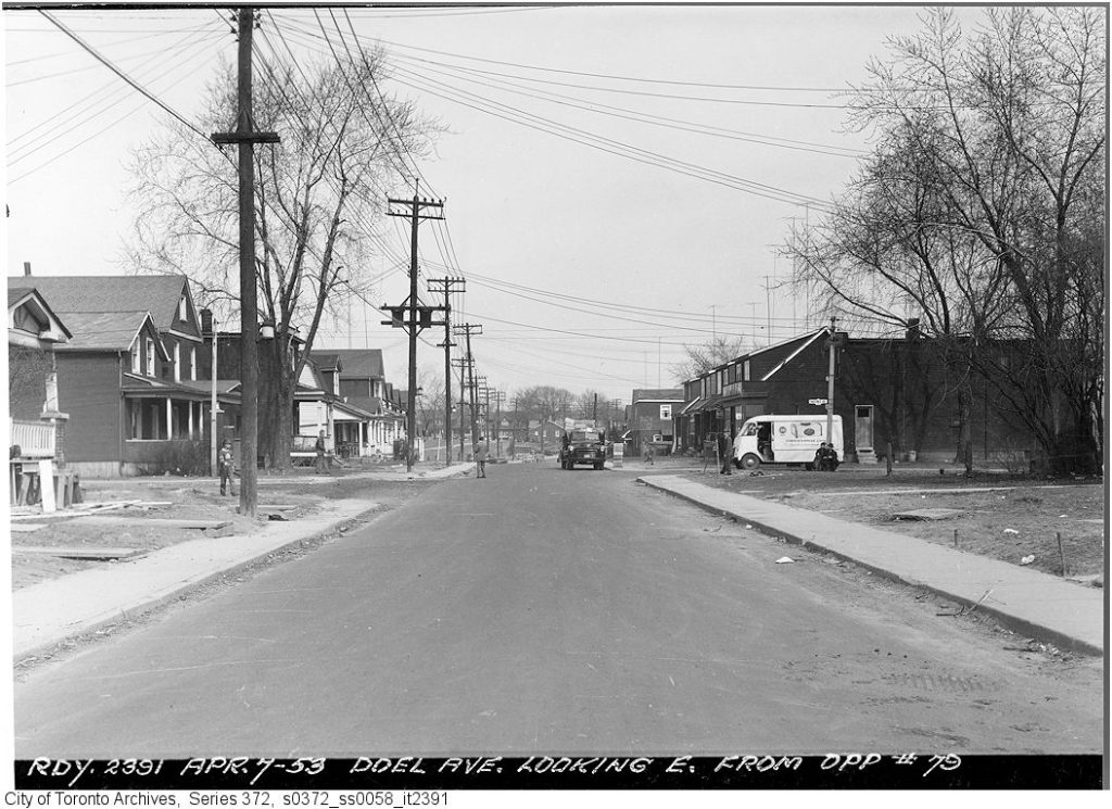
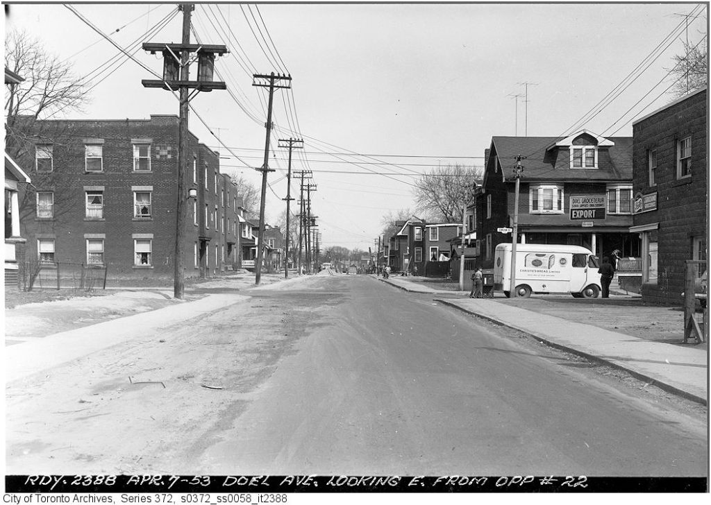
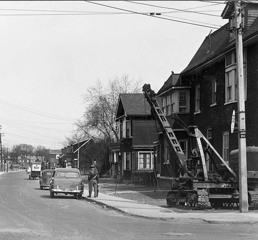
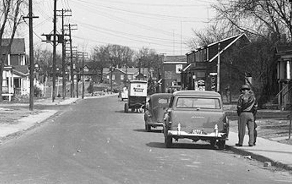
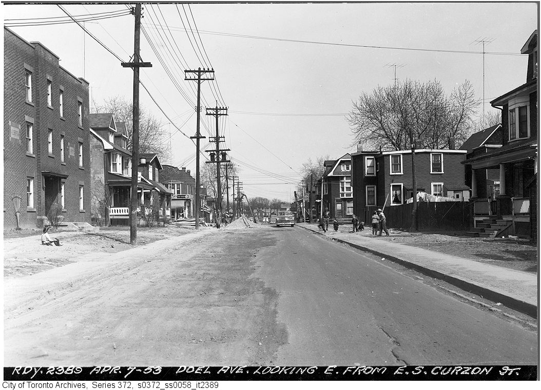
13 & 15 Doel Avenue April 29, 1953 This duplex is still standing though renumbered as part of Dundas Street East.18 Doel Avenue, April 29, 1959 This house is also still standing, but the front has been changed beyond recognition. Some of the neighbouring houses retain the spindly pedestals and cornices in this photograph. None of the surviving pedestals or the posts they sit on are quite as off kilter as those in the photo.Goad’s Fire Atlas Plan, 1924, 106 (Pape to Craven south of Gerrard) showing Doel Avenue (now part of Dundas Street East).1924 Goad’s Atlas detail. That’s Jones Avenue on the left. Doel Avenue runs east from Jones Avenue. The houses are numbered (small numbers) as are the lots (larger numbers). The subdivision plan # is 591.1955 Realtor’s map of Metropolitan Toronto (shows Dundas Street route through East End)Doel Avenue looking east from Jones Avenue April 7, 1953Doel Avenue looking east from Curzon Street, April 7, 1953Doel Avenue looking east from Leslie Street April 7, 1953Doel Avenue looking east from opposite #22, April 7, 1953Doel Avenue looking east from opposite #79, April 7, 1953Doel Avenue looking east from opposite #103, April 7, 1953
Approval to extend Dundas Street eastward, Globe and Mail, June 27,1950
Rolph Clark Stone April 1951Rolph Clark Stone April 1951Rolph Clark Stone April 1951Rolph Clark Stone April 1951Rolph Clark Stone April 1951Rolph Clark Stone April 1951Rolph Clark Stone April 1951
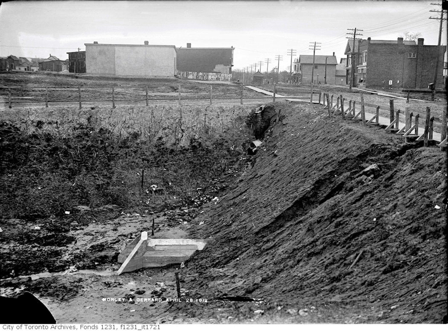
Morley Avenue and Gerrard Street fill operations, April 28, 1912
Morley Avenue and Gerrard St fill April 28, 1912
Looking east across Woodfield Road (then called Morley Avenue) towards Coxwell. Ashbridges Creek is in the deep ravine. A culvert has been installed under Gerrard Street to carry the creek south.
City of Toronto Locomotive No. 6, Morley Avenue fill, July 18, 1912
Workers will install a cement artificial creek about 18-30 metres below the surface. They will then fill in the ravine with sand.
Filling in Ashdale Ravine, Morley Avenue (Woodfield Road), July 18, 1912
A miniature steam locomotive (a dinky), and miniature rail cars (dinky cars) will carry sand dug out from the underpass on Coxwell Avenue along a temporary narrow gauge set of tracks to Woodfield Road.
Dinkies for Civic Car Line Toronto Star, August 18, 1911Dinkies at work, Canadian Courier, October 18, 1911Gerrard car line construction, Toronto Star, November 16, 1911
The culvert crosses Gerrard where the Lahore Tikka restaurant is today.
Looking west along Gerrard Street from Woodfield Road over the filled in Ashdale Ravine, July 15, 2019 photo by Joanne Doucette
The photo from just before the Pandemic was shot looking west along Gerrard Street across the landfill and over the buried Ashbridge’s Creek.
Gerrard St E construction, October 11, 1911 (Colourized)
Ashbridge’s Creek is now two creeks: the creek in the concrete sewer pipes and a groundwater creek flowing through the soil and sediment outside of the concrete sewer culverts.
Cement mixer and labourers, Gerrard Streetcar line, July 6, 1912Cement mixer and labourers at work, Greenwood to Coxwell Avenue, Toronto Star, November 8, 1910Morley avenue (Woodfield Road), Globe, December 28, 1912
The creek began in springs near Michael Garron Hospital.
Flooding Gerrard and Coxwell, Toronto World, November 10, 1913
It flows across Danforth Avenue, across the tracks at Rhodes Avenue and diagonally under the Roden school yard.
Lost Creeks 1909 Topographical map with labels
It crosses Woodfield Road, half way between Fairford and Gerrard.
Believed to be an early photo of Ashbridges Creek from around 1912, just before it was put under ground in pipes.
From there it continues on a diagonal to cross just west of Highfield. It flows south, under the Duke of Connaught school yard, and crosses Queen Street where the Russell streetcar barns are. From there the hidden groundwater creek makes its way south to the lake.
Route & Car barns, Toronto Star, December 11, 1912One fare system, Civic Streetcars, Toronto Sunday World, February 8, 1914Civic car line, Toronto Star, December 16, 1912First Gerrard Streetcar, December 18, 1912, leaving from the foot of Redwood Avenue, heading east.
Ticket, Civic car line, Toronto Star, December 19, 1912
Toronto Civic Railways Car No. 3 – February 24, 1913
Cherry Beach looking over a rolling Border Terrier to the Leslie Street SpitEast Gap at Toronto Island – 1953Sand pump east of Eastern Gap – Oct. 18, 1935 A pump is mounted on the dredge. Sand is sucked up at one side of the barge to deepen the Eastern Gap. At the same time, the sand sucked up is discharged through the long pipe to be deposited near the natural sand bank, building it up to create what we now know of as Cherry Beach.Sand pump east of Eastern Gap – Oct. 18, 1935 This process had been used by the City of Toronto since the 1890s and accelerated during World War One and the creation of the Eastern Industrial District, now known as the Portlands.Sand pump east of Eastern Gap – Oct. 18, 1935 The Eastern Gap had to be constantly dredged to keep it open for traffic as the offshore currents brought in sand eroded from the Scarborough Bluffs.Sand pump east of Eastern Gap – Oct. 18, 1935, looking west towards Ward’s Island. The dog park is in this area now and the remains of the lighthouse and jetty remain, albeit with more debris and sandbar willow, goldenrod and other plants, both native and non-native, reclaiming the construction debris for Mother Nature and the pups.Sand pump east off Eastern Gap – Nov. 23, 1935 Sand pump east of Eastern gap – Nov. 23, 1935Beach near sand pump east of Eastern Gap – Nov. 23, 1935Sand pump east off Eastern Gap – Nov. 23, 1935
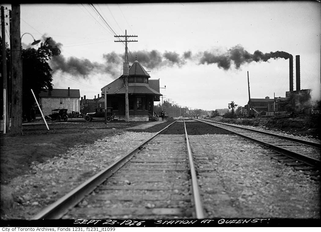
Queen Street East crossing looking north – [1890s]Queen Street East at the Grand Trunk Railway crossing by Degrassi Street. View is looking north-west on Queen Street East.The north side of Queen Street East near Degrassi Street, facing the Grand Trunk Railway’s Riverdale Station.The north side of Queen Street East facing McGee Street, adjacent to the Grand Trunk Railway’s Riverdale Station, visible on the left of the image.The north side of Queen Street East at the Grand Trunk Railway crossing by Degrassi Street. View is looking north-east on Queen Street East. Visible in the background is the Dunlop Rubber factory.Queen Street East and Degrassi Street. View is looking north-west between 1920 and 1926
In 1884 when the area was still Leslieville there was no Brooklyn Avenue and it is not listed in the 1885 Polk’s City Directory or the 1886 Polk’s City Directory. A real estate company owned by James Armstrong and John J. Cook sold most of the property on the street. Brooklyn Avenue was named for a small creek that ran down through it, across Queen Street and down to Ashbridges Bay. Brickmakers followed the banks of these rivulets to look for deposits of the blue clay that they could use to make good bricks. Brooklyn Avenue ran through two brickyards. John Russell owned the brickyard on the west side of Brooklyn Avenue and David Wagstaff owned the brickyard on the east side.
John Russell Globe, July 5, 1902
James Armstrong, Brooklyn Avenue, pavement, Globe, May 4, 1886
Lots sold on Brooklyn Ave, Globe, June 24, 1886
Lots sold Brooklyn Ave, Globe, February 15, 1887Lots sold Brooklyn Ave, Globe, March 26, 1887Lots for sale, Armstrong & Cook, Globe, November 8, 1887Lots for sale, Globe, February 18, 1888lots for sale, Globe, July 21, 1888Lots for sale cheap, Globe, August 27, 1892
James Armstrong, Armstrong & Cook dead, Globe, October 13, 1919
Both John Cook and James Armstrong died very wealthy men. James Armstrong, Armstrong & Cook, will, Globe, December 4, 1919
Realtor mourned John J Cook, Armstrong & Cook, Globe, June 5, 1933
The women of the family rarely get a mention. She was an exception and must have been an exceptional woman. Mrs John J Cook obituary, Globe, March 28, 1935
Maps
1851 map showing the area before the construction of the Grand Trunk Railway (now the GO Train line). The Holy Blossom Cemetery is on Pape Avenue. 1860 map shows the new Grand Trunk Rail line. George Leslie’s nursery is in the lower right, but he had not yet made his fortune and purchased the Widmer property on the west side of Jones Avenue or the Beaton property on the right.Brooklyn Avenue doesn’t yet exist in 1884Goad’s Atlas Plan, 1884Plan of the City of Toronto 1885 Brooklyn Avenue area. Three creeks ran through the area. Holly Creek on the left crossed Gerrard and Carlaw Avenue. Leslie Creek in the middle gave Brooklyn Avenue its name — “brook” meaning a small creek and “lyn” from “linn” — A waterfall or cataract, or a ravine down which its water rushes https://en.wiktionary.org/wiki/linn#English
The creek on the right is Hastings Creek.1888 Plan of the City of Toronto and Suburbs by Penson, showing a new street: Brooklyn Avenue
Assessment Roll, Brooklyn Avenue, 1897
1890 Assessment Roll p. 471890 Assessment Roll p 48
Often property owners were slow, sometimes very late, in paying their property taxes. Brickyard owners and those with connections at City Hall made a practice of this at times. John Russell found that sometimes too late was really TOO LATE. When he didn’t pay his taxes on one of his many brickyards, the City of Toronto seized it for back taxes and sold it to create an industrial park on Carlaw Avenue that still stands today albeit re-invented as condos and boutiques. Russell fought it all the way to the Privy Council in London, England, but lost. Below is a list from the Toronto Star of November 4, 1897, of those property owners who were in default of their taxes. Many were absentee landowners, holding on to lots as investment opportunities.
Tax arrears, Toronto Star, November 4, 1897
Assessment appeals, Armstrong & Cook, Globe, June 9, 1897
From 1836 to 1837 workers had straightened and planked the Kingston Road. It became a toll road, providing a reasonably good route for transporting products in and out of Toronto. Here, in 1842, Scottish gardener and tree grower, George Leslie, leased 20 acres of land from Charles Coxwell Small for a 21-year term. George’s landlord, Small, a member of the Family Compact and Clerk of the Crown, was the owner of extensive lands in the area. (Coxwell Avenue is named after him.) Small may have thought he got the better of the deal when he found someone foolish enough to lease his 20 acres of mucky swampland on the shores of Ashbridge’s Bay. The Toronto Nurseries was built on a tamarack-covered swamp (Larchmount Avenue recalls this). These 20 acres of rich black mud were the core of his nursery which would expand to 200 acres, the largest in Canada. George Leslie did not buy that land until the lease ran out in 1863. Then Small demanded an exorbitant price from Leslie and apparently got it. George Leslie valued that soft, rich dark muck and others recognized its worth, as shown in the Annual Report of the Bureau of Forestry for the Province of Ontario.
The memory of the tamaracks and reeds remained for decades. Marigold Gardens, the subdivision on Toronto Nurseries land, was nothing but “bulrushes and swamps”. Ward 8 News. “Short Stories of Leslieville” in Ward 8 News, February 9, 1979. Marigold Gardens is one street in the former Leslie Gardens subdivision built by realtor and contractor H. Addison Johnston.
Leslie Nurseries 1884 I’ve added notes and marked where the creeks were.
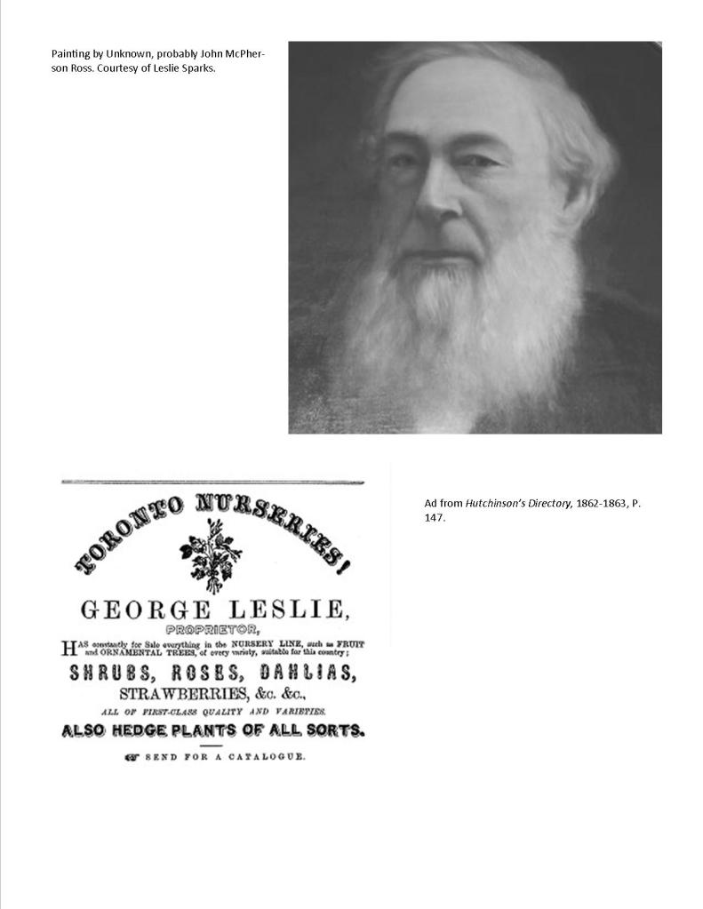
George Leslie attributed to John McPherson Ross ca 1907. John McPherson was a poor Scottish boy when George Leslie took him on as an apprentice. He rose to become foreman of the Toronto Nurseries and Leslie’s right-hand man. After George Leslie died, his sons made unwise investments, became embroiled in scandal, and lost the Toronto Nurseries. Most of it become housing, but a small portion along Eastern Ave continued under the ownership of John McPherson Ross. Caroline Avenue at the west side of Leslie Gardens is named after George Leslie’s first wife.
George Leslie died on June 14, 1893. George Leslie left a large estate with considerable real estate, including properties on Queen Street East, on Jones Avenue, on Curzon Street, on Eastern Avenue, and on Leslie Street, worth almost $115,000 in 1893. Not long after George Leslie died most of the Nurseries was sold. Before long most of the land was mortgaged to the Gooderhams and sold off around 1910. Some Leslie descendants still remember the grudge against the Gooderhams who “took” their land; others remember how like prodigal sons, John Knox and his brother George Leslie Jr., between the two, spent like millionaires, gambled, drank and womanized. The Leslie family’s loss was another family’s fortune.
Success Came by Giving People Made-to-Order Homes, The Canadian Builder and Carpenter, April 1916H. Addison Johnston had made a name for himself building high-end homes in the Beach. He gained a reputation quality — “honestly built”… “genuine Johnston-built homes.” Toronto Star, March 1, 1919
The economy was still in the grip of a depression and Toronto City Council was hesitant about incurring more costs to provide work. Councillor Gibbons nailed it when he said, “These men are going hungry. We have been at this since last September and nothing done.” The municipality had few choices: make-work projects, welfare (the dole) or hungry, angry veterans who had already demonstrated that they could and would riot. But Council took a risk and agreed to put the sewers for Leslie Gardens out to tender. Addison Johnston was a canny man and an experienced builder and developer. Toronto Star, February 2, 1922
Leslie Gardens sat on the easternmost section of George Leslie’s Toronto Nurseries. A semi-bungalow was a house with a second story with slanted walls to the rooms –not full head-height walls. Globe, December 16, 1922
Globe, January 24, 1923
The Roaring Twenties was beginning to roar finally after the economic downturn that followed World War One. Globe, February 27, 1923
Leslie Gardens School construction, Globe, March 20, 1923
City Council approved laying the sewer system for Leslie Gardens at a cost of $63,618. Globe, April 17, 1923
Addison Johnston’s house-a-day plan explained. Larchmount was a new street in 1923 and built up quickly as was the rest of Leslie Gardens. Johnston used pre-fabricated or kit homes and an assembly line approach to putting them up. The fact that they were put up quickly does not mean that the construction was shoddy. However, because Leslieville Gardens was built on an old marsh at the edge of Ashbridge’s Bay, some of the houses may have settled and/or may have problems with wet basements. The black wet marsh mud was great for George Leslie’s nursery but didn’t necessarily make for the best residential building sites. Globe, May 10, 1923
Sales Larchmount Avenue Globe June 4, 1923
Globe, July 31, 1923. A building boom took off in the spring of 1923 after a short but sharp post-war depression and houses at 66, 68, 72 and 84 Larchmount Avenue sold quickly.
Looking east on Moseley Street with the Leslie Gardens Service Station on the left.
“The market for small house properties continues to be very active.” Toronto Real Estate News Aldridge and Leslie Gardens, Globe, July 21, 1923
This is a photo of the Leslie Gardens gas station on Eastern Avenue and Mosley Street, just west of Leslie Street. The view is looking east towards Leslie Street. The Leslie Garden’s Service Station’s address was 780 Eastern Avenue
42, 60 and 70 Larchmount Avenue were sold. The lots were narrow with 16 feet of frontage on the street but long at 100 feet. Toronto Star, July 26, 1923
photo from the 1970sGlobe, July 31, 1923Leslie Gardens Service Station, Imperial Gasoline, ca. 1929 Toronto Star, August 13, 1923. Most of the new home buyers worked in the factories along Eastern Avenue and up Carlaw. To supplement their income and pay a portion of the mortgage, many let rooms or took on boarders.Globe, August 17, 1923Leslie Gardens, 1970s
The school was completed but the Board of Education needed to level the playground and parking area. Globe, October 31, 1923
Leslie Gardens, 1970s
Leslie Gardens school opens, Globe, December 4, 1913Leslie Gardens School, 1923 (probably on the opening day) and Bruce Public School, 2014Leslie Gardens 1924 included the east side of Caroline Avenue, Larchmount Avenue, Berkshire Avenue, Rushbrooke Avenue, Marigold Avenue (now Marigold Gardens) as well as the triangle of land at Eastern and Leslie Street.Building the infrastructure of the Roaring Twenties, Toronto Star, January 18, 1924photo from the 1970s
Leslie Gardens house for sale, Toronto Star, June 13, 1924
Leslie Gardens School was renamed Bruce Public School, June 28, 1924
Globe, July 1, 1924Leslie Gardens, 1970sGlobe, October 2, 1924Leslie Gardens, 1970sFor rent Globe, October 29, 1925. Some of the houses in Leslie Gardens were built for investment income and rented out.
Leslie Gardens, Toronto Star, March 11, 1926. In the early days of subdivision development, an investor or group of investors or sometimes a real estate company bought up a block on land and sold sections of 6-12 houses to builders. This was not true for Leslieville Gardens. Most of the houses there were built for and by Addison Johnston. However, 570 feet of street frontage was a sizeable amount of land enough for 20-30 houses.
Do you enjoy reading local history? Would you like to know more about the past of your neighbourhood? If you do, please read this.
Most, but not all, people who research and write about the history of neighbourhoods do not have advanced academic degrees, such as the very Harry Potterish picture of Professor John Ashley Soames Grenville, historian, taken in 1950 (Public Domain) featured above. The local historian is, like me, an amateur not a professional.
Many academic historians look down on local historians as muddlers who don’t get the big picture. And sometimes that is true, but often not.
Local history is a very democratic kind of practice, drawing on community histories (e.g., in the local history collections of our branch libraries), family history, genealogy and oral history. The best local history relies on meticulous and careful use of original and secondary sources as well as ongoing discussion with professional historians. But local historians have limited resources. Not everyone has the money to get those letters behind the name. We do not have access to the records, the peer-review process, conferences and journals of the academic historian. We rely on sources and our works are published informally – on blogs, Facebook groups, etc. My peers are those who read my posts and blogs and respond. And I am very grateful to you. But I rely on sources and sources are not always right.
There are basically two kinds of sources – primary sources and secondary sources.
A Census is an example of a primary source.
Primary Sources
Primary sources are things like newspaper accounts, letters, marriage licenses, death certificates, baptismal certificates, tax assessment rolls, etc. They are usually reliable but have to be “handled with care”. Sometimes original sources contain simple mistakes. Sometimes the originator actually lied. Sometimes they didn’t know what they were talking about. Not so different than today. Usually, the records are biased in ways that we now recognize – racist, sexist, etc.
This is an example of a secondary source. The writer of the caption was not there in 1783 when King George presented the fire engine. Fire Engine, Maclean’s, September 1, 1929
Secondary Sources
Secondary sources are records written after the event. The writers rely on records that they might not understand or they may not have researched adequately. Or they too can intentionally distort the truth, often with “little white lies” that romanticize things – the “good old days”, etc.
The story of my family’s mixed MI’kmaq and European ancestry is oral history passed down by word of mouth through the generations depicted here. Family photos: Susan Brewer (nee Doucette), Thomas Leo Doucette and Agnes Lucy (nee Devenish) and Thomas Vincent Doucette.
Oral History
And then there’s oral history. Memories fail and stories passed down often begin to stray from the facts though there’s usually a core that can be verified through researching primary and secondary sources – which leads me back to where I wanted to go.
An original baptismal record confirming the Indigenous roots of my family
Why am I saying all this?
When the Leslieville Historical Society wrote up a plaque to the Underground Railroad two years ago, we made a mistake. The quote didn’t begin to appear until 2007. We relied on secondary sources, even a leading U.S. politician, and the Harriet Tubman Monument and other apparently reliable sources for the following quote:
A contemporary illustration of Harrriet Tubman
“Every great dream begins with a dreamer. Always remember, you have within you the strength, the patience, and the passion to reach for the stars to change the world.” -Harriet Tubman (1822-1913)
But, as a Toronto historian brought to my attention, Harriet Tubman said no such thing.
Here’s the back story. We did our best three years ago in terms of due diligence, believing our sources were valid and checking with various authorities, including some friendly folks with PhDs. We also ran the wording by the Ontario Black History Society which suggested some changes which we duly made. They shared generously of their time and sent representatives to the unveiling. While they gave us the go-ahead, the responsibility lies with us and more particularly me.
Here’s a quote from Harriet Tubman in a book from 1869 that we could have/should have used.:
“When I found I had crossed that line, I looked at my hands to see if I was the same person. There was such a glory over everything; the sun came like gold through trees, and over the fields, and I felt like I was in Heaven”.
Harriet Tubman
Sometimes, as when I wrote a small paragraph about Black World War one hero, Jeremiah Jones seven years ago, I did not have access to primary sources. I found nothing in the news of 1914-1920 about him and could not access his military records as they were not digitized yet.
So, I followed the lead of the CBC and noted that he was wounded at Vimy and Passchendaele. The journalist apparently relied on family history as recounted by a descendant, Adam Jones.
Jones was wounded at Vimy Ridge but not the other battle. (Yesterday I downloaded his military records online and double-checked.)
The Historian as Detective by Matt (CC BY-NC 2.0) FlickR
We work diligently to uncover lost histories but ask for fairness and respect for the work we get right and the service we provide to our communities. It is fair to ask for some courtesy when our sources fail us.
Public shaming is far from helpful and comes across as an attempt to silence. If local historians were to be silent, then the stories of ordinary families on ordinary streets would be lost. And I for one think that would be a shame because all families are extraordinary and all streets have stories to tell. We need to respect each other.
To quote a perceptive article:
“The academic historian is the discipline expert. They therefore have a responsibility to provide leadership. They should inspire amateur historians to increase their standards of scholarship. This needs understanding, trust and encouragement from academics. Not paternalism.”
This photograph is from the Schlesinger Library on the History of Women in America and has no known copyright restrictions.
Afterword
A Local Historian & Oral History
“Biography: Kathleen Adams, a graduate of Atlanta University in 1911, taught in the public schools of Atlanta for about 34 years, and also at the Carrie Steele Pitts Home, an institution for the care of orphans. She retired from teaching in 1957. A member of one of the prominent Black families of Atlanta, Mrs. Adams showed an early interest in history. She has preserved the history of her family in documents and memorabilia and has made tapes for the local historical society on the history of the Atlanta public schools. At the time of her interview, she was the historian and oldest active member of the First Congregational Church in Atlanta.
Description: The Black Women Oral History Project interviewed 72 African American women between 1976 and 1981. With support from the Schlesinger Library, the project recorded a cross section of women who had made significant contributions to American society during the first half of the 20th century.
Photograph taken by Judith Sedwick
Repository: Schlesinger Library on the History of Women in America.
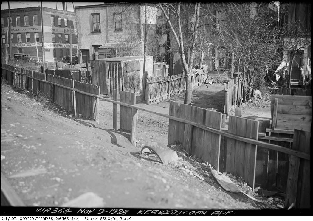
In the distance can be seen the Canadian Chewing Gum factory, makers of Chiclets. The photographer took this shot from the railway line into the backyards during the construction of the raised railbed that they called “the Toronto Viaduct”. This scene shows the raised rail bed under construction and the old rail bed next to it, as well as two women taking a dangerous but commonly-used shortcut.
Disputing their property taxes seemed like an annual game in the old East End, including Leslieville. Globe, Nov. 9, 1895
Rolph Clark Stone’s employee newsletter, November 9, 1948
Palmolive site with Wrigley Bldg & Rolph Clark Stone background. Aug. 2, 1917. Library and Archives Canada.North Wrigley Building, Dec. 5, 1916. Library and Archives Canada.South Wrigley Building. No date. Probably spring, 1916. Library and Archives Canada.Goad’s Atlas, 1923. Dundas Street was not built through the East End until the mid-1950s.
I wonder how many in our neighbourhood have Red Seal builders in their family trees?
There is a small clue in this rather mundane article from the Toronto Star of October 25, 1917.
Lewis Rootham was a contractor who built many of the houses on the lower of Woodfield, Connaught and neighbouring streets. But he wasn’t just any old kind of contractor: he was a Red Seal builder. (see article below)
Toronto Star, May 27, 1935
Some years ago, I had the opportunity to speak with one of his descendants and here is a transcript of part of that conversation:
“Lewis Rootham built the house in the early 1900s. He talked about the area being like old English countryside at first with grass and creek that ran into Ashbridges Bay. His dad and uncle used to swim there. He talked about Ashbridge who were said to be United Empire Loyalists with connections to royalty. The Ashbridges were deeded a lot of land, but my dad thought Jesse Ashbridge a bit odd because he cut the grass in the rain. My dad said the whole atmosphere of the neighbourhood changed with the relentless advance of civilization. He cited three major steps in the area’s development. First, stores opening on the south side of Queen Street, bringing more people to the street. Next, came the building of the TTC car barns and yard. That changed the atmosphere from that of the English countryside to mechanical. Then, the building of the big school north of the Ashbridges place, the Duke of Connaught, started a building boom. The Ashbridges kept 200 feet of frontage [on Queen Street]. He described the houses on one side of Woodfield Road (the Rootham house is at 42 Woodfield Road) as being low-class row houses, but said the other side had pretty good houses. He said his grandfather’s house was big, but unique in design because it had multiple levels. Master, living and front hall were on one level, but you went down two steps to dining and kitchen; up to bath and two bedrooms and up again to two more bedrooms. It was a great big house with only one bathroom. He remembers the fireplace as marvellous and the wood panelling and brickwork, all in classic English styling. He said times were tough later and his grandfather replaced the backyard with garages he could rent out to people with automobiles to have some money. He said the driveway was cinder and he was always getting hurt on it.”
Leslie House at Jones and Queen (north east corner) torn down Telegram October 20, 1923Globe, May 6, 1893 showing a separate entrance for his officeGeorge Leslie’s house at the north east corner of Queen and Jones (undated, but probably early 1920s). The verandah and main entrance faced on Jones. Originally the main entrance was on Queen Street.The stores that replaced the Leslie house, 1986Goad’s Map 1910. I have added labels.
This series of photographs will take you on a trip from downtown Toronto to Main Street on the new Toronto Viaduct, a raised railbed that lifted the train high above the city streets, eliminating several of the most dangerous level crossings such as the one at Queen near DeGrassi Street.
Plan of the Toronto Viaduct (raised railway line) to Logan Avenue, 1913Leslieville businessman, teacher and contractor won the race to become Mayor based in part on his commitment to get the long-awaited Toronto Viaduct built. He kept his promise.Creator: Alfred J. Pearson
Date: December 5, 1926
Archival Citation: Fonds 16, Series 71, Item 4646
Credit: City of Toronto Archives
http://www.toronto.ca/archives
Copyright is in the public domain and permission for use is not required.
s0372_ss0079_it0118 001s0372_ss0079_it0117 001s0372_ss0079_it0113 001s0372_ss0079_it0112 001s0372_ss0079_it0111 001s0372_ss0079_it0110 001s0372_ss0079_it0108 001s0372_ss0079_it0109 001s0372_ss0079_it0107 001s0372_ss0079_it0106 001October 6, 1926, looking east from Woodbine AvenueGrand Trunk Railway, International Flyer running between Montreal and Chicago; looking east between York Station & Woodbine Ave TPLMain Street bridge, looking east, April 26, 1915York Station, from the Main Street bridge looking east
It was a fine autumnal morning (October 4th) when I put my equipage in motion from Queenston towards York, accompanied by a friend and a favourite pointer.
Map from Travels in Canada and the United States in 1816 and 1817, 1818
The diary of traveller Lieutenant Francis Hall as he travelled from Queenston (near Niagara-on-the-Lake) to York, published in 1818. This British army officer had served in some of the bloodiest fighting of the Napoleonic Wars with in the 14th Light Dragoons.
Officers of the 14th Light DragoonsHamilton Hotel, Queenston (Niagara-on-the-Lake, Ontario), painted in 1913 by Owen Staples
Twelve Mile Creek (St. Catharines, Ontario) painted 1913American Woodcock, 1835, by John James AudubonForty Mile Creek later became Grimsby, Ontario, postcard from 1910Stoney Creek, photo, 1933
The Bay, HamiltonHumber River, looking south to Lake Ontario. Toronto, Ont., by William Arthur Johnson, 1867Credit River, 1796, by Elizabeth Posthuma SimcoeLAKESHORE Boulevard West, looking west across Humber River, showing Charles Nurse’s hotel, south side Lakeshore Boulevard West, west side Humber River, 1891Near Toronto (Swansea) by Mary Collenya Russell MorganLooking north from near Lighthouse, Centre Island as it was in 1817 by William Armstrong
Looking south towards Gibraltar Point, showing firing of salute, 1793 by Elizabeth Posthuma Simcoe
Queen Street East – Old track – October 1, 1913 Looking west to Logan Avenue (Coca Cola sign on side of drugstore)Queen Street East – Old track – October 1, 1913Rolph Clark Stone Oct 1, 1948Leslie Grove Playground October 1, 1913The Canadian Engineer, Vol. 27, (October 1, 1914) Lost Creeks 1909 Topo map with labels
The bridge to Leslieville through Riverside, over the Don River: Queen St bridge September 28, 1910Queen St bridge September 28, 1910Queen Street – King Street – Don River bridge looking east Sept 28 1910John McPherson Ross painted a landscape scene looking east along Queen Street over “Ashport”, the tiny creek at today’s Vancouver Avenue. The old 1811 Ashbridge House is in the distance. This digital painting was done using a black and white photograph of the original painting from about 1910.Rainy day, Austin Avenue, September 28, 1916
There are lost bridges (buried under fill and pavement in Leslieville. One of those lost creeks crossed at the end of Austin Avenue. City of Toronto Creek Locations 1912
Goad’s Atlas 1903Looking east along Gerrard Street from the top of the railroad bridge at Carlaw Avenue. The boys are sledding on the banks of that little creek that crossed Austin and Badgerow. Another branch of the same creek crossed Gerrard just east of the firehall. Photo – February 20, 1904This photo shows the bridge over that little lost creek.Gerrard At Carlaw, 1964 – Unknown Photographer
Allen “Teddy” Morris from the Canadian Football Hall of Fame
Thanks for pulling this information together. It appears that Allen Morris, listed as the son of policeman Gordon Morris of 59 Austin Ave in the 1911 and 1921 censuses, was Canadian football Hall of Famer “Teddy” Morris, real name Allen Byron Morris, who won 3 Grey Cups playing for the Toronto Argonauts (1931-39), and 3 more Grey Cups as their head coach (1945-49), becoming one of the giants of Toronto sports of the middle third of the twentieth century. I research Argonauts history and am working on a biography of Morris. He was famous for being tough as nails despite a small stature – they called him “Little Iron Man” – and it sounds like he grew up in a tough neighbour hood.
CNR Riverdale Station looking north September 23, 1926Globe, September 23, 1914Don River, Riverdale – September, 1945Don River, September 1945Canadian Furniture World and The Undertaker, September, 1915Canadian Furniture World and The Undertaker, September, 1915
Pape Avenue looking north from Eastern Avenue – March 25, 1957Location, location, location. Pape Avenue stretched south to the shore of Ashbridge’s Bay at Eastern Avenue.1884 Goad’s Plan – Willow Street is now Pape Avenue from Eastern to Queen Street (some modern street names have been added to help viewers orient themselves)
Willow Street Auction sale property, Globe, September 26, 1885
Pape Avenue looking north from 8 – March 25, 1957
Ashbridges Bay, by John Wilson, 1900, looking west towards the city of Toronto near the foot of Leslie Street
Sandbar Willow, USDA, 2011Beaverpond Baskettail dragonfly (from the Master Naturalist course I attended at Lakehead University’s Orillia campus)Bumblee pollen basket on leg
Women’s Basketball, Globe April 18, 1895
Ashbridge’s Bay with tall grass and willows, looking east towards the foot of Leslie Street from around the foot of Pape near Eastern Avenue.
Anibhnaabe families, including the KIchigos, frequented Ashbridges Bay up until World War I, according to oral history. Basket Makers, Mount St. Hilaire, Quebec, ca. 1870
Mi’kmaq child and woman weaving a basket, Whycocomagh, Nova Scotia, no date (where some of my ancestors came from and no doubt weaved baskets — JD)
Hanging Baskets George Leslie, Globe, May 31, 1873
Basketmaker, Globe, Sept. 25, 1925 (Fleet Street is now part of Lakeshore Blvd. through Leslieville. Some of my ancestors came from Sussex in England where baskets like these, called trugs, are made. JD)
Willow renamed to Pape, Toronto Star, June 25, 1925
The gardener for whom Pape Avenue was named.
Willow Branch changing room Leslie Beach Globe & Mail, 07 July 1938“You don’t know what you’ve lost till its gone…” Joni Mitchell Ashbridge’s Willow, photo by Joanne Doucette, May 18, 2009
We hope you will be able to join us for at 11:30 a.m. on November 19, 2019, at The Logan Residences, 899 Queen Street East. The Leslieville Historical Society and The Daniels Corporation will unveil a plaque recognizing the Underground Railroad and the families who made their way to freedom, forming a black community here from the early 19th century.
Here is the wording of the plaque:
“Every great dream begins with a dreamer. Always
remember, you have within you the strength, the patience, and the passion to reach
for the stars to change the world.” -Harriet Tubman (1822-1913)
Many families came to Toronto in the1800s to
escape slavery, violence and oppression in the American South. They
courageously followed the dangerous path to freedom via the Underground Railroad
and some settled here, near the corner of Queen Street East and Logan Avenue.
While a few returned south after the Civil War (1861-1865), many remained,
helping to forge the identity of Leslieville today.
This plaque commemorates these families: the
Barrys, Cheneys, Dockertys,Harmons, Johnsons, Lewises, Sewells, Whitneys,
Wilrouses, Winders, Woodforksand others who came here from Kentucky, Maryland,
Virginia and other States.
BY THE LESLIEVILLE HISTORICAL SOCIETYWITH THE
DANIELS CORPORATION AND THEIR PARTNER STANLEY GARDEN
2019
In 1793 Upper Canada passed law banning the import of slaves (first such law in British Empire (9 July). The Abolition Act decreed slave children born in Upper Canada from this day forward are to be freed when they are 25. In the 1840s and 1850s a series of American court decisions and laws tightened slavery’s grip and made escape even more dangerous. Increasingly, refugees from slavery headed to Canada, many using the secret network known as The Underground Railroad, but most travelling alone or in small family groups with no help from anyone, using the Northern Star to guide their way.
By the mid-1860s 60 to 75 black people lived here,
out of a population of Leslieville’s population of about 350. We honor their
contributions to our community where their descendants still live and work
today.
1909 Map of Township of York and City of Toronto East Toronto (north of Benlamond)1909 Map of Township of York and City of Toronto East Toronto (south of Gerrard but not including the Beach)1909 Map of Township of York and City of Toronto- Woodbine to Victoria Park1909 Map of Township of York and City of Toronto Leslieville and Riverside1909 Map of Township of York and City of Torontonorth shore of Ashbridges B1909 Map of Township of York and City of Toronto Midway (north)1909 Map of Township of York and City of Toronto Midway (south)
A ghostly Riverdale Collegiate stands behind an orchard. Workers with pick and shovel fill in the Devil’s Hole or Devil’s Hollow, a ravine cut by Hastings Creek and widened and deepened by brickmakers. Nearby Harriet’s Hill shows how deep the hole really was and even the bottom of the gully there has been filled in with brickyard waste — broken bricks and cinders. Riverdale Collegiate itself was built of those deep red bricks from the local brickyards.1910 map with my labels.
There is an urban legend that Myrtle, Ivy and Harriet Streets were named after local women (true) who argued so much that they could never meet so the streets don’t meet (not true). The deep ravine called “the Devil’s Hollow” had more to do with keeping the streets from meeting. The women were all members of local brickmaking families who actually seemed to have got along quite well.
This is likely along Hasting’s Creek near Riverdale Collegiate. Note the orchard at the top of the bank. The Clay Worker, November, 1906. The area was still quite rural in 1907 when Riverdale Collegiate began as can be seen in this photo of Pape Avenue looking north from about the railroad tracks. A cartoon appealing for British immigrants to come to Toronto. From the Globe, March 19, 1908.
Canada’s immigration policy was openly racist and specifically sought white Scottish, Irish and English immigrants to counter the feared “Yellow Peril” — immigration from China and, to a lesser degree, Japan. This is clearly and, none to subtly, reflected in the poem below. John Wilson Bengough (1851-1923) was one of Canada’s leading cartoonists.
British immigrants crossing the “Bridge of Tears” over the railway tracks at Union Station around 1911. It was called this because here people said goodbye to loved ones or cried because they had left everything they had to gamble on a new start in a new country. Everything they own is in their hands.
Most came in family groups like this. Mother has baby in her arms. Dad is at the back. Two teens carry the luggage and grandmother is at the back carrying another child. The grinning child on the right reflects the hope they had, but others don’t look so enthralled with Toronto.
At the same time that a Shacktown was growing outside the city, families like the Andersons built brick and brick-fronted houses like these west of Greenwood Avenue. The City of Toronto imposed stricter building requirements due to the danger of fire. The so-called “Fire Limits” required brick construction at least on the street facade and fire resistant cladding on the other walls. Much of that cladding was Insulbrick, a kind of asphalt impregnated with asbestos. There is still a lot of that material around, often covered with newer aluminum siding.
The Andersons, professional builders from Scotland, preferred to build solid brick, sturdy houses, like these three. Many of those still stand today near Riverdale Collegiate. (Photos courtesy of Guy Anderson)
After 1905 a Shacktown developed east of Greenwood Avenue on land that was still outside of the limits of the City of Toronto. A flood of impoverished British immigrants arrived here to start new lives only to find that while jobs were available (at least at first), there was no housing for them. So they bought lots at around $5 to $10 a foot of frontage and scrounged bits of lumber, old crates, tarpaper, tin and whatever could use to create their own homes. These are on Coxwell Avenue.
City of Toronto Building Construction Dates City of Toronto Works and Emergency Services, Technical Services, Survey and Mapping Services, Mapping Services. Produced by Patricia Morphet, September 2003 This map is on line at http://oldtorontomaps.blogspot.com/2014/06/contemporary-maps-with-historical.html From Goad’s Atlas, 1913, Plate 100, showing Riverdale Collegiate. Curzon Street was later renamed Bushell Avenue north of Gerrard. Bushell may have been named after a brickmaker named Bushell who was killed in World War One. After that bloodbath the City of Toronto renamed a number of small streets after particularly courageous men who died. Another such street is Dibble near Eastern Avenue and McGee.
December 22, 1919 Boys playing hockey on Hastings Creek. Hastings Creek crossed the Danforth just east of Jones and cut a ravine at Ravina Crescent in “The Pocket” and another gully, known as the “Devil’s Hollow” between Jones & Greenwood.
The creek continued south through the Hastings’ farm (Hastings Avenue to Alton Avenue) and across where Greenwood Park is to enter Ashbridge’s Bay between Leslie Street and Laing Street. The City filled the ravine in a number of times and finally buried the creek in the sewer system in the early 1920’s.
A staff member at the East End Garden Centre recalled when her grandfather caught fish in this pond. Others have told me of their grandparents tobogganing down the hill or skating on the pond.
Cattle and pigs were driven along roads leading into Leslieville from very early in the 19th century. The men and boys who managed the cattle en route were called “drovers”. Later they were brought in by train. When they reached Leslieville the animals were let loose to graze on the nutritious meadow grasses along Ashbridge’s Bay.
Some were even fed on the leftovers from the Gooderham Worts Distillery. Then they were slaughtered by butchers in the many abattoirs that were feature of Leslieville’s economy. Of the cattle that were fed on whisky mash, it is said that they died happy.
This is looking west along Jones Avenue just north of Riverdale Collegiate. Heavy industry lined the track, including a pork packinghouse on the west side of Jones where pigs where slaughtered. The stench was incredible especially on hot days, making nearby houses and the high school even more uncomfortable in the days before air conditioning,
This map was published in 1908 and is based on surveys done in 1907. Hastings Creek has now been put underground as part of the sewer system. The penciled in line just east of Leslie Street may indicate the path of the sewer. By this time the creek was heavily polluted with industrial and human effluent. But public health was coming into its own by the 1920’s and chlorination of drinking water, immunizations against infectious diseases, pasteurization of milk, and the invention of new drugs like penicillin began to revolutionize society in ways that we often don’t recognize today. Nonetheless, the teenagers of Riverdale paid a heavy price in the First World War and Great Flu pandemic that followed. I hope the short history of the Riverdale Collegiate site that I have written will help all of us appreciate young people more through understanding the area that they grew up in. Globe, Sat., Aug. 31, 1907 On the former exterior south wall, now inside an atrium, a 1965 Toronto Board of Education plaque. This is what it says: “In co-operation with the Riverdale Business Men’s Association, the Toronto Board of Education persisted in building a school on Gerrard Street, named Riverdale Collegiate Institute. The original school, consisting of a principal’s office, library, auditorium, four classrooms and two science rooms, was occupied in 1907.” Contrary to some sources such as Wikipedia, Riverdale Collegiate Institute was first called Riverdale High School NOT Riverdale Technical School. Riverdale Technical School, founded in 1919 on Greenwood Avenue north of Danforth Avenue was renamed Danforth Technical School. Colourized postcard, 1907 Photo from The Report of the Dept of Education 1910 By the second and third years, classes had to be held in the cloak rooms. The first addition was completed in 1910 and consisted of the assembly hall and the eight classrooms to the north and south of it. Photo from Report of the Dept. of Education, 1914. Additions were built in 1914, 1922, and 1924, in accordance with the architect’s original plan for the expansion of the school. Architect’s blueprint showing planned extension to Riverdale Collegiate. City of Toronto Archives. Postcard of Riverdale Collegiate after 1924 when additions were added to enlarge the school further. This is likely from an architect’s drawing prepared for that extension to the school. CC BY 2.5, https://commons.wikimedia.org/w/index.php?curid=1201756 THE END
The Leslie Hotel (right) was a corner store on Nov. 5, 1948. A doctor’s home is on the left where the drugstore is today. It was built on land that had been part of William Wood’s property, The section of Carlaw Avenue just north of Queen had also been part of The Leslieville Hotel’s grounds.
WOOD’S HOTEL
Where Carlaw Avenue now cuts through north of Queen Street there was situated on the north side of the Kingston Road a hotel called “Woods Hotel.”
Close up of Carlaw and Queen from the 1884 Goad’s Atlas. Note that Carlaw Avenue does not go through north of Queen. The buildings on the left were probably the stables for the Leslieville Hotel which is the red (brick) building across the street from the Presbyterian Church. The zoo, conservatory and other buildings are to the east of the hotel and like the stables are made of wood (yellow on the map).
A row of tall poplar trees shaded the front. In the yard behind the hotel, was a small zoo. Peacocks, guinea hens, a couple of monkeys and a number of dogs of different nationalities.
An old darkey, who, gossip said, was an ex-slave was the custodian of the animals, and he was also the porter of the hotel.
For more about the use of derogatory terms and the role of racism see the background section.
The hotel people cut down six of the tall trees which were at the front and shaped the stumps in the form of chairs, and they were really easy and nice to sit in.
There was also a large wooden watering trough for horses. I remember watching a fight in front of the hotel and one of the men knocked the other into the watering trough and held him there until he was thoroughly soaked. It seemed to wash all the fight out of him.
A detail from a City of Toronto Archive photo, August 31, 1983 Where the Shoppers’ Drug Mart is today was a grocery store. The Leslieville hotel was a variety store in 1983.Celine’s Garden Restaurant, closed 2015 Photo by J. PattersonCourtesy of Toronto Pubs https://torontopubs.wordpress.com/2016/12/12/the-thirsty-duck/
About the use of the term “darkie” in the article.
I debated within myself whether to censor this out of the quote. The racism of Sam Herbert’s day was open and largely unrecognized, being so widely held as it was. Today racism is generally more subtle but it would not surprise many of us if we heard similar terms tumble out of the mouth of the former president of the U.S.A. Not all shared (or share) that prejudice or used its poisonous language. George Leslie, the gardener who dominated Leslieville, others like John Logan and William Woods, owner of the Leslieville Hotel, shared Reform (Liberal politics) with its strong anti-slavery element.The Toronto Anti-Slavery Society was formed in 1851 and included supporters from “Over the Don”. Leslieville’s thriving Black community participated in this struggle. Ice merchants like Henry Lewis of Leslieville, hotel keepers like James Barry of Leslieville, other entrepreneurs, farmers like the Sewells, and others. They organized to assist refugees and fight slavery, even enlisting in the Union army.
Some of the first Black residents appeared in the 1830’s in what was to become Leslieville. Around 1834 or 1835, an English settler named Charles Watkins built a tavern near the northwest corner of Boston Avenue and Queen Street East, just east of where the Leslieville Hotel was to be built around 1876. Watkins liked farming more than running an inn so he rented the inn out. The first landlord, Sandy Watson, kept the inn until about 1847. Then James Shaw rented the place and it became known as Shaw’s Hotel. It was one of the first taverns in Leslieville. According to John Ross Robertson:
Mr. Shaw was very fond of horses, and it was one of the sights of the neighbourhood to see the black hostler, an old escaped slave known as ‘Doc’, trot out Mr. Shaw’s team to water every morning.John Ross Robertson, Landmarks, Vol. III, p. 320
“Doc” was Lewis Doherty (or Dockerty), an American who escaped here with his family. The picture below shows Lewis Doherty holding a horse in front of Shaw’s Hotel (northwest corner of Queen Street and Boston Avenue). Many in the Black community here worked in the hotels, especially with horses.
About William Woods and The Leslieville Hotel
William Woods had experience running a grocery store and then a hotel downtown before he started his own and it appears from the beginning that his hotel was different from most of the day.
The numbering of houses on streets in Leslieville did not begin until door-to-door mail delivery begin. The Post Office had Queen numbered in 1886. This time line shows how William Woods was listed in the Directory each year, but the listings reflected the cataloging done the previous summer.
William Woods, proprietor of the “Leslie Hotel,” Kingston Road, was born in King’s County, Ireland, and came to Canada in May 1853. For seven years [or until 1860] he occupied a position in the house of Robert Reford, establishing himself in the grocery and liquor business at the corner of Caroline and King streets afterwards. From this locality he removed to the corner of Sackville and King streets, remaining there till he bought and took possession of the above hotel [in Leslieville] in 1876. History of Toronto and County of York Ontario. Vol. I. Toronto: C. Blackett Robinson, Publisher, 1885, 489 – 490.
He actually began as a grocer in Leslieville before getting a hotel license. In 1876 William Woods opened the Leslie Hotel near today’s Carlaw and Queen. His hotel, named “The Leslieville Hotel” had rooms, a meeting hall that could hold 200, a restaurant and a bar.
Cherry Hill Tavern, old four-poster bed. – September 23, 1928
[William Woods] bought and took possession of the above hotel in 1876. In connection with this hotel he has a garden and conservatory and also owns a lot near the lake for the use of guests desirous of boating or fishing. His premises have a frontage of 81 x 230 feet.History of Toronto and County of York Ontario. Vol. I. Toronto: C. Blackett Robinson, Publisher, 1885, 489 – 490.
A time line showing 972 Queen and it’s neighbours through the years.
He is listed in the 1881 Census as a hotel keeper. One of the permanent residents of the hotel was James Barry, born in Africa sometime around 1820, probably the porter and zookeeper in Sam Herbert’s article. [The Census was careful to record if a refugee from slavery was born in the U.S. Barry may have been one of the last to be carried on a slave ship to America.] Fanny Wright was a domestic, probably the hotel’s housekeeper. All were members of the Church of England.
Tavern keepers offered food, drink and shelter to travelers and their horses, but taverns were also social centers. Taverns and inns were not just places to get drunk. Militia musters, fairs, agricultural society dinners, election banquets, political meetings, church services, dances, and parties were held in taverns.
EAST YORK. Mass Meeting of Electors in Leslieville.
A mass meeting of electors of East York was held on Wednesday in the hall adjoining Wood’s store, Leslieville. Mr. Alex. Gibb was called to the chair, and opened the meeting with a few remarks, and concluded by calling upon Mr. G.W. Badgerow, the reform candidate for the Riding, who after a few preliminary remarks, in which he expressed a hope that his opponent would put in an appearance in order that they might have a free discussion of the questions now before the country, said that these questions were altogether different from those which were decided upon by the electors upon the 17th of September last…The meeting closed with three cheers for the Queen, a similar honour being given to each of the candidates. Globe, Nov. 18, 1879
A large number of the electors of East York assembled at Wood’s Hall, Leslieville yesterday. Among those present were Messrs. Geo. Badgerow, M.P.P., W.H. Doel, J.O., George Leslie, Jr., Alexander Bigg, W. Woods, F. Farendon, J. Mallendine, J.M. Ross, George Martin, John Strader, T. Holland, J. Farrell, Julian Schmidt, Jr., Wm. Perry, J. Taylor, and others.
Mr. Woods occupied the chair.Globe, March 24, 1882
Some hotels, including some Leslieville hotels, but not THE LESLIEVILLE HOTEL offered illegal pleasures such cockfighting, dog fights, poker and prostitution.
…the man who owned a fighting dog was better known than the Mayor of the city. A story of the old days, when there was a battle royal every Saturday night between the adherents of the Orange and Green or a mix-up betwixt the volunteer firemen and the bluecoats, will earn a footing quicker than an invitation to the house to lubricate.Toronto Star, April 6, 1901
One function that was unique to William Woods’ hotel was the use of his hall for court cases, which may lead to a certain amount of animosity against him among Leslieville’s rowdies.
Wood’s Hall, next to the Leslieville Tavern likely had some kind of stage and was used for a wide variety of purposes. It would not, however, have been the formal court room pictured here.
THREATENING AT DON MOUNT. – Thomas Pierce was brought up before Mr. John Hamilton, J.P., at Wood’s Hotel, Kingston Road, on Friday evening last, charged with threatening to assault Gus Williams. He was bound over to keep the peace towards the complainant. Globe, Sept. 1, 1879
A DON MOUNT WIFE-BEATING CASE.
A man named Charles Ashby, who had been drinking for some time, is charged with having committed a most flagrant assault upon his wife Elizabeth on Saturday and Sunday, and from his kicks and blows her face and body were covered with bruises.
The inhuman treatment she has received from the hands of her husband, together with the effect of an illness which followed immediately after the birth of her last child some time ago, have apparently contributed to reduce her to a sate of partial mental aberration.
County Constable Woods attempted to serve a summons on the husband yesterday, as it was intended that an investigation should be made into the facts last night at Wood’s Hall, Kingston road, but he could not be found. Later on a warrant was issued by Mr. Doel, J.P., but the attempt to make a service met with a like result. It was then seen that Ashby had escaped.
In view of the necessity of providing for the poor woman, she was brought up last evening at Wood’s Hall on the charge of insanity. Dr. Carroll testified that he had known Mrs. Ashby since last January. His opinion as a medical man, was that with proper treatment she would recover, but if neglected she would become worse. She was melancholic, and without proper attention she might become suicidal.
The poor woman was attended last evening by two of her boys and her little girl. Questions were put to her by Mr. Doel, a few of which she answered, but the others appeared to be beyond the grasp of her mind and to them she was silent.
She was then committed to gaol [jail] as a lunatic and will be brought up before Judge Mackenzie on Wednesday next. Her children, it is expected, will be well taken care of by the neighbors.Globe, August 5, 1879
Woods himself was assaulted again and again over the years, but managed to retain his sanity and his livelihood, having more resources and far more status than many victims of violence.
The rowdies had their revenge on William Woods over the years.
At the Criminal Court yesterday, before Mr. Justice Falconbridge, Frederick Collins, charged with perjury, was dismissed, the witnesses failing to appear. Michael Roe, charged with wounding William Woods … asked time to prepare his defense, when the case was postponed until the next Assizes and the prisoner allowed bail of two sureties at $400 each. Globe, Feb. 3, 1880
William Woods testified against one member of a gang that was involved in a brutal murder, kicking a lone man to death behind his home on McGee Street. This was gang violence, young men fueled with liquor and jealous of any attention other men to “their women”. One gang was based in Leslieville; the other west of the railway tracks. A local athletic star, rower Hugh Wise and one of his friends, were falsely accused of the murder and sent to penitentiary for manslaughter based on the testimony of William Ashby and another man who had originally been convicted of the murder but once in prison changed their stories and alleged that Wise and his friend and done the deed.
WHO MURDERED WM. LONG? Ashby, the Crown Witness, Charged with Perjury at the Trial.
The Long murder case, which was thought to have been finally closed by the committal of Wise and Phillips to the penitentiary, has been re-opened at the Police Court by the preliminary investigation in the case of Wm. Ashby, accused of perjury at the trial. Robert Tyson, official stenographer, testified that the document put into court was a correct transcript of the evidence given by Wm. Ashby at the trial of Wise and Phillips on the 18th of January last. The copy was produced, and the question, “Had you a piece of railroad iron with you on the night of the row?” and Ashby’s answer in the negative were read by Mr. Murdock.
Robert Dickey, sworn, said he was in the Leslieville Hotel on the night of July 12th, about 8 o’clock, when Ashby and Cooper, with two other young men, came in and had a couple of drinks. Ashby then sprang upon the end of the bar counter, and witness saw something sticking out of his pocket and seized the article and drew it partially out, but Ashby pulled it away from him.
IT WAS AN EEL-SKIN,
and on the end, but on the inside, was a heavy piece of iron. Ashby wound the skin two or three times round his hand, and swung it in the air, after which he restored it to his pocket and left the hotel.
William Woods, bar-tender at the Leslieville Hotel, corroborated the evidence of the previous witness.
…Wm. McFadyen said that after Long had been assaulted he heard Ashby say to a party ofyoung men, but not to himself personally, that he (Ashby) had “put the boots to the son of a —–.”
Hugh Kelly said that he was present when Long was being beaten, and Ashby aimed a vicious kick at the prostrate form of Long, and hit Wise, who was endeavouring to shield Long. Wise did not say “there’s life in the —— yet,” and throw Long to the ground, and kick him again. William Long was in the bar-room of the Leslieville Hotel the day after the row, and heard Ashby say, “I’m only a little fellow, but I had more to do with it than any of you; and if it had not been for Wise he would have got more than he did.” Globe, Feb. 16, 1883
Criminal gangs don’t like those who testify against them.
The number of licensed hotels for Leslieville’s small population was large. Many catered to summer visitors and those who came out to enjoy the races at the Woodbine track (Coxwell and Queen). To serve liquor, an inn had to have been licensed. As noted, the north side of Leslieville was in the Township of York until 1884 while the south side was in the City of Toronto. Liquor licences were issued by both for the areas in their jurisdiction. Both taverns licenses on a yearly basis. The innkeeper or hotel keeper had to show that he had the necessary number of rooms ready to accommodate travelers. A saloon was not required to have rooms while a shop license was a license to sell liquor but not for consumption on the premises.
There were legal places to drink and lots of illegal ones too – and lots of rowdies to make a pub owner’s life interesting.
LESLIEVILLE. ROWDYISM IN THE VILLAGE. The other night some young men from Toronto gave an entertainment and dance in Gowan Hall. After the dance was over, almost three o’clock next morning, they amused themselves by breaking fences and gas lamps on the Kingston road, and breaking over County Constable Wood’s door. The constable was awakened, and it is said learned the name of two of the rowdies; and on Saturday afternoon he laid an information, and obtained warrants of arrest from W.H. Doel, J.P. for John Forbes and James Ryan. Globe, April 26, 1880
Rowdies brawling in the street. Public domain
FIGHT.
Two men near the railroad track, Kingston-road, fought yesterday morning, and they bit, gouged, and kicked each other like barbarians. Globe, April 29, 1882
A DISGRACEFUL FIGHT. Yesterday afternoon about five o’clock a disgraceful scene occurred on the Kingston-road. Five rowdies, natives of Corktown, including a well-known character nicknamed Paddy the Lash, were driving towards the city, and when opposite the residence of Mr. Russell, Sr., came to words, stopped the waggon, dismounted, and had a rough and tumble fight, kicking, biting, and gouging each other, rolling over and over on the road. Finally they were separated Globe, May 15, 1882
Little Trinity Church at 425 King Street East ca 1950
William Woods was a man of some status in the community, elected as a County of York public school trustee and a devout Christian, active in the Little Trinity parish in Corktown.
Leslieville
Mr. Wood, school trustee, at an interview with the directors of the Exhibition Association yesterday, obtained permission for the pupils of the Leslieville Public and Separate Schools and the Norway Public School to visit the great show to-day. The could news could not be made known to the children before closing school on account of some neglect or irregularity on the part of the servants of the Montreal Telegraph Co. Mr. Wood having sent a telegram in time but which was not received.Globe, Sept. 16, 1881
The closing exercises of the school in Section No. 6 took place yesterday afternoon under the direction of Mr. Lannin, the master…Before distributing the prizes, the children were addressed by Dr. Carroll and Mr. Vennell. The following comprise the list: A Bible from Mr. Woods for the greatest number of verses from Scripture recited, Hallie Sawyer; a Bible from Mr. Woods for best specimen of handwriting, Willie Wallace; by Mrs. Manson, two prizes for recitation – 1st, John Taylor; 2nd. George Manson. Globe, July 8, 1882
There were only two licensed hotels on the north side of Kingston Road (Queen Street East) in Leslieville — The Leslieville Hotel (William Woods) at Carlaw and Queen and The Puritan Hotel (Catherine Greenwood) at Greenwood and Queen. Joseph Trebilcock ran George Leslie’s post office and corner store at Curzon and Queen and applied for a license as a liquor store. Only two of the old hotels from both sides of Queen Street in Leslieville remain: the Duke of York (1870) and The Leslieville Hotel (approximately 1876).
GRANTING OF SHOP AND TAVERN LICENSES.
Notwithstanding the resolution of the Board of License Commissioners for East York to supply the list of successful applicants first to a country paper and withhold it from the city dailies, the Riverside reporter of THE GLOBE has got the names of the successful ones in his district. They are as follows: Taverns – B. Tomlin, T. Farr, J. Mallindine, Riverside; W. Woods, Mrs. Greenwood, Leslieville; Charles Heber, Dutch Farm; Ira Bates and John Ross, Norway. Shop licenses – John Coombe and James Murray, Riverside. The applications of Messrs. Trebilcock (Leslieville) and A. Tiffin (Riverside) will receive further consideration by the Commissioners on Saturday next. Globe,April 20, 1882
George Leslie’s store at the northwest corner of Queen and Curzon became a liquor store as well when Joseph Trebilcock got his license.
TAVERN LICENSES
The following tavern and shop keepers of this vicinity took out their licenses on Thursday and paid the necessary fees: John Ross and Ira Bates (Norway), Terrence Farr, John Mallindine, B. Tomlin, John Coombe, James Murray (Riverside), William Woods and Joseph Trebilcock (Leslieville), Andrew Henderson, Catharine Greenwood, Kingston-road. Globe, April 29, 1882
By 1884, the north side of Queen Street and the rest of Leslieville had been amalgamated into the City of Toronto. The City’s liquor laws required each hotel to have at least six fully-furnished bedrooms for rent. Some owners did not bother to rent the rooms, getting their income from the bar only, and keeping the rooms only to comply with their license. The hotels in the Township of York (north side of Queen Street) were notorious. Since they were outside the City of Toronto, Toronto’s police were absent, but the County Constables were stretched thin and rarely patrolled the area. William Wood’s “The Leslieville Hotel” was a real hotel with rooms, a public hall and a bar, but some were simply the front room of a house with a rough bar installed.
And the rough housing went on.
A CHARIVARI – A gang of young men and boys disturbed the peace of the residents in St. Matthew’s Ward [this included much of Leslieville] on New Year’s Eve by parading the streets with a charivari band for the purpose of serenading a newly married couple residing in the neighbourhood. P.C. Crawford took down the names of several of the offenders. Toronto Daily Mail, Jan. 2, 1885
FOSTER’S FOOLISHNESS– Toronto Daily Mail, Jan. 2, 1885 a man named Foster entered the Leslieville hotel about eight o’clock Thursday night, and made things lively by assaulting the proprietor [William Woods] and several other persons. P.C. Crawford was sent for, but on his arrival the ruffian had made good his retreat. Proceedings will be taken against him. Toronto Daily Mail, Jan. 2, 1885
EAST YORK LICENSES.
A meeting of East York License Commissioners was held yesterday afternoon, when the following liquor licenses were granted: — York Township __ William Brunskill, Ira Bates, David B. Birrell, George Empringham, Sarah Hackett, Michael O’Sullivan, William Woods and Teresa Wall, taverns. Markham Township – Robert Ash, beer and wine; Catharine Button, Annie Milley, John Torrance, taverns. Scarboro’, Norman Burton, Daniel Beldon, George Corfield, Wm. Keeler, Joseph Moon, taverns; J. Davies, six months, beer and wine. Markham Village, T G Percy, Edwin C Hall, John Jerman, taverns. Richmond Hill, Benjamin Baillinger and John Balmer, taverns. Colin A McKinnon and James Gates, York Township, refused. Globe, April 29, 1887
Leslieville men had a reputation for fighting with their feet, kicking their opponents when they were down:
A fight occurred in Jones’ hotel [E.A. Jones hotel, formerly Morin House, now the Duke of York], on the Kingston road, Monday night, during which a Leslieville bricklayer named Allcock was badly kicked about the face. Constable Patterson, one of the mounted policemen, arrested Gus Hamilton as the guilty party yesterday morning.Globe, September 21, 1887
William Woods was a devout Anglican, a school trustee and a prominent man in Leslieville and he didn’t welcome the kind of illegal activity that many men (and some women) came “over the Don” to find. It seems he paid for this with many a beating until one final brutal assault ended his career as a hotel-keeper.
Jeremiah Johnson, cab-driver, was arrested and lodged in Agnes street station yesterday evening for assaulting William Woods, of Kingston road, and inflicting serious bodily injury on his person. A man named James Dorsey was arrested on the same charge. Globe, Dec. 29, 1887
A Serious Case from Norway.
Before Mr. Wingfield and Mr. Doel, justices of the peace, at the Court-house yesterday, Jennie Novel, Jeremiah Johnston, John Brumagin and Alice Mason were tried on a charge of feloniously wounding William Woods at his hotel at Norway on the 27th December. The charge is that the prisoners visited Woods’ hotel, with others, and beat him with a loaded whip, broke a number of bottles and glasses, and drank liquor which they found in the place, without any provocation on the part of Woods. The damage done was to the extent of about $60 or $70. Novel and Johnston were committed for trial. The others were remanded pending some further arrests which will probably be made in connection with the case. Mr. N.G. Bigelow conducted the case for the prosecution. Messrs. Patterson and Murdock appeared for the prisoners. Globe, Jan. 7, 1888
True Bill Found Yesterday. The grand jury found true bills in the following cases: Robert Neil, alias Robert Thompson, for the murder of John Rutledge; Emerson Dollery, Alexander Romain, Adam Scholes, Thomas Drynan, Robert Kirk and Henry Jackson, feloniously wounding James Richard; Jeremiah Johnston, James Norval, Gus Hamilton and Michael Rae, unlawful injury to property; Jeremiah Johnston, James Norval, Gus Hamilton and Michael Rae, feloniously wounding William Woods. Globe, Jan. 24, 1888
After this beating, obviously seriously injured, William Woods gave up the hotel business.
Temperance
Hard drinking, binge-drinking and chronic alcoholism were perpetual problems. Alcohol was cheap and life was hard for many. Many women came to see drinking as an assault on their families, robbing the family of the husband’s pay and health. By this point, William Woods might well have agreed with them. He sold the Leslieville Hotel to the Women’s Christian Temperance Union (WCTU) for Leslieville’s very own Temperance Hall. It was conveniently located right across the street from the Presbyterian Church, a bastion of temperance. The pastor, Rev. William Frizzell fought against liquor and organized his congregation to do so. (Globe, January 22, 1887)
Queen Street East Presbyterian Church
Temperance gave women a sense of power in their lives at a time when they were still disenfranchised politically.
There were plenty of targets for their anger: licensed and unlicensed taverns, saloons and liquor stores, as well as bootleggers.
Group of WCTU meet in Toronto 1889
They had the support, not only of the churches, but the working man’s paper, The Toronto Star:
MANY DISREPUTABLE EATING HOUSES
Low Whisky Dives That Are Operated Under City Licenses
Rendezvous of Thieves and Shameless Women—No Pretense Made to Respectability—Few Victuals Sold, But Immense Quantities of Liquor Disposed OF at All Hours of the day and Night—The City Council to Blame.
The present license system in Toronto has much to answer for. To it is due the existence of some of the most objectionable resorts in the city. Under its cloak the liquor law and other laws against immorality are publicly or semi-publicly violated.
When I speak of the license system I have reference to the system by which men who have frequently been convicted of the illegal sale of liquor can secure the sanction of the city to run resorts with no pretence to respectability.
As it is now an application need only be made to that august body known as the Property Committee of the City Council and permission is secured.
A year or two ago a faint bluff was made that the issuing of these licenses was under the control of the police because the police were asked for a report before the application would be considered. But in most cases where the report was unfavorable, the request was granted, for there were always ward heelers enough around to force the goodly representatives of the people at City Hall to give their consent.
Lately, however, even the report from the police is not asked for. The result is that at the present time the city is beginning to swarm with beer and whisky dives that bear the very innocent name of “all night restaurants.”
There are a few decent and respectable places where meals can be had at any hour of the day or night. There are many where a dollar is turned over in liquor to every cent that is made of victuals.
Nor is this the most objectionable feature of the places. They are the resorts of fallen and degraded women and men that have almost by their acts severed themselves from the human race.
In these holes the frequenters of the police court are found in numbers.
There are, of course, grades in these places, but the highest grade of these liquor dives is altogether too low for a city that lays claim to morality as does Toronto.
The other evening I went out on a tour of investigation. At the door of a York street establishment a young woman was sitting in order that the approach of the police might be made known to the people on the inside.
I was allowed to pass the sentinel without being challenged and on stepping inside I found what was once a store divided on the one side with stalls. On the other side was a short counter.
There was not enough food in sight to feed a dyspeptic pug dog though the place is supposed to be an eating house.
Each of the stalls contained a table and four chairs and all of these were fairly well occupied.
The sight was disgusting. There were men and women in various stages of intoxication, drinking beer and telling the vilest sort of stories.
In the motley throng were young men who have served terms of imprisonment for crimes that they were led into by frequenting resorts of this kind: young men who are not yet recorded in the calendar of crime, but who are in a fair way to have the distinction before many months have passed.
The women, some young, some older, for the most part were of that class that has fallen as low as it is possible to fall. Without reputation, shame, or honor, they assemble in such places as this to gather what pleasure they can out of brutal pastime.
I crossed the road and went in to see a man who for so long kept a dive on Elizabeth street. There were not as many people there that evening as there sometimes are, but it is hardly necessary to say that they were the sort of people that respectable citizens would not care to entertain.
Another old-timer runs a similar place on King street west. His patrons are of a better class. His is the sort of establishment where “respectable” young men entertain ladies of doubtful reputation.
A very fair meal can be had, and all the beer that is necessary to wash it down. Private rooms are provided for ladies and their escorts and no questions are asked.
Still another old-timer has a place on Adelaide street near Simcoe. It is placarded all over with bills announcing that oysters have arrived, but if a past record counts of anything he will not trust to oysters to bring him an income.
In his time, he has contributed more than a moiety to the provincial and civic coffers in the way of fines.
He formerly ran an establishment on York street and though he is not at the old stand, the old stand is there doing business as usual.
And another old-timer is back in our midst. He has a restaurant on Queen street, west of the avenue. He has not long been there, but long enough to be caught selling liquor and fined.
He and his better half did not when they lived together enjoy that domestic felicity which is conducive to happiness. The result was that she applied to Magistrate Denison for an order of protection and was granted her request.
Her husband was cast upon the cold world and she continued the business. She had been well instructed while she submitted to her husband and when he was ordered to quit the place, she continued right along to sell liquor. She was fined for so doing.
Recently she moved from Yonge street to King street east, where she is now to be found. Then there is another woman who was proprietress of a restaurant on York street for some years. She left the rather doubtful place and now she is selling liquor on Queen, a few blocks west of Yonge. She may not be there herself all the time, for when last I heard of her, she was doing time across the Don, because she could not pay a fine.
It is quite impossible for the police to break up these resorts, while the present license system is in vogue.
Aldermen do not or should not know the vice of the dens that they license. They why should they undertake to issue the licenses? The matter should be left entirely in the hands of the police who know the character of the places as well as the people who run them.
It is a shame the one man, for instance, who has run a whisky dive in the city for many years should be granted an eating-house and a cigar license as he was granted them within the last fortnight.
It is a shame that similar licenses should year after year be granted to a dozen others whom I have located as having been convicted of law-breaking.
And just here there is room for another protest. When these dive-keepers are convicted Inspector Dexter out of the goodness of his heart postpones the cases from week to week to give the guilty an opportunity to scrape together their fine.
That is not the spirit of the law. The Ontario Government never intended that money should be extorted out of people guilty of violating the liquor law. The idea was to stamp out illicit selling and regulate the legal sale and this can best be done by vigorously prosecuting the offenders and giving them no time in which to pay their fines.
The community can well afford to pay the board of such people in jail.
Some years ago the good fathers of the city though they could manage pedlars’ licenses.
What was the result?
Just before the exhibition crooks from all over the continent were in the habit of coming to Toronto and procuring a license that give them the freedom of the city.
The vagrancy act, the great preventive of crime, was in this way rendered useless and Toronto was overrun with blacklegs.
Now the police regulate these licenses. As a result, pedlars are more respected and citizens are better protected.
The revolution brought about in this way could also be brought about with regard to these all-night eating houses. A few night restaurants are a convenience, but when the great majority of them has degenerated into grog-shops, haunts of thieves, institutions where all the vices are permitted, it is high time that something was done to bring about a change.Toronto Star, October 20, 1894
World’s WCTU convention held in Toronto in 1897, Toronto Public Library
In 1901 there were only five hotels left “over the Don”. The Toronto Star published an article on April 6, 1901 on Leslieville’s taverns. By that time, there was only one liquor store and five hotels left in Toronto’s East End “across the Don”.
By 1908 temperance supporters were moving to reduce liquor licenses across Ontario. They were well organized and well financed. They divided Ward One, including East Toronto, into seven districts. Charles Bully was in charge of Gerrard Street, east of the Don and north to city limits; E. O. Weston – Don River to Logan Avenue, between Gerrard and Queen Streets; Walter Davidson – Logan Avenue to Greenwood Avenue, between Gerrard and Queen Streets; and H. Radcliffe – Don to Greenwood Avenue, south of Queen Street. They elected a Finance Committee that included a representative of the Salvation Army. They were highly successful in restricting liquor in the City’s newly acquired suburbs east of Greenwood Avenue.
THE HOTELS ADJACENT TO THE RESIDENTIAL DISTRICTS
A Good Deal of Money Has Been Spent on Structures Where Some of People Will Ask The Commissioners to Cancel Licenses—Three Aspects that Worry the Board. The handling of the reduction question preparatory to the first of May, with reference to the hotels situated in the residential districts of Toronto, is the one which will give the License Commissioners a good deal of worry.
For this there are principally three reasons. The first one that the feeling throughout the city is that Toronto’s residential districts should be free of hotels and liquor stores, as was shown in the vote of January first, when Ward Six piled up the biggest majority in favor of reduction, as a protest against the forcing of a shop license in the residential district of Parkdale.
The second cause of worry to the commissioners is that there are no laws governing what is a residential district and what is not in the strict sense of the term. There are the civic by-laws, declaring certain locations to be residential, which means that in the future all factories and certain kinds of stores are excluded, but in a number of instances there are locations more residential than some of those declared so.
What License Act Says
Further, that is not the intention to limit the commissioners to the already declared residential districts is shown by the Liquor License Act which says:
“A petition signed by not less than 75 persons, being at least a majority in number of the electors in any polling sub-division, may be presented to the Board of Licensing Commissioners, for any city praying than any tavern license issued for any premises situated in the said polling sub-division be not renewed on the ground that the locality that the same are situate in is a residential and not a business locality…The third cause of anxiety to the commissioners is the fact that in cutting off the hotels in residential districts they will have to deal with four practically new hotels upon which upwards of $125,000 have been spent during the past few years.
Beginning at the east end of the city, in the newly-annexed district, there is not a hotel in the residential belt. One of the five existing houses is close to it, that of R. Harris, at the corner of Main street and Kingston road… Toronto Star, February 25, 1909
Many young people were persuaded to take THE PLEDGE.
In 1916 Ontario prohibited the sale of alcoholic beverages except native wine (generally considered vile stuff), for purposes other than medicinal or scientific. Doctors began writing prescriptions for liquor to their more desperate patients who carried the precious medicine home in brown paper bags. In 1919 The Volstead Act passed in the U.S. and the rum-running era began. Many Canadians smuggled liquor across the Great Lakes at night. Al Capone is rumored to have had a late-night rendezvous with local rum runners at Cherry Beach. In 1924 Ontario voted to keep prohibition, but the next year near beer, watered down beer, was allowed.
Prohibition was repealed in Ontario in 1926. The Liquor Control Act placed the sale of alcoholic beverages under government control. Liquor was and is sold in government liquor stores while the large brewers founded the Brewers Retail to sell beer.
A group of guys in drag poking fun at the WCTU. Source unknown.
In 1934 strong beer and liquor were again allowed in hotels and taverns under bizarre rules that ruled until only a few decades go. For example, you weren’t allowed to pick up your beer and walk to another table with it. Instead you had to get a waiter or the bartender to do it for you! Beer is now available in grocery stores (some). Women can enter a bar without a man and are not confined to a separate entrance for “Ladies and Escorts”. The silliness of some of this beggars belief, but people across Canada got to make fun of our now vanished obsession with keeping Ontario virtuous and dry. And, of course, most people were neither virtuous or dry.
Horse racing, the year the Woodbine racetrack opened, The Canadian gentleman’s journal and sporting times [Vol. 5, no. 248 (May 26, 1876)]
Woodbine races postponed, The Canadian gentleman’s journal and sporting times [Vol. 5, no. 248 (May 26, 1876)]
Members’ Stand, Woodbine, Saturday Night, May 26, 1906It was a slow tiring business trying to getting home, Toronto Street Railway to and from the Woodbine racetrack, Toronto Star, May 26, 1913Haskell children runaways, 1128 Queen St E Globe, May 26, 1933Firebug, Globe and Mail, May 26, 1950Queen St E at Connaught – Ashbridges House,
Date: May 26, 1977
Toronto City Council with biographies of the Mayor, Aldermen (including John Knox Leslie, son of George Leslie, Toronto Nurseries, Blong of Blong Avenue, etc.) and leading City Officials (including John Jones of Jones Avenue and Richard T. Coady of Coady Avenue)
The Men Who Rule Toronto, Globe April 27, 1895 Page 1The Men Who Rule Toronto, Globe April 27, 1895 Page 2 Lieut. Col. Campbell Grand Chief, Sons of ScotlandMarkham Lacrosse ClubPrime Ministers Bowell and LaurierAssessment DepartmentCouncil Chambers[Old] City HallThe Mayor’s OfficeJohn Blevins, City Clerk48 Thomas Graham47 Chambers46 Dr. Sheard45 Emerson Coatsworth44 John Blevins43 John Patterson42 Richard T. Coady41 James C. Forman40 Nicholas Maughan39 Thomas Caswell36 C. H. Rust36 C. H. Rust36 C. H. Rust35 E. H. Keating34 Rowe33 Bates32 Hubbard31 Robert Davies30 Crane29 Blong28 Thomas Murray27 Bernard Saunders26 Thomas Allen25 R. H. Graham24 Jolliffe23 Joseph D. Oliver22 J. J. Graham21 Scott20 Bell19 Wm Burns18 Oliver Barton Sheppard17 John Knox Leslie16 Dunn15 McMurrich14 Lamb13 John Halla12 John Shaw110 Warring KennedyHistory of City CouncilHistory of City CouncilHistory of City CouncilHistory of City CouncilHistory of City CouncilHistory of City CouncilHistory of City CouncilHistory of City CouncilHistory of City CouncilHeadlineJohn Knox Leslie[Old] City Hall
Walsh’s Magazine Vol. II, No. 1 (April 1896)Walsh’s Magazine Vol. II, No. 1 (April 1896)Walsh’s Magazine Vol. II, No. 1 (April 1896)Walsh’s Magazine Vol. II, No. 1 (April 1896)Walsh’s Magazine Vol. II, No. 1 (April 1896)Walsh’s Magazine Vol. II, No. 1 (April 1896)Walsh’s Magazine Vol. II, No. 1 (April 1896)Walsh’s Magazine Vol. II, No. 1 (April 1896)Walsh’s Magazine Vol. II, No. 1 (April 1896)Walsh’s Magazine Vol. II, No. 1 (April 1896)Walsh’s Magazine Vol. II, No. 1 (April 1896)
In 1845 Toronto had only 21,000 residents. In 1846 there was crop failure through Ireland. A blight, caused by an oocyte, destroyed the potato crop. “The Great Hunger” or An Gorta Mor, killed over a million people: another million left Ireland. By the end of the winter of 1847-48, 38,560 immigrants had passed through Toronto. 1,124 died. Some of these Irish immigrants landed in the suburbs around Toronto, including Ashport [became Leslieville about ten years later], where they usually became labourers.
Below docks on a Coffin ship
In 1847 about 105,000 Irish emigrants left for British North America, many landing at the Simcoe Street docks. The Times of London:
[the] …quay at Toronto was crowded with a throng of dying and diseased abjects; the living and the dead lay huddled together in horrible embrace.[1]
Larratt Smith lamented:
They arrive here to the extent of about 300 to 600 by any steamer. The sick are immediately sent to the hospital which has been given up to them entirely and the healthy are fed and allowed to occupy the Immigrant Sheds for 24 hours; at the expiration of this time, they are obliged to keep moving, their rations are stopped and if they are found begging are imprisoned at once. Means of conveyance are provided by the Corporation to take them off at once to the country, and they are accordingly carried off “willy nilly” some 16 or 20 miles, North, South, East and West and quickly put down, leaving the country to support them by giving them employment….It is a great pity we have not some railroads going on, if only to give employment to these thousands of destitute Irish swarming among us. The hospitals contain over 600 and besides the sick and convalescent, we have hundreds of widows and orphans to provide for.[2]
Only those immigrants who had family or friends in Toronto or neighborhood could stay in the City; the others had to get out or be arrested, put on a wagon and dumped in the countryside. For many Toronto was just a stop on their ultimate destination: the USA. Many others walked away along the main roads: Yonge Street to the north, Dundas Street to the west, and Kingston Road to the east, seeking food, shelter and employment. Many found this in Leslieville, often working for Protestant Irish or Scottish market garden owners and brickyard owners. These immigrant Irish provided a pool of cheap labour for Ashport’s market gardens, brickyards, piggeries and ice companies.
Toronto Board of Health,
SANATORY REGULATIONS,
ADOPTED BY THE BOARD OF HEALTH,
JUNE 19, 1847.
First—That all Emigrants arriving at this Port by Steamers or other Vessels be landed at the Wharf at the foot of Simcoe-street, commonly known as Dr. Rees’ Wharf, and there only. And the Master of any Steamer or other Vessel violating this Regulation, will subject himself to the penalties prescribed by the City Law in that case, made and provided.
SECOND—That all Emigrants arriving at this Port, at the public charge except only those who come hither to join their friends or connections residing in, or in the immediate neighbourhood of this City, be forwarded to their intended destination by the very first conveyance, by land or water, which the Board of Health or the Emigrant Agent may provide for that purpose. That after the means of conveyance, as aforesaid, shall have been provided for them, no such Emigrants shall be permitted to occupy the Emigrant Sheds, or to receive the Government allowance of provisions, except only in case of sickness of the Emigrant or his family, and except in such special cases as may be sanctioned by the Board of Health.
THIRD—That provision being made for all such Emigrants during their necessary detention in the City, no such Emigrant will be allowed to seek alms or beg in the City, and anyone found doing so, will be immediately arrested and punished according to the City Laws, in such case made and provided.
FOURTH—All Tavern-keepers, Boarding or Lodging—Housekeepers, and other persons having Emigrants staying in their premises, are required to make immediate report to the High Bailiff, or other Officer on duty at the City Hall of any sick person who may be staying in their houses; and any Tavern, Boarding or Lodging-Housekeeper, who shall neglect to make such report of any sick person who may be in their premises, will, upon conviction, be fined conformably to the Law.
FIFTH—That the Medical Officer in charge of the Emigrant Hospital, be required to visit the Emigrant Sheds, morning and evening of each day, for the purpose of examining and removing to the Hospital all sick Emigrants, who may require medical treatment, and that the said officers be also required to visit all Steamers, or other Vessels which may arrive at this Port with Emigrants, immediately on the arrival of such Steamer or other Vessel, for the same purpose as above stated.
Published by Order of the Board of Health, Charles Daly, C.C.C. Clerk’s Office, Toronto, June 19th, 1847.[3]
Many in Toronto and, no doubt, along Kingston Road, rallied to do what they could for the unfortunate Irish, but others were not above exploiting the situation to make money. In 1847 William H. Boulton, M.P.P. and Toronto’s Mayor, had a farm in Ashport, on Kingston Road, …very sandy in soil, 270 acres in extent, and very hard to be disposed of…” Boulton was trying to sell it but was asking a phenomenally exorbitant amount in what even then was considered a conflict of interest. He tried to sell it to the City of Toronto for £5000 pounds as a site for a new House of Industry, insisting that there really was no other suitable site. City Council declined. Boulton used scare tactics, warning of hordes of emigrant Irish to come. Still Council would not budge:
But the council were not to be humbugged—they would have nothing to do with it—they thought that the emigrants might be very well provided for in the sheds now used as an Hospital and in the Convalescent Hospital.[4]
These were not the first Irish immigrants to Toronto and area. Almost half a million Irish came to British North America before 1847. Like the Beattys and most of the other Protestant Irish who became the employers in Leslieville, these were middle class, educated people, usually with a trade and some savings. Unlike the coffin ships of Black 1847, these Irish Protestants came on sound, relatively comfortable ships. Most of them came from the north of Ireland. They, with the Scots, gave Ashport a very Celtic character. Thomas Beatty and John McLatchie typified these earlier emigrants and their children. Some had sympathy for the flood of hungry, typhus-ridden Irish; others had little, thinking of themselves more as British and certainly as Protestant, and, therefore, both more loyal and deserving. Most belonged to the Orange Lodge, an anti-Catholic, pro-British fraternal order.
Some Irish Catholics were early settlers too. The Hollands arrived in the area before the others. They had been involved in the Upper Canada Rebellion and moved here to escape possible persecution and prosecution. Daniel O’Sullivan, blacksmith and tavern owner, had also been involved with William Lyon Mackenzie. He arrived in Toronto just after the War of 1812. These early residents succeeded in their businesses and socially, putting them in a position to help the Famine refugees.
The settlers were mostly British, including English, Scots, and Irish – mostly Protestant Irish, making Leslieville and an Anglo-Celtic village with an Irish Catholic underclass. Catholicism and Irishness were seen synonymous; many Irish Protestants simply referred to themselves as “Scottish” or “British”.
By 1850 Ashport had a small, but growing middle class, including farmers, brickmakers and market gardeners. Farmers made money through subdividing their property as Leslieville grew. The village was overwhelmingly working-class with only a few more prosperous inhabitants, including the Ashbridges, Blongs, the Hastings, some brickyard owners and a few others and, of course, George Leslie, market gardener and tree specialist who bought up most of the land around Leslieville’s “four corners”: Queen Street East and Leslie Street.
Ashport became known as Leslie or Leslieville after George Leslie Junior became postmaster in 1862.[5] George Leslie Senior was known as “Squire Leslie” and was the Justice of the Peace and a major employer, as well as landowner, in Leslieville. George Leslie, a close friend of Liberal premier Oliver Mowat, was a “True Grit” and for a man of his time, progressive in most things. He allowed his private park to be used to raise money for St. Joseph’s Catholic Church. “A most successful open-air festival and picnic was held in Leslie’s grove, Eastern Avenue, yesterday in aid of the building fund of the Leslieville Roman Catholic church. A brass and quadrille band was in attendance, and a happy time was spent in athletic sports, races, etc.” They raised $150.00.[6] Like other churches St. Joseph’s hosted concerts, teas and other social events. Sometimes these were held at Poulton Hall, including a concert in April, 1893.[7] Leslie had the largest tree nursery in Canada in the nineteenth century.
Irish Catholics formed an enclave in one of Leslieville’s first subdivisions: north of Queen Street between Jones and Hastings around the Holland’s abattoir and piggery between Curzon and Leslie, north of the Kingston Road on land owned by George Leslie. The Fogartys, Finucans, Flynns, Larkins, Ryans, Kavanaughs and others lived there. Here they had small market gardens of their own, but Irish Catholics, often called “native Irish”, also took on the jobs no one else wanted. They worked for hard labour for low wages in the market gardens, cutting ice, fishing and/or making bricks. Labourers worked at a series of seasonal jobs, with no job security, no benefits, often being toiling in a brickyard during the “making season”, harvesting crops and cutting ice in the winter. Women often worked in these industries, particularly market gardening, or sometimes became servants. Working people did not put their economic security in “one basket”. The whole family worked at whatever they could find.
Though welcome to do menial labour, Irish immigrants were not entirely welcome in society. Victorian society was hierarchical, patriarchal and racist. People were expected to know their place. With hard work an ambitious Protestant might become a self-made man, but it was much harder for Irish Catholics to climb the social ladder.
The tycoons like street railway owner Frank Smith and brewer Eugene O’Keefe were exceptions However, some Leslieville Catholics (e.g., Patrick Fogarty and James Morin) did become small businessmen through hard work, enterprise and luck. Some fought their way through life with their fists like some of the Hollands and Daniel Tim Daniel O’Sullivan, a blacksmith and hotel owner from the Blacksmith Arms in Norway. He was a street brawler who served as a rough and tumble leader of the native Irish in nineteenth century Toronto and a founding member of St. Joseph’s Parish, Leslieville. Locked out of society, Catholics fought hard to build their own institutions, including schools, hospitals, insurance companies, lodges and charities. In the 1870’s Irish Catholics formed the new St. Joseph’s Parish in Leslieville. (It even had its own brass band.)
In 1841 the Catholic Church divided Upper Canada into two dioceses. The Pope gave Michael Power (1804-47) the western half of the former Diocese of Kingston. It became the new Diocese of Toronto. Michael Power, Toronto’s first Catholic bishop, was born in Halifax to Irish parents. His father was a sailor; his mother kept a boarding house. He was ordained at 23. He had several postings in Quebec before he came here in 1842 as bishop. Michael Power died on October 1, 1847, of typhus he caught looking after Irish immigrants. He was 42. His bereft diocese buried him under the altar of St. Michael’s Cathedral, still under construction. The Famine did not discriminate. Both Anglican and Catholic priests died serving the sick and dying Irish. Giving the sacraments to the dying was particularly perilous as the priest struggled to hear in the noisy Immigrant Sheds. The lice that carried typhus jumped from the dying patient to the priest as he leaned over to hear their confession or perform the last rites. The Famine and Black 47 changed Toronto and Leslieville forever.
From 1860 to 1890 the number of Toronto’s Roman Catholic parish churches increased by 40. The number of Catholics grew through immigration and a high birth rate. It was almost as if Catholics were giving birth to make up for the many lost. However, given the high mortality rate among infants and children, the more children a couple had the more chance one or two would survive to adulthood.
In 1871 Catholics built a two-room brick school on the west end of a 55-foot lot running from Curzon Street to Leslie Street on property owned by the Archdiocese of Toronto. It was next to an abattoir and a piggery, but at the heart of Leslieville’s Catholic community. At first, this new school was used for church services. Priests, including Rev. Francis Rooney, came out from St. Paul’s Church on Power Street to celebrate Mass every Sunday. On November 10, 1878, the Diocese of Toronto created St. Joseph’s Parish. It was the first Toronto parish east of St. Paul’s. In 1878, Catholics began working to fund and build a new brick church. The architects were Kennedy, McVittie and Holland. The church was to be built between Curzon and Leslie Street
The priest at this new St. Joseph’s Church for most of its early days was Michael McCartin O’Reilly (1842-1893). O’Reilly was born at Granard, County Longford, Ireland, in 1842, He entered St. Mel’s Day School in January 1860 and left in 1862 for the Toronto Mission.[8] He studied philosophy at St. Michael’s College, Toronto, and theology at Niagara Falls and Montreal. Bishop Lynch ordained him in 1866 and he was sent to St. Mary’s Church, on Bathurst Street, as assistant. O’Reilly served in various parishes, including Brock, St. Catharines, Thorold, Stayner and Uxbridge. In June, 1878 he took charge of the new parish of St. Joseph and later founded the parish of St. John further east on Queen Street. He died on January 17, 1893 and was buried under the altar of St. Joseph’s Church. Robertson, an Orangeman if ever there was one, said of O’Reilly, that he was:
…as popular as a man as he was as a priest. He was always welcomed wherever his business or his duties took him throughout the district, irrespective of his creed. He took considerable interest in public affairs and was also a member of the Separate School Board.[9]
Archbishop Lynch laid the cornerstone of St. Joseph’s Church on September 28, 1884. Lynch did his duty in the pouring rain, assisted by Fathers O’Reilly and Kenny. He used the same silver trowel that Bishop Power used to lay the cornerstone of St. Michael’s Cathedral in 1843. About 200 people stood in the rain to watch. They included ex- Alderman James Pape, James Walsh, Thomas Finucan, Thomas Wild, Daniel Tim Daniel O’Sullivan, Daniel Fitzgerald, Lewis Fitzgerald, John Pape, J.G. Murphy and others. The Irish Catholic Benevolent Union Band played. James Pape contributed a beautiful floral arrangement in the shape of a horseshoe. It rained and then it poured.
John Ross Robertson said of St. Joseph’s, while disparaging Leslieville’s landscape:
…is one of the prettiest features in a district which has few natural advantages, either in scenery or surroundings…The church is bright, light and airy, cool in summer and always comfortably warmed in winter. In addition to these advantages the congregations at all the services are always good, and when any noteworthy preacher occupies the pulpit, or special services are announced, it often happens that many of the would-be auditors fail to find the necessary accommodation.” [10]
Despite Orangeman Robertson’s positive notes about St. Joseph’s, all was not smooth sailing between Irish Catholics and Protestants. Almost every year, on St. Patrick’s Day, March 17, and the anniversary of the Battle of the Boyne (July 12th) violence usually broke out between the Orange and the Green as one side tried to parade through the other side’s neighbourhood. Even though only rarely was anybody killed, it was nasty enough. Handguns were common and cheap; liquor was even cheaper. The police force traditionally sided on the side of the Orangemen and even participated in the riots. Eventually the whole police force was fired and replaced with a professional force under a soldier, William Prince. Many Irish Catholics came to almost trust the police after Orange mobs attacked a peaceful procession of Catholics, mostly women and children. The 1875 procession was celebrating a Jubilee Year, proclaimed by the Pope. The Jubilee Riot was probably the largest riot in Toronto’s history. To the astonishment of all concerned, the police served and protected the Catholics even though it meant a number of constables were seriously injured. The new Toronto police force was there to maintain law and order, not support misbehaving Orangemen.
Thus, it was with some trepidation (and cleaning and oiling of firearms), that both Protestants and Catholics awaited the big party Catholics planned to celebrate the birth of the Great Liberator, Daniel O’Connell. Daniel O’Connell, one of the great heroes of Irish independence, was loathed by the Orange Order. Catholic Leslieville was not to be left out of the birthday bash.
Toronto’s Emerald Beneficial Association (EBA) was widely considered a front for the Irish Brotherhood, a radical organization. Leslieville’s Emerald Band played familiar old country tunes as it led the Leslieville Branch No. 4 of the EBA along Kingston Road. They marched through Corktown and down to the docks. There they greeted the Hamilton EBA led by M. McMahon. The growing body began to form up behind Grand Marshall James Doherty. Vicar-General Francis Rooney was in the first carriage with Mayor O’Reilly of Hamilton and others. The parade got under way, marching up from the docks to the Bishop’s Palace on Church Street. The bands played Irish music all the way.
The Archbishop graciously received the parade.
From the Palace they marched to the Cricket Ground. There was music, food and a little discreet gambling. There was archery. There were also games and prizes:
standing jump (prize box of cigars)
running jump (bottle of champagne)
married men’s race ($4 prize)
running hop, step and jump (box of cigars)
three quick jumps (bottle of wine)
100-yard race ($50); etc.
Of course, speech followed speech followed speech. The Emerald Beneficial Association [EBA]’s stated purpose was innocuous. It was to provide members with support and financial assistance in case of sickness or death. There was nothing about armed rebellion, overthrowing the Crown or liberating Ireland. Instead, the speakers called for friendship between Protestants and Catholics, and celebrated Canada’s freedom of religion.
After the speeches, men let a greased pig out of a box to run panicked and squealing through the crowd until captured (and roasted). After the speeches, sports and games, the Emeralds of Toronto and Leslieville marched the Hamilton contingent back down to the docks. The bands played more Irish music. The Hamilton brethren and their Mayor, James Edwin O’Reilly, sailed back home. The remaining Emeralds embarked on the steamer Prince Arthur for their midnight cruise. However, a mob of Orangemen were now crowding the dock, prepared for an old-fashioned donnybrook or riot. Obscenities flew as fast as the rocks flying at the Prince Arthur as she pulled away from her moorings. The EBA failed to arm themselves with stones and instead responded by hurling deckchairs down at their foes. The police pushed the rioters back from the steamer. As the good ship sailed beyond the reach of their rocks, the Orangemen continued to roar at the Irish Catholics. The Prince Arthur disappeared into the dark of Toronto Harbour.
About 500 anti-Catholic rioters thronged the dock. More streamed down the streets leading to the waterfront. They came from north, east and west, armed with rocks, bottles and more serious weapons. Orange banners unfurled. The police formed a thin blue line. With nightsticks at the ready, their backs were to the bay. Rocks rained down on them. At least one constable was seriously injured.
While the Emeralds were celebrating, others had been planning a much wilder party. When the Prince Arthur docked, men planned to board the steamer itself and attack the EBA. Police reinforcements poured in and the Orange mob was finally cowed. When the Prince Arthur finally returned at about 1:30 a.m., nearly everyone had gone home or to taverns to wash away their sorrows. Despite the rioting, no arrests were made. A few years later, in 1878, during the O’Donovan Rossa riots, several men were shot during a brawl in Leslieville.
Like other churches, St. Joseph’s social events involved more than marches and the possibility of riots. The parish hosted concerts, teas and other fundraisers. Benefits helped to pay off the church debts, including the mortgage. In 1880 St. Joseph’s Parish hosted a concert at St. Lawrence Hall “to aid in liquidating the debt on the parochial residence of Rev. Father O’Reilly, at Leslieville.” It was a success. The concert featured quartettes, soloists, including a piano solo of the sentimental favourite “Home Sweet Home” and, of course, Irish songs. In 1882, “A most successful open-air festival and picnic was held in Leslie’s grove, Eastern Avenue, yesterday in aid of the building fund of the Leslieville Roman Catholic church. A brass and quadrille band was in attendance, and a happy time was spent in athletic sports, races, etc.” They raised $150.00.[11] There was a concert at St. Lawrence Hall to raise funds to help liquidate the debt of Leslieville’s Roman Catholic schoolhouse. The concert featured vocal and instrumental music presented by Misses Murphy, Lynch, Carroll, and Doherty, and Messrs. Costello and Gallivan. Dancing followed the concert.
Despite the concerts and some goodwill from non-Catholics, Leslieville still was not safe for Catholics. Bullies roughed up Father O’Reilly. Even Orangemen were shocked. This was their local priest, and no one would touch him. It must have been strangers:
Father O’Reilly is deservedly respected in the neighbourhood by both Catholics and Protestants and does not deserve such treatment. It is only fair to say the young men are not residents of Riverside.[12]
By 1888, St. Joseph’s Church was finished. Bishop O’Mahoney dedicated the Church on July 18. The Rev. Dr. O’Reilly, treasurer of the Irish Land League of Detroit, gave the first sermon. One can only wonder what Leslieville’s Orangemen thought. Even then, however, things were more nuanced than a simple Green vs. Orange reading would admit. The larger community, including some Orangemen, helped to defray the parish’s debt. Fundraisers were held at Squire Leslie’s Leslie Grove. In 1898:
The fancy fair in aid in clearing off the heavy debt of St. Joseph church will open this evening in Dingman’s hall, corner of Queen Street East and Broadview Avenue [now the Broadview Hotel] and will be continued for one week. The Mayor will be present and act as chairman. The programme will consist of songs, drill, and declamations by the children of St. Anne’s and St. Joseph’s schools. There will also be a concert each evening.[13]
Following Father O’Reilly’s death, Father Bergin was pastor for several years until, in 1893, W. C. McEntee became rector of St. Joseph’s. St. Joseph’s became well known for its services, especially its musical vespers. The parish was blessed with some fine singers and a dedicated congregation.
St. Joseph’s parishioners helped St. Joseph’s not just because it was expected of them or because the priest told them that that they must. The Catholics of Leslieville had lived through a shocking, unprecedented event, the Potato Famine. There were those who had not themselves suffered from starvation since they came here before the Famine. However, their family, friends and villages had surely lived and died in that terrible time. The Famine changed how Irish Catholics, here and in Ireland, related to the Church. Most Irish Catholics before the Famine were not considered deeply religious. The harsh Penal Laws imposed by England on Ireland had restricted the practice of Catholicism and particularly Catholic education. Thus, Catholicism in Ireland was important, but not central to many people’s lives. However, after the Famine, Irish Catholics here and in Ireland turned to their Church for leadership, comfort, social services and education. By the end of the 1800’s, the Church was a central force in the lives of most Irish Canadian Catholics. The pulpit influenced every aspect of life, including how a man voted. Bishops and even ordinary priests did not hesitate to tell Catholics how they should vote. Some of the most difficult struggles with in the Roman Catholic Church in Toronto in the late nineteenth century were over the introduction of the secret ballot in the election of school board trustees. The clergy were quite direct in their instructions to the laity to oppose the secret ballot.
Catholics did not take their Church for granted. They fought for the right to vote and for their own schools. They dug deep to pay for their own social service agencies, such as the House of Providence and St. Michael’s Hospital. While they did give up the Irish language, they rallied around their faith.
In small villages it could be almost as if people were living in two separate worlds, one Catholic, one Protestant, on the same landscape with the same roads, rivers and trees. Occasionally, however, even in Leslieville, there was intermarriage between Catholics and Protestants. In 1870, even feisty brawler, Daniel Tim Daniel O’Sullivan married an Anglican. Wealthy Family Compact descendent Charles Small married a Catholic. In these cases, the children were usually raised in their mother’s faith and “lost” to the church of their father. The churches, both Protestant and Catholic, vigorously disapproved of mixed marriages.
By 1900 St. Joseph’s parish had 220 families. Most worked in brickyards, market gardens and stores. When the streetcar suburbs boomed, thousands of Catholics moved into the “Goose Flats”, as Leslieville was sometimes called. More parishes were created. However, Protestant immigrants, mostly from English cities, began to pour into Toronto in the late nineteenth century. Although Catholics grew in number from 7,940 in 1851 to 28,994 by 1901, their relative share of Toronto population fell from 25.8 per cent to 13.9 per cent.[14]
In 1907 the Separate School Board authorized constructing a new four-room school on Leslie Street just north of St. Joseph’s Church. It was expected to cost $15,000.00. In 1914 St. Joseph’s Roman Catholic Church built a new parish house. But as this caricature of Irish man with flag, Toronto Sunday World, March 17, 1912, shows the old stereotypes still held sway in what was nicknamed “The Belfast of the North”, Toronto.
[1] Coyle, Jim, “A fitting tribute, a horrific time”, inTheStar.com – News – A fitting tribute, a horrific timeToronto Star, June 19, 2007.
[2] Careless, J.M.S., Toronto: An Illustrated History (Toronto: J. Lorimer and the National Museum of Man, 1984), p. 71.
[5] City of Toronto Directory for 1867-68. Sutherland. Mitchell’s general directory for the City of Toronto and gazetteer of the counties, 404. of York and Peel for 1866, p. 404
[14] Nicolson, Murray W. “The Other Toronto: Irish Catholics in a Victorian City, 1850-1900” in Polyphony Summer (Toronto: Multicultural History Society of Ontario 1984), pp. 19-23.
Receipt, George Leslie, Toronto Nurseries, 1882George Leslie, The Canadian Horticulturist Vol 8 no 4 April 1885George Leslie, The Canadian Horticulturist Vol 8 no 4 April 1885
George Leslie attributed to John McPherson Ross ca 1907. John McPherson was a poor Scottish boy when George Leslie took him on as an apprentice. He rose to becoming foreman of the Toronto Nurseries and Leslie’s right hand man. After George Leslie died, his sons made unwise investments, became embroiled in scandal and lost the Toronto Nurseries. Most of it become housing, but a small portion along Eastern Ave continued under the ownership of John McPherson Ross. Caroline Avenue at the west side of Leslie Gardens is named after George Leslie’s first wife. George Leslie, The Canadian Agriculturalist, Vol. 8, No. 4, April 1856George Leslie, The Canadian Agriculturalist, Vol. 8, No. 4, April 1856George Leslie, The Canadian Agriculturalist, Vol. 8, No. 4, April 1856George Leslie, The Canadian Agriculturalist, Vol. 8, No. 4, April 1856George Leslie, The Canadian Agriculturalist, Vol. 8, No. 4, April 1856
How Dunlop miracle’s miracle recovery became a nightmare, Toronto Star, April 11, 1970How Dunlop miracle’s miracle recovery became a nightmare, Toronto Star, April 11, 1970

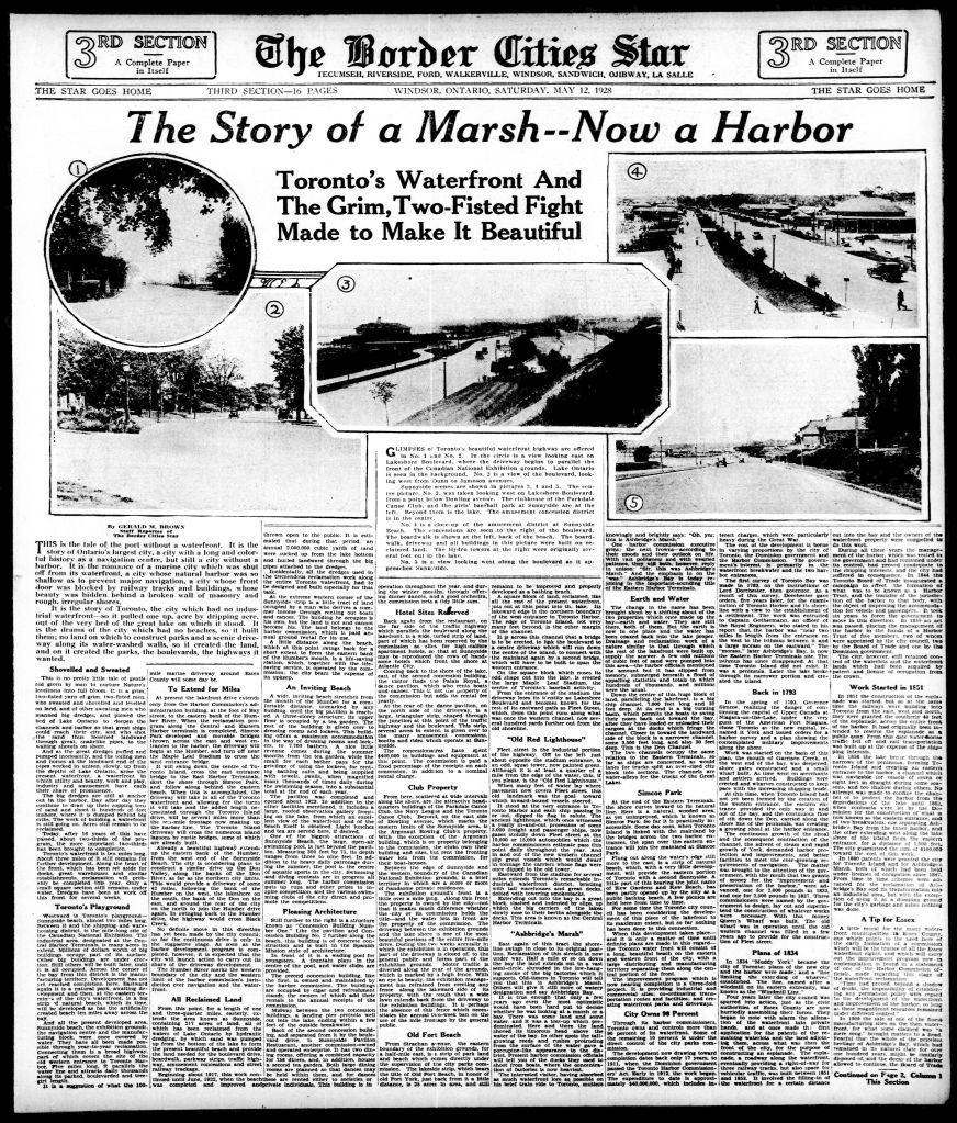


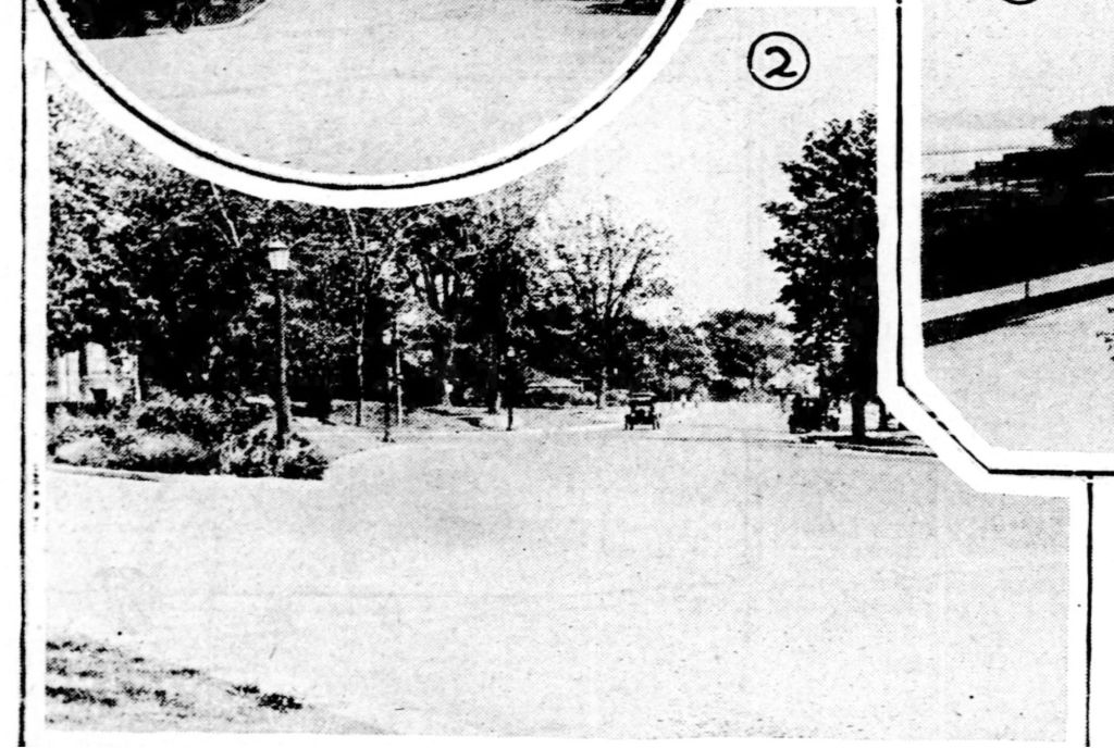


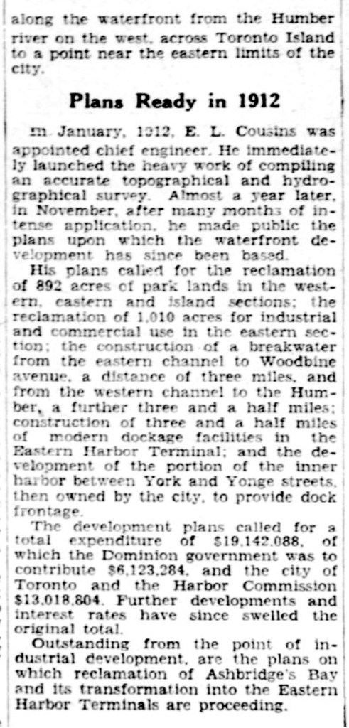

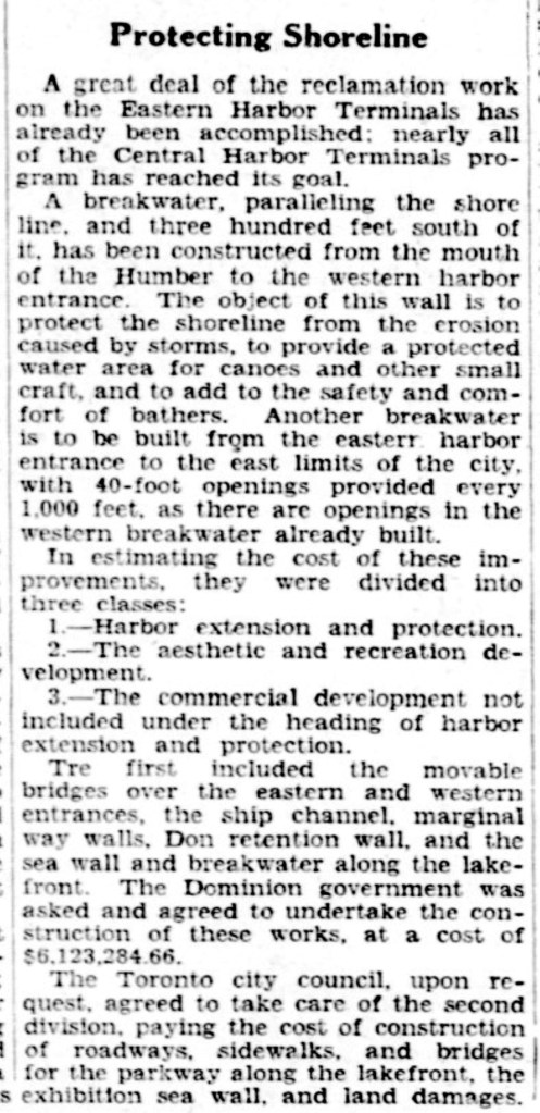


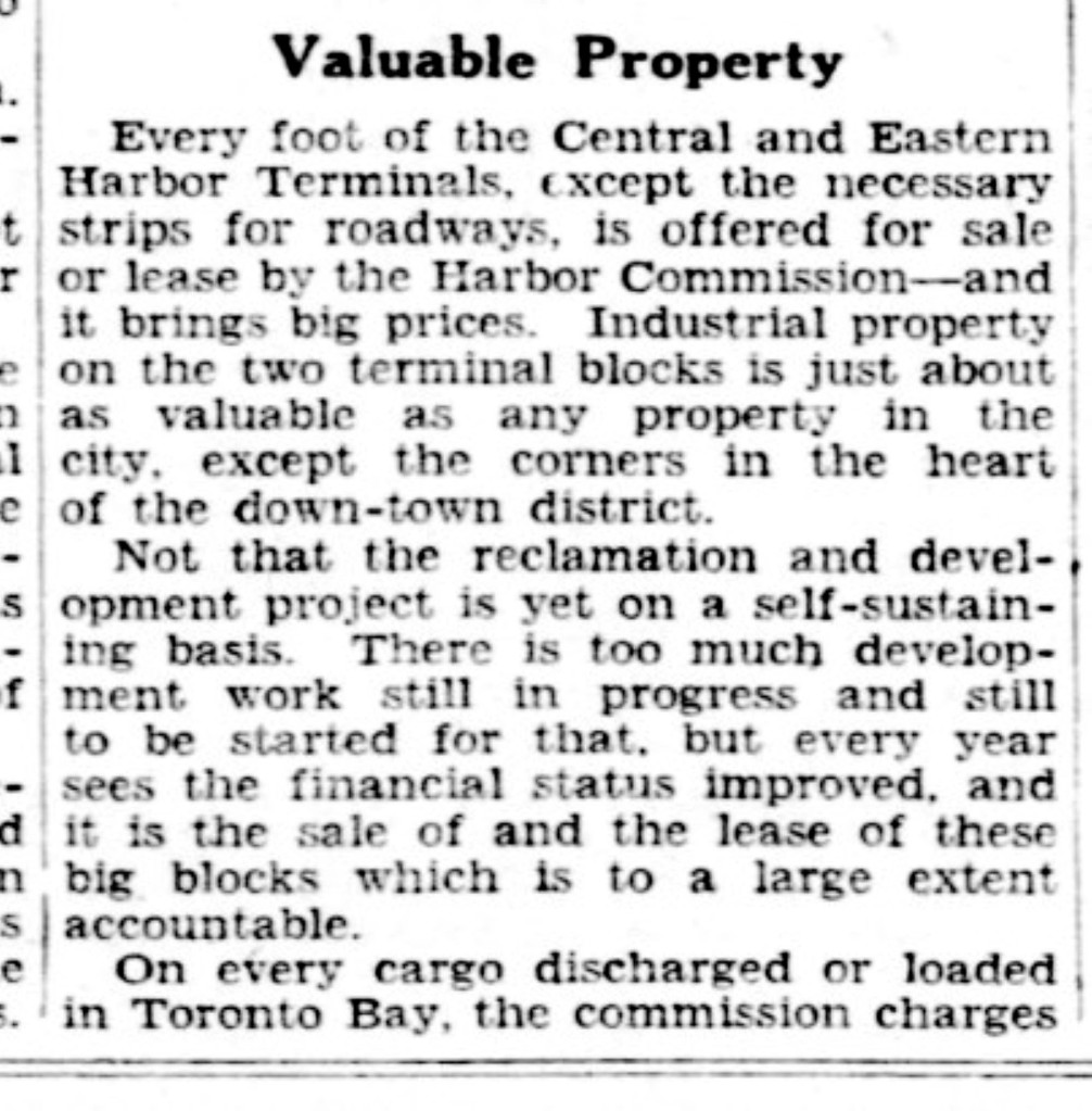


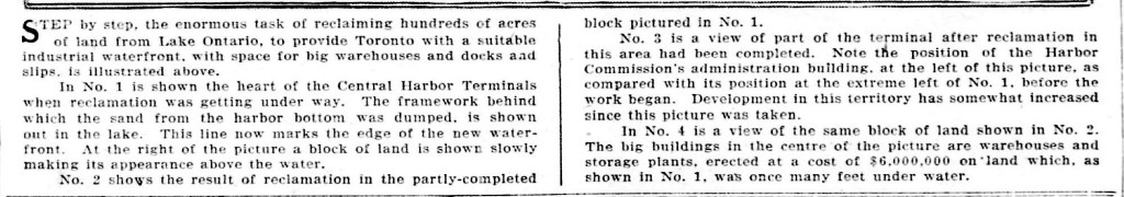


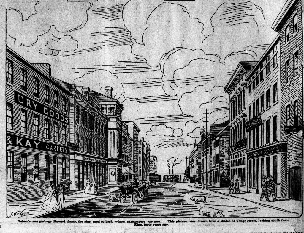


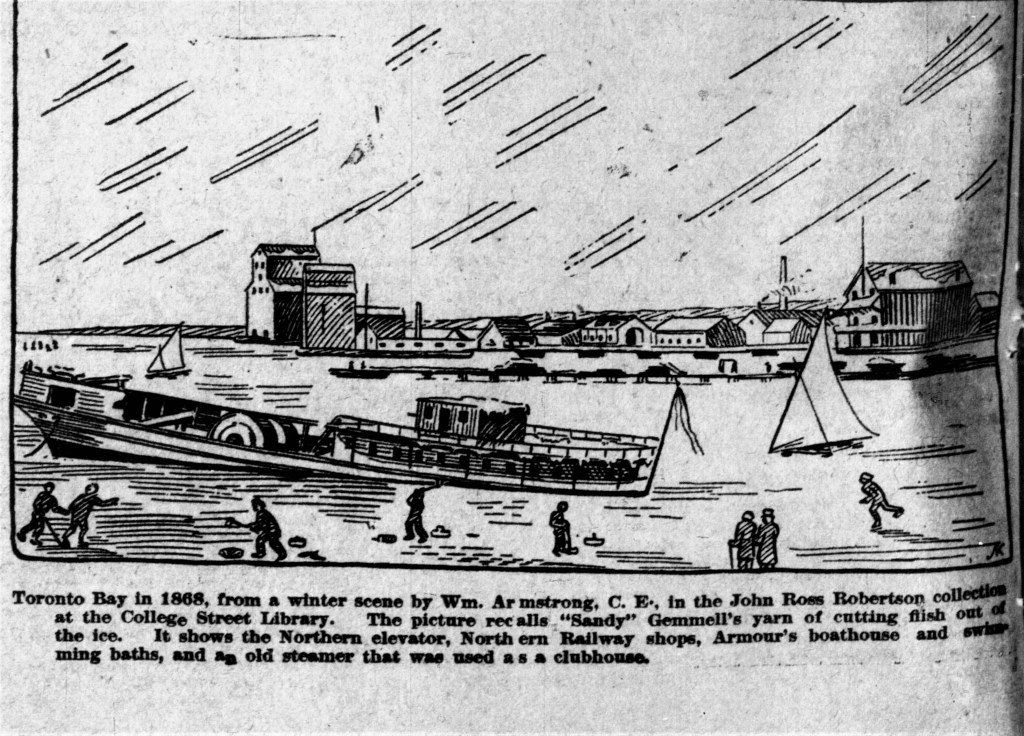


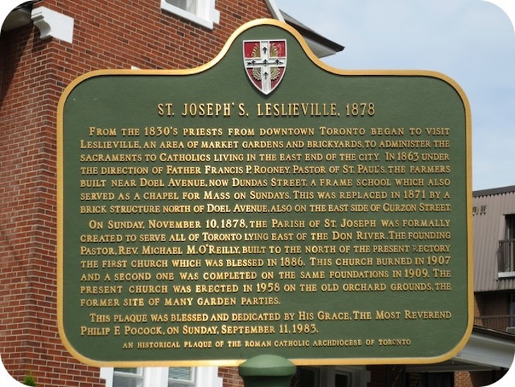


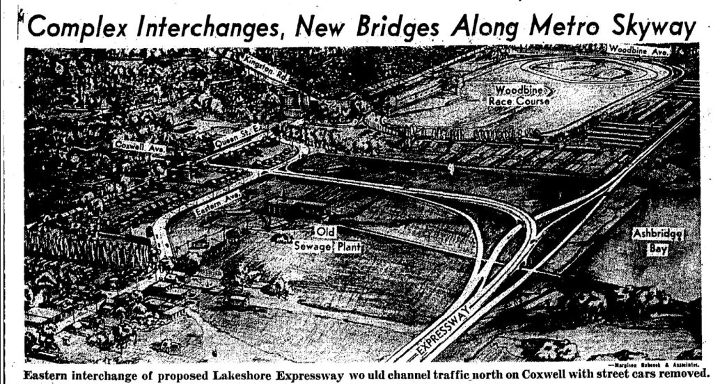


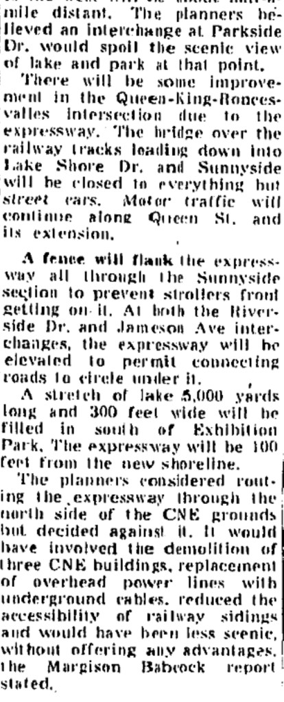


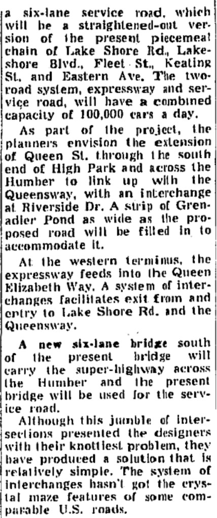


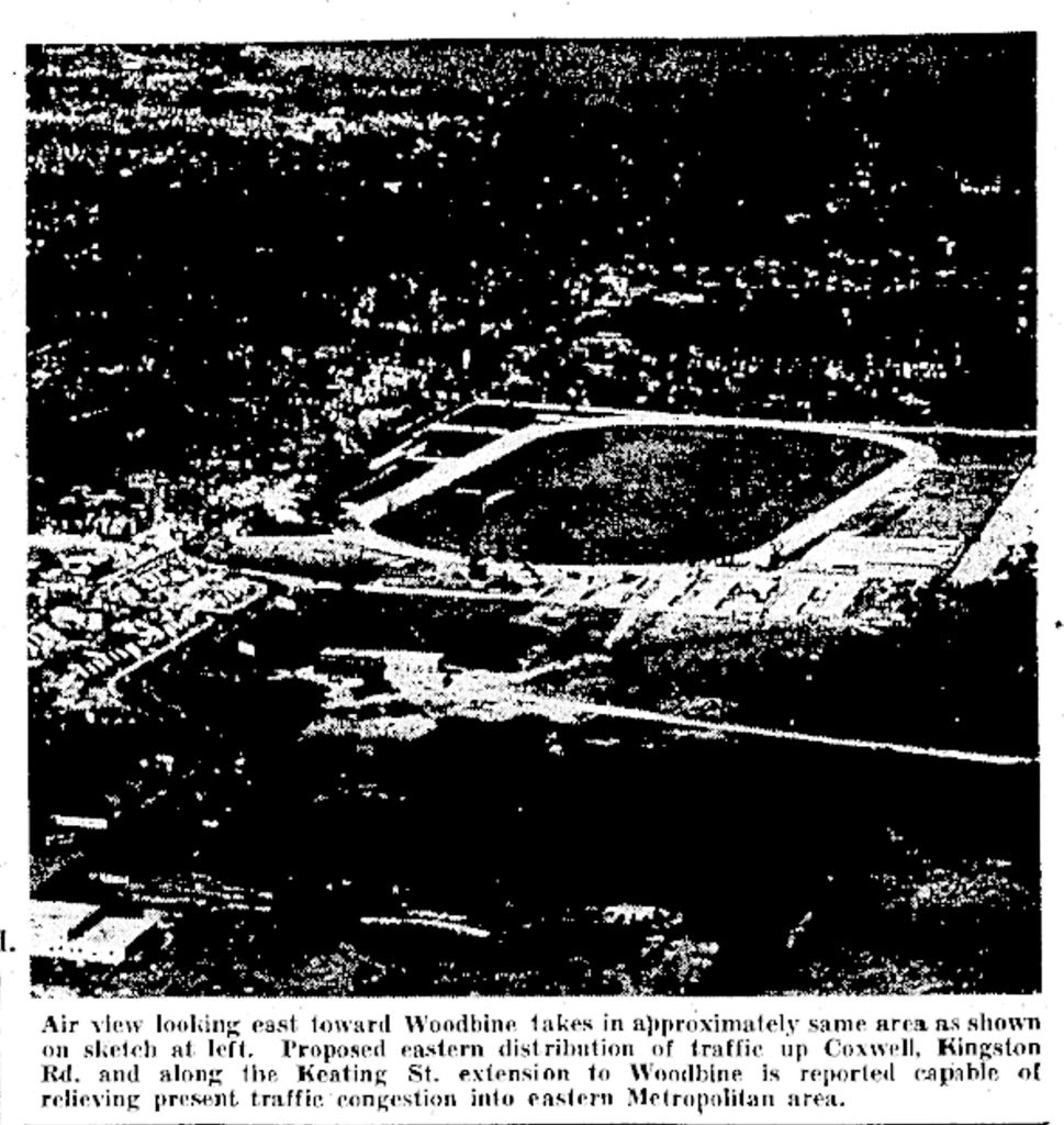
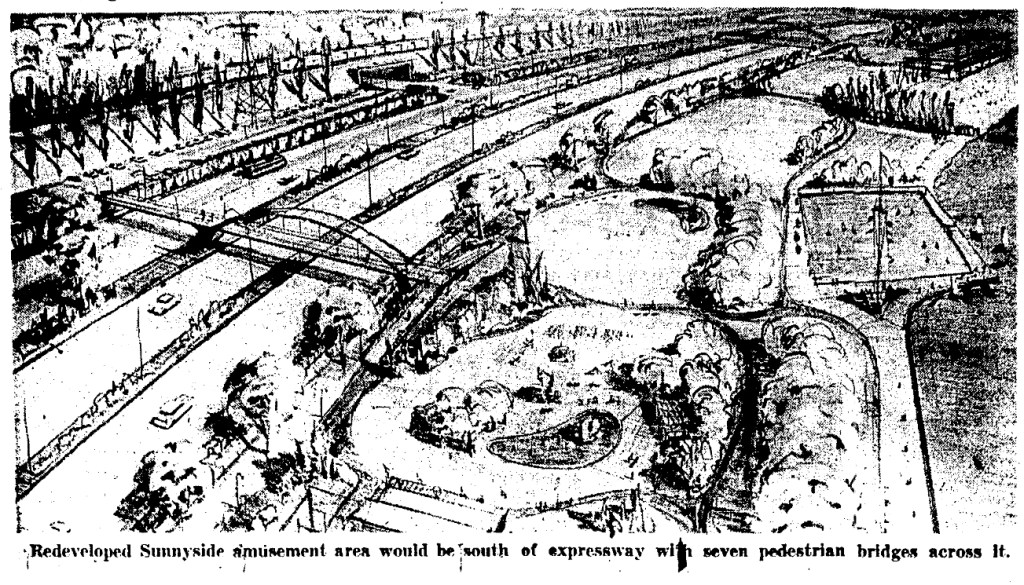

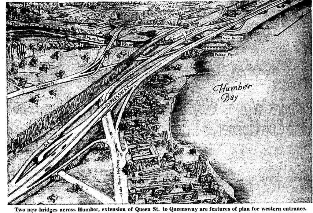


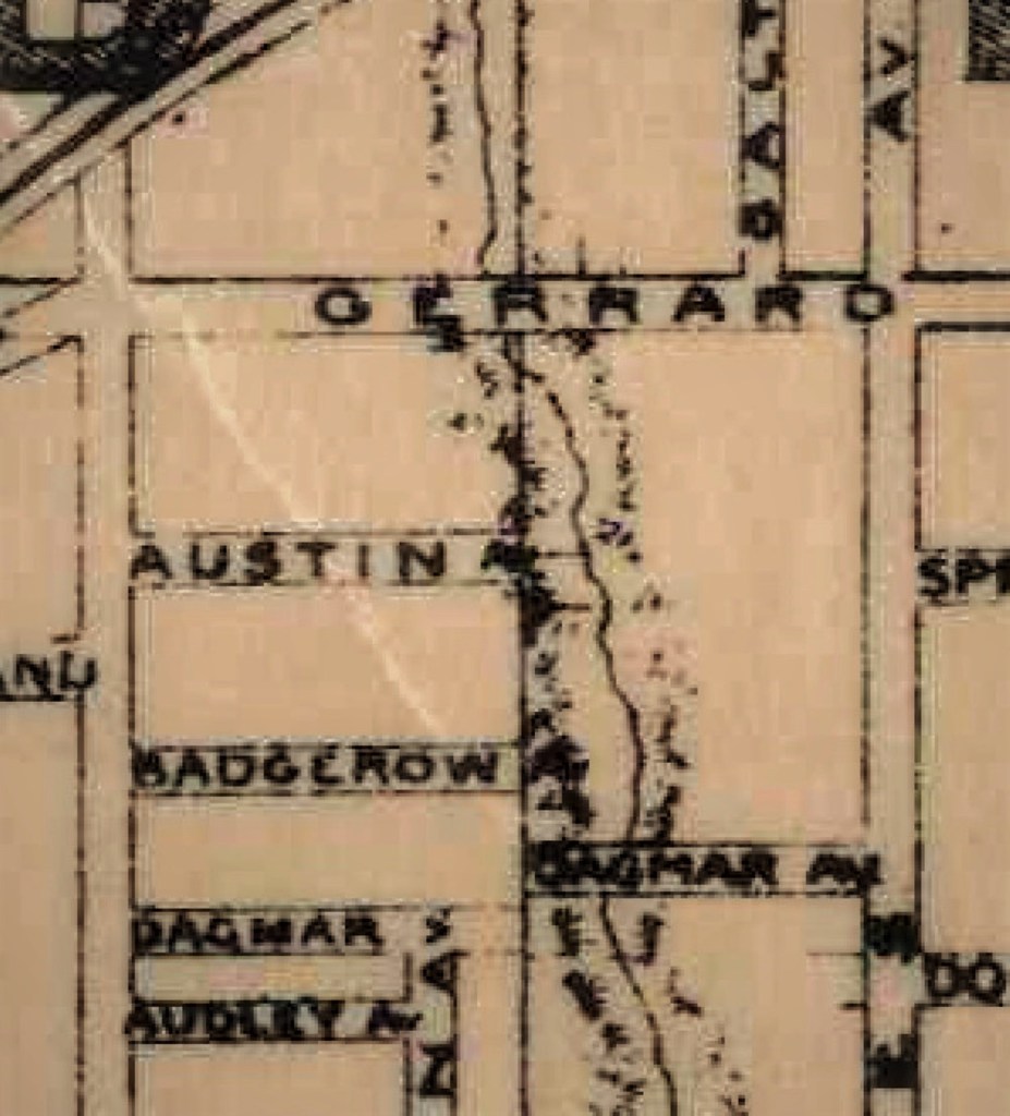
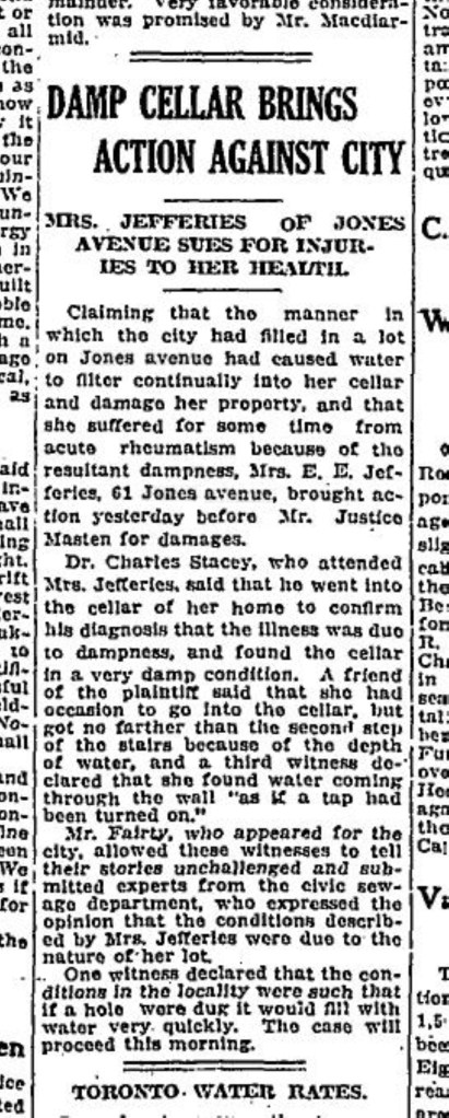

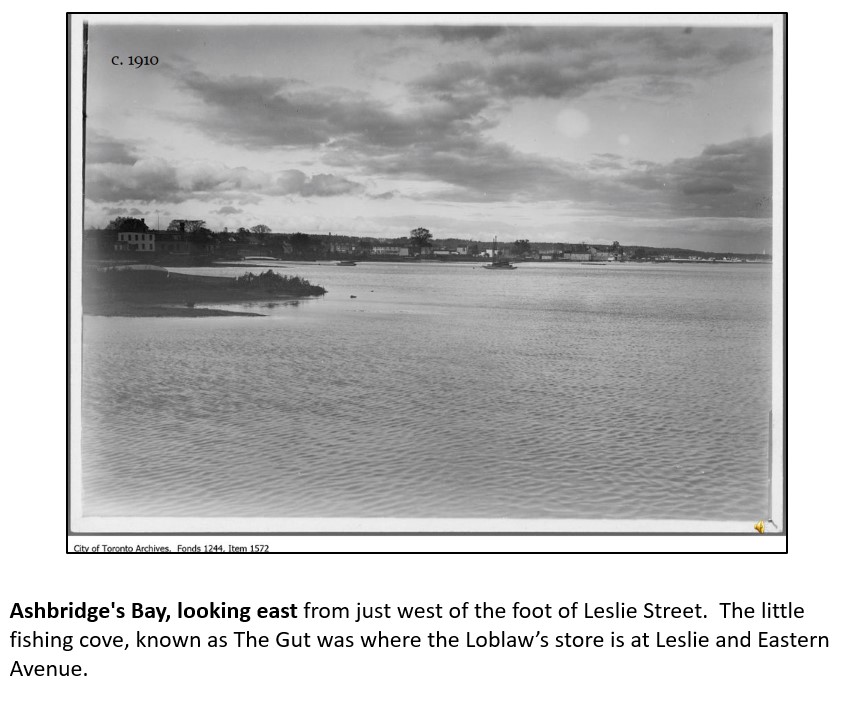


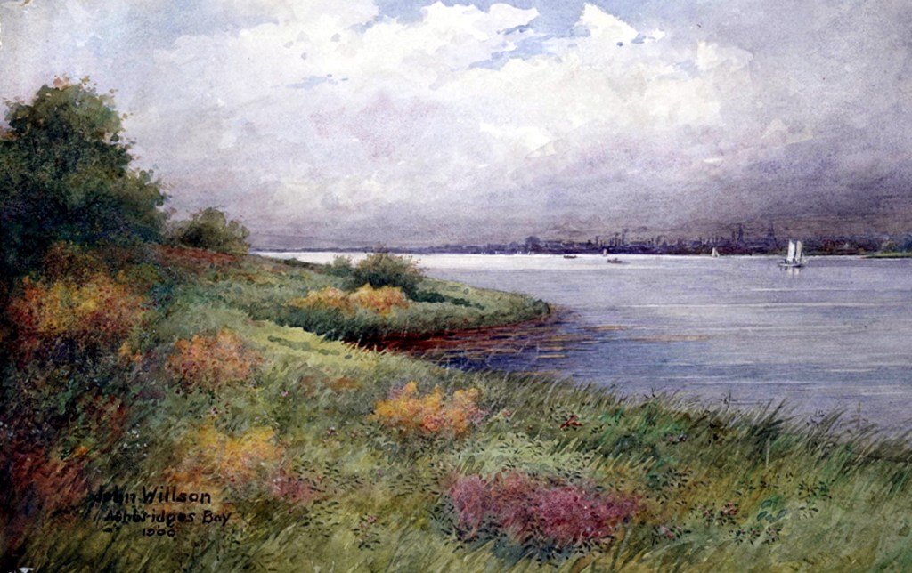


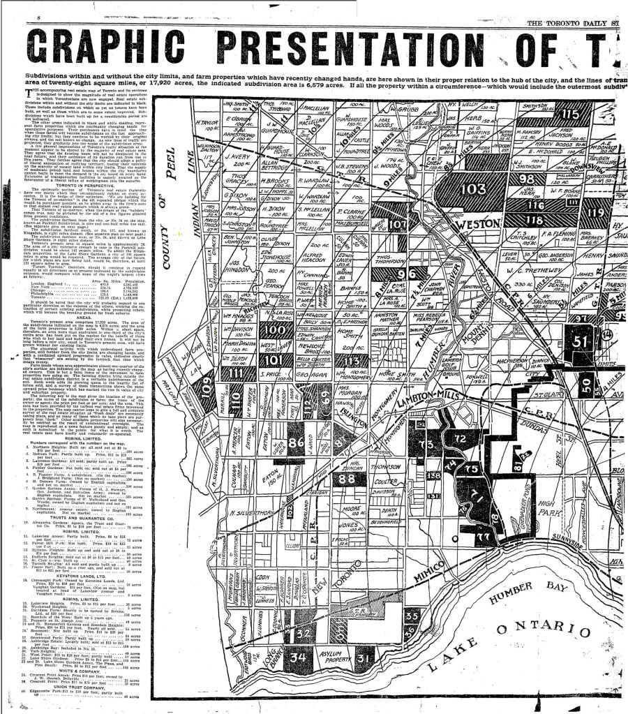
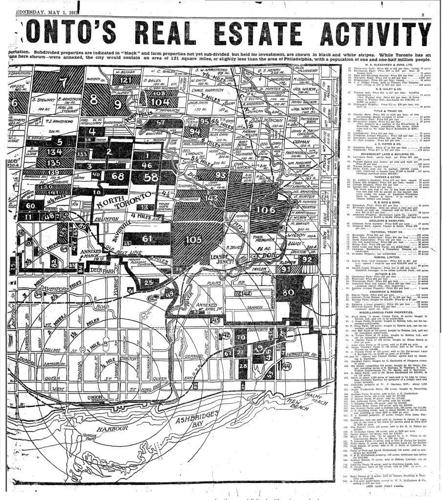


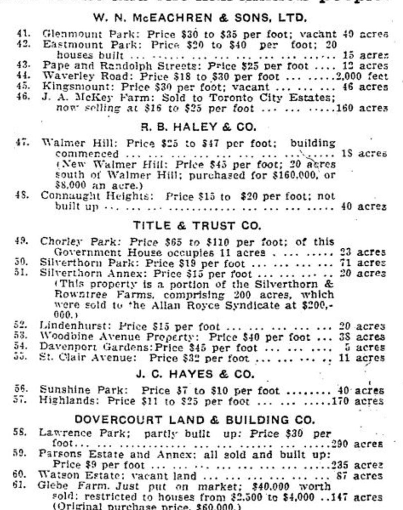
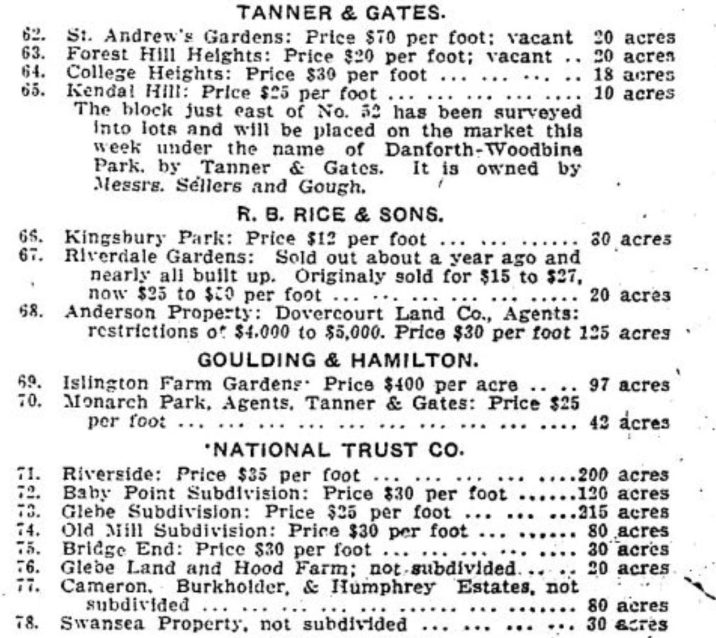


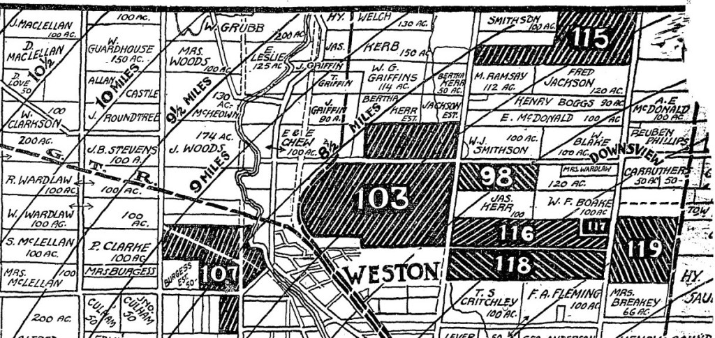


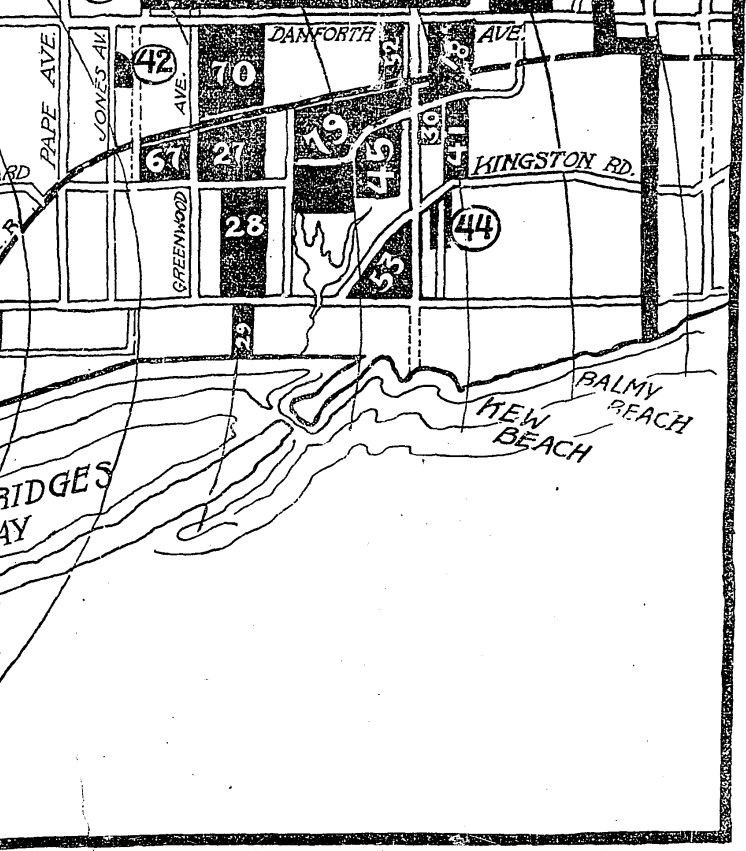

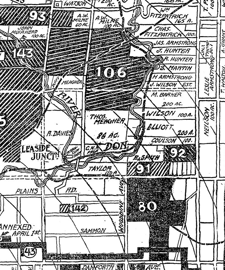


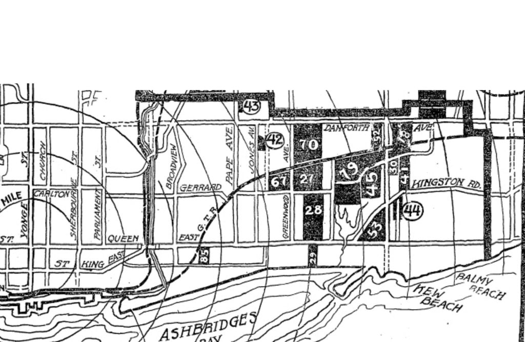


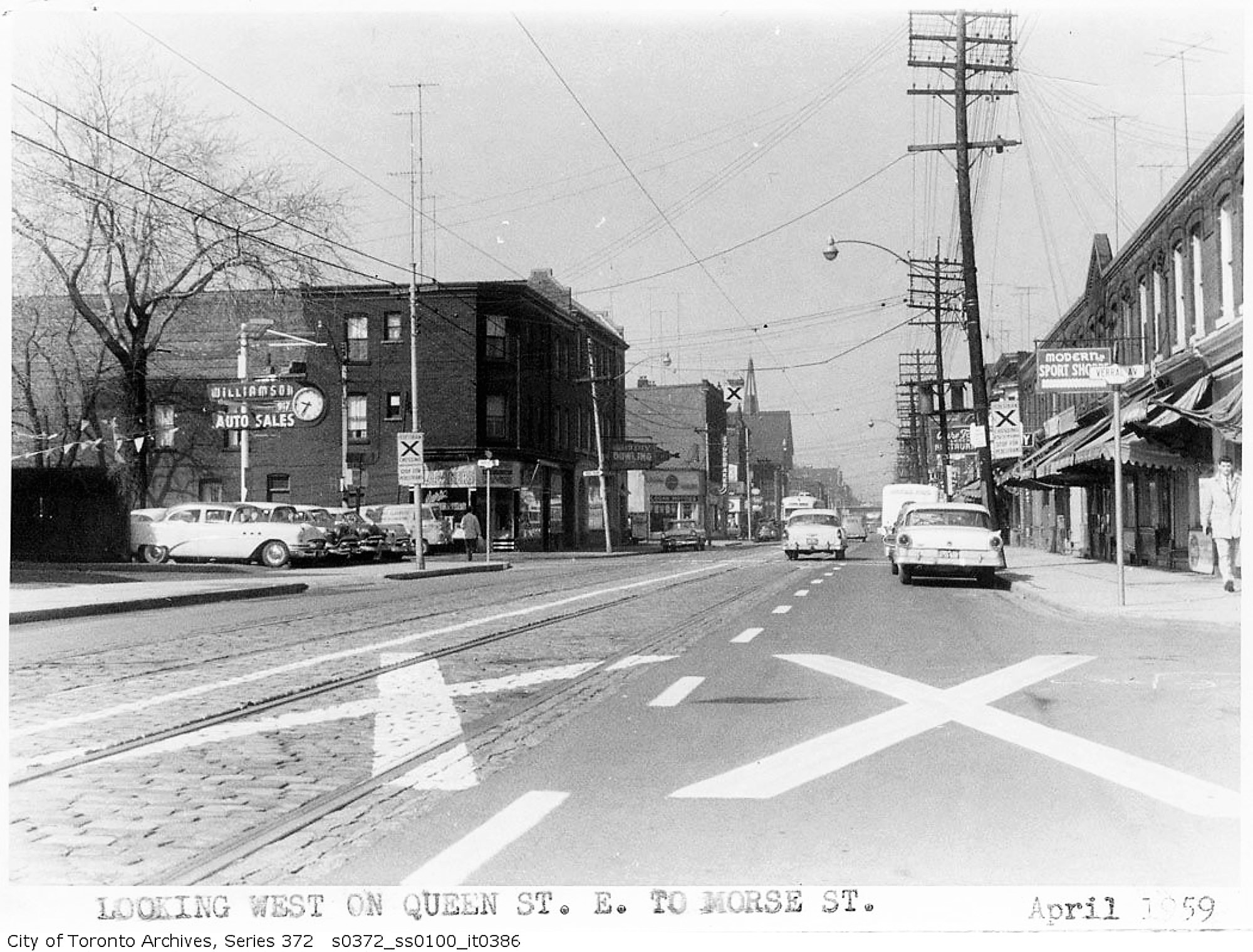


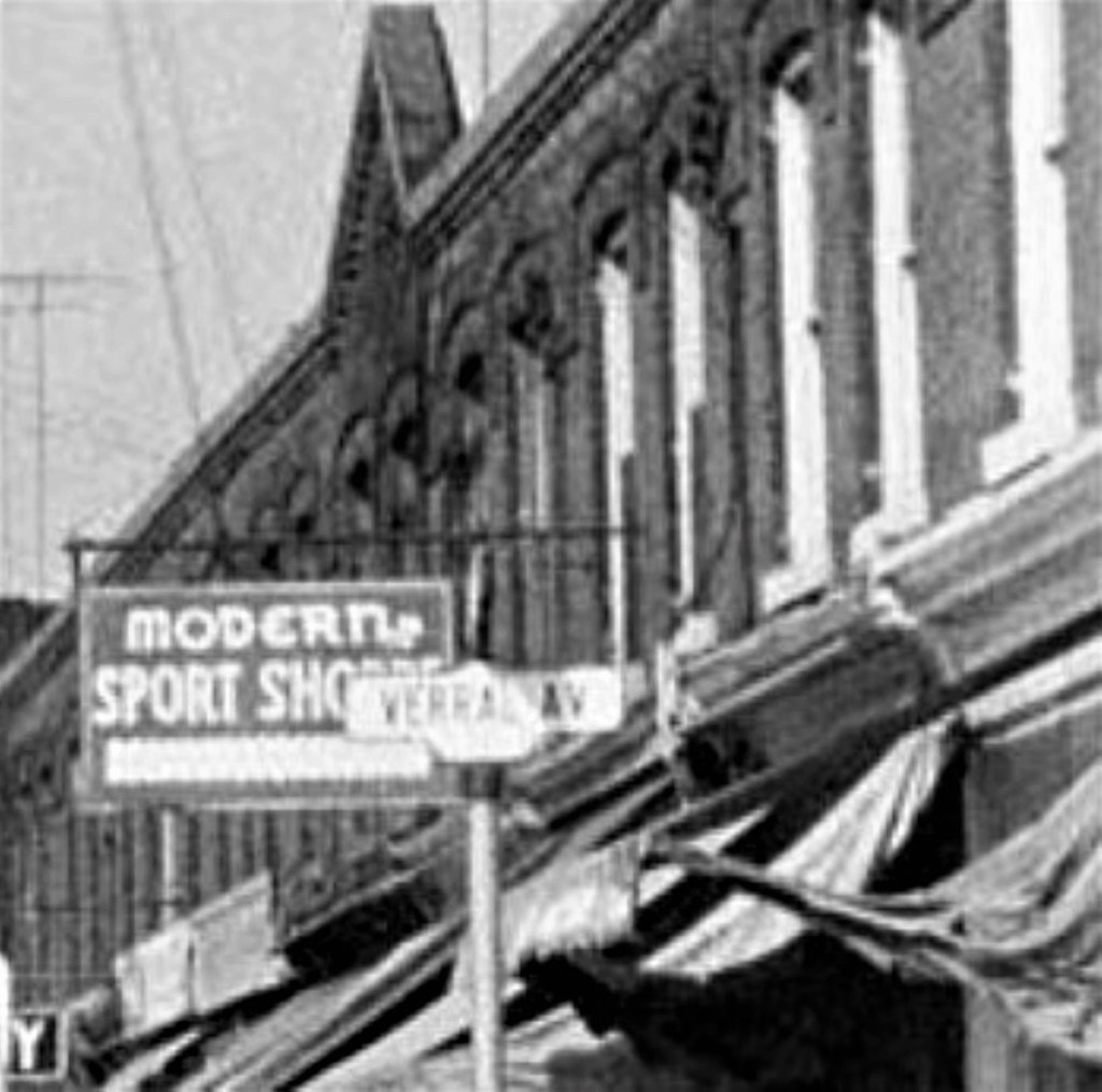


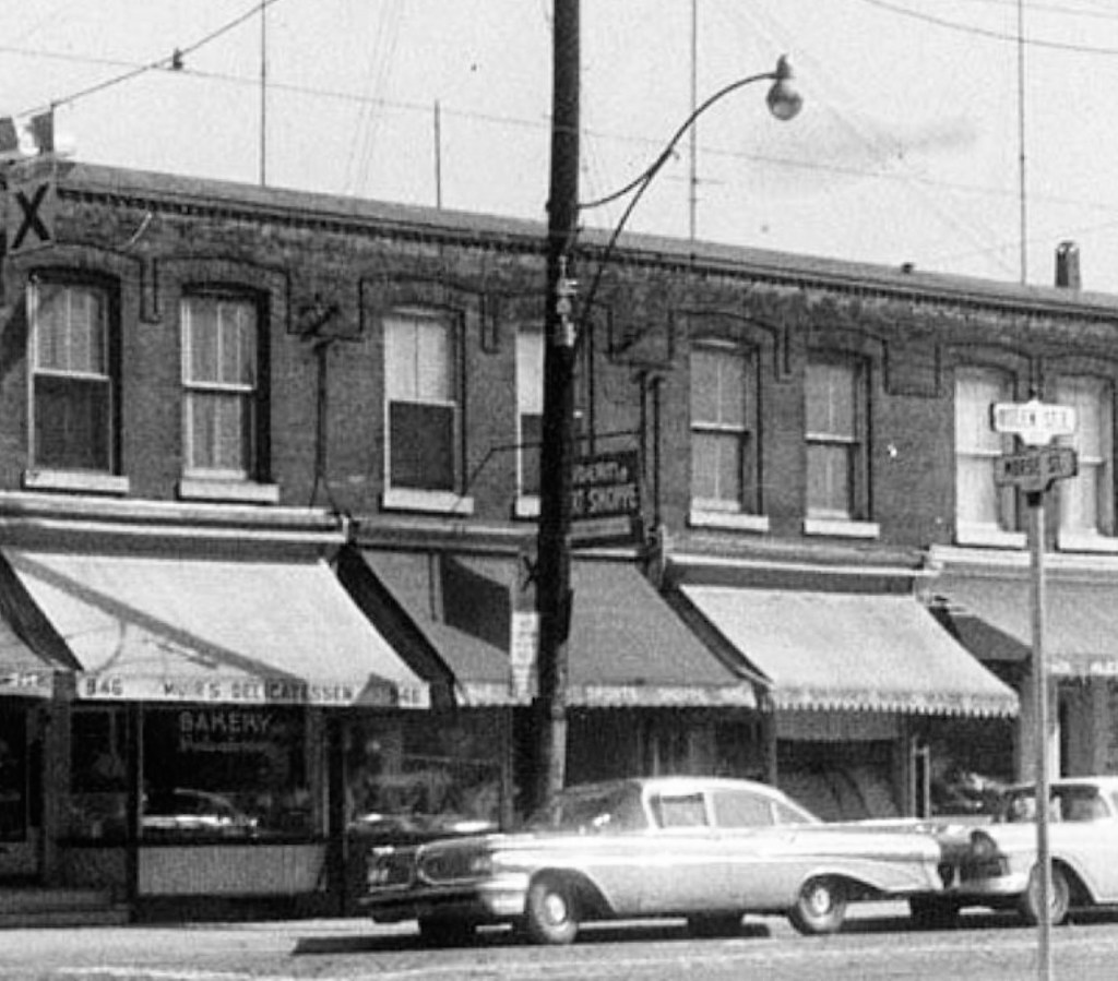


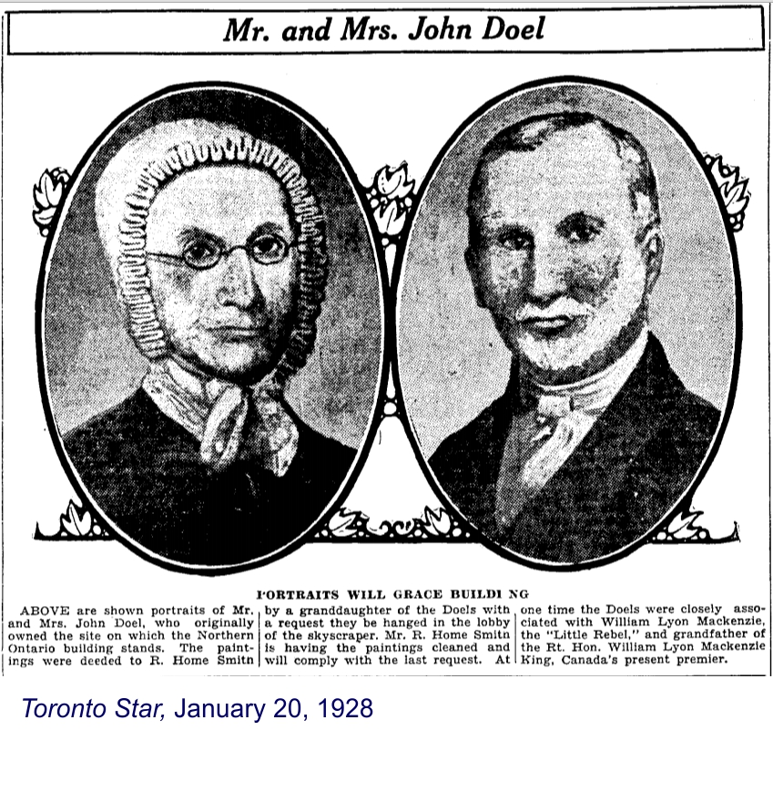


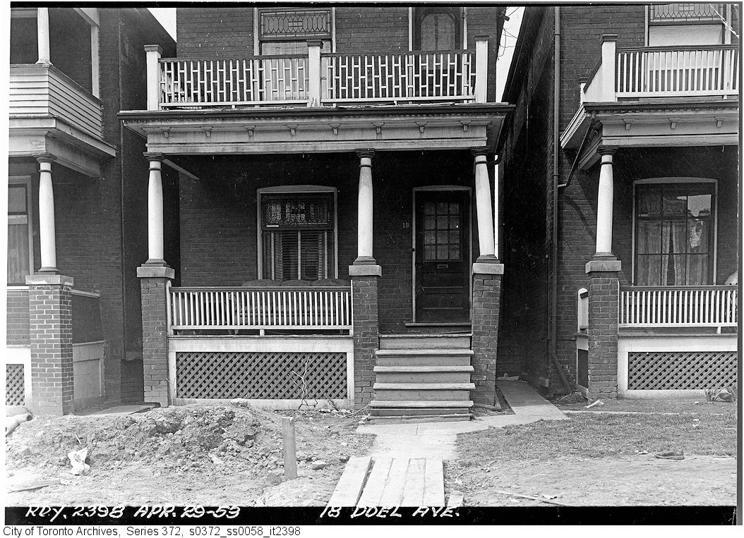
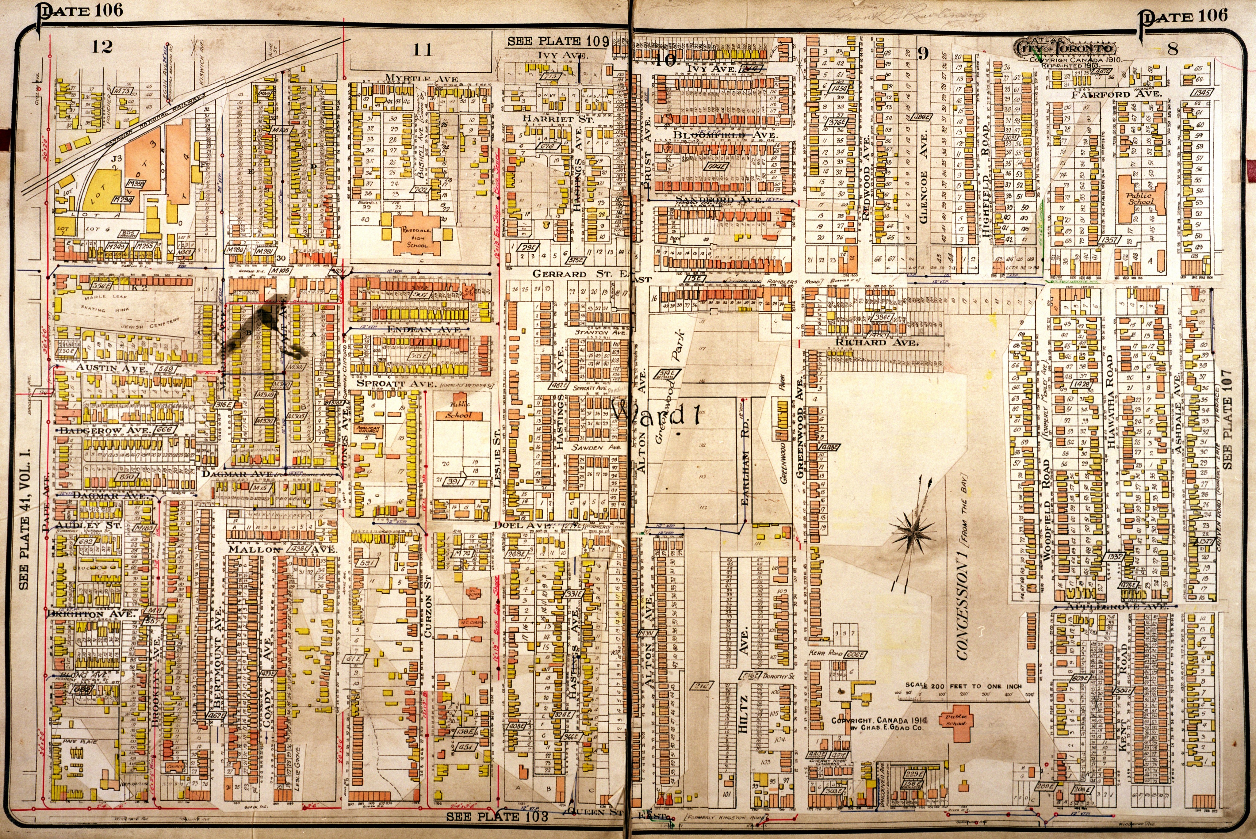


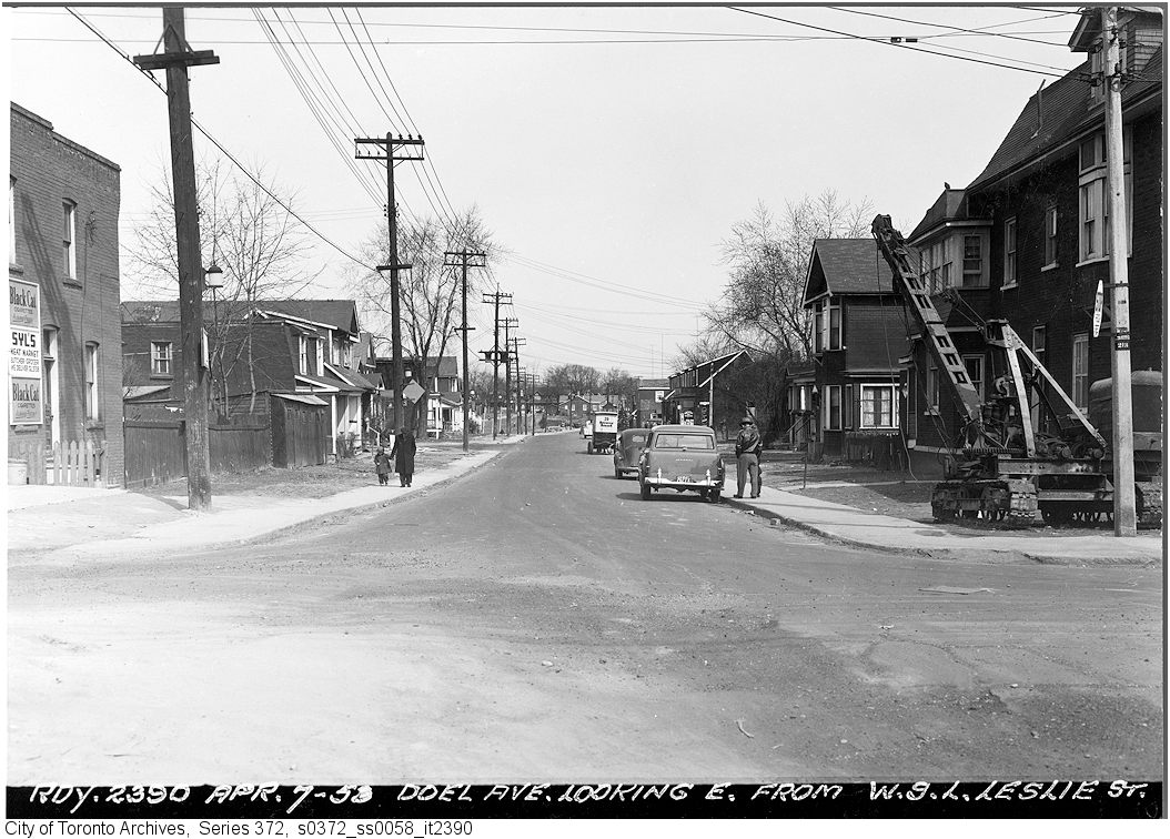


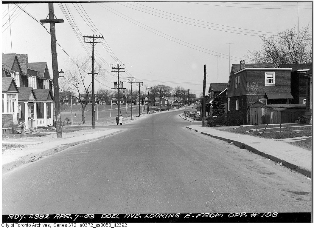


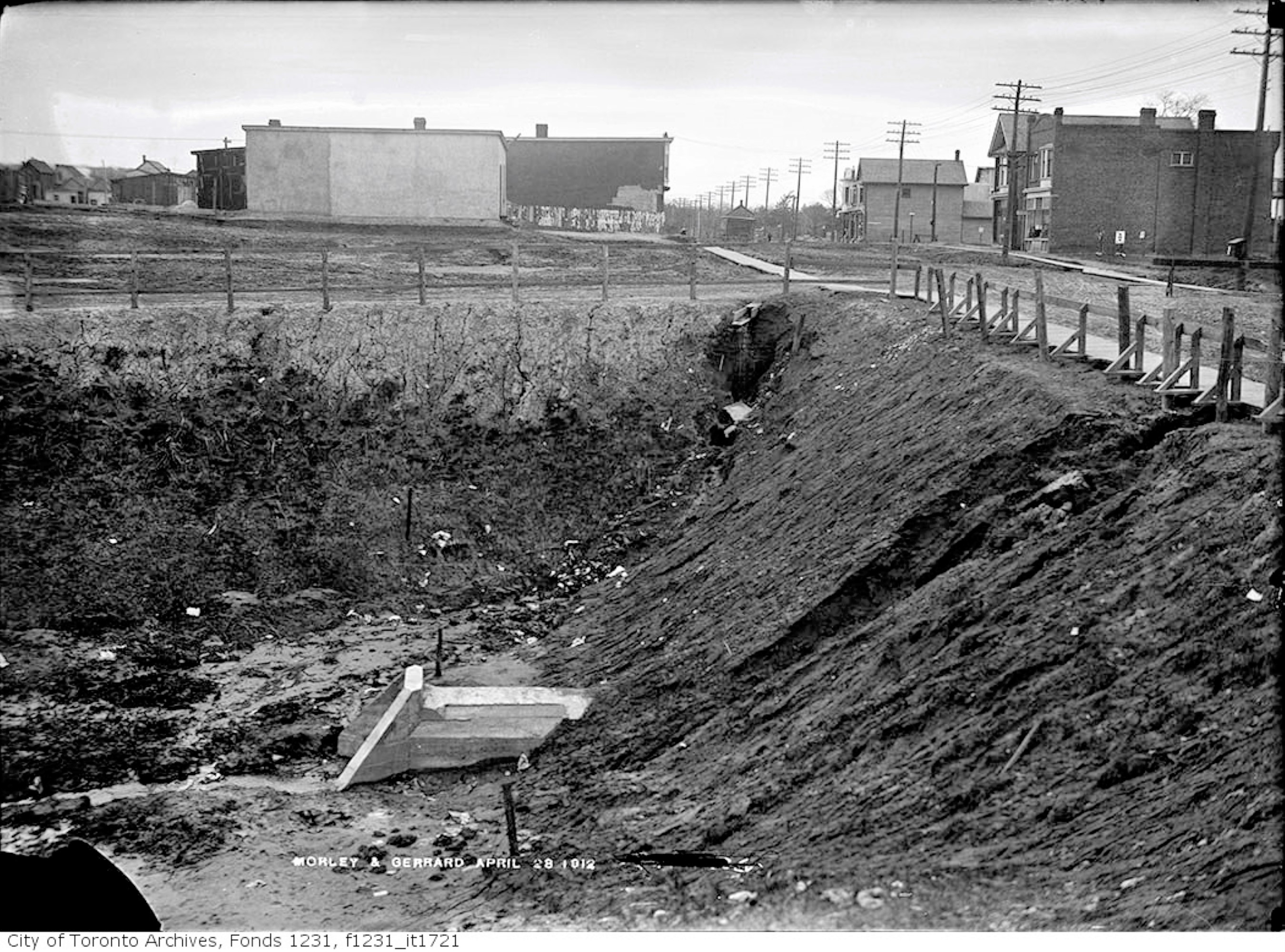
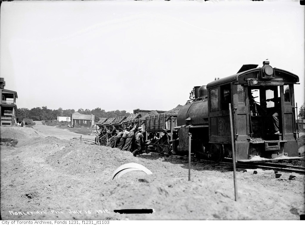


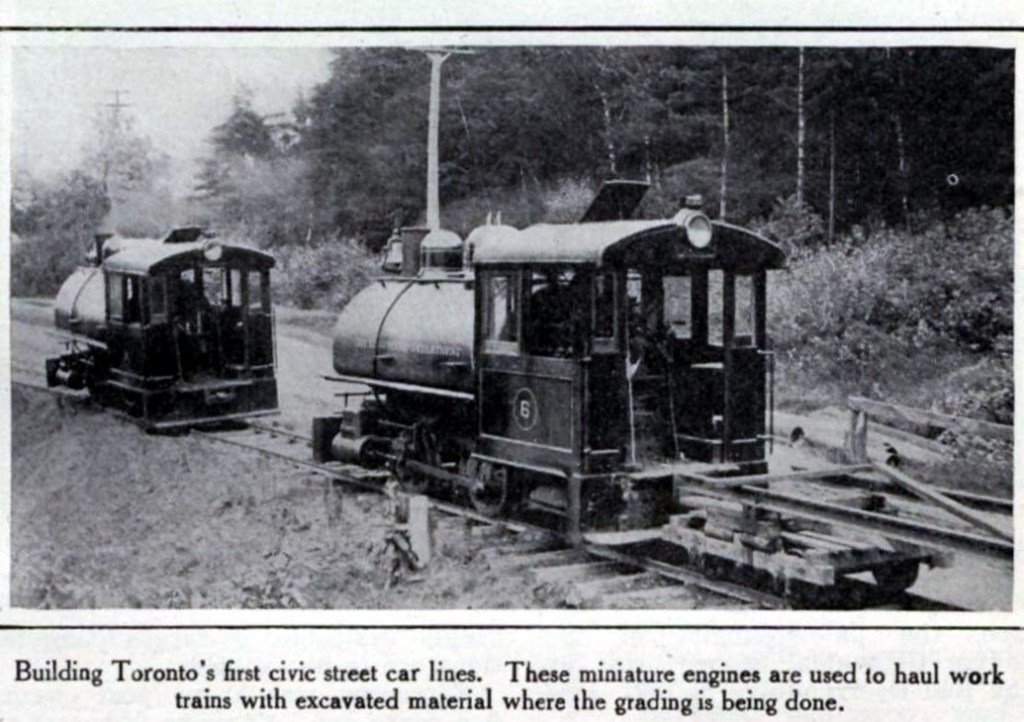


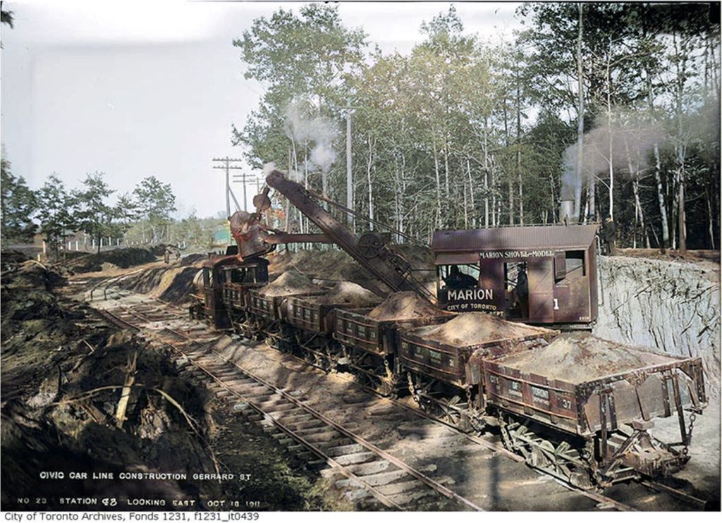


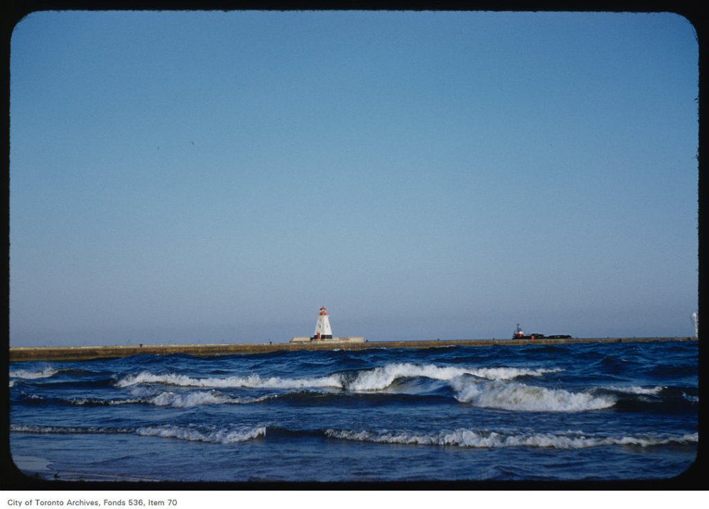


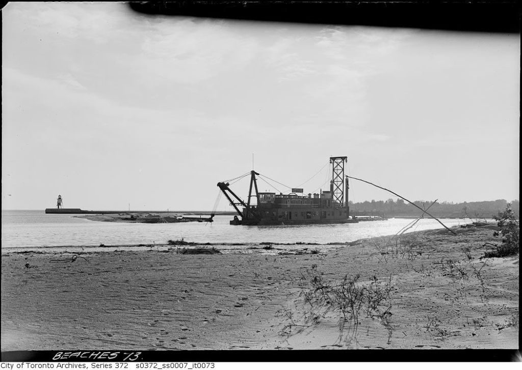


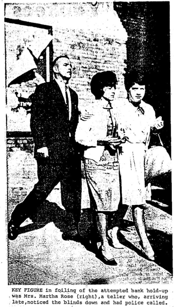


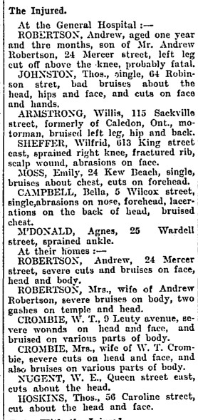


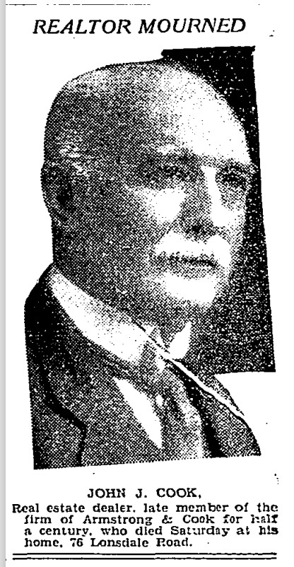

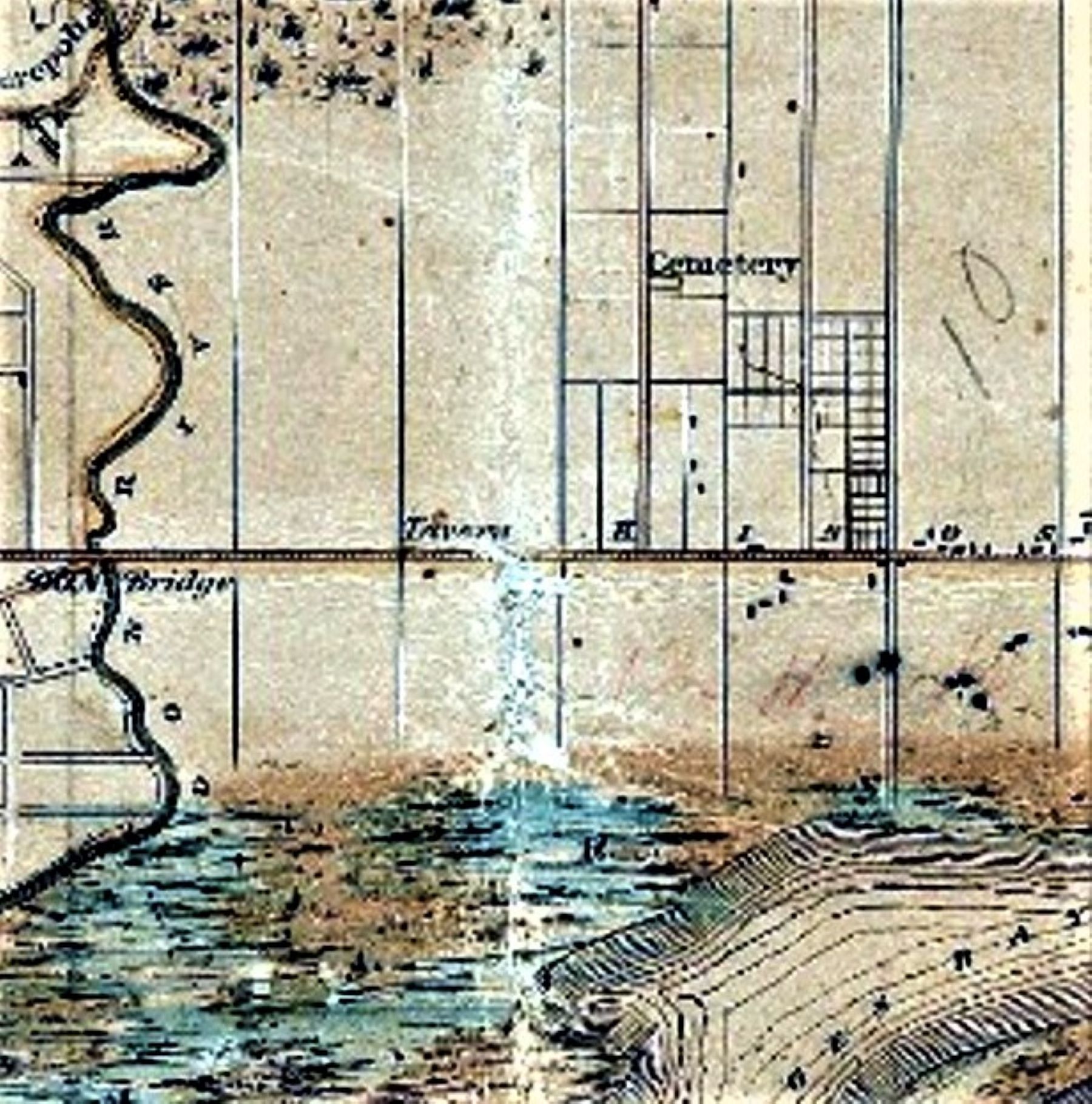
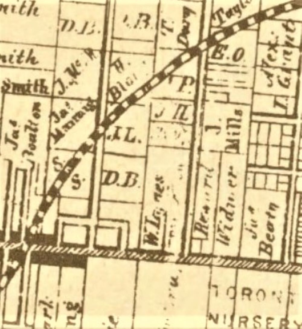
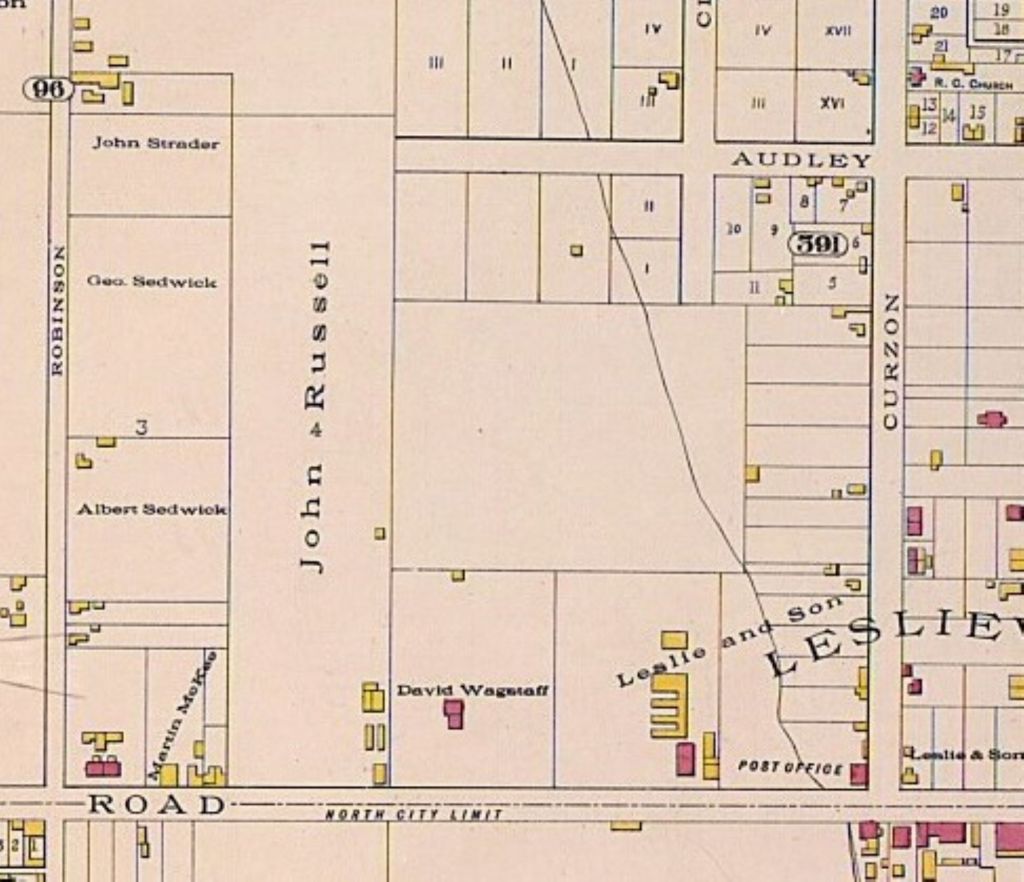
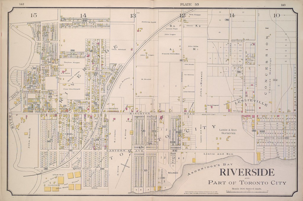


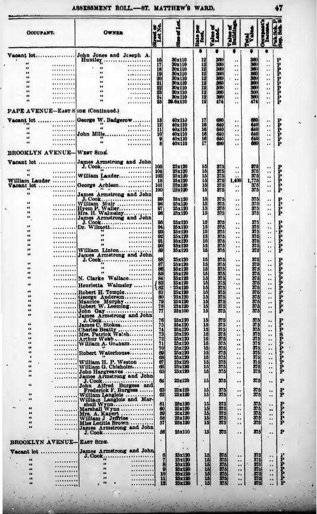


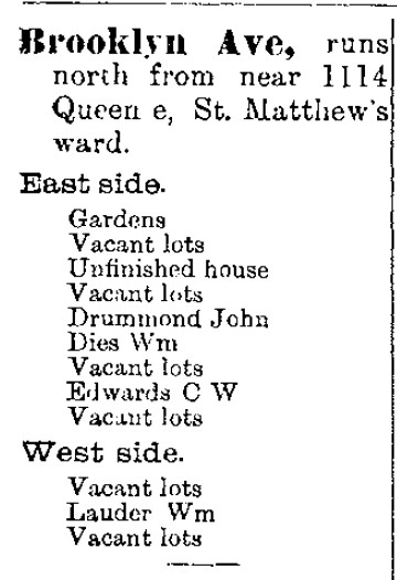
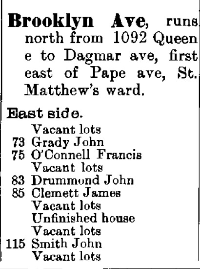


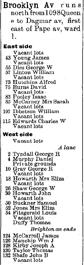


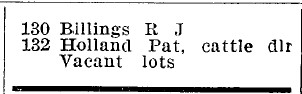


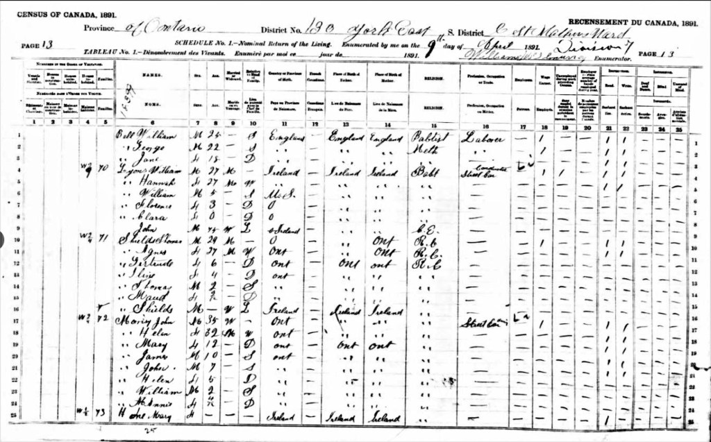


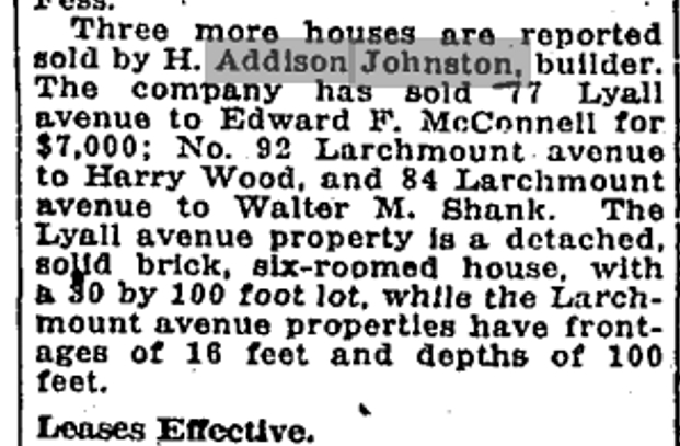
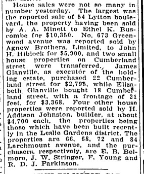
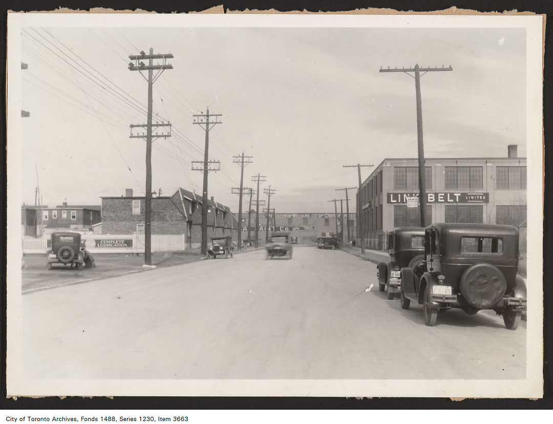

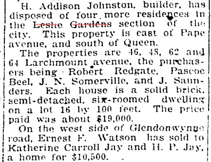


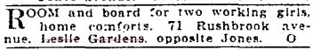


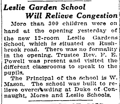
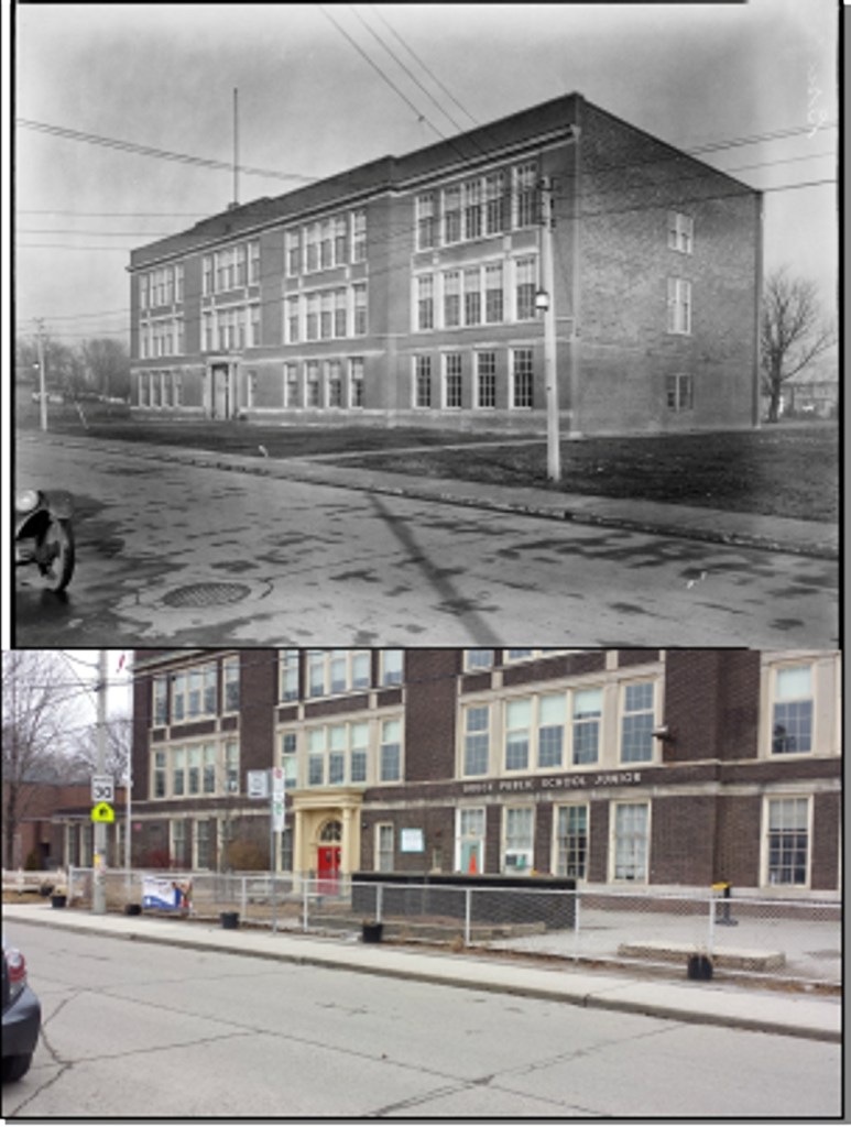


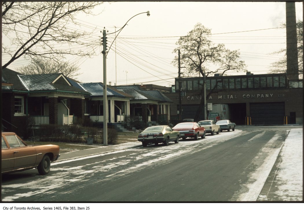


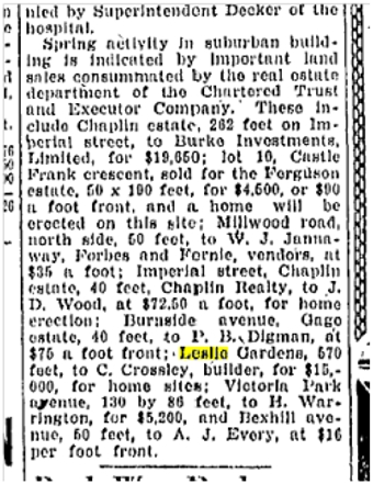


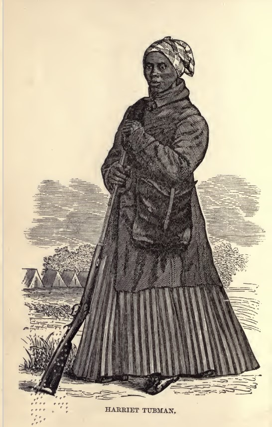

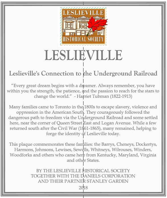


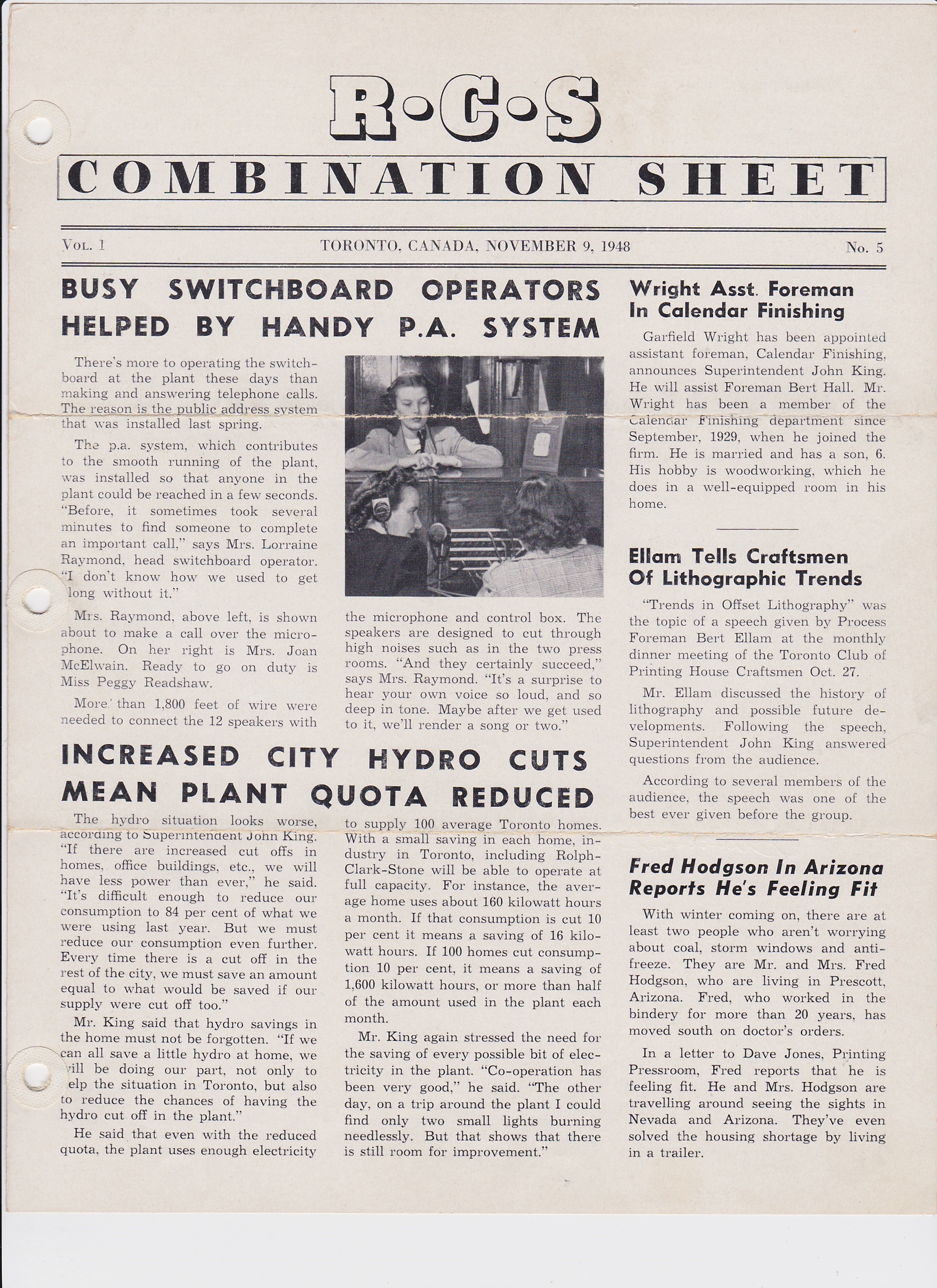

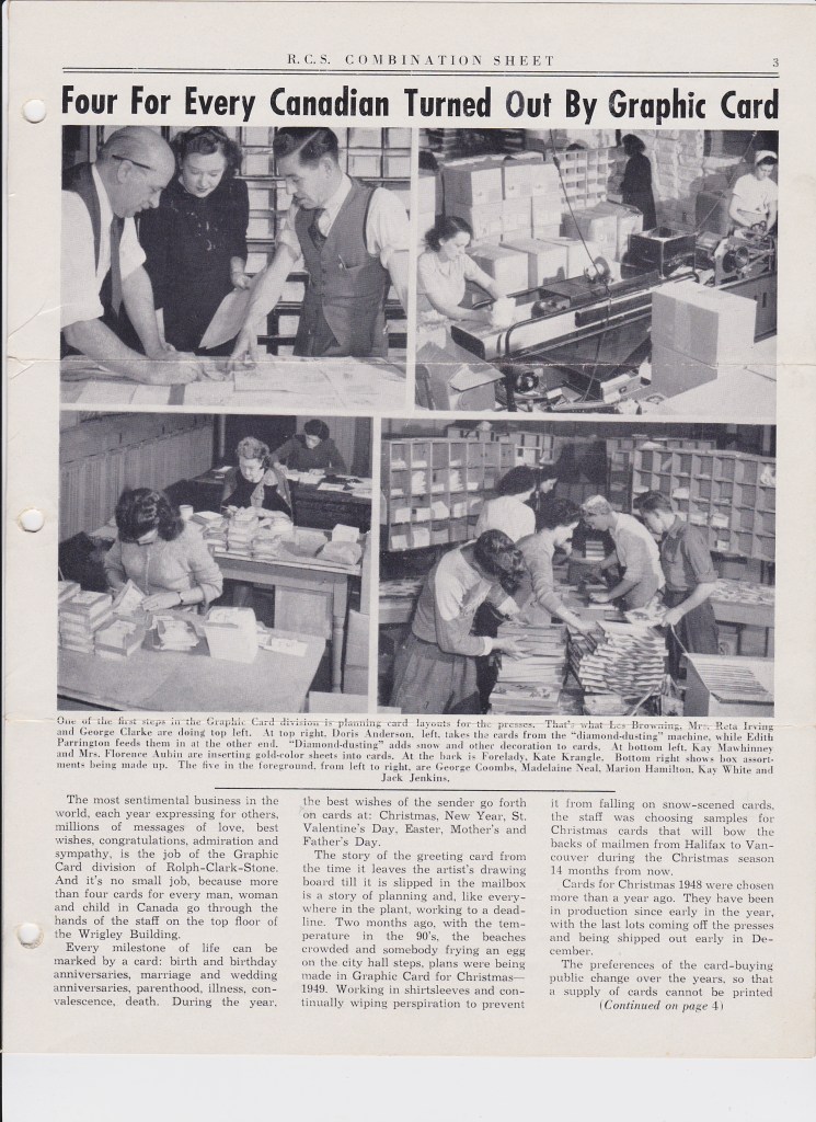

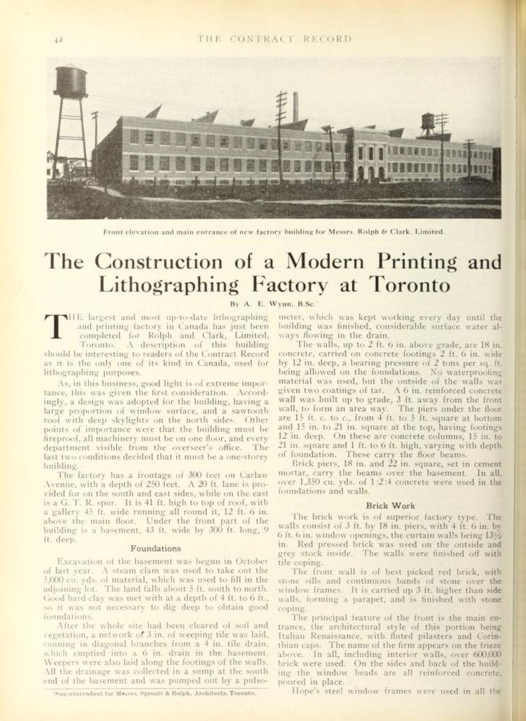


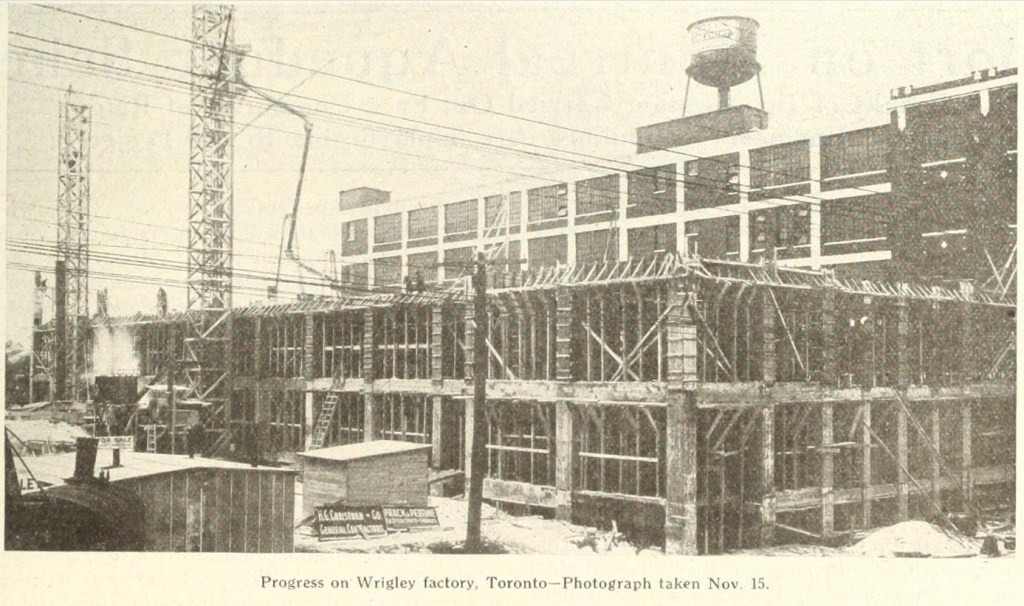

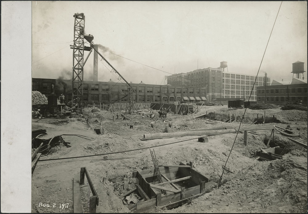


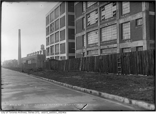


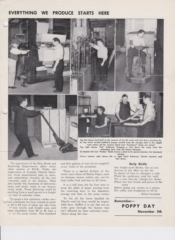


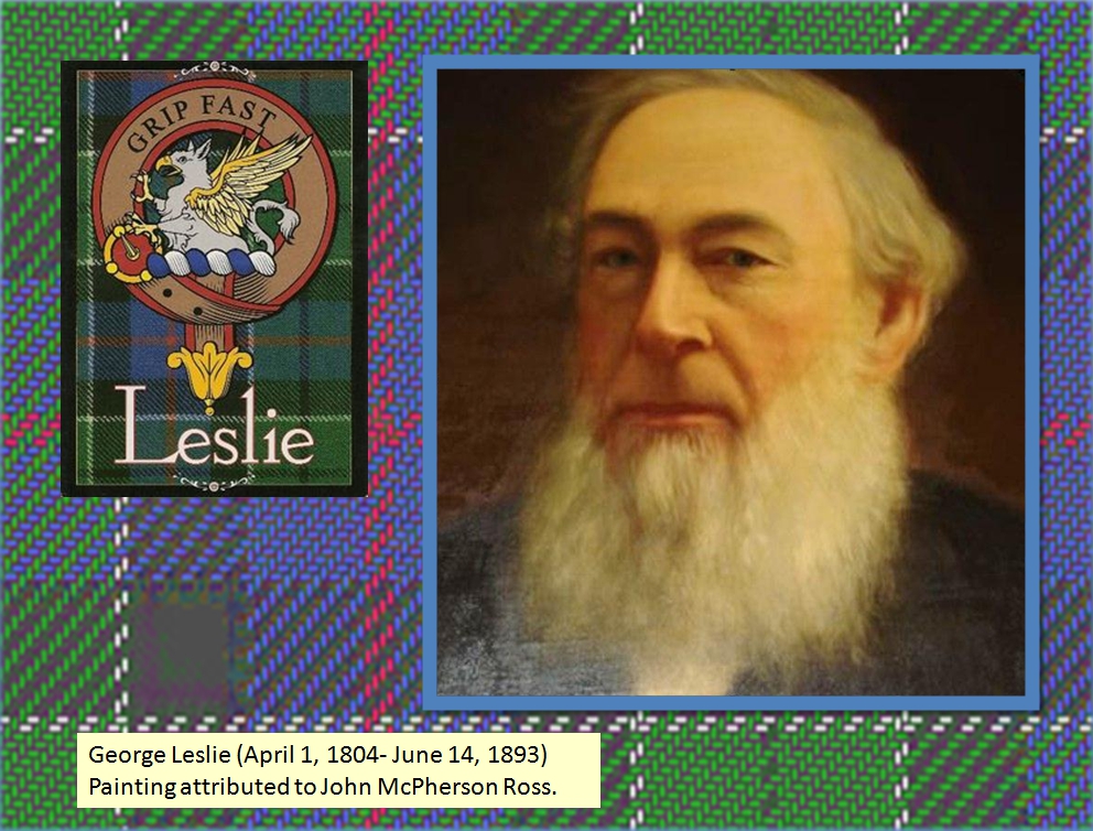


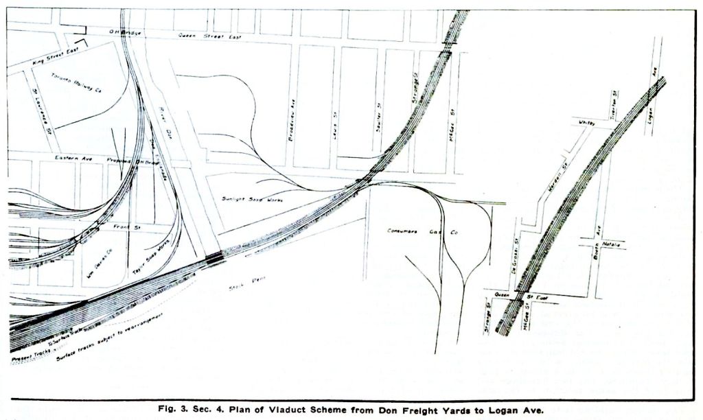


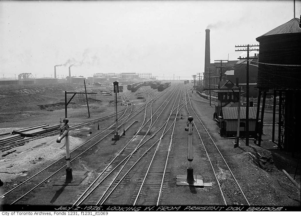

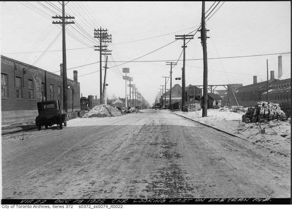


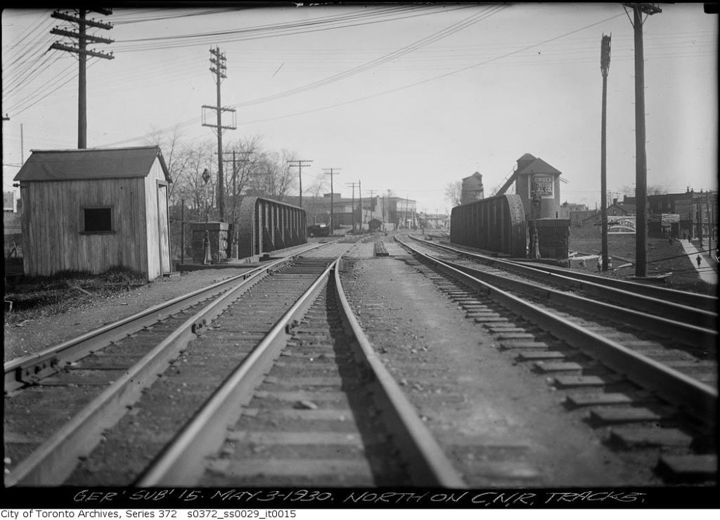

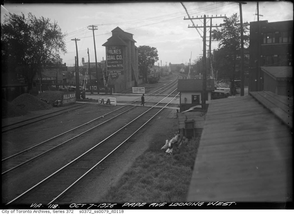


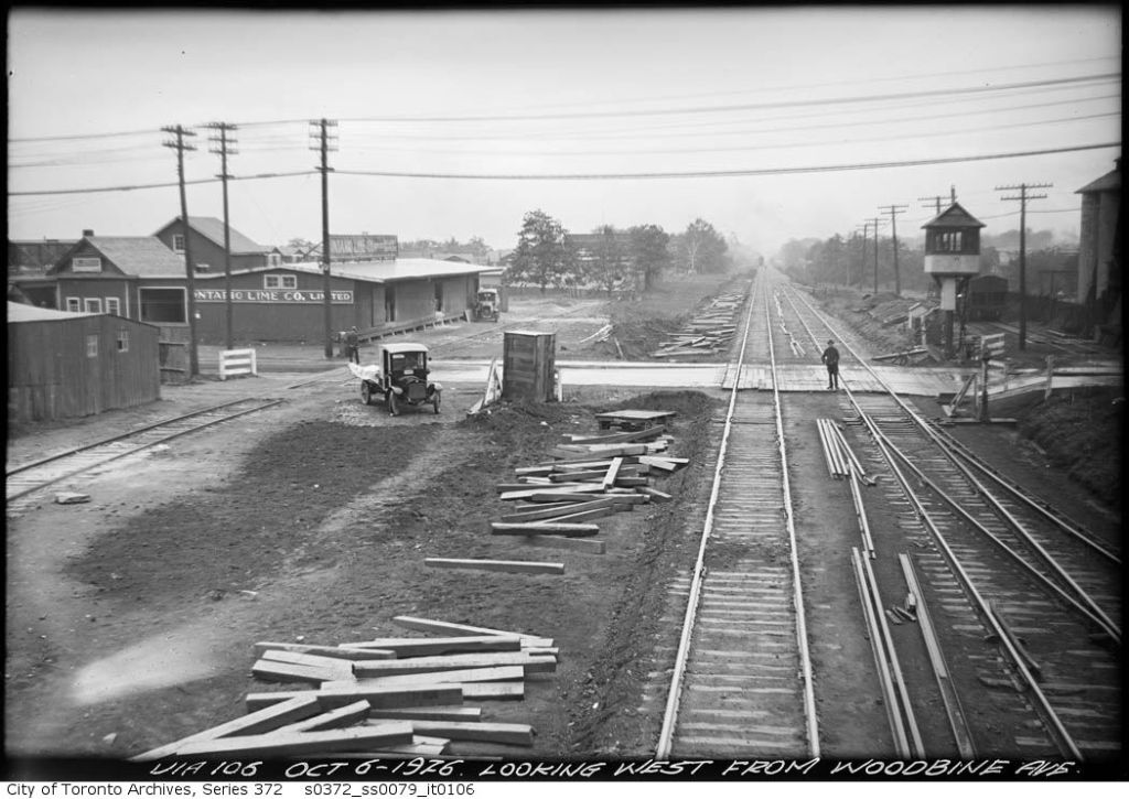

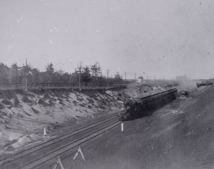

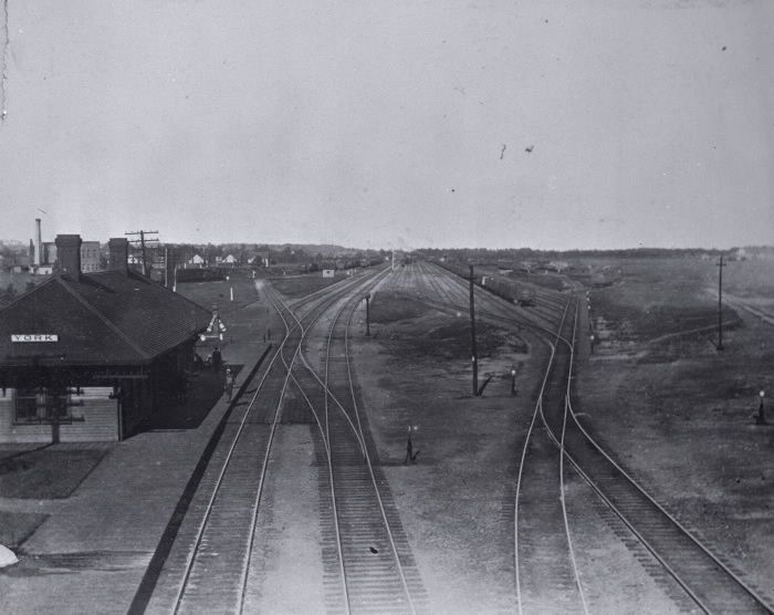


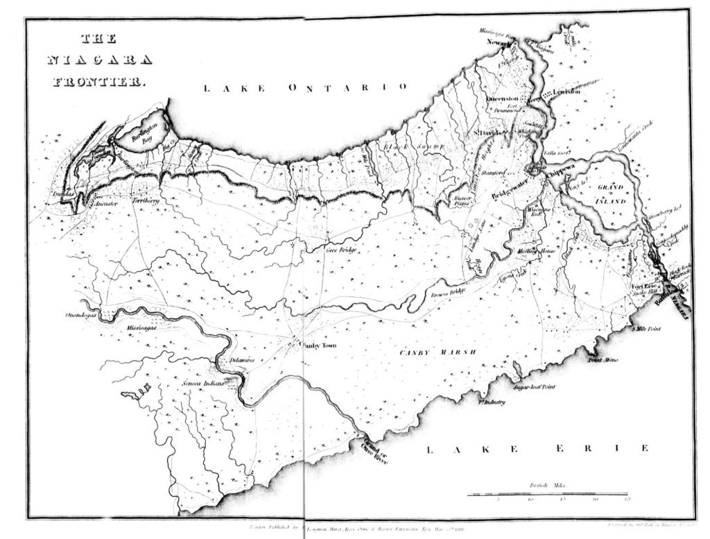


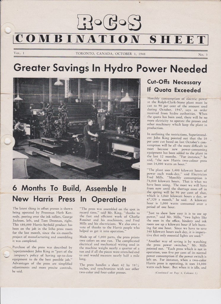


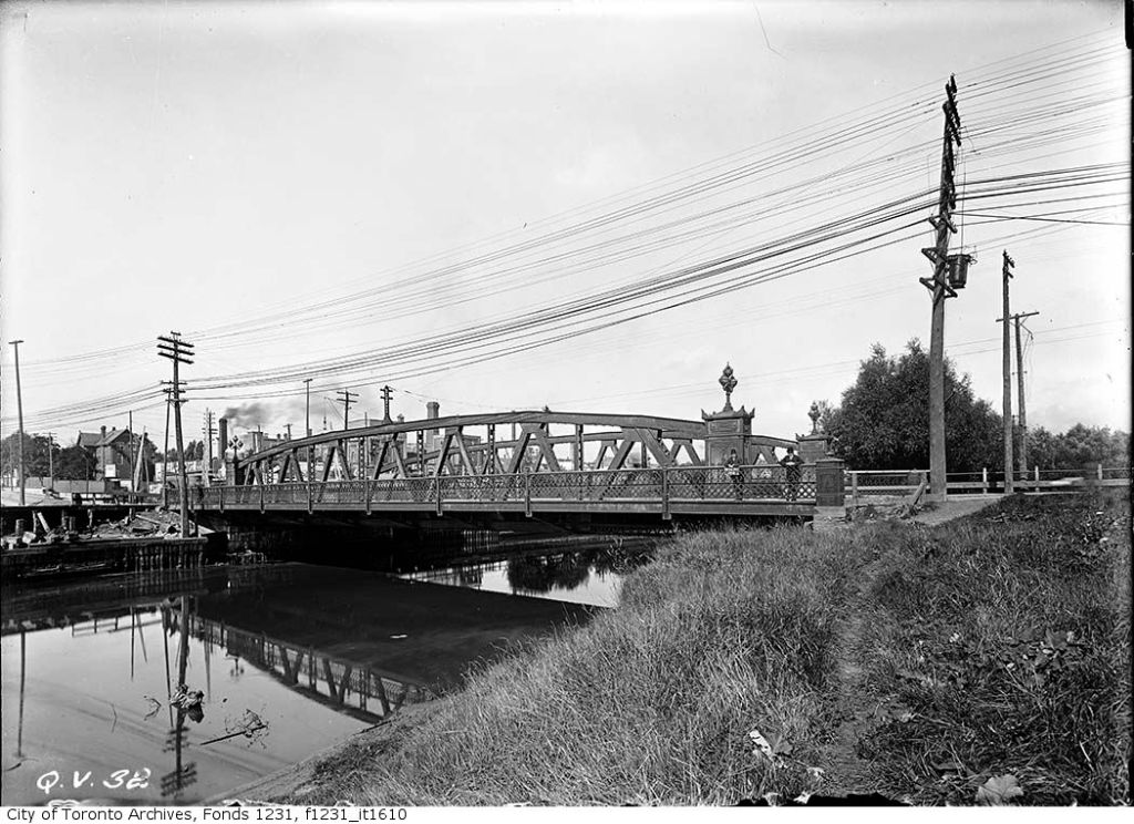

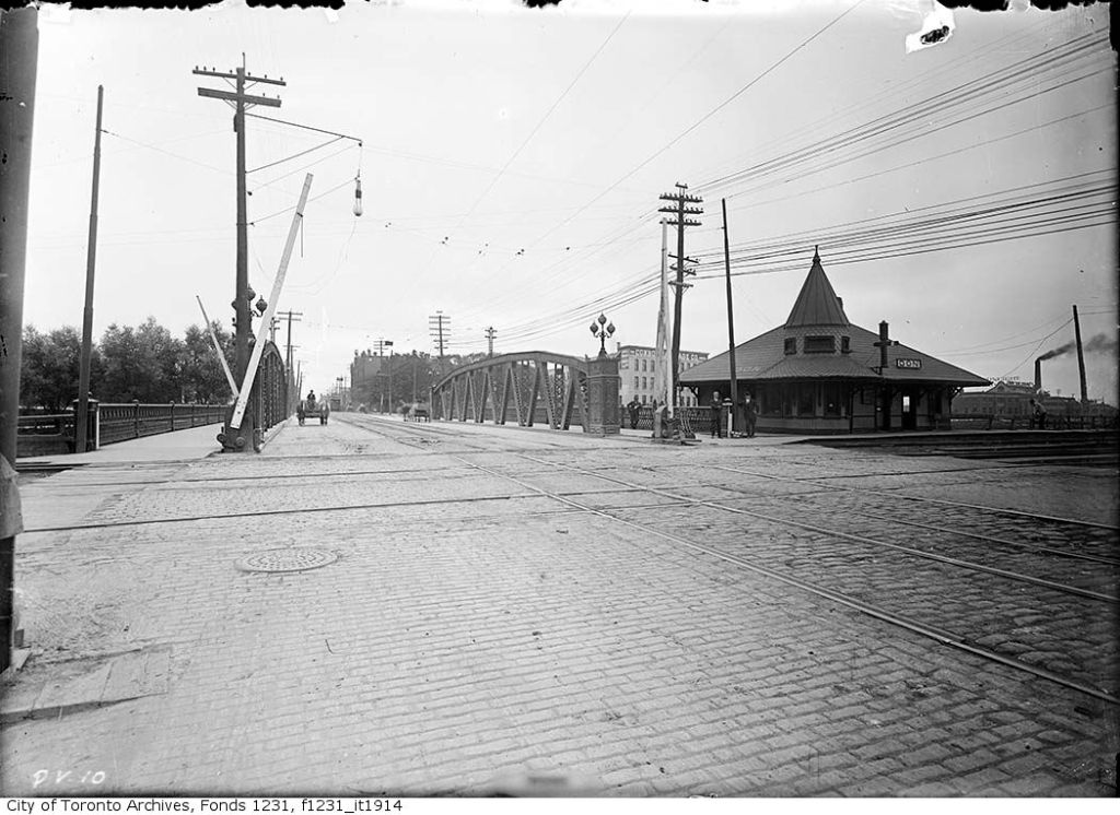
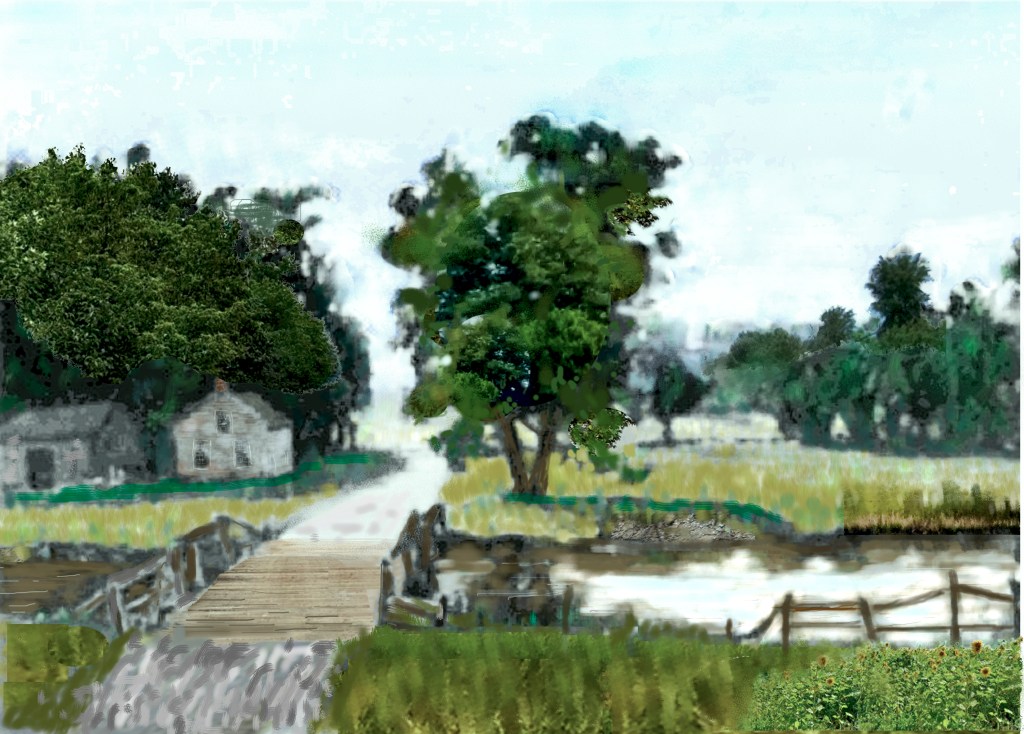

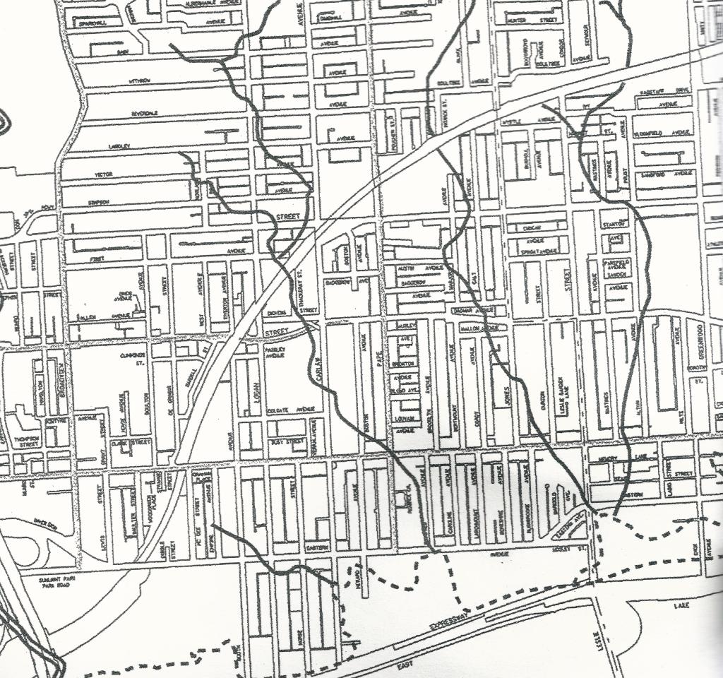
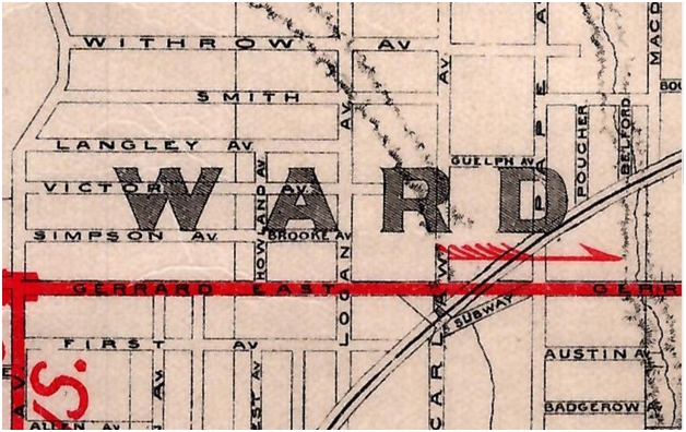
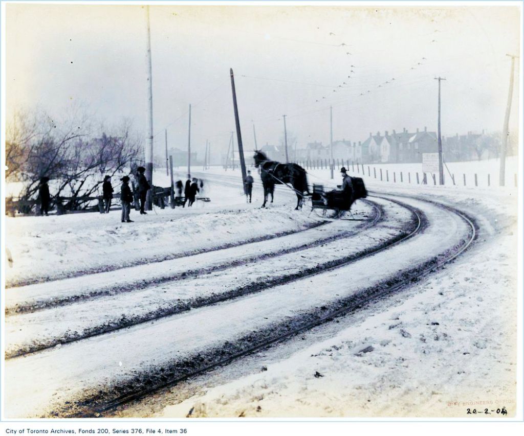


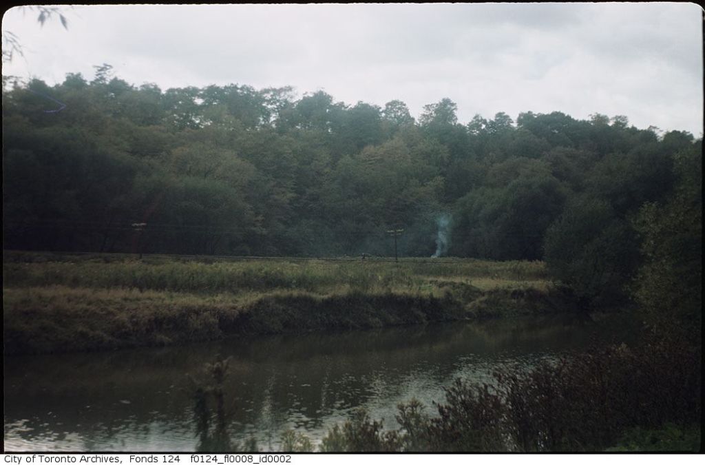


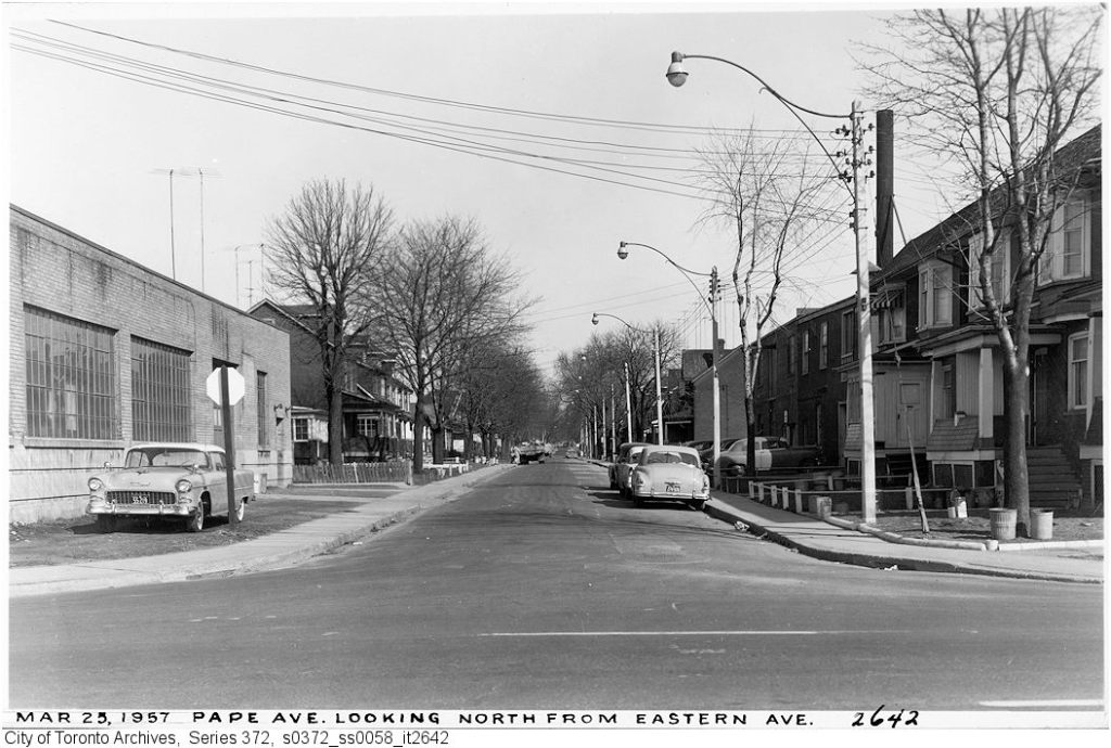
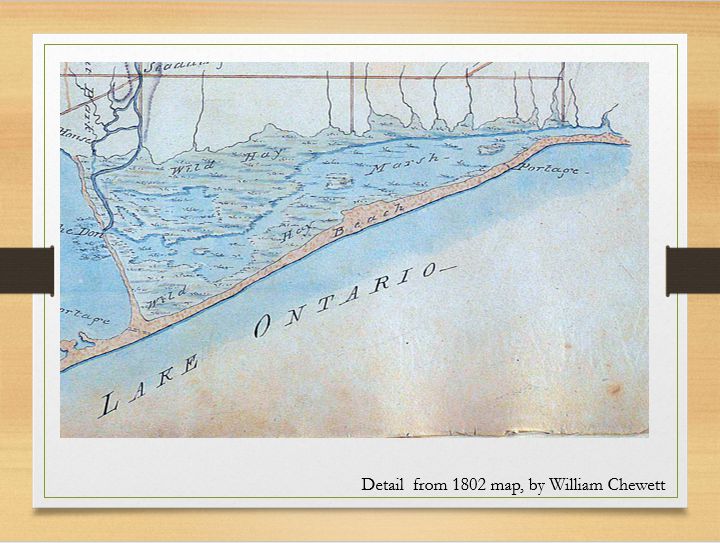
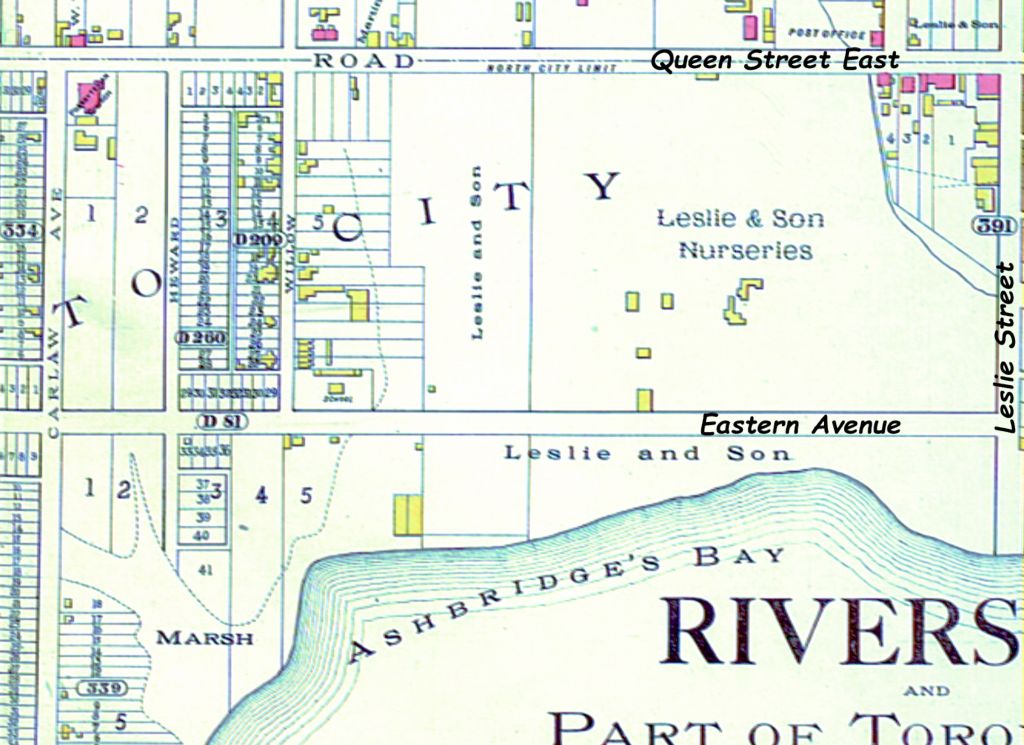


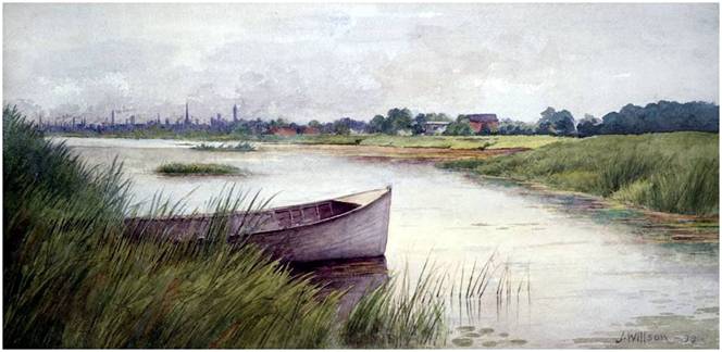


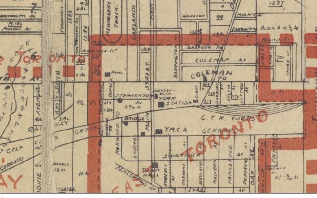


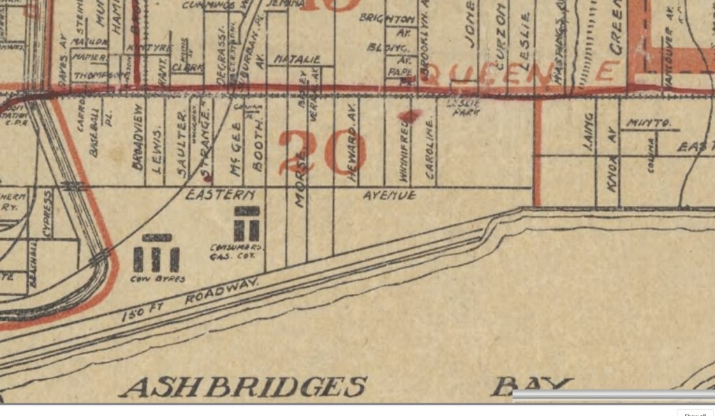

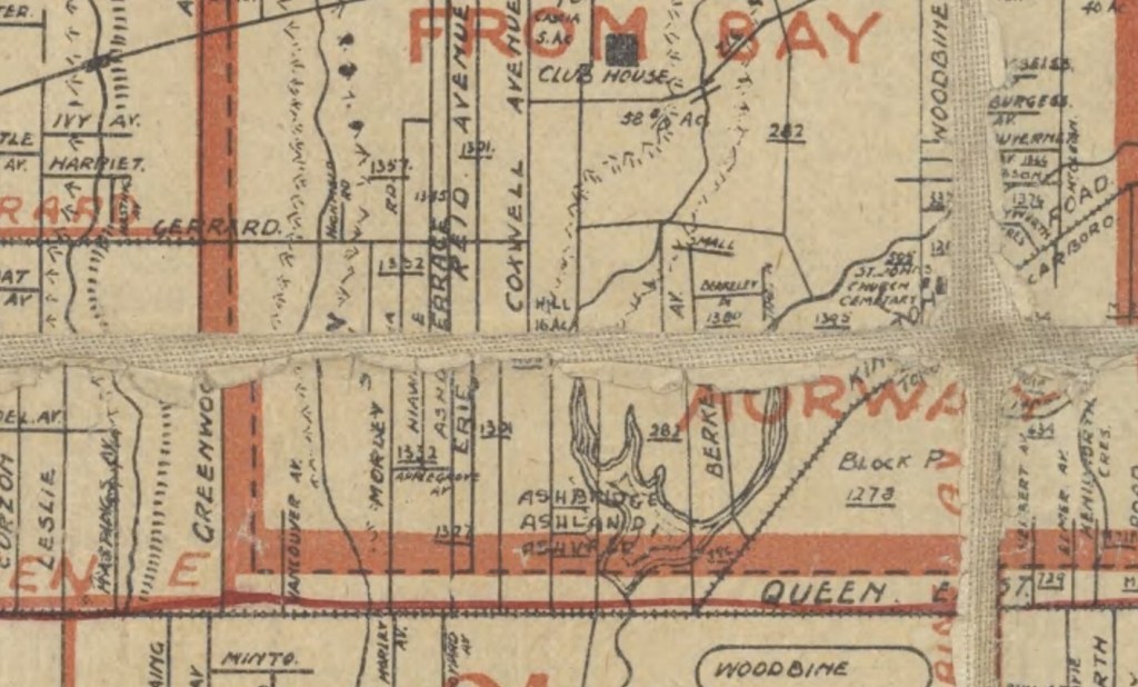


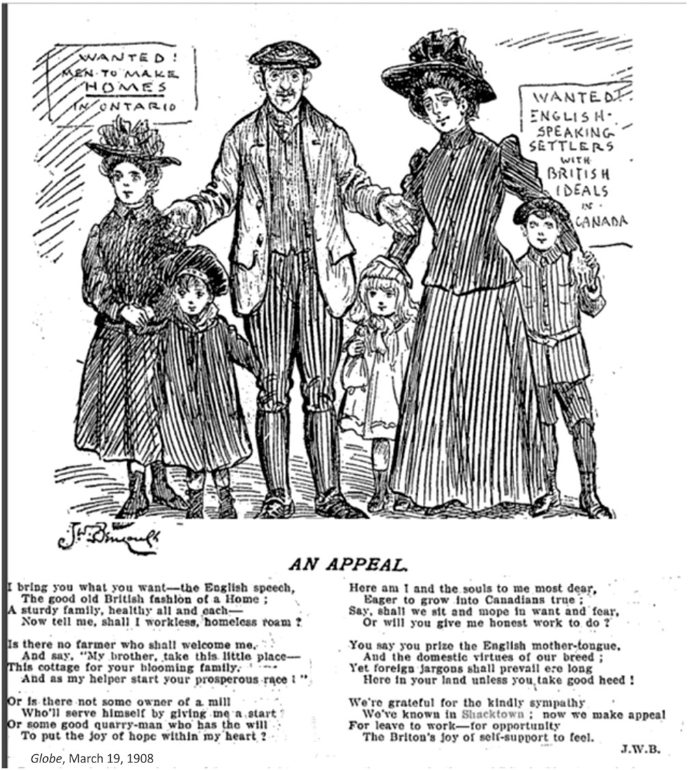


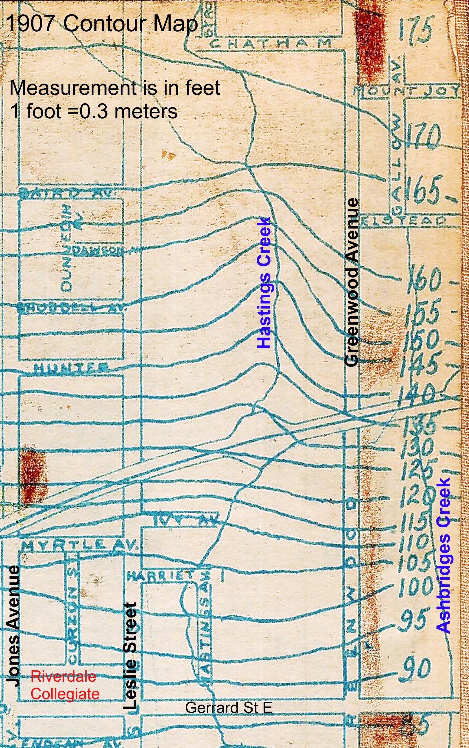

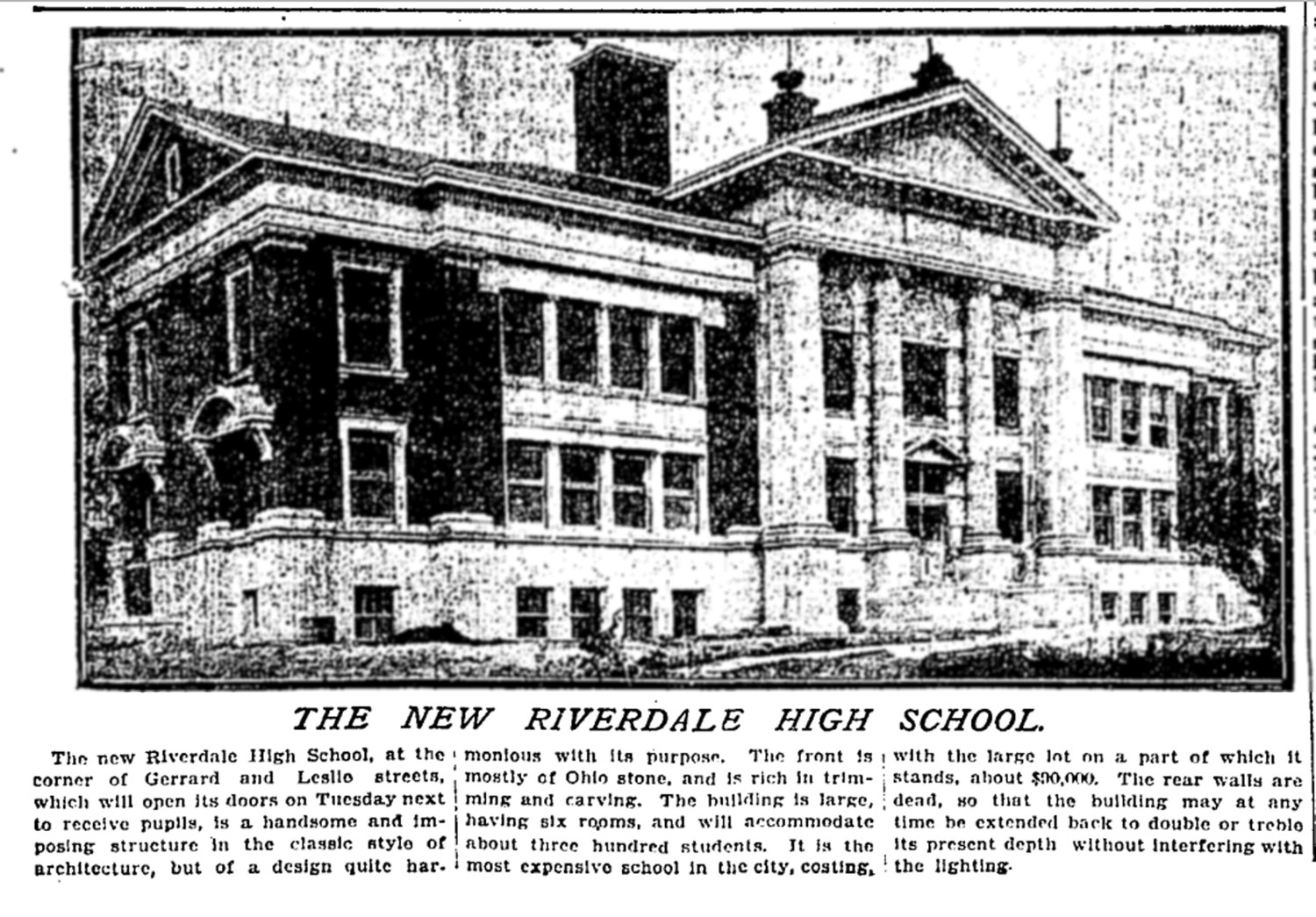


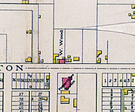


 A DON MOUNT WIFE-BEATING CASE.

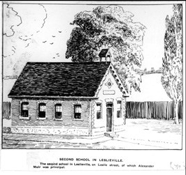

 Leslieville men had a reputation for fighting with their feet, kicking their opponents when they were down: