Dundas Street extension Toronto Star, April 6, 1920
They only had to wait another 35 years!
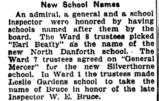
New School Names Leslie Gardens Toronto Star, April 4, 1924
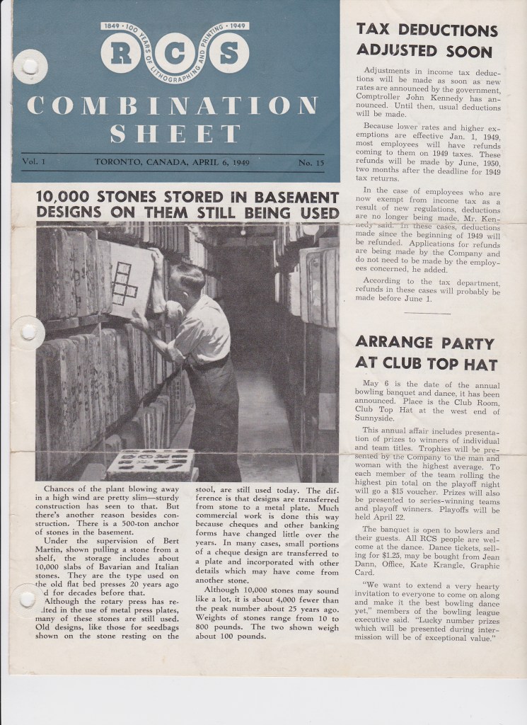
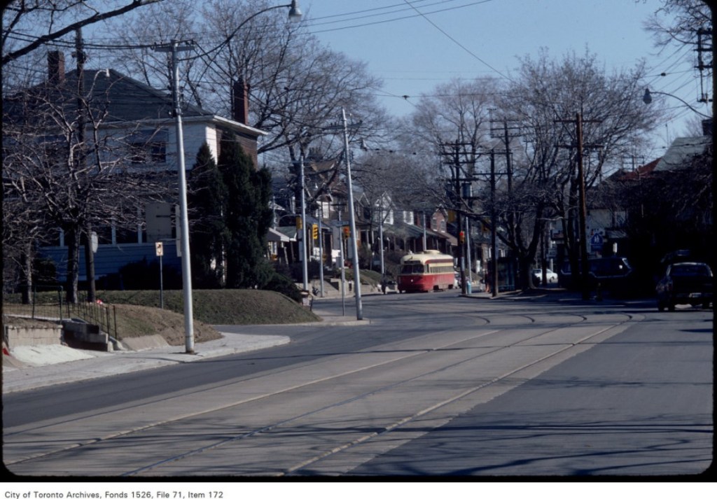
Rolph Clark Stone April 6, 1949Rolph Clark Stone April 6, 1949Rolph Clark Stone April 6, 1949Rolph Clark Stone April 6, 1949Rolph Clark Stone April 6, 1949Crosswalk overhead signs located on Gerrard at Leslie, looking east – April 11, 1984Crosswalk overhead signs located on Gerrard at Leslie, looking east – April 11, 1984
Some photos from Gerrard Street East, April 3, 1984
Crosswalk overhead signs located on Gerrard at Leslie, looking east – April 11, 1984Creator: Harvey R. Naylor Date: April 11, 1984 Archival Citation: Fonds 1526, File 40, Item 59
Copyright was transferred to the City of Toronto by the copyright owner.Creator: Harvey R. Naylor Date: April 3, 1984 Archival Citation: Fonds 1526, File 46, Item 162
Copyright was transferred to the City of Toronto by the copyright owner.Creator: Harvey R. Naylor Date: April 3, 1984 Archival Citation: Fonds 1526, File 71, Item 173
Copyright was transferred to the City of Toronto by the copyright owner.Creator: Harvey R. Naylor Date: April 3, 1984 Archival Citation: Fonds 1526, File 71, Item 171
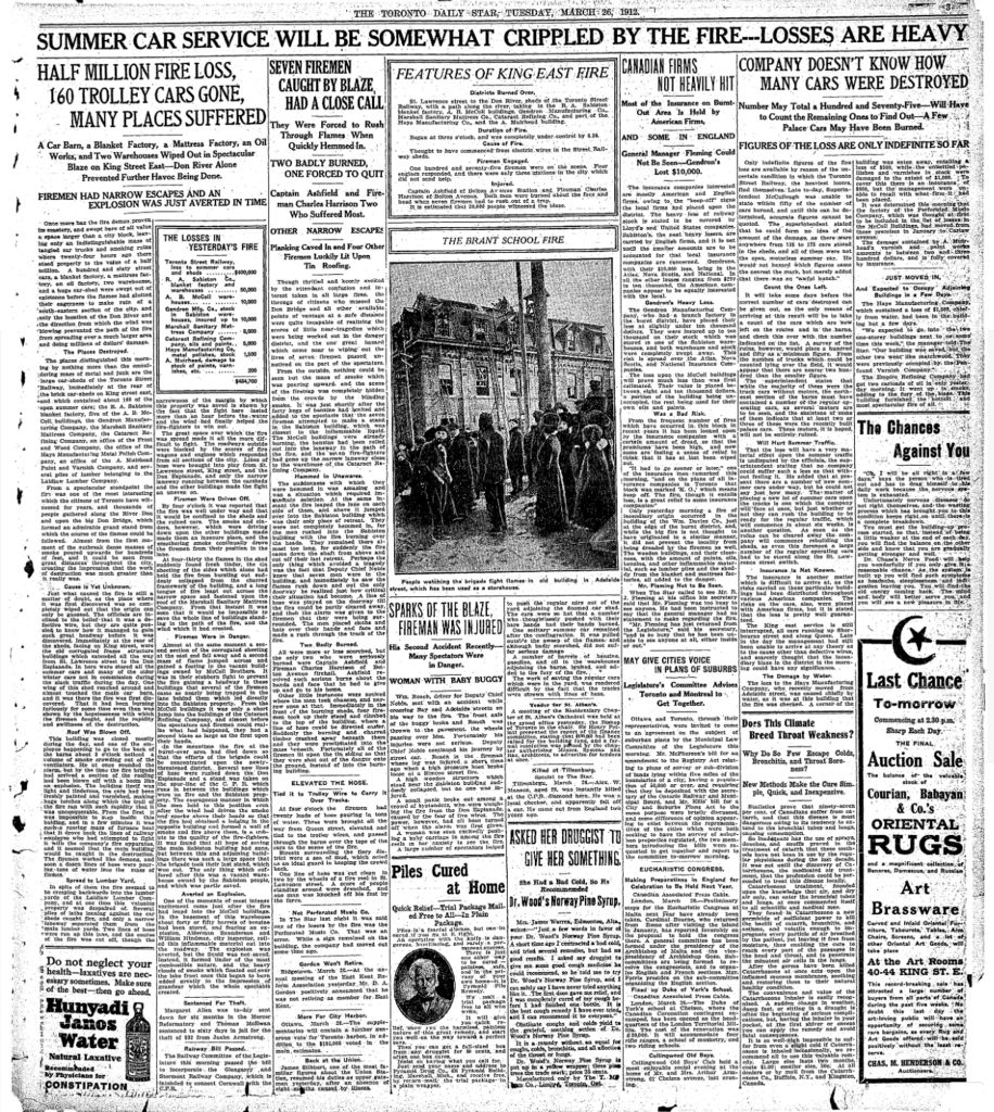
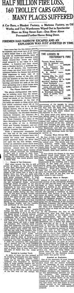
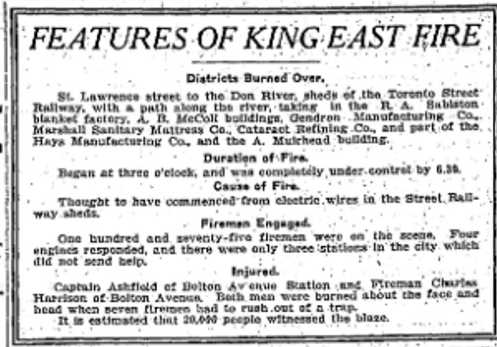
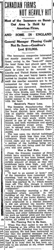
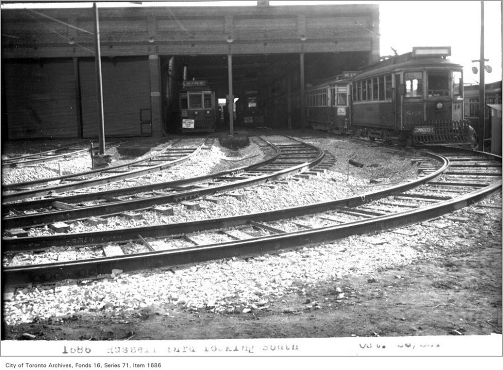
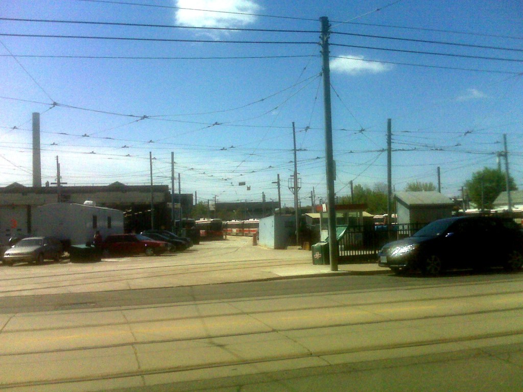
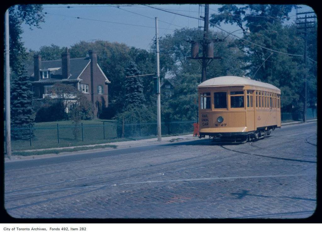
Scroll down through this post for a visual history of the TTC Car Barns at Connaught Avenue and Queen Street East. Commonly known as the Connaught Barns, they are officially the Russell Car Barns, probably named after Joseph Russell.
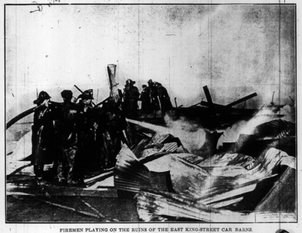
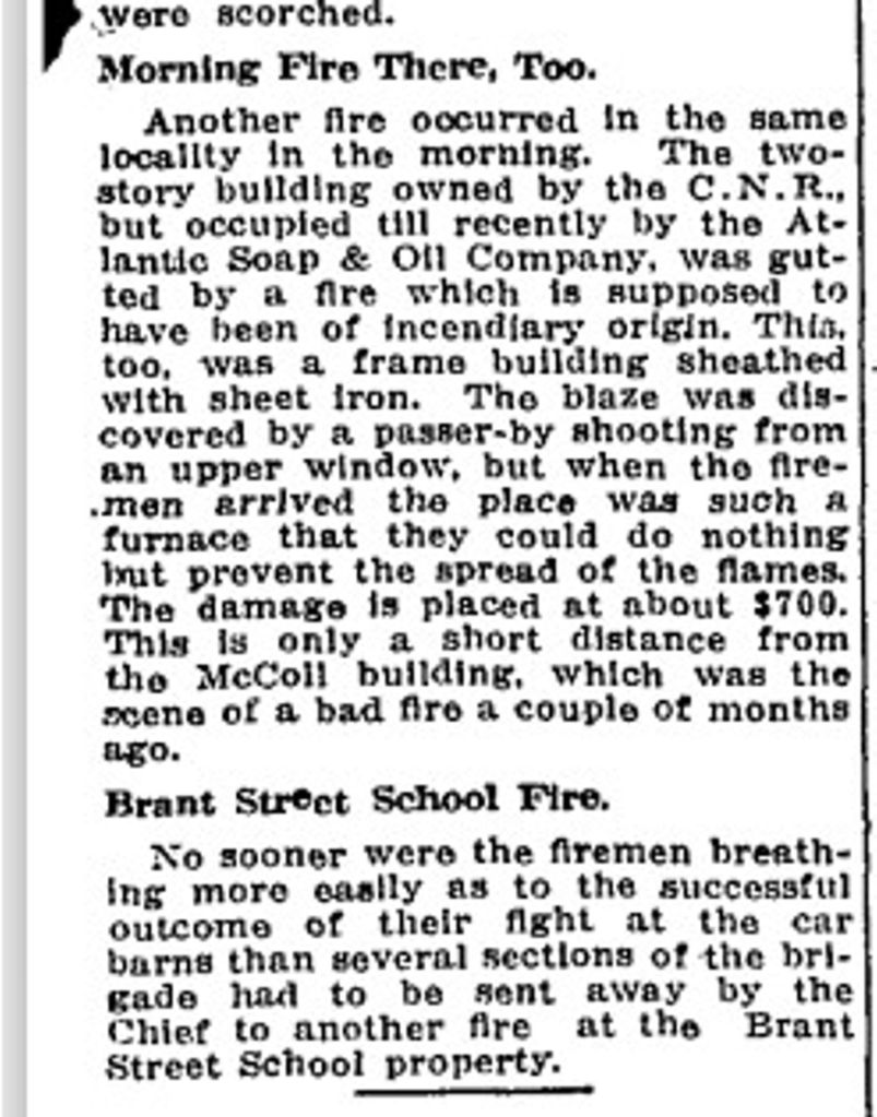
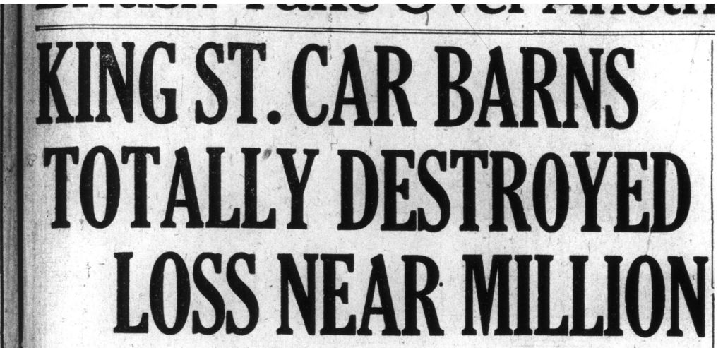
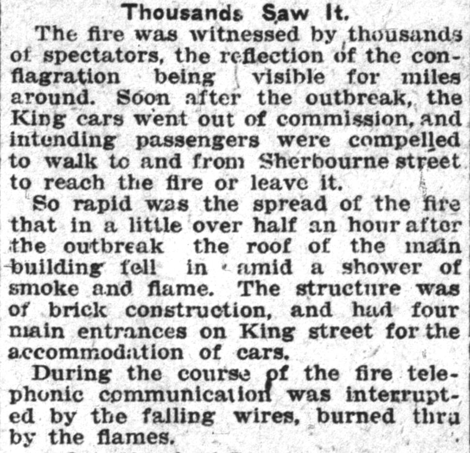
The Toronto Railway Company barns that burned downMonday’s big fire, car barns Toronto Sunday World, March 31, 1912Monday’s big fire, car barns Toronto Sunday World, March 31, 1912Monday’s big fire, car barns Toronto Sunday World, March 31, 1912Fire at car barns, Don Esplanade – March 26, 1912Fire, Toronto Railway Stables, Toronto Star, March 26, 1912Fire, Toronto Railway Stables, Toronto Star, March 26, 1912Fire, Toronto Railway Stables, Toronto Star, March 26, 1912Fire, Toronto Railway Stables, Toronto Star, March 26, 1912Fire, Toronto Railway Stables, Toronto Star, March 26, 1912Fire, Toronto Railway Stables, Toronto Star, March 26, 1912Fire, Toronto Railway Stables, Toronto Star, March 26, 1912Fire, Toronto Railway Stables, Toronto Star, March 26, 1912Fire, Toronto Railway Stables, Toronto Star, March 26, 1912Fire, Toronto Railway Stables, Toronto Star, March 26, 1912Fire, Toronto Railway Stables, Toronto Star, March 26, 1912Fire, Toronto Railway Stables, Toronto Star, March 26, 1912Fire, Toronto Railway Stables, Toronto Star, March 26, 1912Fire, Toronto Railway Stables, Toronto Star, March 26, 1912Fire, Toronto Railway Stables, Toronto Star, March 26, 1912Fire, Globe, March 26, 1912Fire, Globe, March 26, 1912Fire, Globe, March 26, 1912Fire, Globe, March 26, 1912Fire, Globe, March 26, 1912Fire, Globe, March 26, 1912Fire, Globe, March 26, 1912Fire, Globe, March 26, 1912Fire, Globe, March 26, 1912New car barns, Toronto World, May 20, 1913
The second fire sealed the deal, creating the Russell Division and car barns.
Second fire at car barns, The Toronto World, Vol. XXXVI, No. 13,197 (December 29, 1916)Second fire at car barns, The Toronto World, Vol. XXXVI, No. 13,197 (December 29, 1916)Second fire at car barns, The Toronto World, Vol. XXXVI, No. 13,197 (December 29, 1916)Second fire at car barns, The Toronto World, Vol. XXXVI, No. 13,197 (December 29, 1916)Second fire at car barns, The Toronto World, Vol. XXXVI, No. 13,197 (December 29, 1916)Second fire at car barns, The Toronto World, Vol. XXXVI, No. 13,197 (December 29, 1916)Second fire at car barns, The Toronto World, Vol. XXXVI, No. 13,197 (December 29, 1916)Second fire at car barns, The Toronto World, Vol. XXXVI, No. 13,197 (December 29, 1916)Second fire at car barns, The Toronto World, Vol. XXXVI, No. 13,197 (December 29, 1916)Second fire at car barns, The Toronto World, Vol. XXXVI, No. 13,197 (December 29, 1916)Second fire at car barns, The Toronto World, Vol. XXXVI, No. 13,197 (December 29, 1916)Second fire at car barns, The Toronto World, Vol. XXXVI, No. 13,197 (December 29, 1916)Second fire at car barns, The Toronto World, Vol. XXXVI, No. 13,197 (December 29, 1916)
Site of Russell Car Barns, 1907
Site of Russell Car Barns, Dec. 12, 1921Russell Yard, looking south – October 26, 1922 These are the old TRC car barns that were demolished by the TTC.Russell Yard, looking south, 2000, photo by Joanne Doucette
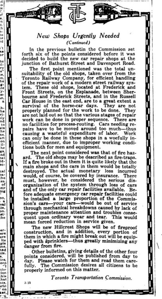
New shops urgently needed, Globe, Feb. 7, 1923
New shops urgently needed, Globe, Feb. 8, 1923
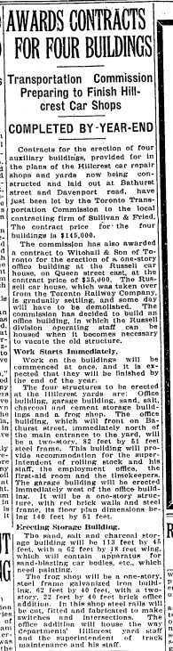
Contracts TTC Russell carhouse, Globe, September 6, 1923
Call for tenders, Toronto Star, March 10, 1924
Demolition of Russell Car House, Toronto Star, March 11, 1924
This is the old TRC Carhouse [Carbarn]
Wrecking Russell car house Toronto Star April 14, 1924Old Russell Car House at Queen and Connaught torn down, Toronto Transportation Commission Annual Report, Toronto Star April 29, 1924
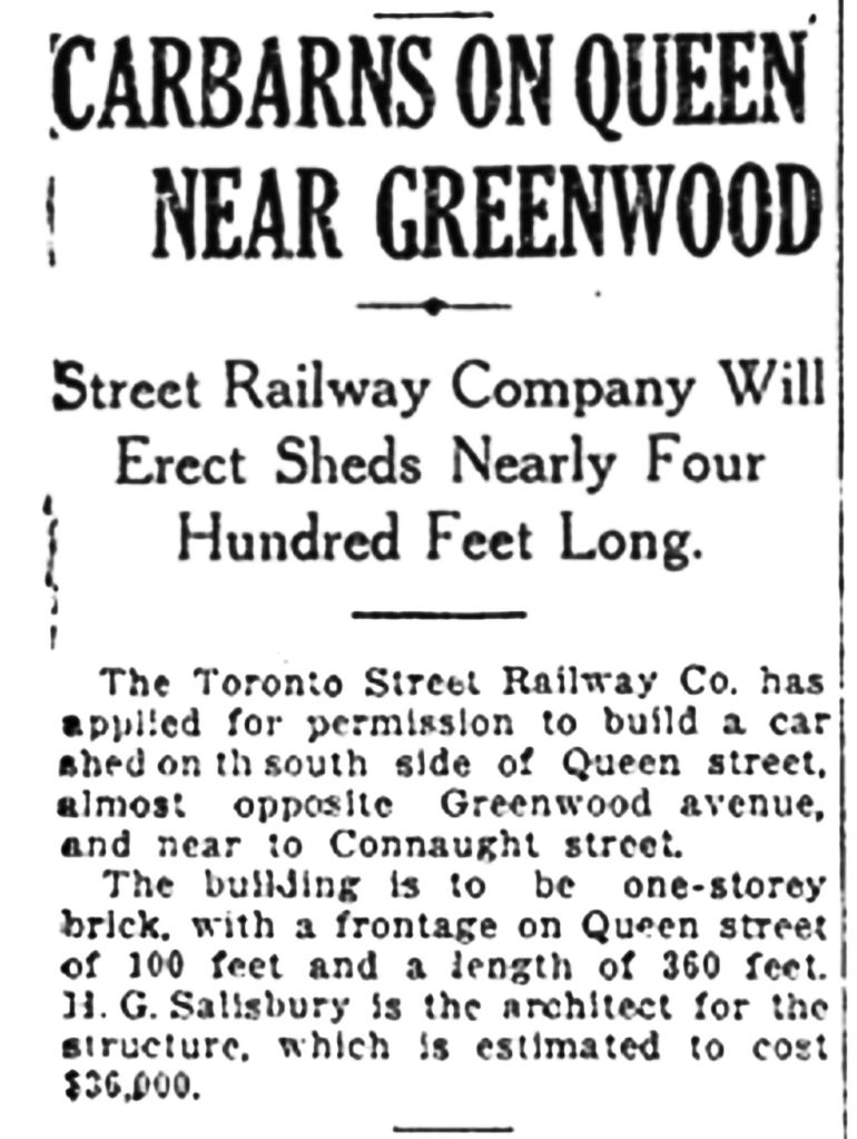
…the issuing yesterday of a permit to the T.T.C. for the construction of its car barns at Eastern Avenue and Connaught, at a cost of $190,000. Globe, May 1, 1924
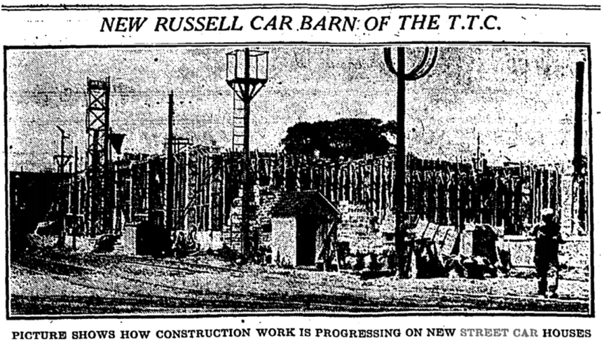
Russell Car barn, Globe, July 18, 1924Construction, Russell Car House, December 5, 1924The new TTC Russell Car BarnsRussell Car Barns, 2000, photo by Joanne Doucette
Our first local “big business”, the industrialization of Leslieville, and more.
George Leslie ad, Canadian Agriculturist, Vol 1, no 4, April 2, 1849
This is one of the earliest ads for George Leslie’s nurseries. He had just moved his business from King and Yonge Streets out to Ashport, as it was then called. The downtown was getting too crowded for a plant nursery! He put his house on rollers and pulled it with a team of horses out here.
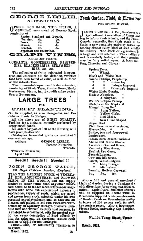
George Leslie, The Canadian Agriculturist, Vol 14, no. 7, April 1, 1862
By the time of this ad, the area was being called “Leslie” or “Leslieville”.
Dunlop Tires ad, Toronto Sunday World, March 27, 1910
Leslieville was becoming built up with factories such as Dunlop on Queen Street between the railroad tracks and Booth Avenue. The Jimmie Simpson Community Centre and park fills the site today. By 1910 “Leslieville” was falling out of use although the Toronto Nurseries, George Leslie’s business, still existed.
Contract Record, April 2, 1913
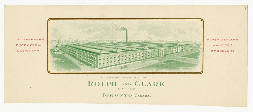
Another one of the new industries. This one on Carlaw Avewnue was soon to be renamed Rolph Clark Stone, now the printing House Lofts. This is the earliest view of Boston Avenue (background) that I have found.
Ross & Son, Toronto Nurseries, Toronto Sunday World, March 27, 1914
George Leslie’s sons, Knox and George Jr., badly mismanaged the family business and it was taken over by George Sr.’s foreman, John McPherson Ross (1850-1924) until it finally succumbed to the Great Depression of the 1930’s and went bankrupt.
Pratts Make that Lazy Loafer Lay Globe, March 31, 1920
One of the many industries that grew up along Carlaw Avenue, powered by cheap electricity from Niagara Fall’s, thanks to Adam Beck, and protected by a tariff wall that created a “branch plant” economy in Canada.
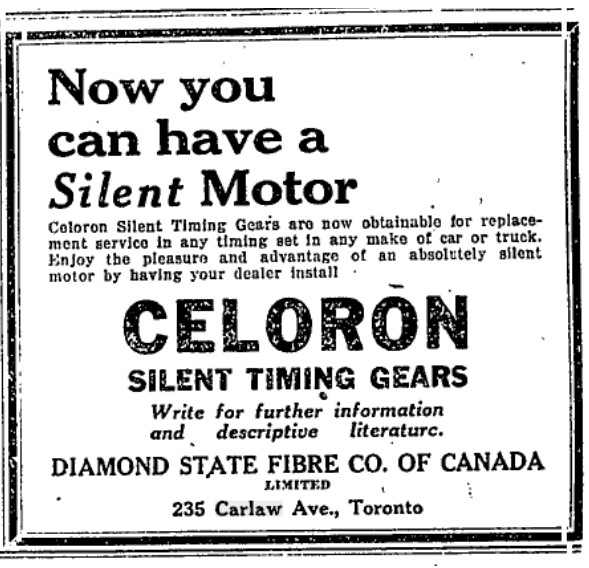
Diamond State Fibre, Carlaw Avenue, Globe, April 2, 1926
Free trade spelled an end to Carlaw Avenue as an industrial area, leaving a brownfield of empty, neglected factories until a family of forward-thinking South Asian entrepreneurs, the Jains, stepped in. They saw the industrial heritage of the area as an opportunity and rehabilitated buildings for lofts and boutique stores. Others took up their vision and we have a whole new Carlaw today.
Insecticides, lead, cyanide, Canada Paint Co., The Canadian Grocer, March 26, 1930
The other major industrial area in Leslieville was along Eastern Avenue with many much more polluting industries such as the Canada Paint Company on Leslie near Eastern.
Armstrong twins & Jones Twins, Riverdale Collegiate Toronto Star, March 26, 1938Riverdale Collegiate annual concert Toronto Star, March 30, 1939Little Bo Peep, Pape Recreation Centre Toronto Star, March 31, 1939Colgate Palmolive, Toronto Star, March 31, 1949
Grass fires, Ashbridges Bay, Toronto Star, April 4, 1953
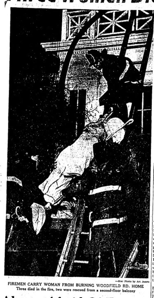
Fire, Emma Ashbridge House
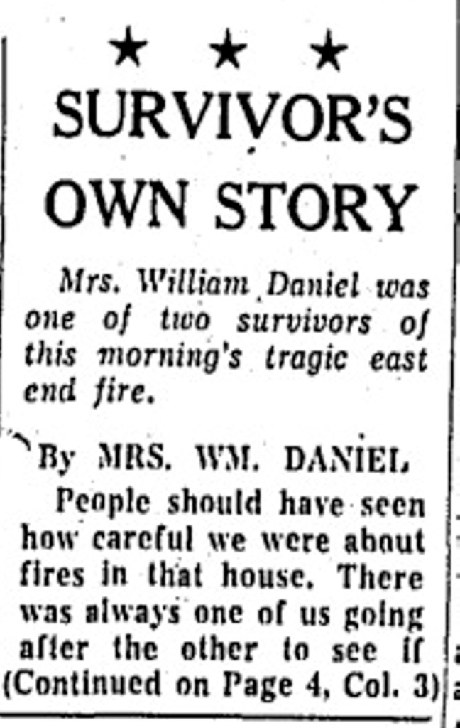
Emma Ashbridge House, Globe, Nov 1 1922Emma Ashbridge House in backgroundFire, Woodfield Road, Toronto Star, April 5, 1962Fire, Woodfield Road, Toronto Star, April 5, 1962Fire, Woodfield Road, Toronto Star, April 5, 1962Fire, Woodfield Road, Toronto Star, April 5, 1962Fire, Woodfield Road, Toronto Star, April 5, 1962Fire, Woodfield Road, Toronto Star, April 5, 1962Fire, Woodfield Road, Toronto Star, April 5, 1962Fire, Woodfield Road, Toronto Star, April 5, 1962Fire, Woodfield Road, Toronto Star, April 5, 1962Fire, Woodfield Road, Toronto Star, April 5, 1962Survivor tells own story, Fire, Woodfield Rd, Toronto Star, April 5, 1962Survivor tells own story, Fire, Woodfield Rd, Toronto Star, April 5, 1962Survivor tells own story, Fire, Woodfield Rd, Toronto Star, April 5, 1962Survivor tells own story, Fire, Woodfield Rd, Toronto Star, April 5, 1962
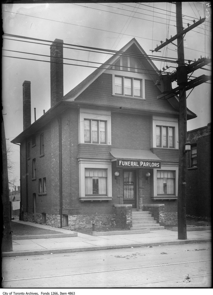
Leslieville, Atlas of the city of Toronto and vicinity, March 1890 Library and Archives CanadaConstruction, Wrigley Plant, March 24, 1915Leslie Gardens School construction, Globe, March 20, 1923Photo by Joanne Doucette, March 29, 2014Photo by Joanne Doucette, March 29, 2014Photo by Joanne Doucette, March 29, 2014Ingram’s Funeral Parlour, 1055 Gerrard E., March 24, 1925Russell Car House, March 25, 1925 by Alfred J. Pearson
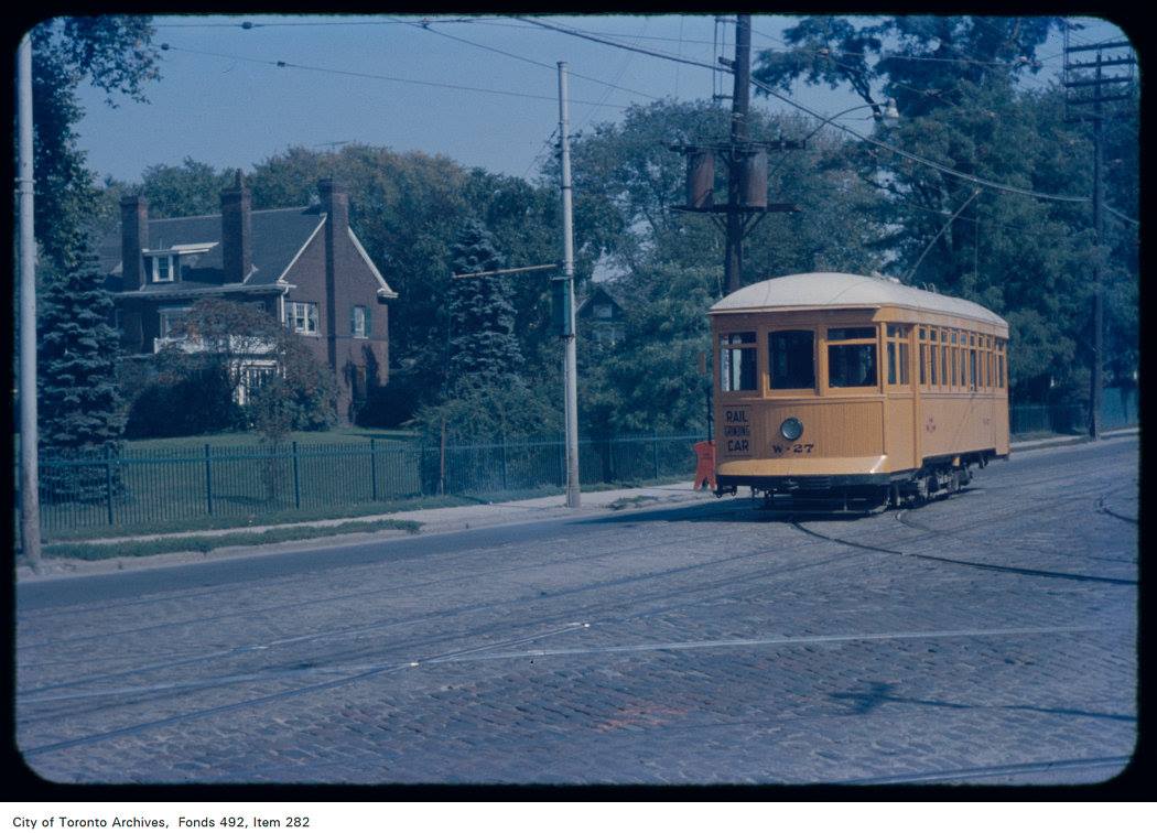
The 3 Bears, Pape Recreation Centre, Globe and Mail, March 20, 1948T.T.C., No. 2544, at Russell carhouse, Queen Street East, southwest corner Connaught Avenue March 24, 1955 by James V. Salmon TPLThey’re off and dining at the Terrace Dining Room at Greenwood racetrack yesterday, March 25, 1971 by Boris Spremo, Toronto StarCOVID epidemic, Seen on Woodfield Rd., March 27, 2020 by J. Doucette
The Black Rock, Irish Commemorative Stone, Montreal, courtesy of Coastal Elite from Halifax, Canada – The Black Rock: Irish Commemorative Stone, Montreal, 2017, CC BY-SA 2.0, https://commons.wikimedia.org/w/index.php?curid=90571606
Map Showing the Size of York and Toronto, 1797-1896, by Owen StaplesSummer resort for sale, 887 Eastern Ave., Toronto Star, March 15, 1912Sons of Scotland, Pape Avenue, Toronto Sunday World, March 15, 1914cariactures of city politicians including Jimmie Simpson, Toronto World, March 15, 1914Bonita Theatre, Toronto Sunday World, March 15, 1914
Riverdale Boarding Stables, Toronto Star, March 15, 1919
Pedestrian rights Booth accident, Globe March 15, 1919
Martin Senour Paints (Carlaw Avenue), Macleans March 15, 1923
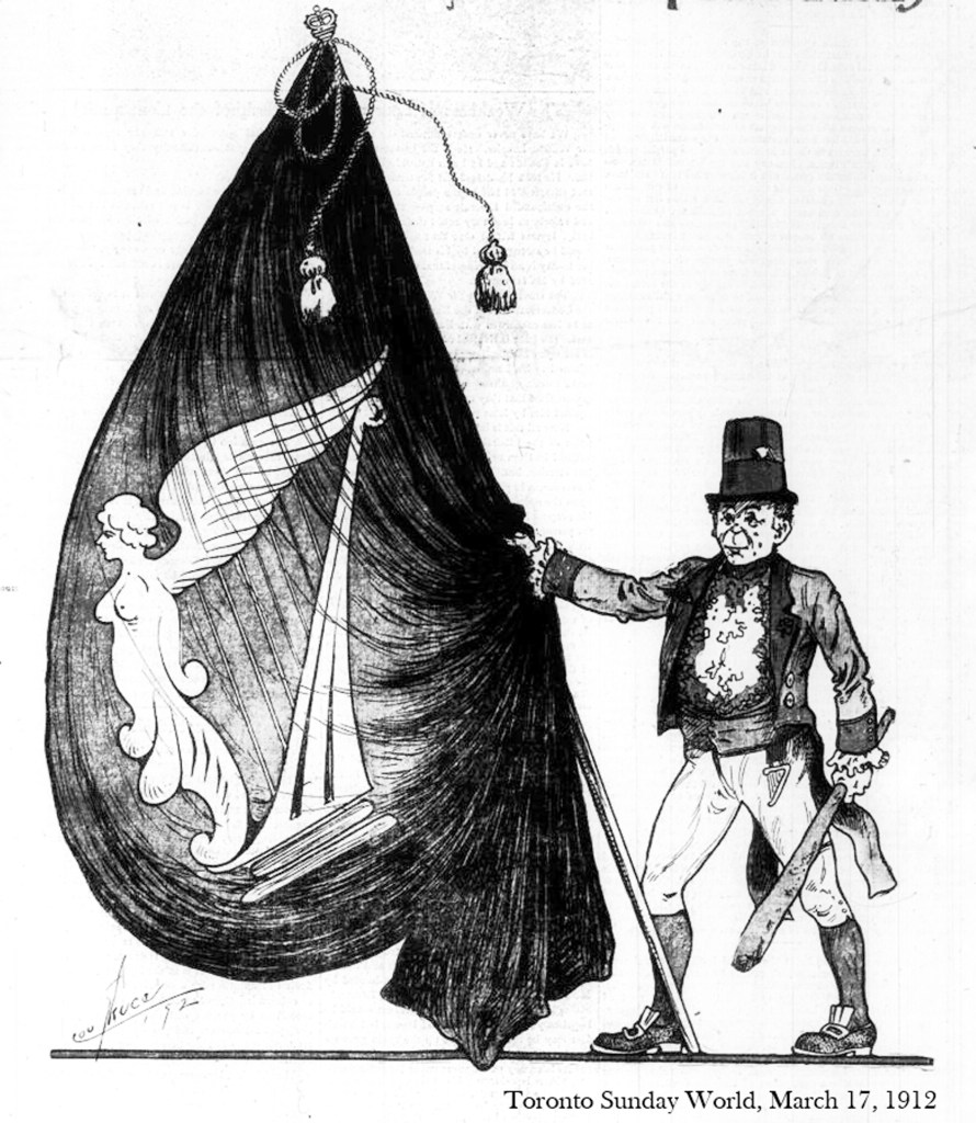
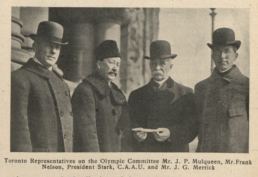
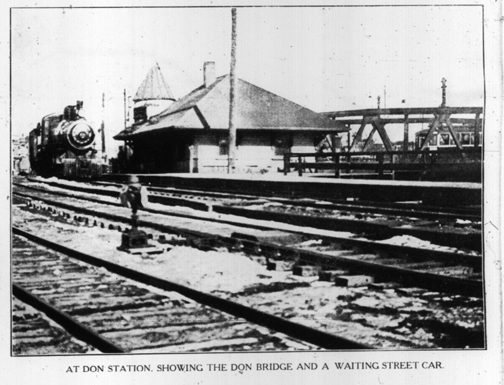
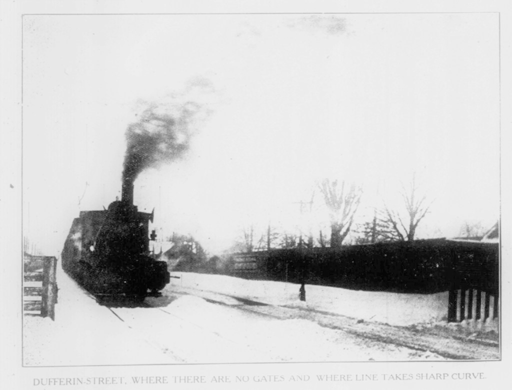
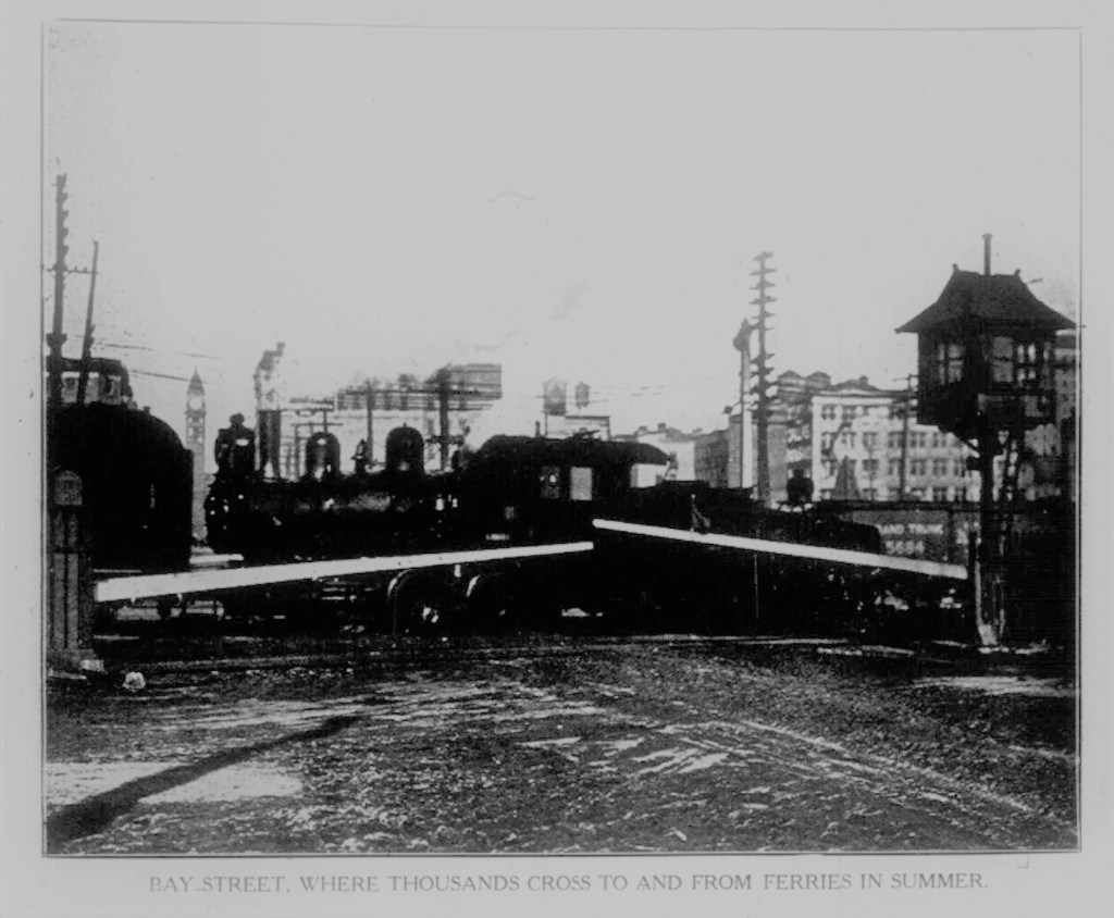
Stark’s Athletic Grounds The Canadian Courier, March 14, 1908 (south of Eastern Avenue and Logan Avenue)Level Crossings in Toronto, Toronto Sunday World, March 14, 1909Level Crossings in Toronto, Toronto Sunday World, March 14, 1909Level Crossings in Toronto, Toronto Sunday World, March 14, 1909Level Crossings in Toronto, Toronto Sunday World, March 14, 1909Level Crossings in Toronto, Toronto Sunday World, March 14, 1909Level Crossings in Toronto, Toronto Sunday World, March 14, 1909Level Crossings in Toronto, Toronto Sunday World, March 14, 1909Level Crossings in Toronto, Toronto Sunday World, March 14, 1909
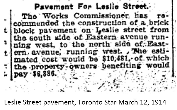
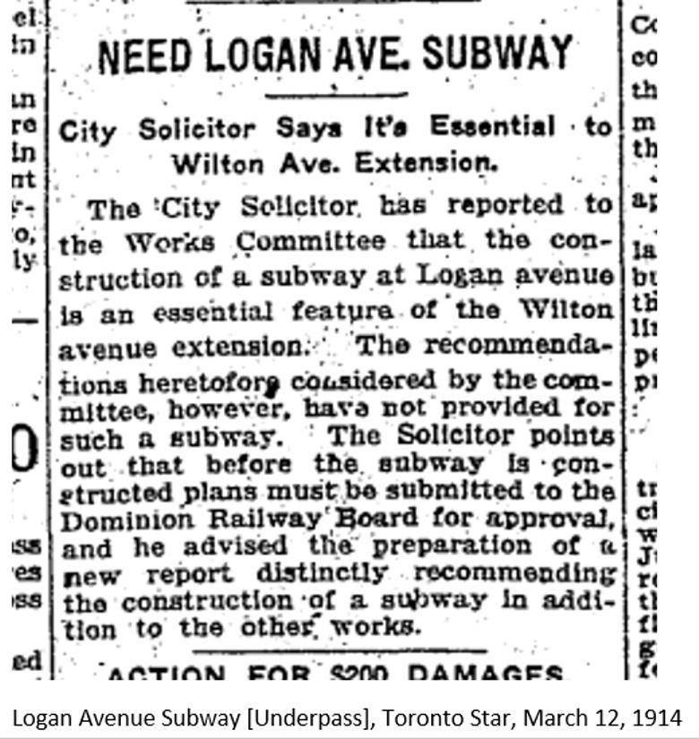
Office and works Carlaw Ave. Toronto Rolph and Clark Stone Ltd., 1913Leslie Street pavement, Toronto Star March 12, 1914Logan Avenue Subway [Underpass], Toronto Star, March 12, 1914Patriotic Poultrymen, Pratts, Carlaw Ave, Globe, March, 12, 1919
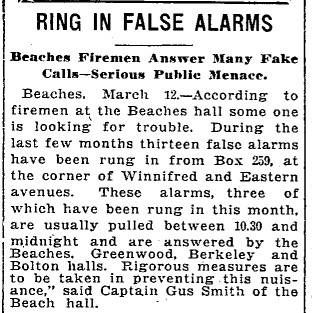
False Alarms Winnifred and Eastern Toronto Star, March 12, 1919
Riverdale Collegiate students find gold Toronto Star, March 12, 1920
Eureka Friendly Club, The Dawn of Tomorrow, March 12, 1927Streetcars collide, Queen & Connaught, Globe and Mail, March 12, 1942Proposed block plan of Lever Brothers Ltd. on B.A. and CNR sites – March 12, 1946Dunlop Rubber workers picketing Queen’s Park, Globe and Mail March 12 1970Sudden shutdown of industries, Globe and Mail, March 12, 1970 1