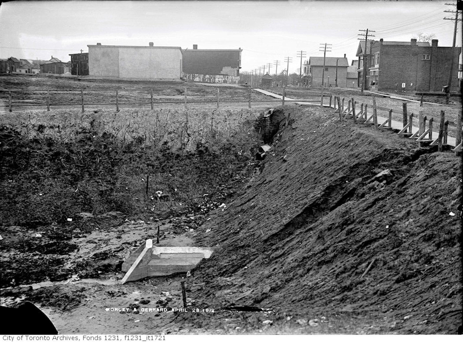
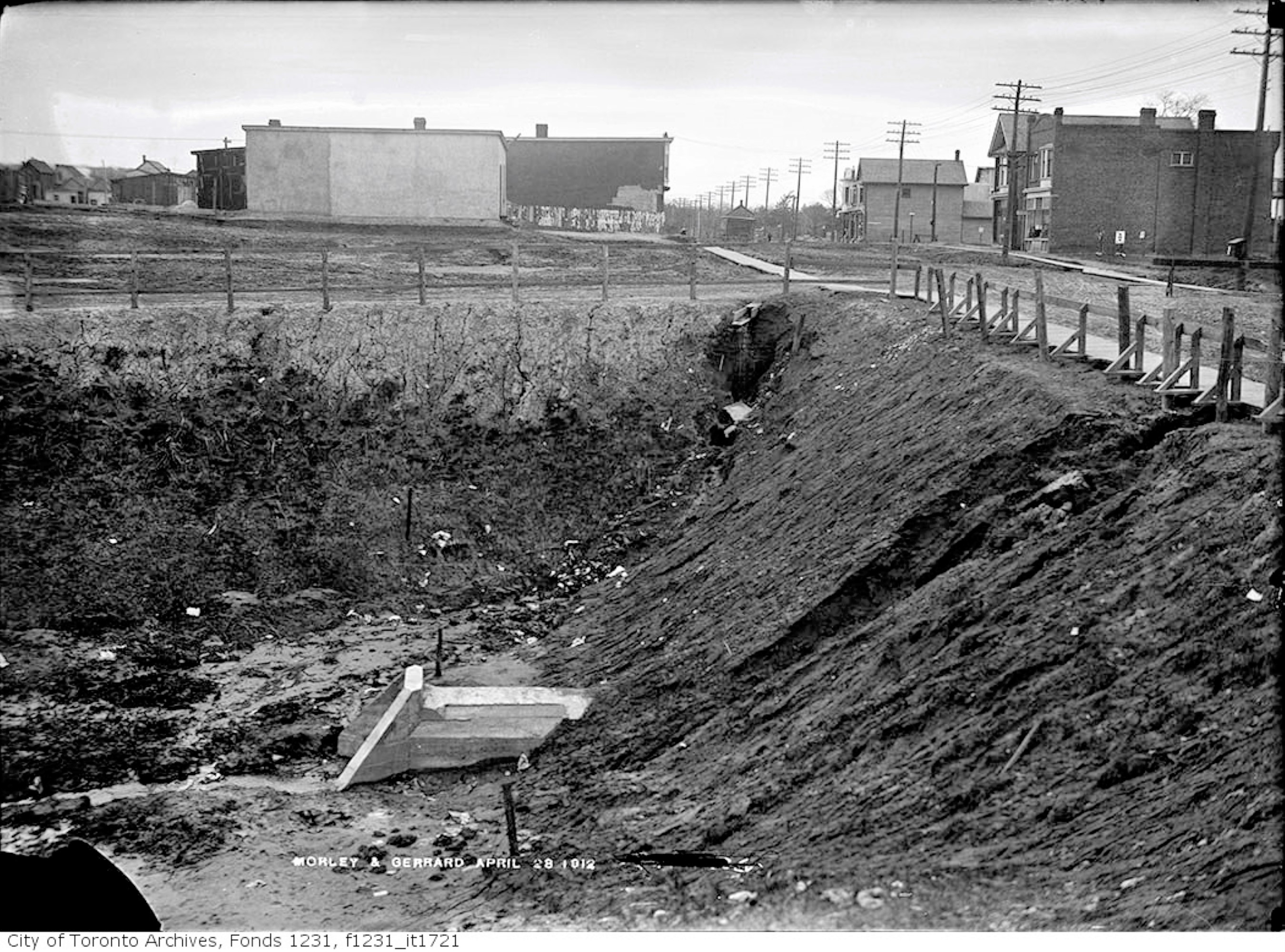
Morley Avenue and Gerrard Street fill operations, April 28, 1912
Morley Avenue and Gerrard St fill April 28, 1912
Looking east across Woodfield Road (then called Morley Avenue) towards Coxwell. Ashbridges Creek is in the deep ravine. A culvert has been installed under Gerrard Street to carry the creek south.
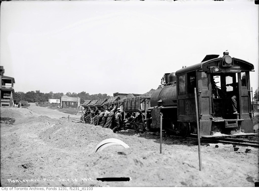
City of Toronto Locomotive No. 6, Morley Avenue fill, July 18, 1912
Workers will install a cement artificial creek about 18-30 metres below the surface. They will then fill in the ravine with sand.
Filling in Ashdale Ravine, Morley Avenue (Woodfield Road), July 18, 1912
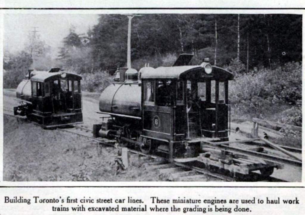
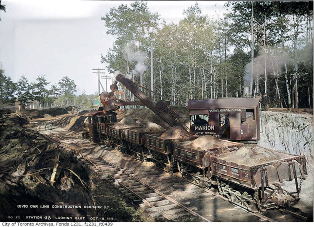
A miniature steam locomotive (a dinky), and miniature rail cars (dinky cars) will carry sand dug out from the underpass on Coxwell Avenue along a temporary narrow gauge set of tracks to Woodfield Road.
Dinkies for Civic Car Line Toronto Star, August 18, 1911Dinkies at work, Canadian Courier, October 18, 1911Gerrard car line construction, Toronto Star, November 16, 1911
The culvert crosses Gerrard where the Lahore Tikka restaurant is today.
Looking west along Gerrard Street from Woodfield Road over the filled in Ashdale Ravine, July 15, 2019 photo by Joanne Doucette
The photo from just before the Pandemic was shot looking west along Gerrard Street across the landfill and over the buried Ashbridge’s Creek.
Gerrard St E construction, October 11, 1911 (Colourized)
Ashbridge’s Creek is now two creeks: the creek in the concrete sewer pipes and a groundwater creek flowing through the soil and sediment outside of the concrete sewer culverts.
Cement mixer and labourers, Gerrard Streetcar line, July 6, 1912Cement mixer and labourers at work, Greenwood to Coxwell Avenue, Toronto Star, November 8, 1910Morley avenue (Woodfield Road), Globe, December 28, 1912
The creek began in springs near Michael Garron Hospital.
Flooding Gerrard and Coxwell, Toronto World, November 10, 1913
It flows across Danforth Avenue, across the tracks at Rhodes Avenue and diagonally under the Roden school yard.
Lost Creeks 1909 Topographical map with labels
It crosses Woodfield Road, half way between Fairford and Gerrard.
Believed to be an early photo of Ashbridges Creek from around 1912, just before it was put under ground in pipes.
From there it continues on a diagonal to cross just west of Highfield. It flows south, under the Duke of Connaught school yard, and crosses Queen Street where the Russell streetcar barns are. From there the hidden groundwater creek makes its way south to the lake.
Route & Car barns, Toronto Star, December 11, 1912One fare system, Civic Streetcars, Toronto Sunday World, February 8, 1914Civic car line, Toronto Star, December 16, 1912First Gerrard Streetcar, December 18, 1912, leaving from the foot of Redwood Avenue, heading east.
Ticket, Civic car line, Toronto Star, December 19, 1912
Toronto Civic Railways Car No. 3 – February 24, 1913
Welcome to the Leslieville Historical Society's website. Please feel free to join us, to ask questions, to attend walking tours and other events, and to celebrate Leslieville's past while creating our future. Guy Anderson, President, Leslieville Historical Society and Joanne Doucette, local historian and webmaster.
View more posts