a creek … also started near the sandpit and ran through the gardens of Cooper’s, Bests and Hunters, crossed the road by the Leslie Postoffice. Here it joined a small creek that drained the nursery, and both crossed Leslie street under a bridge that has since been filled up by intersecting sewers.
The Globe, January 18, 1918
Not much left to see of the creek and most of us don’t know it was there. But like all ghosts, it still can haunt us even many years later.

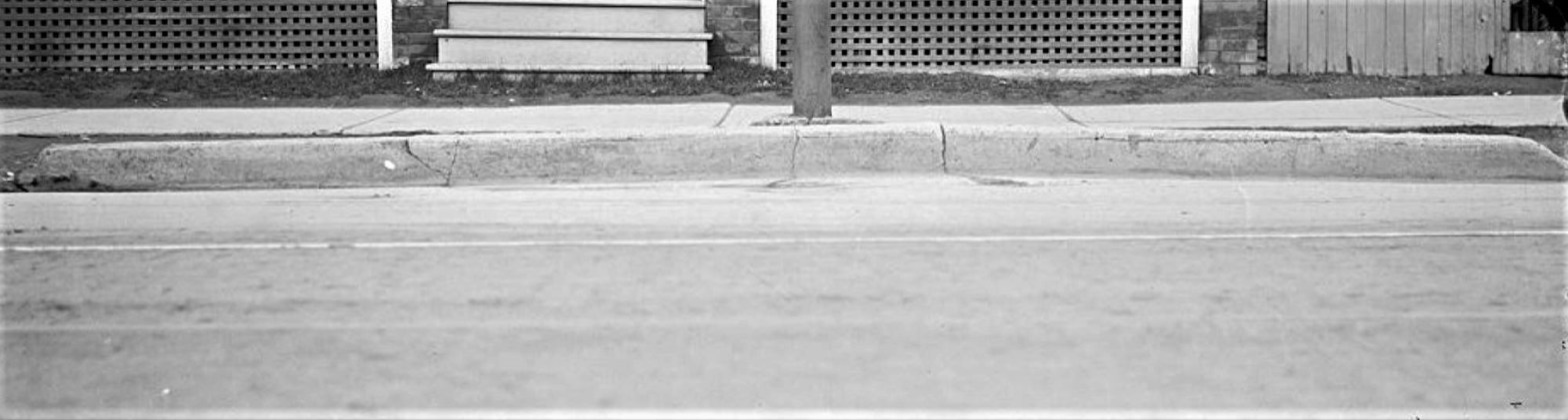
This photo of 1211 Queen Street East shows a ghost of Leslie Creek.

Leslie Creek originated in springs on the slope of the hill in the area of Strathcona Avenue and Eastview Park.


It crossed the railway tracks where Gerrard Square’s parking garage is now.

According to Elsie Hays, an old East Ender that I interviewed, it was a small brook that ran through an orchard west of Galt Avenue. She caught minnows in it when she was a child (before World War One). It crossed Gerrard where there is a shallow dip in the road to mark it.
Two branches of the creek came together and crossed the GO Train tracks (GTR) east of Marjory Avenue where it took a turn left. One branch of Leslie Creek was dammed in the late nineteenth century to form Maple Leaf Skating Rink at Pape and Gerrard, behind the Maple Leaf Tavern. There are remnants of a ravine west of Marjory Avenue south of Gerrard. Then the creek swung diagonally southeast to cross Dundas at Dagmar.
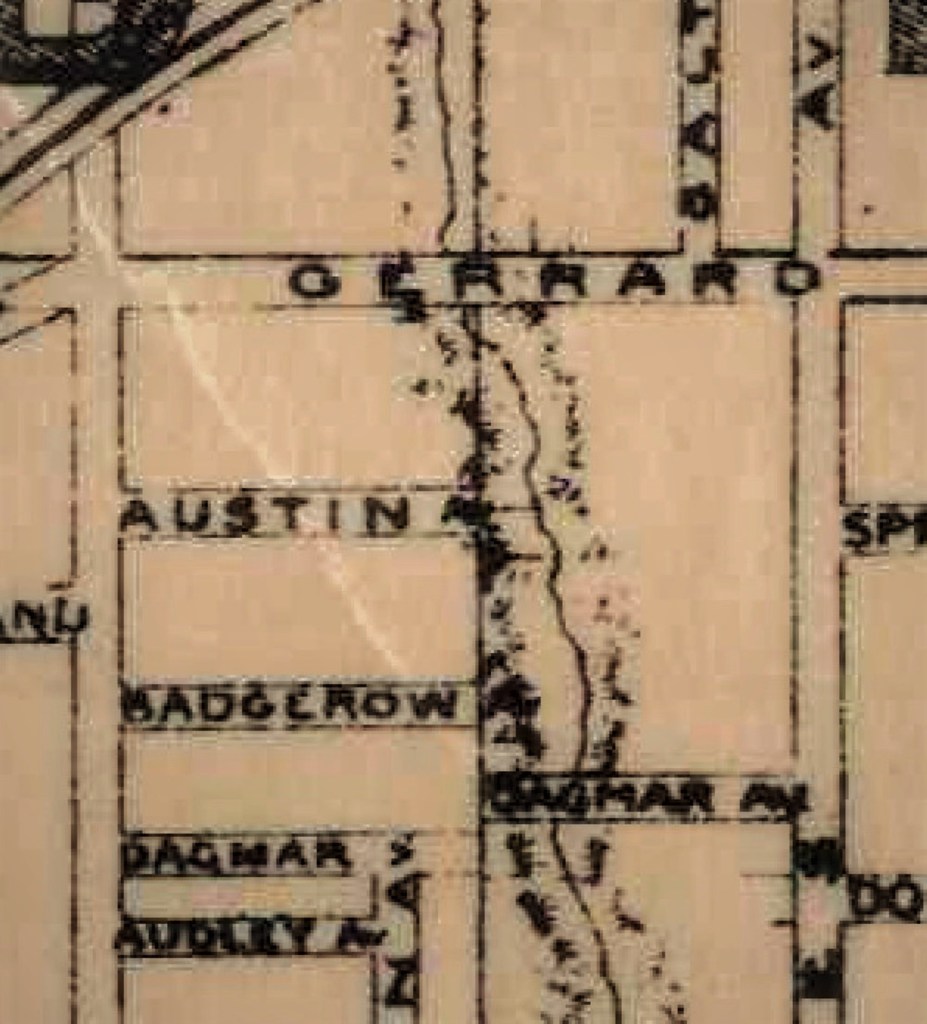
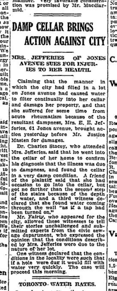
It continued south to cross Jones Avenue at #61 Jones Avenue where there was heavy basement flooding.
It ran behind the stores on the north side of Queen Street (George Leslie’s house and selling grounds) and crossed at 1211 Queen Street East.

From there It continued south, curving east to enter Ashbridge’s Bay at the foot of Laing Street where there was a cove called the Gut.
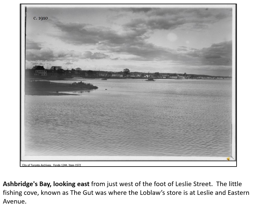
The Gut is where the Loblaws Super Store and City of Toronto Works Yard are now.


Coke allie? the gas works, how it was made etc Booth ave& Eastern ave,a story would be great,coke ash that fell
Onto everything,and what was eventually done?jat
Thanks Joanne.
This is the area my Grandfather John E Russell lived.
Steve