Tag Archives: Woodfield Road

March 10th

February 23 in Leslieville’s history
Ashbridge’s Creek: twins: one captured, one free
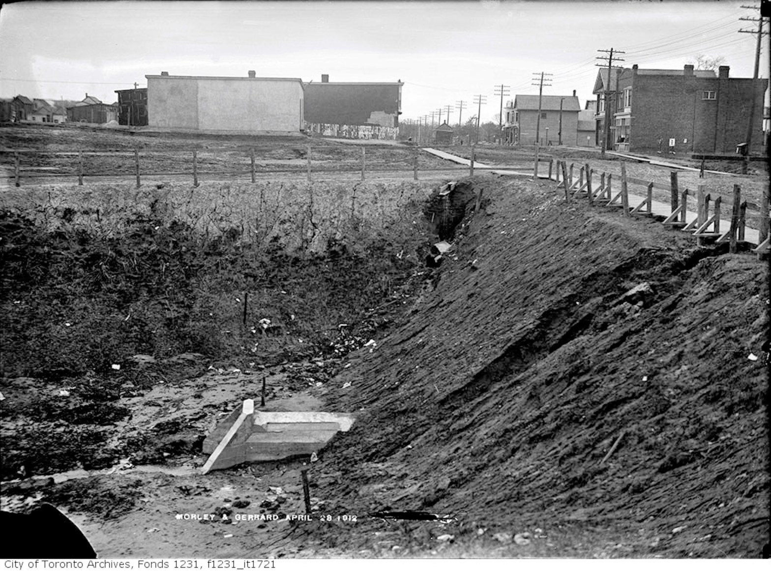
Morley Avenue and Gerrard Street fill operations, April 28, 1912 Looking east across Woodfield Road (then called Morley Avenue) towards Coxwell. Ashbridges Creek is in the deep ravine. A culvert has been installed under Gerrard Street to carry the creek south. Workers will install a cement artificial creek about 18-30 metres below the surface. TheyContinue reading “Ashbridge’s Creek: twins: one captured, one free”
