1848 The first regatta took place on Toronto bay in 1848.[1]
1880 It has been arranged that H.D. Wise, of Leslieville, will contest with Charles Annis, on Orillia Bay, a three mile race with a turn…for $100; the race to come off on August 25th. [2]1880 It has been arranged that H.D. Wise, of Leslieville, will contest with Charles Annis, on Irillia Bay, a three mile race with a turn…for $100; the race to come off on August 25th.[3]
1881 “THE Hounds. The Hounds will meet this afternoon at Ben Lamond corners, Kingston Road, at 3:30.”[4]
1882 The militia met to practice shooting. The 12th Battalion (York) had No. 1 Company (Riverside). The troops competed for prizes and cups, individually and as teams.[5]
1883 Sleighing Party. A large and merry crew sailed forth from O’Keefe’s brewery last evening and wended their way to the Woodbine, on the Kingston-road. Including the contingent which joined them at Simcoe-street, the party mustered about 200, and formed a pleasing procession as the half-dozen pleasure-vans, with flambeaux blazing and the Garrison Artillery band discoursing sweet music, passed through the principal thoroughfares. At their journey’s end, after partaking of refreshments; dancing commenced, which was carried on far into the morning, when the party made tracks for home. [6]
1887 August Charles Gaudaur of Orillia and Hugh Wise of Toronto rowed a race against each other on Lake Couchiching.[7]
1887 October The Mayor called a meeting in the Board of Trade Council Chambers to discuss setting up a public park system for the City of Toronto. A report recommended that a by-law go ratepayers for approval to raise money to buy more park property. Alderman Peter MacDonald moved that following properties be purchased for parks: 1) The lands between Broadview and Carlaw south of Wilson Avenue. 2) “All the lands lying south of Danforth avenue and the westerly production thereof, and north of Gerrard street between the Don and Broadview avenue. 3) “All the lands lying south of Queen street east, north of Ashbridge’s Bay, between Leslie street and Willow street, known as Leslie’s Nurseries.” 4) The Necropolis and lands north of the Necropolis occupied by P.R. Lamb & Co., St. James Cemetery. 5) The lands known as the “Provincial Lunatic Asylum grounds”. 6) “The lands adjoining High Park and Grenadier Pond, about 35 acres.” 7) The Bickford property (Gore Vale). 8) The University Grounds, near Queen’s Park. The motion carried though “nine gentlemen voted against it.”[8]
1888 August SCULLS AND SHELLS. AT STUGEON POINT. O’Connor, Gaudaur, Wise and Lee declare the Sturgeon Point course one of the best they have seen. The Don four, with Shea in Long’s place, the Don double (Shea and Scholes), and the Don singles, Sheas, Scholes and Strickland will represent the Leslieville section at next week’s regatta, and Sculler J.J. Ryan will row No. 2 in the Tornto four against the Dons, taking “Bush” Thompson’s place.[9]
1890s EA Thompson was a repeating champion in the 1890’s; JF Cosgrave was one of the rowing stars of his country. So were EB Butler, Robert Dibble, …[10]
1891 March Robert George Dibble was born on 12 March 1891 in Toronto, the son of Harry H. and Lucy Grace Dibble. The family home was at 223 Woodbine Avenue.[11]
1891 August The fourth annual tug-of-war and sports of the Sons of England Benevolent Society took place on Saturday afternoon in Mosspark in the presence of a large and enthusiastic company. A lengthy programme of sports and games was gone though, considerable interest being evinced in many of the events. The principal event, however, was the tug-of-war between teams from various city lodges for a cup presented by the City of London Fire Insurance Company. The heats resulted as follows: — First heat – London v. Albion – two straight pulls for London Second heat – Stratford v. Manchester – 1st pull Stratford, 2nd and 34d Manchester. O. Final heat – London v. Manchester – two straight London. London lodge consequently took the cup, which they hold for one year, the trophy having to be won three successive years to become the property of the winners. The names of the winning team are Messrs. Ben Hughes, Harry Price, S. Greenwood, H. Wise, T. Goodman, J. Lane, H. Dibble, W. Hawker, I. Price anchor, W. Jones captain.[12]
1891 September Hugh Wise of Toronto and John Teemer agreed to row together against Hanlan and O’Connor in a double skull race.[13]
1892 September “Toronto, Ontario, Sept. 3. – The general verdict of oarsmen who attended the Hamilton regatta to-day was that the course on the bay there is the finest in America for rowing. The course was a mile and a half with turn. Hedley of Vespers, Philadelphia, easily won the senior singles in 10:31. Ten Eyck of Worcester, Mass., won a well-contested professional single scull race over a course with a turn of three miles, keeping the lead throughout the race. J. Rogers, Worcester, Mass., was a good second, with C. Stephenson, an Australian who has lately settled in Toronto, third, and Hugh Wise, Toronto, fourth, Time—21:40. The rest of the races were contested by Canadian amateurs, and with the exception of the senior four-oared race, which was won by the Argonauts of Toronto in 9:08, defeating the Dons of Toronto, were rather uninteresting.”[14]
1894 “An interesting race is to be run on Wednesday afternoon on the Exhibition grounds between a trotting horse belonging to Wm. Booth, of Logan avenue, and H.H. Warren on a bicycle. The penalty to the loser is the purchase of two silk hats. At present the odds are in favor of the bicyclist.” [15]
1894 “Brickenden Bros. have erected a skating rink at the corner of Logan and Eastern avenues.[16]
1894 Feb East End Notes. Mr. Edward James, of the Woodbine, sent his horse “The Dude” to Montreal last night to take part in the ice races.[17]
1894 February The regular monthly meeting of the Royal Canadian Bicycle Club was largely attended last evening. Twenty-one propositions for membership were received. The Hard Times sleighing party was reported a financial success.[18]
1894 September “Notwithstanding the bad weather last evening the rowing race between the icemen and brickmakers for the championship of Ashbridge’s Bay came off in the presence of a large number of people. Messrs. Samuel Greenwood and L. Marsh, icemen, were the winners by a boat’s length and a half against Brickmakers J. Grady and Sam Heale.[19]
1894 October Miss Louise McAllister has taken to bicycle riding.[20]
1894 November “Mr. William Rheinholt, of Carlaw avenue, has gone on a trip to Rochester on his bicycle.”[21]
1894 December OVER-THE-DON NEWS. AN R.C.R.C. CONTEST—TRUE BLUES’ MEETING—OTHERE EASTE END NOTES. The members and officers of the Royal Canadian Bicycle Club players a game of Pedro last night, the losers to pay for a barrel of apples. The members won by 21 to 19.[22]
1895 The Toronto Hunt Club, after conducting its activities in various places in and about the city for fifty years, acquired its present site in south western Scarborough, and built a clubhouse on spacious grounds extending from the Kingston Road to the lake. Here hunting was in full swing until 1930, when the hounds ceased to be kennelled on the property; and a golf course, laid out on extra land acquired on the north side of the Kingston Road in 1910, flourished until increasing highway traffic made necessary its sale in 1943. The Club, however, still maintains its headquarters on seventy-one attractive acres above the lake. To this area also in the 1890’s and early 1900’s came other Toronto families with lesser means and social pretensions to build their summer cottages among the birch trees growing along the top of the cliffs; and it appears that one of these named Stark first called their home here Birch Cliff. This name was then chosen for the post office established in 1907 in Arthur Mitchell’s grocery store at the corner of the Kingston Road and Birchmount in response to the request of Mr. Henry E. Redman, a summer resident who had moved out to Scarborough permanently four years previously.[23]
1895 April Members of the Royal Canadian Bicycle Club and their friends, to the number of seventy-five, spent a jolly time last night at Smith’s hotel, Kingston Road, the occasion being a complimentary supper by Mine Host Smith to the R.C.B.C.’s. A very pleasant hour was spent before supper in songs by members of the club and others. A sumptuous supper was served at eleven o’clock, after which the musical and literary program was resumed, and a jolly time was spent in songs and speeches and reminiscences of the past season’s wheeling. [24]
1895 April Notwithstanding the threatening state of the weather yesterday, crowds of people were out walking, driving and bicycling. In the forenoon hundreds of bicyclists rode east on Queen street. One would think there were races going on so great was the number who took the spin east.[25]
1896 May “There was a big turn-out of East Enders to see the race for the Queen’s Plate this afternoon.”[26]
1896 May An invitation has been extended to all Methodist wheelmen and lady bicyclists of the East End to join in a run with bicyclists of Broadway Tabernacle.[27]
1896 June DOMINION DAY REGATTA Entries Don. R.C. S. Greenwood, F. Hogarth Senior Doubles [28]
1899 May The Woodbine race track attracted visitors from out of town and filled the hotels from summer to fall, but particularly before important races, such as the King’s Plate [now Queen’s Plate]. “One section of the community which is greatly benefited is the hotelmen. The hotels in the east end from the Don to the Woodbine, have felt the impulse for over a month, these suburban hostelries being occupied for the last month with stablemen, trainers, grooms and the miscellaneous entourage of the race horse.”[29]
1901 May “Toronto In Grip of Walking Habit. Men and Women Tramp to Business for Pleasure and Recreation. Walking Clubs are Formed. Ladies Take to It Also to Vary the Monotony of the Social Round. Toronto is divided into two classes, those who walk and those who don’t and the latter class may be subdivided into two sections again, those who walk for pleasure and those who walk to save; and the keen observer can still further divide the class into those who walk to save money and those who walk to save health. The rest cure is a good thing, but hundreds in the city are trying the walk cure…”[30]
1901 May Women from the Toronto Golf Club east of Coxwell complained about the firing at the Toronto Police Force’s rifle range at the rear of Small’s Park, near to the Toronto Golf Club. Fearing getting shot, the women said “that the institution is a menace to public safety.” They took the owner, Mr. Hill, to court.[31]
1903 The Woodbine Racetrack grandstand was built and the fashionable sport of thoroughbred racing became even more comfortable.
1909 February Maple Leaf Rink Open To-Night, Weather Permitting. Band. Admission 10c and 6c. Phone M. 2500. [32]
1912 Bob Dibble began rowing competitively in 1912 and won the Canadian Henley Regatta that year. He was a machinist and a union member, very different from the “gentleman” sportsman of English tradition, but, in Canada, many Canadian working class men, like the Dibbles, father and sons, were involved in amateur rowing.[33] Robert Dibble went on to win the Canadian singles title five times.[34]
1912 Toronto Lodge, No. 235, has within her ranks Robert Dibble, the champion of the Henley Regatta of Canada, who, starting out as a novice oarsman this year, …[35]
1914 January Motordrome – motorcycle and bicycle racing on Greenwood avenue, 1914. Five year lease on land and option to purchase. Joint enterprise with the Federals Baseball League. Motorcycle and bicycle racing three times a week and 77 ball games a season.[36]
1914 May 2 Frank Banford, address unknown, fell nearly 30 feet at the new Motordrome at Greenwood avenue and Gerrard streets. He had serious head injuries and was taken to hospital.[37]
1914 May 18 More than 2,000 showed up for the Saturday preview of the Motordrome on Greenwood Avenue, and a crowd also showed up on Sunday. About fifty bicycle racers showed up.[38]
1914 May 23 Motordrome opened May 23,1914. The bicycle track was built inside the motorcycle track. It would be a good place for Canadians to train for the Olympics in Berlin, in 1916 [!], according to Louis Rubenstein, a League official. The manager of the track was George Kreamer [Kramer]. The wooden cycling “saucer” was considered steep and a fast track.[39] There was seating for 7,000 and all seats were taken for that opening night. 1,000 candlepower nitrogen lights were used to have evening races.
1914 June 1 June Brownie Carslake won a marathon 26-mile motorcycle race at the Motordrome. There were over 7,000 spectators.[40]
1914 August 16 The Canadian Wheelmen’s Association began planing for a corps of bicyclists to act as scouts to patrol the Welland Canal. There were about 75 trained cyclists at the Motordrome where the CWA was to meet and organize the corps.[41]
1915 August “…Local interest is attached to the meeting of Riverdales and Maitlands in the junior series. This game is the play-off for the local group honors. It was to have been played last Saturday, but inability to secure suitable grounds caused a postponement. The Motordrome has been secured for Saturday, and this will prevent the interference of spectators with the game.”[43]
1915 Commissioner Chambers wanted a number of new parks at a cost of more than $600,000, but the Parks Committee of City Council shelved the plan as too expensive. One of the parks was the “southwest corner of Gerrard and Greenwood, 13 ½ acres”.[45]
1915 MOTORDROME ASSIGNS AND MAY NOT REOPEN. Motorcycle Bowl Experiences Unprofitable Season – Want Solman as Manager. jd summary The Motordrome, Greenwood avenue, was bankrupt due to poor weather in the summer of 1915. “Motorcycle racing in the big bowl proved very popular last summer, the second of its operation in Toronto, but the weather was peculiarly unfavorable and the attendance therefore not up to proportions that would have made the Motordrome a financial success.” It was a quarter-mile wooden “saucer” owned by a group, including Lol Solman, owner of the Island Stadium. People wanted Lol Solman to take over the management of the Motordrome, but it apparently did not happen and the track closed for good.[46]
1915 MOTORDROME CHOSEN FOR JUNIOR PLAY-OFF Maitlands and Riverdales [baseball]Will Settle Their Dispute on Saturday
1915 The major promoter of the Motordrome was Floyd A. MacFarland. He was the General Manger of the Cycle Racing Association and a well known champion cyclist himself. On Apil 18, 1915, in Newark, N.J., at a Velodrome race, a disgruntled concession owner plunged a screwdriver into MacFarland’s head, killing him.[47]
1915 TORONTO OARSMEN WIN. All Except One Race Won by Home Sweepsters. St. Catherines [sic], Ontario, August 6.—Toronto oarsman were victorious in the opening races of the wartime regatta of the Canadian Association of Amateur Oarsmen on the Royal Canadian Henley course today. Members of the Don and Argonaut Clubs of Toronto took all except one of the events. The race for working boats which featrued the prgoram was closely contested. Harry Dibble, brother of the senior champion, Bob Dibble, was a conspicuous figure, winning three of the four races in which he contested. He finished last, however, in his final effort.[48]
1920 The Toronto World, July 5, 1920 1920 Greenwood Park Opened For Sports Mayor Church and Several Aldermen Assist in Formal Opening. Mayor Church, assisted by several aldermen, opened the new playground in the east end, near the corner of Gerrard street and Greenwood avenue, on Saturday afternoon. [Ald. Beamish, Johnson, Hiltz and Maxwell attended.] The board of control granted $20,00 towards putting the field, which used to be a brickyard, into fit condition for playing, and the result is considered highly satisfacoty by all. [The band of the Queen’s Own Rifles played.] A violent rainstorm brought the proceedings to a hasty close.[56]
1928 March The Leafs took three games from the Giants and the Orioles won the odd game from the Cubs in the Leslieville Court of the Catholic Order of Foresters League. Meehan had high single with 312. A. Waring, Knowles, Berney and C. Waring were others to turn in good counts for their teams.[51]
1956 The new Woodbine Racetrack is built in north-west Toronto. The name of the local racetrack was changed to Greenwood in 1956 and it became Greenwood in the spring of 1963. [52][53]
1960 DIBBLE, ROBERT GEORGE, b. 1891, Toronto — d. July 17, 1960 Toronto. North American sculling champion. …[54]
1993 Live racing at Greenwood was terminated at the end of 1993 and a betting parlour and cinema complex, along with a new public park and housing, were constructed on the site.[55]
[1] Wallace, William Stewart and Robert H. Blackburn. The Encyclopedia of Canada. 1935, 285.
Ever wondered who lived where your home is long, long ago? Well, I can give you some idea because I have directories from the early twentieth century and the nineteenth century. But there are no street addresses in the earlier directories. Look at this example from 1866 for Leslieville.
1866 Mitchell’s General Directory p 404
I think you’d agree that there is lots of information here. Who knew that there was a Leslieville Oil Company! They found pockets of natural gas, but no oil. The people are interesting and even more so if you know a little about them. R. Ambrose was a labourer in George Leslie’s Toronto Nursery. Later Ambroses became gardeners on the long-vanished Toronto Golf Club course at Upper Gerrard and Coxwell. The Ashbridge Estate still has a lovely old Ashbridge family home and hosts a flea market in the summer. James Berry was an African American who came north before the end of slavery. The Finucans and others were Irish Catholics who came here during the Potato Famine. William Higgins was Toronto’s first High Constable or chief of police. Henry Lewis was another black merchant. Logan Avenue is named for John Logan, a tall shy market gardener. James Morin built the Duke of York Tavern, in 1870. Alexander Muir wrote “The Maple Leaf Forever”. Pape Avenue is named after the Papes who specialized in growing flowers. Joseph Pape was one of Ontario’s first florists. Samuel Sewell was the patriarch of Leslieville’s black community. Thugs murdered his 15-year-old son, Isaac, ostensibly because he flirted with a white woman, but more probably that motive was piled on another — they robbed him of a substantial amount of money. There are so many stories, but from this you would not really have much idea where they actually lived.
The same Directory gives us more information, but only if you understand the rather cryptic language used. It lists every head of house (i.e. men) alphabetically for the Township of York East. Leslieville was in York East, but so was Riverside, the Village of Norway, etc. — and the City of Toronto.
Let’s look at a few examples: Ashbridge, Jesse Con 1 Lot 8f; Beaty, Hanah Con 1, Lot 15f (single women and widows were included, especially if they owned property); and Calendar, Henry, laborer, Con. 1, Lot 5h.
With that information we know within a city block or two where these people lived. But how?
Concessions, Lot numbers, Land Owners, 1796, Township of York East, from Victoria Park on the east to the Don River on the left.
Maps say a lot, but you have to understand the language they are using or at least the basics.
Just as we begin learning French with basic phrases like “Bonjour” or “Merci beaucoup”, we begin with a few basic terms in the language of those who laid out the roads and side roads, farms and subdivisions — surveyors. If you own a home, you want an accurate survey to know where your property begins and ends or you may find yourself tearing down the new fence you just built and/or having a heated argument with your neighbour. So, now and then, surveyors used state-of-the-art equipment, to lay out a pattern of roads and property divisions called “lots”. In the Township of York East, they began by carefully laying out an accurate base line — an imaginary, but crucial east-west line. Then they laid out a second line and a third and a fourth and so on, like rungs on a ladder reach north from the lake — each rung at a equal, pre-determined distance from the base line. The area between the base line and the second line was called “the First Concession”; and between the second and third line it was “the Third Concession”.
They laid out another set of lines, but these ran north and south, again in pre-determined and equal distances. These lines were known as side lines. Between each sideline and the one to the west of it was a “farm lot” or simply called a “lot” of 200 acres. The lots are number from east to west, beginning at the Victoria Park, the boundary between the old Scarborough Township and the Township of York East.
In this way, the early surveyors laid out the Township of East York as a grid and their orderly lattice of concessions, sideroads, and lots is still with us today. When settlers or contractors “opened up” or built a road along the imaginary line, the road became known as “the First Concession Road” or “Base Line Road”; Second Concession Road; Third Concession Road; etc. In rural areas today, you will often hear, “Oh, so-and-so lives on the Second Concession”, meaning the Second Concession Road.
1851
In our area, the First Concession Road became known as the Kingston Road or the road to Kingston. Parts of it later became known as “Queen Street”.
Where Kingston Road bends and goes up the hill towards Woodbine Avenue, Lee Avenue and beyond, it is no longer on that imaginary line but follows an ancient First Nations trail. In fact most of our streets that run diagonally or meander lazily around hills and through valleys, are trails made by the Wendat, Haudenosaunee and Missisauga, and the Nations that went before them. This includes Kingston Road, Dawes Road, Broadview Avenue, Todmorden Road, Bayview Avenue, Rosedale Ravine Road, Davenport Road, and so many more. Some like the Ridge Road in this map have been completely forgotten.
1896 Arthur Thompson Map of Scarboro (Left side)
Queen Street through the Beach is on the line of the First Concession Road. The roads alone the sidelines became known with numbers in most rural areas, but in our area the sideline roads have names. This Map of the Townships, York, Scarboro, and Etobicoke from ca 1911 by C.H. MacDonald clearly shows the area streets with the numbered lots. People called the area between Queen Street and the bay and lake “the Broken Front” because it was the front of the grid but was not continuous, being cut up with coves and inlets.
If we take an even more detailed part of the map above and flip it 90 degrees, we can see the names of the sidelines better.
The sideline at the boundary with Scarborough Township is now Victoria Park Avenue. The next sideline, separting Lot 1 and 2, is Willow Avenue. Between Lot 2 and 3 is Beach Avenue, then spelled “Beach Avenue”. Then between Lot 3 and 4 is Main Street which becomes Southwood Drive south of Kingston Road. Sidelines here are not as straight as the first surveyors, mostly military men, would have wished because the steep hill and numerous ravines messed up their neat plan. The side line between Lot 4 and 5 was called “Morton Road” but is now “Norwood Road”. South of Kingston Road it is Lee Avenue.
Sideline
1912
2017
1-2
Willow Ave
Willow Ave
2-3
Beach Ave
Beech Ave
3-4
Main Street
Hammersmith Ave, Southwood Rd, Main St
4-5
Lee Ave, Norwood Rd, Morton Rd
Lee Ave, Norwood Rd, and roughly Westlake Ave
5-6
Woodbine Ave
Woodbine Ave
6-7
Roughly along line of Berkeley Ave
Now roughly along Edgewood Rd, then Beaton Ave, Wembley Rd, and Hillingdon Ave
7-8
Coxwell Ave
Coxwell Ave
8-9
Morley Ave
Woodfield Rd and closer to the Danforth it is Gillard Ave
9-10
Greenwood Ave
Greenwood Rd
10-11
Leslie Street
Leslie Street and north of the CNR tracks Condor Ave
11-12
Jones Ave
Jones Ave
12-13
Carlaw Ave
Carlaw Ave
13-14
DeGrasi St
DeGrassi St and further north near the Danforth it is Hampton Ave
15
Broadview Ave
Broadview Ave
Even today our houses sit in numbered subdivisions within the original farm lot.
So let’s decipher our examples. Keep in mind that while the sideline is not mentioned, we don’t really need it. There were very few streets opened up in 1866 and only two major Concession Roads: Queen Street and Danforth Avenue. Kingston Road being a First Nations Trail was “off the grid” and not a concession road in York East.
Ashbridge, Jesse Con 1 Lot 8f means Jesse Ashbridge, living on Queen Street between Woodfield Road and Greenwood Avenue, in Leslieville. “Con 1” is Concession One or the block of land that lies between the Baseline (Queen Street) and the Second Concession Road (Danforth Avenue). “f” is for “front”, meaning the south end of the block of land while “h” is for “hind” or “rear”, meaning on the south side of Danforth Avenue.
Jesse Ashbridge House, Queen Street East between Woodfield Road and Greenwood Avenue on the north side.
Beaty, Hanah Con 1, Lot15f means Hannah Beatty (typos even back then) lived on Queen Street between Broadview and the Don River — in Riverside.
Calendar, Henry, laborer, Con. 1, Lot 5h is a lot trickier because Kingston Road intersects Lot 5 and though it says “h” for rear, he could be living on Kingston Road or near to Danforth Avenue, somewhere between Norwood Rd. or Westlake Ave. and Woodbine Avenue.
From Tremaine’s Map of the County of York, 1860
1868 Map. Dawes Road is the diagonal road in the upper right. It ran all the way to Kingston Road which arches like a bow along the brow of the steep escarpment above the Beach.
1878
We will follow the Jesse Ashbridge property. Jesse Ashbridge died in 1874 of tuberculosis. His wife Emma Rooney died in 1919. Their son Wellington Ashbridge died in 1943 and Jesse Ashbridge Junior died in 1945. Wellington Ashbridge had two daughters: Dorothy died in 1996 and Winnifred in 2002.
1884 Goads Atlas
1884 Ashbridge Estate
1892, Abrey & Tyrell map
Riverdale 1893
1899 Goad’s Atlas
1903
1910
Toronto Star, June 30, 1910
1924
Detail Goad’s 1924
Goad’s Fire Atlas maps have a great deal of detail. For example, take the block of buildings from Vancouver Avenue (formerly Ashport) to Greenwood Avenue, on the north side of Queen Street. When someone planned a subdivision they had to register the plan with the Registry Office and they received a number for their new subdivision. The number 303E is the subdivision number for the storefronts and houses here. There are seven narrow north-south lots, numbered from east to west 1 to 7. 7 is the store on the northeast corner of Greenwood and Queen. The address is also given and for this store it is 1372 Queen Street East. It also tells us the construction of the buildings. Not surprisingly the reddish-brown brick-coloured buildings are brick. The yellowish builds are wooden. The red line in the lower left corner is the water line for a fire hydrant. The fire hydrant is a circle.
So if you wished to research the title for 1372 Queen Street East, you know it is in Concession One, Lot 10, Subdivision Plan 303E, Lot 7. You could also check it in some of the other City Directories.
1891 City Directory
1906 City Directory
1906 City Directory (cont’d)
This should be entitled Queen Street SOUTH Side JD
1914 City Directory
1922 City Directory
1922 City Directory (cont’)
View of Queen Street East at Greenwood Avenue, 1981
Photo by J. Doucette
Postscript: The Ashbridge Estate
Globe and Mail, June 9, 1954
Ashbridge House, 1444 Queen St. E. July 1986 Toronto Public Library
Streetscape, Bloomfield Ave, Riverdale Gardens, October 17, 2017 photo by J. Doucette
We think of the Edwardian period as the time when King Edward VII, Victoria’s son reigned. That is the period from 1901 to 1910. For Riverdale Gardens, this is the period when Albert Wagstaff and others opened brick yards along Greenwood near the railway tracks. William Prust, Riverdale Garden’s founder, retired from his positions in Haliburton during this period and moved to Greenwood Avenue in Toronto. Let’s be clear, I love this neighbourhood and it is very different from anything else in our area. Some of the words to describe these Edwardian homes are quite technical and, if you don’t know them, don’t worry, I didn’t either — at least when I began researching many years ago. I have added a section at the end with definitions of the various technical terms used.
The Canadian Courier, Vol. IV, No. 19 (Oct 10, 1908)
Toronto Star, May 21, 1910
An old cherry tree from the orchard that was here before Riverdale Gardens was built. October 17, 2017 photo by J. Doucette
One of the old trees from the orchard that William Prust promised to leave in every yard. October 17, 2017 photo by J. Doucette
But Edwardian architecture, including the house style that dominates Riverdale Gardens, began earlier in the dying years of Queen Victoria’s reign. The change from the Victorian architecture of the 1890’s to the new style was dramatic. In the earlier Victorian period there were many more varieties of house design. The Edwardian era featured simpler designs and fewer styles, chiefly the Edwardian Classic house and the Arts and Crafts bungalow, both of which are found in Riverdale Gardens.
While technically the Edwardian architectural period coincided with the end of World War One in 1918. But Edwardian houses continued to be built in Riverdale Gardens up until the end of the 1920s, no doubt because William Prust himself preferred this style.
Toronto Star, March 16, 1921
At the beginning of Edwardian era, most of the East End was still not subdivided. The Hastings and Ashbridges farms had not been sold to developers and the Toronto Golf Club’s course from Coxwell to East Toronto was in operation until 1912. Gerrard Street from Greenwood to Main was not opened until 1912.
Looking north on Greenwood at the railway tracks, Toronto Star, November 5, 1912
Greenwood Avenue was widened in 1909. Gerrard and Greenwood was a major streetcar junction with Greenwood cars going north-south to Danforth and Queen and Gerrard cars going east-west.
We may chuckle now, but it is important, I think, to remember that the architects and builders, be it 1917 or 2017 consider their work “modern” and “state-of-the art”, but certain periods featured such dramatic technological and social change that they stand out.
With the advent of cheap hydro-electricity after 1907, industry was expanding along key East End streets, particularly Carlaw, Eastern and, to a lesser extent, Coxwell Avenue. Virtually the only industry on Greenwood in this period was brick making. These new plants provided employment for managers, foremen, and skilled tradesmen such as lithographers and engravers who followed their employers from downtown to the East End. Toronto’s growing middle class embraced change, including electricity, the expansion of public transit, and the new architectural styles.
City Hall decorations for the inauguration of Toronto Hydro – May 2, 1911
The middle class begin to move farther away from downtown to new “streetcar” subdivisions such as Riverdale Gardens. This accelerated in the 1920s as the automobile became cheaper and more accessible, offering another transportation option. In the “The Roaring Twenties”, Gerrard Street and Greenwood Avenue were built up all the way from the Don to Main Street and from Queen past the Danforth. As the population of Toronto boomed, real estate along Gerrard also boomed.
Riverdale Garden’s Goad’s Atlas, 1924
The Edwardian era featured apartment buildings built with plumbing and electricity, such as Albert Wagstaff’s Vera Apartments at Wagstaff Drive and Greenwood Avenue. Wagstaff build it as a modern building, in the latest style, and as a practical investment allowing his managers and foremen to live right next to their workplace. He may even have subsidized some of the rents, but this remains to be documented. Wagstaff built a number of apartment buildings in the East End, but apartment buildings were very controversial at the time. They were often and unfairly labelled “tenements” with all the associations to over-crowding, unsanitary conditions and poverty. The new type of apartment building pioneered in Toronto by Wagstaff and others made these buildings socially acceptable and even fashionable.
The Vera Apartments, Wagstaff Drive. William Prust lived in the duplex next door. October 17, 2017 photo by J. Doucette
Prust was careful to include shops in Riverdale Gardens. Shopfronts were simpler than their Victorian predecessors. Glazing now featured broad panes of plate glass instead of the smaller-paned windows. Although merchants could buy machine-made plate glass from as early as 1800, it was very expensive and did not come into common use until later and only became relatively common by the 1890s. These show windows featured fresh fruit or vegetables, hardware, shoes or other merchandise.
Globe, December 7, 1923 Arnold’s Market, 251 Greenwood Avenue — the south-east corner of Greenwood and Gerrard. Grocery stores were much smaller then.
Globe, December 7, 1923 Arnold’s Market, 251 Greenwood Avenue — the south-east corner of Greenwood and Gerrard.
Stop and Shop, now the Better Price Food Market, Toronto Star, October 9, 1930
Southwest corner of Greenwood and Gerrard, October 17, 2017 photo by J. Doucette
Toronto Star, April 26, 1928 Collins Hardware, 224 Greenwood Avenue, now Maha’s Restaurant.
One of the businesses of Riverdale Gardens, October 17, 2017 photo by J. Doucette
Originally one of the stores of Riverdale Gardens. October 17, 2017 photo by J. Doucette
Sandford Avenue at Prust, October 17, 2017 photo by J. Doucette
Bloomfield and Greenwood, Riverdale Gardens, October 17, 2017 photo by J. Doucette
Ivy Avenue, October 17, 2017 photo by J. Doucette
Bloomfield Avenue at Prust. October 17, 2017 photo by J. Doucette
The Isaac Price house at 216 Greenwood stands out both because of its size and its style and would have been considered slightly old-fashioned by many even when it was built. The Queen Anne house featured asymmetrical; textured surfaces; classical ornamentation; often towers/turrets; wraparound porches; balconies; art glass; and high brick chimneys. The Isaac Price house is a more restrained rendering of the Queen Anne style and includes some Arts and Crafts elements. It might better be considered a “vernacular style”, but does feature a vertical orientation, asymmetrical massing, projecting gables, and contrasting materials, particularly brick and wood. Of course, the brick it featured was Isaac Price’s own high-quality face brick, virtually identical to his brother’s “John Price Red”.
The Isaac Price House, 216 Greenwood Avenue, October 17, 2017 photo by J. Doucette
Most of us see Edwardian Classic houses each and every day and don’t think much about them. But they, and Prust’s guiding hand, are what makes Riverdale Gardens unique and beautiful. So let’s take a second of many more long looks at the houses and neighbourhood of Riverdale Gardens.
The original paving is still there. Globe, October 17, 1928
The typical Edwardian house of Toronto’s suburbs has a gable front, three or four bedrooms upstairs, and a big front porch. Most have lots of windows, often with Indiana lime stone sills, and a smooth brick walls on a high cement or field stone foundation. The wide porch usually was painted white and has clustered columns.
Edwardian Classic villa, Gerrard Street north side at Prust, October 17, 2017 photo by J. Doucette
How the homes of Riverdale Gardens were viewed in the Twenties. Toronto Star, June 16, 1924
Many Edwardian houses are basically rectangular brick buildings with classical elements drawn on the architectural vocabulary of “classical” Greece and Rome. (Personally, I would like to see more homes today build on the not-so-classical vocabulary of the wigwam but is another story.)
Classic dentilation above a bay window, Riverdale Gardens. October 17, 2017 photo by J. Doucette
Classic detailing, Edwardian home, Riverdale Gardens, October 17, 2017 photo by J. Doucette
Many have modified Doric columns. The architrave is usually quite plain. The cornice maybe exaggerated and with dentil blocks. The window surrounds are large but not ornate. Some area owners have retained the original windows with storm windows added, preserving the original design. The front door is important and many Riverdale Gardens home showcase the front door with the house’s most prominent Edwardian features.
The entrance to this Sandford duplex echos an ancient Grecian temple. October 17, 2017 photo by J. Doucette
Many verandas span the whole front façade and have a simple pediment over the staircase, as in this example above. Above the smooth tapered Doric columns, a plain architrave supports the porch. Under the soffit of the roof, a plain frieze board would have repeated the design of the architrave, subtly unifying the building while referring to the classical ideals that were so much a part of the middle-class education of the day.
An Edwardian Classic from the ground up, Ivy Avenue, Riverdale Gardens, October 17, 2017 photo by J. Doucette
Examples of original Edwardian Art Nouveau or Arts and Crafts art glass still survive to grace Riverdale Gardens. Some owners such as those who own the house in this photo have preserved their art glass, and, incidentally, improved the value of their house.
Original art glass, home, Riverdale Gardens. Unfortunately or cowardly of me, I wasn’t willing to go closer and trespass to get a better photo. October 17, 2017 photo by J. Doucette
This Edwardian house features the clean lines and solid massing of the Edwardian style but also presents some Arts and Crafts elements. The gable has half-timbered effects. The simple brown and white painting of the timber is, as with many Edwardian touches, restrained and subtle compared to Victorian paint schemes.
The “Tudorbethan” house with turret that was built for Isaac’s son, William Henry Prust. October 17, 2017 photo by J. Doucette
This is a typical Edwardian verandah with Doric colonettes on brick posts. The stairs are wide and simple, welcoming, and there is lots of room for the wicker chairs they loved so much.
Classic Doric colonettes on posts with the original entablature, bay windows, gable dormers, on a duplex. October 17, 2017 photo by J. Doucette
Some Edwardian homes sometimes have half-timbered exteriors, in what has sometimes been jokingly referred to as “Tudorbethean” or a fabricated mixture of Tudor and Elizabethan architecture. Sometimes the fill between the timbers is stucco and occasionally “pebbledash”.
Pebble dash, photo by J. Doucette, 2017
I think of the Edwardian houses or Riverdale Gardens as neatly-wrapped presents. They look good, really good, on the outside and you just can’t wait to get into them. And what is inside them is treasure. Prust’s lay-out of the streets and houses and his insistence on “trees, trees, trees, if you please”, add to this feel that characterizes Riverdale Gardens. But, like a wrapped present, there are goodies on the inside.
The front door of an Edwardian house made a statement. It was panelled and sometimes incorporated Masonic symbols or images and stained glass. Walk through the front door of these Edwardian homes and you found paintings (albeit reproductions or prints), sparkling tileworks, stained glass and decorative features inspired by both the Art Nouveau and Arts and Crafts movements. To get an idea of the fashionable home interior of the early 1920s and the clothing of the men and women who lived when most of Riverdale Gardens was built, one of the best places to look is the Eaton’s catalogue. These are from the Eaton’s Fall and Winter catalogue of 1920 to 1921.
This slideshow requires JavaScript.
Prust houses often had piping for gas lighting, stoves and fireplaces, but all had electricity. This was one of those revolutionary technological changes we take for granted until a transformer somewhere on the grid goes down and the lights go out. As electric lights brightened interiors, those interiors opened up, creating a very different interior from the larger hall to the bigger rooms, with larger windows and taller ceilings. The living-room replaced the parlour. Simple replaced the fussy. Light colours replaced the dark colour schemes of the Victorian interior.
This was a new vision of the living space: light-filled, with open, airy rooms, considered far more healthy especially at a time when the “white plaque”, tuberculosis (TB), killed so many. Incidentally, this term is not a reference to race, but to the ashy paleness of those eaten up or consumed by “consumption”, another term for TB.
Women had more say in how homes were designed. These Edwardian houses and their Arts and Crafts contemporaries featured the first built-in kitchen cabinets, the first built in kitchen sinks and stoves, as well as bedrooms with a closet in every room, even though those closets seem small to us today. Servants no longer looked after the middle class and these houses were made easier to clean – especially with the electric vacuum cleaner.
The floors would be dark, polished wood as would be the staircases, posts and banisters. Persian-style rugs broke up the expanses of bare floor with splashes of colour and texture. Walls were often white downstairs, but wallpaper was frequently used in the bedrooms. Walls could be white when they were lit by electricity. Gaslight, oil lamps and candles made walls sooty and dark Victorian paint and wallpaper concealed this. Now wallpaper was softer and easier on the eye than Victorian wall paper. It often featured delicate floral patterns in pastel shades.
Many homeowners in Riverdale Gardens have renovated their Edwardian homes with extensions, skylights and additional windows, very much in the spirit of the original design with its emphasis on light, airy space. Riverdale Gardens is a very attractive location, part of Leslieville with its very desirable “location, location, location”. Properties gain both aesthetically and in value when homeowners understand more about the Edwardian nature of their houses. These gracious understated houses were built with the highest quality materials and workmanship especially when someone William Prust controlled the development of the subdivision. The bricks were the best, usually Price bricks. The timber was the highest quality, old-growth pine for framing and quarter-sawn oak, American chestnut or other fine wood for floors, interior moldings, doors and windows. These houses, detached, duplexes, triplexes and a few terraces, if lovingly maintained, will last for centuries, long after hastily-constructed condos will be nothing but dust and rust.
Three local bricks: a Wagstaff brick is left; an Ashbridge’s and Morley brick, centre; and an Isaac Price brick, right.
Globe, Friday, May 11, 1923 $6200
Toronto Star, March 24, 1923 117 Ivy Ave
Globe, June 15, 1923
Even the roads of Riverdale Gardens were better maintained that Greenwood and even Gerrard. The brick wagons with their heavy loads cut deep ruts into Greenwood Avenue. To avoid the bog, motorists detoured through Riverdale Gardens. This went on for at least a decade, but probably more. At the time that Prust Avenue was built, Alton Avenue did not extend all the way to Gerrard but stopped before the steep drop-off that was the north face of the clay pit where Greenwood Park is today.
Toronto Star, October 3, 1917
The traffic, even when not befuddled [or inebriated] was not welcome.
Greenwood Avenue was in such bad shape that cars preferred to detour down Prust to Gerrard. Residents wanted it declared a private road. Another solution was found: making the streets of Riverdale Gardens one-way in direction, deterring through traffic. Toronto Star, Oct. 29, 1927
Architecture: The art of designing and building according to the rules regulated by nature and taste.
Architrave: The lintel or flat horizontal member which spans the space between columns; in classical architecture, the lowest member of an entablature.
Aspect: The direction in which a building faces.
Balcony: A projection from a wall of a building. It is usually placed before windows or openings.
Balloon framing a method of wood framing (begun in the 19th century) where the exterior walls are continuous from foundation to roof plate, and all the framing members are secured with nails.
Baluster: Any of the singular posts of a railing, one of a series of uprights, often vase-shaped, used to support a handrail.
Balustrade: the low wall made up of a series of balusters and railings, a row of columns supporting a railing.
Bargeboard: fancy, wooden ornately carved scrollwork, attached to and hanging down under the eaves of the projecting edge of a gable roof
Base: The architectural element on which a column or pier rests. See also column, pier. Other parts of columns and piers: abacus or impost block, capital, shaft.
Baseboard (skirting board): interior finish trim hiding the wall and floor junction.
Bay Window: A window forming a bay or recess in a room or an alcove projecting from an outside wall and having its own windows and foundation.
Bay: A unit of interior space in a building, marked off by architectural divisions; sections of a building, usually counted by windows and doors dividing the house vertically.
Bond: the pattern in which bricks are laid, either to enhance strength or for design.
Bracket: historically, a support element used under eaves or other overhangs. In Edwardian architecture, exaggerated brackets used under wide eaves are decorative rather than functional. A projection from the face of a wall.
Builders: trained as apprentices with master builders who were themselves usually carpenters or masons.
Bungalow: The Arts and Crafts bungalow in its purest form didn’t work for cold climates like Toronto, Detroit or Chicago. So, designers reconfigured the bungalow, creating a new style of bungalow that was raised on a stone or concrete foundation with a basement and the most modern furnace available. Nevertheless, they built in elements that emphasized the horizontal vs. vertical even when, as in our neighbourhood, the bungalow was perched half-way up a hill. This new bungalow, sometimes called a “semi-bungalow”, was usually a storey and a half with a dormer, not a full two stories. Although small by today’s standards, often between 800 and 1200 square feet, they were considered spacious at the time. The typical six-room house had two or three bedrooms, one bathroom, a livingroom that flowed into the dining room, kitchen, and a full basement. It often had a second floor with additional space, but was usually only a storey and a half. It had large porches covered by the overhanging roof and eaves and supported by generous columns. Columns were designed in such a way as to break up the vertical line using groups of columns, a column split into two parts (a bigger base with a small pedestal on top) or so-called elephant columns that were wedge-shaped, narrow at the top and widened like an inverted elephant’s trunk at the ground. By 1923, there was a building boom across Toronto as prosperity had returning following the brief depression of 1919. The area along Gerrard filled in with rows of brick bungalows, detached, duplexes and triplexes. Riverdale Gardens is exceptional in being mostly Edwardian villas with only a few bungalows.
Capital: top part of a column, decorative element that divides a column or pier from the masonry which it supports.
Cladding: exterior surface material that provides the weather protection for a building.
Classical Orders: Doric (earliest and simplest) Doric columns usually have no base; the shaft is thick and broadly fluted, the capital is plain. Ionic (second) Ionic columns are usually slender, with fluted shafts, and prominent volutes on the capital. Corinthian (latest and most ornate Order) Corinthian columns are slender, usually fluted, with capitals elaborately carved with acanthus leaves.
Colonnade: Series of columns set at regular intervals or a row of columns which support horizontal members, called an architrave, rather than arches.
Column: Cylindrical support consisting of base, shaft and capital.
Coping: a cap or covering on top of a wall, either flat or sloping, to shed water.
Cornice: The top section of the entablature; a horizontal molding projecting along the top of a building or wall.
Course: a continuous horizontal row of brick or stone in a wall.
Crenulations or battlement: A parapet with alternating openings (embrasures) and raised sections (merlons), often used on castle walls and towers for defense purposes.
Decorative Wooden Trim: Most homes include a street-facing gable decorated with wood trim such as brackets, patterned millwork, bargeboards, or shingling; this decoration is also occasionally used on the porch gable.
Dentils: small, oblong blocks spaced in a band to decorate a cornice.
Doors and Windows: Front facades of homes in this district are typically wide, which allows architectural elements like windows and doors to also be wider.
Doric: The oldest architectural style of ancient Greece; characterized by simplicity of form; fluted, heavy columns and simple capitals.
Dormer: an upright window projecting from the sloping roof of a building; also the roofed structure housing such a window.
Early roads: Queen Street was the baseline (with the land beneath it becoming known as the “broken front”). Surveyors ran their lines north from Queen Street with the Danforth eventually becoming the first concession. Farms were oriented north-south along Queen Street in 200 acre lots. Villages sprang up at the toll gates along the road — Norway at the Woodbine toll gate; Leslieville at Leslie Street and Don Mount (later renamed Riverside) at Mill Road (Broadview).
Vernacular style: many houses exhibited a mixture of several styles. Many Edwardian architects and builders borrowed elements from different styles, particularly Neo-classical, Art Nouveau and Arts and Crafts, to create their own designs.
Elevation: one of the external faces of a building; an architectural drawing (to scale) of a building façade.
Ell: an addition or wing to a house that shapes it like an “L” or a “T”.
Entablature: A horizontal superstructure supported by columns and composed of architrave, frieze and cornice.
Façade: the faces of a building, often identified by the cardinal direction (N,S,E,W) which it faces.
Fascia: a plain horizontal band; a fascia board will cover the joint between the wall and the projecting eaves.
Floor plan or ground plan: Horizontal cross-section of a building as the building would look at ground level. A ground plan shows the basic outlined shape of a building and, usually, the outlines of other interior and exterior features. The main floor and upper floor plans (if any) are always included. In addition, depending upon the scope of the survey, plans at the following levels may be required: foundation plan, reflected ceiling plans (crawl space, main and upper floors), attic joist plan, rafter plan and roof plan.
Foundation wall, beam, column, footing: Many of the homes of settlers sat directly on the ground. Masonry walls were used for footings from c. 1850 – 1900. Poured concrete foundations were new in the late 19th century and those with Portland cement, harder and more durable, in the 20th century.
Foyer: The entrance hall.
Framework, walls, floors: Wooden structural frame and light cladding. Clad in brick, stucco or wood.
Frieze: the horizontal band forming the middle section of the entablature; usually decorated with sculpture.
Gable: The end wall of a building, the top of which conforms to the slope of the roof.
Gambrel: a ridged roof with two different slopes on each side of the ridge, the lower slope having a steeper pitch (sometimes called a Dutch roof).
Glazing: the glass in a window.
Grand Trunk Railway (GTR): This railway was proposed in 1851 as the main trunk line through the United Province of Canada. It was formally incorporated in 1852 to build a railway from Toronto to Montreal. In 1856 the GTR reached the banks of the Don River in Toronto. The GTR became part of the Canadian National Railway (CN) and now GO Trains roar along it.
Half-timbering: wall construction in which spaces between wooden timber framing are filled with brick, stone, or other material; used decoratively in 20th century houses.
Head: the top of the frame of a window or door.
Header: the end of the brick seen in a brick course.
Industrialization There were a considerable number of highly organized and specialized plants located in the East End. These larger manufacturers were successful, and, with their state-of-the-art machinery mass produced goods, that outcompeted smaller factories. Many, like Palmolive or Wrigleys, were branch plants owned by American corporations who had to build here in Canada because tariff walls imposed high duties on American-made goods.
Jamb: A vertical element of a doorway or window frame.
Jerkinhead: a gable roof with a hipped end
Joist: horizontal structural members to which the boards of a floor or the lath for a ceiling are nailed.
Light (lite) : small panes of window set into an individual sash.
Lintel: A flat horizontal beam which spans the space between two supports.
Lozenge: A diamond shape.
Masonry: work done by masons, including brick, stone, or concrete block.
Massing: the expression of interior volume as form.
Mortar: a material used in the plastic state and troweled into place to harden; used to consolidate brick, stone, and concrete block work.
Newel: the principal post in a banister at the foot of a staircase and at the corners of landings.
Parging (pargeting): to coat with plaster, particularly foundation walls and rough masonry (see stucco).
Pediment: a triangular section, or gable end, often used above doors and windows or at porch entrances.
Pier: An upright support, generally square, rectangular, or composite.
Pitch: the degree of slope of a roof, usually given in the form of a ratio, such as 6:12.
Porch: a roofed exterior space on the outside of a building.
Portal: Any doorway or entrance but especially one that is large and imposing.
Portland cement: a high-strength material (commercially dating to 1824) used as a component of concrete and modern hard mortars.
Quoins: rectangles of stone or wood used to accentuate and decorate the corner of a building
Rafter: framing member supporting the roof.
Repointing: removal of old mortar from joints of masonry construction and filling in with new mortar.
Return: the part of a pattern that continues around a corner.
Ridge: the [top] line of intersection of the opposite sides of a sloping roof.
Riser: the vertical face of a step.
Riverside Missionary Church In 1902 this building was erected as a Primitive Methodist Church on the site of an earlier Church at 466 King Street West, at the corner of Bright Street and King Street.
Roofs: Gable, hipped (mansard included) and flat roofs.
Rusticated block: concrete block formed to replicate rough stone.
Sash: the moveable framework holding the glass in a window or door.
Shaft: The structural member which serves as the main support of a column or pier. The shaft is between the capital and the base.
Shingles: thin pieces of wood used in overlapping rows to cover roofs and exterior walls of houses; can be cut in decorative shapes.
Sidelights: windows at either side of a door; often in conjunction with a transom above door and sidelights.
Siding: the exterior wall covering of a structure. German : common 19th century wood siding pattern, with a combination of concave curve and flat profile novelty : general term for 19th century wood siding with a decorative profile.
Sill: the horizontal water-shedding element at the bottom of a window or door frame.
Site Plan: The site plan shows the legal boundaries; the topographical features, including contours, vegetation, trees, roads, walks, fences and other man-made features; and the buildings. If the grid system is employed, the baseline of the grid, including its true bearing and tie-in dimensions to permanent features, is indicated as well as the level reference datum. Included with the site plan is the location plan, which is a map enabling one to find the property with reference to main roads, towns or natural features.
Soffit: The underside of an arch, opening, or projecting architectural element.
Springer: The lowest voussoir on each side of an arch. It is where the vertical support for the arch terminates and the curve of the arch begins.
Stained Glass Windows and Transoms: Stained glass decoration is sometimes found used in homes, especially in large, arched windows in the front of the house, and in transoms over the front doors.
Streetscape: the combined visual image from all of the physical elements found on both sides of a street, including the property up to the building front Riverside Garden has a distinct, identifiable streetscape. Repetition of design features such as roof and porch trim, and gable shapes, create a sense of unity and rhythm as they are repeated throughout Riverdale Gardens. This gives an overall character, a sense of community, visually to Riverdale Gardens and, of course, those who live there give the rest to that very tangible sense of community.
Stretcher: the long side of a brick when laid horizontally.
Stringcourse: A continuous projecting horizontal band set in the surface of a wall and usually molded.
Studs: the upright framing members for a wall.
Transom window: a window above a door; commonly hinged for separate operation.
Tread: the horizontal surface of a step (see riser).
Trim: the framing of features on a façade which may be of a different color, material, or design than the adjacent wall surface.
Turret: a little tower, set at an angle to the main wall; often at a corner and projecting above a building.
Veranda or verandah: a roofed, open gallery or porch; a large covered porch extending along one or more sides of a building and designed for outdoor living. Verandahs and porches provided shade for the home and offered a sheltered place to sit, especially during warm summer evenings. They also gave homeowners a place to observe and interact with their neighbours. Porches were initially made of wood, which could warp, leak or rot if improperly constructed. By the 1910s, porches were constructed from concrete and brick. As the world became less rural, demand for porches declined; cars stirred up dust and people became more private, spending their spare time indoors with their families and televisions. Most pre-1914 homes in the East End were designed to have some sort of covering for the front door entrance, whether it is a front porch, verandah, or a small overhang. Homes built during the 1920s feature porches that are integrated into the roofline. Porches include a variety of features, including columns, spindles, and handrails.
Verge board: bargeboard.
Vernacular: used to describe buildings with little or no stylistic pretension, or those which may reflect an interpretation of high-style architecture of the day.
Villa: In Roman architecture, the land-owner’s residence or farmstead on his country estate; in Renaissance architecture, a country house; in early 20th-century Toronto, a detached house usually two or more storeys.
Voussoir: One of the wedge-shaped stones used in constructing an arch.
If there is an angel or a saint in the story of Riverdale Gardens it is William Prust, the creator of that quiet enclave dissected by Sandford and Bloomfield, and bounded by Gerrard on the south, Ivy on the north, Prust on the west and Greenwood on the east. William Prust was born on October 23, 1846, in Cheltenham, Gloucestershire, England. His father, Robert, was 29 and his mother, Frances (Fanny) Curtis, was 30. His father was a decorator and a house painter. Both worked hard and both died relatively young at a time when life expectancy among the working poor was short. There was, however, hope for a better life overseas in the colonies: Canada, Australia and New Zealand.
The School of Hard Rocks
In the 1860s, the Canadian Land and Emigration Company of London, England bought 360,000 acres (150,000 ha) on the Canadian Shield north east of Peterborough. The Chair of this company was Judge Thomas Haliburton, well known as the author of “Sam Slick” and a politician. They planned on settling what has now been called “The Land Between” with farmers, working under the illusion that if a country could grow big trees, then it must be good farmland. A well-researched local history “Fragments of a Dream”, by Leopolda x L. Dobrzensky (1985), documents the history of the Canadian Land and Emigration Company lands including the village of Haliburton settled by would-be farmers in 1864.
Founding of Haliburton
The Canadian Land and Emigration Company of London, England, was incorporated in 1861 and purchased for settlement purposes in this region, nine adjoining wilderness townships comprising some 145,700 ha of land. The townplot of Haliburton was surveyed by 1864, a sawmill erected there that year, and a grist-mill built in 1865. Charles R. Stewart was appointed the first resident land agent, and the community was named in honour of Judge Thomas Chandler Haliburton, Chairman of the Company and famous for his stories of “Sam Slick”. Haliburton’s early growth was stimulated by the extensive operations of enterprising lumbermen such as Mossom Boyd, and by the arrival of the Victoria Railway in 1878.
Archaeological and Historic Sites Board of Ontario
The charming devil in this story, Albert Henry Wagstaff was 24 years younger than William Prust and no immigrant and no stranger to the East End. He was born on September 10, 1870, in the family home on Kingston Road (later numbered 1142 Queen Street East). Both his father David Wagstaff and his mother, Matilda Sears, came from similar backgrounds. Their families had been craft brickmakers for generations. Albert Henry Wagstaff went to Leslie Street Public School where he won a prize for the maps he drew. Albert began working as a boy in the brickyards, learning the trade at his father and probably his mother’s side as the whole family, men and women, boys and girls, labored to make bricks by hand.
While he was growing up in a relatively prosperous Leslieville, a suburb of Toronto, the British settlers were struggling to build a community
Early drawing of the Village of Haliburton
in the bush, dealing with extreme weather unfamiliar to them, hordes of black flies in the spring, and an unforgiving terrain where soil, any soil, was scarce. In 1871, according to the Peterborough County Directory, the population of Dysart Township, where Haliburton village was located, was about 500. Guilford Township was, like Dysart, one of the block of nine townships owned by the Canadian Land and Emigration Company In 1871 the population of Guildford Township, where William Prust would move, was only fifteen.
Settlers, Dysart
William Prust married Ellen Addams on March 8, 1871, in his hometown, Cheltenham, Gloucestershire, England. Ellen was living at 11 Sandford Terrace at the time of their marriage. She had been working as a servant. He worked as a house carpenter as well as a house painter. William and Ellen had six children in 13 years, two in Cheltenham and the rest in Ontario.
Haliburton and area from the official highway map of Ontario, 1950
In 1873 Robert Prust, Ellen Addams and their two oldest children, Ada Emily (Ady) and Robert, immigrated to Canada. Not long after, the Prust family moved to Haliburton from the south half of Lots 24 and 25, Concession Three, Guildford Township. Like many who settled on the supposedly good farmland of the Canadian Shield, he became, out of luck, choice or necessity, a jack-of-all-trades. He worked initially as a shoemaker, but also as a carpenter and builder. The Prusts bought Lot 1, Block 4 in Haliburton. Here he put up a house like the ones he would later build in Riverside Gardens –blocky, simple, of the best possible materials, including brick, and made to last, with care and attention to detail. He also constructed other homes in and around Haliburton. Four children, Robert William Bateman, Frances Mary, William Ewart, and Ellen Faustina were born in Haliburton, Ontario.
This 1878 map and pictures show the orchard that would become Prust’s pride and joy. James Richardson was a market gardener and apple grower. His land would become Albert Wagstaff’s quarry and later the TTC Subway Yard. Patrick Norton, James Wallace and Walker Morley would later recall the early days on Greenwood Avenue.
In 1881 William Prust was working as municipal assessor and was the Town Hall’s caretaker, while being listed as a shoemaker in the Census. He became the Clerk of the Municipality of Dysart and of the Division Court while continuing his business. William Prust was clerk of the Township of Dysart for 23 years and, at the same time, Clerk of the Division Court of Haliburton County for twenty years.
Haliburton, County Atlas 1887
In 1887, according to the Ontario Business Directory and Gazetteer, 1886-1887, William Prust was working as both a carpenter and insurance agent. The family were devout Anglicans and involved in the local St. George’s Church. He was a Church Warden and was the auditor for the parish for a while.
During these years Albert Henry Wagstaff was working in his father’s brickyard along with his brothers. Virtually all the older men in the Wagstaff family had served jail time, mostly for minor offences. They were tough men who were inclined to argue with their knuckles and their boots.
Albert Henry Wagstaff married Frances Gertrude Buckland on November 18, 1892.
That year David Wagstaff sold a 30 by 200-foot lot on the west side of Jones Avenue to his son Albert Wagstaff, assessed at $800 an acre, for one dollar. Bert build his new home at 40 Jones Avenue. That lot was 400 feet north of Queen. David Wagstaff sold the lot next door to another son, Charles, also for a dollar. The Wagstaffs moved into their new homes.
1891 Map of East End
Bert Wagstaff was 22 years old and apparently very much in love with Frances. They had three children together: David Henry, born April 15, 1893; Vera Winnifred born April 7, 1898; and Frances Irene was born on June 11, 1901.
Haliburton Town Hall, 1895
Meanwhile, in Haliburton, the economy was growing, based not on farming as much as on logging. Although there was some good arable land, much of the area was simply hard rock and lakes, perfect for cottages, but not cabbages.
Fenelon Falls Gazette, April 16, 1897
The Growing East End
From 1900 to 1913 the world’s economy expanded with a few serious dips including the Panic of 1907. There was a flood of British immigrants, as well as Canadians moving from the farm to the city. Between 1910 and 1912, Toronto also saw an extraordinary number of new factories, especially along Carlaw and Eastern Avenues. Those factory labourers and their foremen, the merchants who sold them food and clothing, and the doctors and other health professionals who cared for them all needed home.
In Toronto there was a housing shortage and rents soared up by 100 percent while wages grow by 32 percent. The rent-to- income ratio of skilled workers, such as carpenters and master brickmakers, increased from 19.4 percent in 1905 to 23.3 percent in 1913. Laborers who worked full time saw their rents go from 22.8 percent of their wages in 1900 to 35 percent in 1913. This offered great opportunities to some and hardship for others. Brickmakers like Albert Wagstaff could sell bricks as fast as they could produce them. Developers subdivided Leslieville and began building it as a working class suburb of Toronto. Real estate agents took husbands, wives and sometimes children, on what was often their first car ride – out to see a lot where their new home could be built. The poorer immigrants moved just outside the city limits and built their own homes, often flimsy tarpaper shacks such as those found in “Shacktown” between Greenwood and Coxwell. Some estimate that up to 15,000 houses were built by owners for their own use in the period between 1900 and 1913. Others, a little more affluent, looked for something better and either hired a builder to put up their larger, more comfortable homes or bought a new house already built by a contractor in a new subdivision.
Greenwood Avenue looking north October 20, 1901. City of Toronto Archives. The big shale pits have not yet been dug. Greenwood is a rural road lined with apple orchards. There is no underpass at the rail line. The sidewalk is made of planks. The roads in this area were notoriously bad. The soil was sand but there were numerous springs and, whenever it rained, the sand particles became wrapped in a coat of water turning them into miniature “ball bearings”, rolling instead of clumping. Another name for this is “quicksand”.
Property owners and investors wanted better access to their holdings. The old muddy roads, as seen in this photograph looking south on Greenwood Avenue on October 20, 1901, were not good enough for the streetcars on which the many travelled and the automobiles enjoyed by the few. East Enders pushed the City of Toronto to extend Gerrard Street eastward from Pape Avenue to East Toronto at Main Street and to span the Don Valley east to the Danforth with a new bridge, the Bloor Street Viaduct. At the very least they wanted a light at the dangerous crossing on Greenwood Avenue.
Toronto Star, January 26, 1899
The picture taken in 1901 shows the new light at the crossing.
Skating on Hastings Creek, The Devil’s Hollow
Extending Gerrard Street to Greenwood Avenue was challenging because of the deep ravine known as the “Devil’s Hollow” or the “Devil’s Dip”. Hastings Creek cut over 100 feet deep into the earth.
The Dominion Census of 1901 showed that the population of Toronto had grown from just over 9,000 in 1834 to over 300,000 in 1901. 90 percent of Toronto’s citizens were, like the Wagstaffs, of British ancestry. Haliburton was also very British and William Prust had become an important merchant and civic official there. He was the 1901 census commissioner for Haliburton and Township Clerk forDysart.
Albert Henry Wagstaff, 1902, courtesy of James Harris
Albert Henry Wagstaff and Frances Gertrude Buckland only had nine years. She died in February 3, 1902, aged 33 years, from chronic septic meningitis related to nephritis or kidney disease. (Today she would likely have lived with dialysis and a kidney transplant.) They had three children: David Henry, Vera Winifred, and Frances Irene who died at only nine months of age on March 18, 1902. Within only about six weeks Albert lost both his wife and his baby daughter. Maybe he wasn’t so much a devil, as bedeviled. He must have wondered if his little child would have survived with a mother. In the days before his first wife died he may not have had a drinking problem though he was no abstainer.
Frances Gertrude Buckland and Little Frances Irean’s tombstone in St. John of Norway Cemetery at Woodbine and Kingston Road.
Three months later, on June 4, 1902, in Muskoka, Bert Wagstaff married Margaret Diemal, his 22-year-old housekeeper and nanny to his children, nine years younger than him. No doubt he was still reeling from the loss of his wife and baby, and this could have been marriage “on the rebound”. However, it was common for a man, if he had small children, to remarry quickly after his wife died. This would substantially increase the chances of the children surviving to grow up. However, this certainly shocked his family, friends and the neighbourhood. Marrying a servant just wasn’t done. Class distinctions mattered, even though the Wagstaffs were rough, tough men who’d pulled themselves up by the straps on their hob-nailed boots.
1903 Goad Atlas, Map Lots 9 and 10
This map shows the subdivision plan for the Riverdale Gardens (#214), but it wasn’t built for another seven years. It also shows Hastings Creek running through a tunnel under the railway tracks and through the Devil’s Hollow. The deep clay pits have not yet been excavated from the orchard lands. Ashbridge’s Creek is visible on the right of the solid red line. The red line is the boundary between the City of Toronto and the Township of York East.
In the fall of 1903 seven out of the 20 landowners on Greenwood Avenue petitioned the City of Toronto to widen Greenwood’s Avenue between Queen and the railway tracks. The street was only the standard width of a street – 33 feet. Widening it to 66 feet would require the City to expropriate a 33 feet wide strip running north-south on the east side of Greenwood. Brick manufacturers wanted a wider road to transport their bricks by horse-drawn wagon into the city.
By 1904, there were brickyards, north of the railway tracks on Greenwood Avenue. What had been orchards was now a deep, gaping quarry. Albert Henry Wagstaff went into business for himself and built a large new modern plant on Greenwood Avenue just south of the level cross and adjoining the Grand Trunk Railway line. Originally he had only ten acres of brick clay about 75 feet deep, but he soon expanded his operations north of the tracks. It was a good location. He could easily go over the tracks on a level crossing to get to the quarry on the other side. He could load his bricks directly onto box cars on a siding for delivery across Ontario and even Canada. Other brickmakers considered Bert Wagstaff a highly skilled craftsman as well as a shrewd businessman. His brick works specialized in the purple and black brick that can still be seen on the Vera Apartments at Wagstaff and Greenwood.
Albert Wagstaff was not an armchair boss or a white-collar man. He had worked in his father’s brickyard from a very young age and continued to do hard physical labour through most of his life. In June 1905 he was working in his brickyard on Greenwood Avenue north of the railway line when he lost his balance and fell. The heavy post he was carrying toppled on top him causing internal injuries and damaging his shoulder.
Toronto Star, June 17, 1905
A map of the area from before Riverdale Gardens was built. Ivy is a short street running east off Jones Avenue and dead-ended at the ravine called the Devil’s Hollow.
In 1905 the City of Toronto applied to the courts for an order directing the Grand Trunk Railway to provide “proper protection” at the level crossing on Greenwood Avenue just north of Wagstaff Drive. By this time a number of sidings lined the north and south side of the GTR on both sides of Greenwood. These sidings served the new brickyards and the boxcars and flatcars blocked the view of the cross, adding to what was already a dangerous situation. The GTR argued that it shouldn’t have to put in any measures at its expense because it was there before Greenwood Avenue was built. Any safety measure should, therefore, the GTR argued, be paid for by the City of Toronto. The City’s lawyer produced copies of deeds going back to 1843 showing that the Sideroad there had already been laid out. The Provincial Land Surveyor confirmed that it had been a provincial “highway” since 1857.
Travelled the Road as Boys
James Wallace, 73 years of age, who lived in the vicinity of Greenwood’s avenue for forty-eight years, and who worked on the construction of the G.T.R., testified that fifty-four years ago [1851] he had travelled over Greenwood’s lane, as it was then called, and he did statute labor on the road in 1858. Commissioner Jones testified that Greenwood’s lane was in existence and used as a highway in 1852. Patrick Norton, seventy-one years of age, recollected the G.T.R. being built, because he “cut 325 cords of wood off the right of way before those railway fellows got hold of it.” Hastings lane, as he knew it, was at that time a travelled highway, and the cattle guards were constructed there before the rails were laid. Louis Fitzgerald, a farmer of the second concession of York, testified that he had travelled the road for fifty-four years, and corroborated the other witness as to the crossing being planked and cattle guards constructed.
Walker Morley, who has known the road for fifty-five years, said there was a kind of a road through the bush prior to the G.T.R.; it was a lane left by the elder Hastings, by which the children to whom the rear of the farm had been given could get to their lots, and it was always a public lane. Globe, November 8, 1905
In September 1906 the privately-owned Gerrard street car line was extended to Greenwood Avenue, the boundary of the City of Toronto. That year Albert Wagstaff took over as head of the brick business founded by his father, David, in the 1860s, including an old brickyard owned by his father, David, on Greenwood Avenue. Albert used up that clay quickly and switched to knew technology.
Toronto Star, April 23, 1906
Albert Wagstaff extracted shale from the deep deposit north of the Grand Trunk Railway by using a steam shovel set on a railroad car on a portable narrow-gauge rail line. The shovel and the locomotive were called “a Dinky”; the cars were “Dinky cars”. 20-ton saddle engines were often used. The shale was blasted out with dynamite, dumped into dinky cars and steam engines hauled the raw material up the steep on cables to his nearby brick plant. The A.H. Wagstaff produced about three million bricks a year. His brick plant had “the latest and best machinery” including artificial dryers and down draft kilns. This allowed Wagstaff to make bricks all year round. He employed about 30 men. It was said that “few men being able to so thoroughly understand the mechanical part of the work, and at the same time successfully conduct the financial part of the business”. (Commemorative Biographical Record Of The County Of York Ontario Containing Biographical Sketches Of Prominent And Representative Citizens And Many Of The Early Settled Families Illustrated Toronto :J H. Beers and Co. 1907)
A curious ad appeared in the Toronto Star, July 7, 1906. The resident of 420 Greenwood Avenue, almost next door to William Prust’s future address, was James Emmerson. [Greenwood Avenue has since been renumbered.]
Toronto Star, July 7, 1906
William Prust did not come to Greenwood Avenue by accident. James Emmerson and William Prust knew each each other well. In a village of 500 people that was inevitable.
James Henry Emmerson was born on February 1, 1859, in Downpatrick, County Down, Ireland. Emmerson lived in Dundonald, Ayrshire, Scotland, in 1881 and worked as a laborer in a chemical factory. By 1885 he and his wife Mary Bicker and their son Daniel were living in Toronto. Around 1890 they moved to Dysart Township, Haliburton, where they had a farm. They seemed to move back and forth between Dysart and Toronto, but in 1900 they were still in Haliburton and they were there at the time of the 1901 Census. In the 1911 Census they were living in Haliburton Village, Dysart, Haliburton County. On October 19, 1936, James Emmerson died of a heart attack while working as a caretaker at the Consumer Gas complex at the foot of Parliament Street. The family home was 144 Woodington Avenue, Toronto one block east of Coxwell, three blocks north of Danforth Avenue, about a fifteen-minute walk from where he lived at the time of this 1906 ad.
The brickmakers were busy creating a landscape that looked and smelled and sounded like a medieval version of hell itself.
In 1908, William Prust resigned as Township Clerk and moved with his family to the East End of Toronto where he purchased an orchard at the northwest corner of Greenwood and Gerrard, adjoining Wagstaff’s brickyard. He too would, as developer, real estate agent and builder, manufacture a landscape, but one that was very different.
Instead of noise, dirt, explosions and general ugliness, Prust, also an experienced municipal official in a pioneering community, fathered a quiet, tidy subdivision of well-built houses of similar Edwardian design, with uniform set backs, on a few tree-lined streets.
Tragedy struck the Wagstaffs in April 1908, when their daughter Lila Alberta died from pneumonia at just under a year old. They were living at 40 Jones Avenue at the time.
City Engineer’s Map, 1910, showing the 1909 annexations in pink. The Town of East Toronto was annexed in 1908.
In 1909, the city annexed the Midway district, that stretch that included the Ashbridge farm and the Toronto Golf Course, between Greenwood Avenue and the Town of East Toronto.
This detail from a 1909 Dominion of Canada topographical map shows that much of Lot Ten was still covered with orchards but the brick pits were expanding along Greenwood Avenue. Hastings Creek is clearly marked on the map in blue along with the culvert under the GTR railroad line. Brickyards now extend along Greenwood all the way from Queen. The newly-coined name for the area along Gerrard, “Bricktown”, is well deserved given the intense development of the clay and shale deposits here.
Looking north east across the GTR Line towards the orchard where Torbrick Road is today. In the distance is the stack of the Logan brickyard. The photographer is standing where the Wagstaff brickmaking complex on Wagstaff Drive is today, now the home of a variety of businesses, including the Left Field Brewery.
The caption for this undecipherable photograph of the corner of Greenwood and Gerrard, showing sheep grazing in an orchard, reads:
GREEN PASTURES AT THE CORNER OF GREENWOOD AVENUE AND GERRARD STREET
As the city boundaries are pushed to the north and east, the area of “goose pastures” inevitably increases. This was necessary, if the inhabitants of these charmed squares were to have a chance at all, for the open spaces within the old city lines are now nearly all filled. The tired city dweller who has left within him a spark of enjoyment at sight of green fields may still find refreshment in the suburbs. A few weeks ago a nice crop of oats was harvested near the reservoir, and sheep and cattle are pasturing in east-end fields to this day. The market-gardeners have still a harvest to reap, and the sight of the fruits of autumn is ever comforting, though one’s pockets may not bulge with wealth. The Saturday afternoons and Sundays are again cool for walking. Let us renew our love for the farm by a visit to the few green spots that remain in Greater Toronto. Globe, June 4, 1909
Greenwood Avenue would finally be widened, but not until 1912, leading to a protracted lawsuit with the Logan Brickyard, and a much shorter and certainly more whimsical dispute with William Prust who had to pay part of the cost of the road work through a special assessment payable with his property taxes in 1909 even before the actual work was done. William Prust, having been a municipal official for so many years, knew how to calculate the proper amount that he owed to the City of Toronto and that is what he would pay and not 48 cents more. The Toronto Star article of November 9, 1909 says it all.
A World of Change
By 1910 the world of both the Wagstaffs and the Prusts was changing quickly.
Edward VII
Technically the Edwardian era was over as Edward VII died of pneumonia. His son, George V, succeeded him. The new field of market research began, developing advertising programs targeting specific audiences and this was soon reflected in the real estate ads. New technologies captured the imagination. The radio hobby craze swept Toronto. People adapted Quaker Oats boxes to build crystal, cat’s whisker radios. The movie star system was born when Florence Lawrence became “the Vitagraph Girl.” The Christian Endeavor Group, a strong element particularly within the Methodist Church, sought censorship of all motion pictures that show kissing. Bert Wagstaff, though a Methodist and a member of the Woodgreen Tabernacle at DeGrassi and Queen, was not held back by any prejudices against kissing as he developed a reputation as a “ladies’ man.” The first live remote broadcasts carried music into people’s homes.
Two very different men, one seen as the Devil incarnate by some and the other as an angel by others, left the mark on a very special corner of Leslieville. Albert Henry Wagstaff was a handsome charmer, excellent public speaker, astute businessman, inveterate gambler, chronic alcoholic and notorious womanizer. “Bert” Wagstaff owned the property between the backyards on the north side of Ivy Avenue and the railway tracks and much of the huge quarry that stretched from the tracks north to Danforth Avenue.
Thick black smoke from the kilns that burned day and night, all year round, wreathed the brick plant, brick pits, houses and people at the north end of Riverdale Gardens. The clang of heavy machinery from the brick presses and conveyor belts was constant. From time to time, deafening explosions rocked the neighbourhood as workers used dynamite to blast out the shale at the bottom of the quarry. Conveyor belts brought the bits of broken rock to the surface were special equipment thudded into fine powder which made up the basic material of the bricks. Deep ponds at the bottom of the brick pits tempted hot and unwary boys and youths to swim and, all too often drown. Where brick manufacturers had used up the clay, as they had in the Devil’s Hollow just west of Riverdale Gardens, they leased out the gaping craters as garbage dumps or locals simply used them for free. Where dumps appeared so did hordes of rats, clouds of flies and other pests, including thousands and thousands of crickets whose constant trill even competed with the din of the machinery and the roar of dynamite blasting.
In 1910 Ivy Avenue would become the border line between a heaven and a hell, or perhaps, even as some kind of residential purgatory.
1947 Dominion of Canada aerial photo showing the brickyards (outlined in red by Joanne Doucette) along the railway tracks on Greenwood. Ivy Avenue is in the bottom left corner of the picture. The top left corner is dominated by Harper’s Dump, the former clay quarry worked by Albert Wagstaff, the Bell Brothers, Standard Brick and others. The John Price or Toronto Brick Company pit is on the east side of Greenwood above the tracks.
Bell Bros shared the same clay quarry as Albert Wagstaff. This is the Bell Bros Brick plant on the west side of Greenwood Avenue in 1917.
Riverdale Gardens
This 1910 Goad’s Atlas map was based on information gathered the year before. It shows the old subdivision number 214 and a new lane running east west north of Gerrard. Gerrard Street has been subdivided to the edge of the Devil’s Hollow. On the west side of Greenwood between the tracks and Gerrard there are only two houses: the one closest to the railway tracks belonged to Bert Wagstaff and the other, a brick duplex, belonged to William Prust.
The deeply devout, sober and steady William Prust kept busy in his retirement – in his case working as a developer and builder, creating an ideal community on a small scale. He bought the apple orchard south of the brickyard and on it laid out new streets: Cheltenham (now Sandford), Bloomfield and, of course, Prust. He also owned the land on the south side of Ivy Avenue between Greenwood and Prust.
Toronto Star, May 1, 1910
One of the first houses built in Prust’s new subdivision was the home of Isaac Price and his wife Annie (Simpson), members of a closely connected and devout clan of brickmakers from Somerset, England.
The Isaac Prust House, 216 Greenwood Avenue, 1910
William Prust had a vision of a small “garden city”, promising that each house would have at least one fruit tree: “with fruit trees left on”. He named his development “Riverdale Gardens”.
Toronto Star, May 21, 1910 Riverdale Real estate: this 20 acres is Riverdale Gardens.
Builders, like Prust, wanted to create the feeling of a village, a new community which connected people together. Prust not only built the houses but also, in 1920, stores to serve Riverdale Gardens. These were at the southeast corner of Gerrard and Greenwood, including 1291 Gerrard Street East. However, since a planning act was not introduced to Ontario until almost WWI, these subdivisions could and did sit uncomfortably next to factories, brickyards, abattoirs, and garbage dumps.
He constructed Riverdale Gardens in the Edwardian Classicist style. This style lasted from 1900 to around 1920 though builders still put up homes like this even as late as the 1930’s.
William Prust saw the need for houses in a style that would appeal to people more affluent than those in the Shacktown just to the east across Greenwood. His market was the new middle class of businessmen, merchants, office workers – mostly white-collar but still mostly British immigrants like their poorer neighbours. These middle class families were looking for well-built, affordable houses close to streetcars so that they could commute to work. More upscale downtown subdivisions were too expensive, but the so-called “streetcar” suburbs offered affordable options.
While Riverdale Gardens is remarkable for its large Edwardian villas or two to three story houses, most of the new subdivisions that spread across the farms of Leslieville offered, intentionally, a variety of designs. There were bungalows, small terraces, duplexes, triplexes and even quadraplexes, and, of course, large detached villas. Semi-detached houses met the demand for privacy and land from people who couldn’t afford a detached house. Often, members of an extended family lived in both halves of a duplex. Builders liked semis because they were highly profitable.
These new suburbs did not copy Victorian architecture, but struck out in a new “modern” direction, creating the Edwardian classicist style that particularly appealed to middleclass families. They built solid structures with straightforward, balanced layouts, uncluttered, straight rooflines without the turrets and towers the late Victorians loved so much. Ornamentation was understated. These houses usually have a smooth brick surface and many windows. They used local materials, like Leslieville’s brick, and often modern materials like Portland cement, particle board (e.g. Beaverboard) and, unfortunately, asbestos. “Edwardian” architecture was solid and British like King Edward VII who had matured from a licentious rebel into a capable and much-loved monarch. It was classicist in that it incorporated classical features such as colonettes, voussoirs, keystones, etc. but in a simple way that emphasized the mass and form of the building. Unlike Victorian architecture there are no finials, crestings or bargeboard. Cornice brackets and braces are block-like, echoing the form of the building. Architects designed windows and doors flat arches or plain stone lintels, often of Indiana limestone.
Modest homes like those in Riverdale Heights showcase their Edwardian heritage mostly on the front entrances and front facade. Other features include beamed ceilings, leaded and stained- glass windows, wide hallways and stairs, maple and oak floors, sometimes chestnut panelling.
Sandford Avenue was originally Cheltenham, after William Prust’s home town in England. It was renamed Sandford, the street his wife Ellen Addams had lived on. Sandford was also a small village, now part of Cheltenham.
Postcard of Sandford Park, Cheltenham, Gloucestershire, England
Advertisements began appearing in newspapers offering lots and houses. In those days, when a new subdivision opened, no houses were built on it at first. Lots were sold by the foot of frontage. If someone bought a lot with 40 feet of frontage, for example, on Bloomfield Avenue, for $13 a foot, the lot would cost $520, more than most factory labourers made in a year. Lots on nearby Erie Terrace sold for as little as $5 a foot, on lots that were sometimes only 10 feet wide, for a total of $50, affordable to all by the poorest working class families.
Many of the lots were purchased by contractors who bought five to ten lots and erected houses which in turn were sold through a real estate agent. Others were bought directly by prospective homeowners who, in the case of Riverdale Gardens, hired a builder to put up their home on their lot. Other neighbourhoods close to Riverdale Gardens were characterized by a hodgepodge of owner-built houses from tiny shacks to substantial two-story houses. Streets grew almost organically without the uniform setbacks, similar style houses with matching ridge lines on the roofs and front yards that characterized Riverdale Gardens. Prust could and did set his own standards for design and construction. While each residence has its own character, there is a strong sense of continuity that was intentionally built into Riverdale Gardens.
In this ad from The Toronto Star, of September 9, 1911, lots in Riverdale Garden are going for from between $23 to $32 a foot of frontage. Greenwood Realty Company was acting as agents for William Prust and had a branch office at Greenwood and Gerrard. Note that there was some flexibility: a buyer could get a bigger lot, but not, beyond doubt, a smaller one. “These lots may be had in almost any frontage desired.” Prust did not want a Shacktown.
As the lots began to sell, the City of Toronto began work on the streets that Prust had laid out and named: Cheltenham, Bloomfield, Ivy and Prust. Builders began applying for building permits such as this one on Bloomfield near Prust.
Toronto Star, Oct. 19, 1911 building permit
The Wagstaff home, also Edwardian classic brick house, also from about 1911, is now buried behind factory additions, but can still be seen from the front steps of the Vera Apartments and from across the street. I took this photograph of the house tucked in behind Express Auto Collision Ltd. It was no doubt built of Wagstaff’s own red bricks.
The Wagstaff home on Greenwood at Wagstaff Drive. Photo by Joanne Doucette
Another daughter, Lulu Eveline, came into the world on July 16, 1911.
Three local bricks: a Wagstaff brick is left; an Ashbridge’s and Morley brick, centre; and an Isaac Price brick, right.
In the 1911 Census the 65-year-old William Prust was living right next to Albert Henry Wagstaff’s property. Prust is listed as a “gentleman”, meaning that he was retired and wealthy enough to live on his savings, but William Prust was as active as any retiree could hope to be.
Much of the East End was rural as this photo from August 7, 1912, showing the bridge over Hastings Creek on Danforth Avenue.
The listings below are from the 1912 City Directory, compiled in the summer of 1911 and reflecting conditions at that time. These are the streets of Riverdale Gardens, but Riverdale Gardens also included the north side of Gerrard and the west side of Greenwood to Wagstaff’s property.
Ivy, City of Toronto Directory 1912. There is an urban myth that Myrtle, Ivy and Harriet were three local women who could not get along. Therefore, the streets named after them never meet. However. a better explanation, though not as humorous, lies in the wide ravine scoured out by Hastings Creek. The ravine was called the Devil’s Hollow. Note also that Myrtle ended at Leslie – the west bank of the Devil’s Hollow.
Bloomfield, City of Toronto Directory, 1912
Cheltenham Avenue, now Sandford. City of Toronto Directory, 1912.
Prust, City of Toronto Directory, 1912 William Prust had laid out the Prust Avenue and started construction on four houses.
Gerrard Street north side, City of Toronto Directory, 1912.
1912 Mights Directory, Gerrard St north side Jones Ave intersects
Riverdale High School Leslie St intersects [No one is listed between Leslie and Redwood, neither individuals nor businesses. This was the Devil’s Hollow!] Hastings Ave intersects Greenwood Ave intersects
1912 Mights Directory, Gerrard St south side Jones av intersects 1063 Traders Bank of Canada (branch) [Pizza Pizza] 1065 Sharpe Bros., butchers 1065 Hayes, Edward J., confectionary 1069 Vacant 1071 Leidy, Fletcher E., real estate 1073-1075 Cowling, Arthur E., flour and feed 1077-1079 Rickaby, John A., grocer 1081 Babcock, William A 1085 Jerou, Joseph A 1087 Henneworth, John 1089 Wain, Frank 1091 Hempseed, Mrs. Jane 1093 Vacant 1095 Renwick, Mrs. Mary 1097 Murphy, Mrs. Harriet 1099 Rogers, William H Construction (four houses) 1101 Gloster, Michael J 1103 Holmes, Herbert R., physician 1105 Strang, Blake 1107 Magee, Robert 1109 Reilly Hugh J 1111 Wallwin, Rev. Isaac B 1113 Coulter, Norman 1115 Evans, Lawrence C 1285 Webster, George 1287 Jones, Rev Richard J Leslie st intersects [No buildings between Leslie and Greenwood. The Devil’s Hollow again.] Greenwood av intersects
Greenwood Avenue, west side, City of Toronto Directory, 1912
Greenwood Avenue, West side, City of Toronto Directory, 1912
Greenwood Avenue, east side, City of Toronto Directory, 1912 The eastern side of Greenwood became industrialized at the track where a former brickyard was partially occupied by a lumber yard, Eastern Supply Co. (later Bowden’s). The rest of the abandoned quarry was filled with garbage. The Toronto Community Housing project on Walpole was built on top of that dump. I remember some 35 years ago when I took my recycling to a depot on the old dump site – the Blue Box program had yet to come to Toronto. Incidentally Robert J. Billings was also a brickmaker from Bridgport, Somersetshire, the same place that John and Isaac Price came from. Billings Avenue is named for the family.
One of the houses on the east side of Greenwood Avenue north of the railway track that would be torn down to allow the widening of the street. A City Engineer took the photo on January 13, 1912.
Behind the boy and his dogs, across the field that would soon become a brick pit, stands Ashbridge’s Bush. Part of this woodlot was preserved as Monarch Park.
More applications for building permits appeared in the newspapers such as this one from The Toronto Star, January 4, 1912.
Toronto Star, Feb. 7, 1912
Lots continued to sell.
Toronto Star, Feb. 24, 1912
Toronto Star, March 9, 1912
Toronto Star, March 14, 1912
Toronto Star, May 15, 1912
In June, 1912, The City issued tenders again for the grading of Bloomfield, Prust to Greenwood; Cheltenham [Sandford], Prust to Greenwood; Ivy, 116 feet 10 ½ inches west of Prust to Greenwood.
225 Ivy Avenue, Toronto Star, June 8, 1912
225 Ivy Avenue, Toronto Star, June 8, 1912
Toronto Star, Aug. 2, 1912
The north east corner of Gerrard and Greenwood, a sheep pasture in 1909, was now described as “The Queen and Yonge corner of the East End”, stretching the truth more than a little. A gas station went in shortly after. Most of the strip malls in our area are on the sites of long-gone gas station. The cost of remediating the soils contaminated with petroleum products has ruled out housing, but with the real estate prices along Gerrard that too may change.
Toronto Star Oct. 10, 1912 90 Ivy Ave.
That fall finished houses began to appear for sale. All houses in Riverdale Gardens were made of brick, more expensive than clapboard or a veneer of brick on the front of a house, but more fire proof, more insulated, and made to last.
Toronto Star, Oct. 10, 1912 16 Sandford.
“Restricted” means that certain conditions were imposed on the builders. In this case Prust set most of the standards while the City set others. Note “the two fine apple trees”.
Toronto Star, Oct. 10, 1912 90 Ivy
In 1912 cars were costly, custom-made machines that only the rich could afford. Henry Ford and the Ford Motor Company boldly announced that they would make “a motor car for the great multitude”. Ford created the moving assembly line for heavy manufacturing. It became the basis for industrial production. In Ford’s assembly line car plant, workers were paid an unheard of high wage and work only an eight-hour day. Ford wanted his workers to be able to afford his car. Before Ford, even middle class men and women relied on streetcars to reach their homes in “streetcar suburbs”.
“Profits in real estate investment depend primarily upon the location of the property. People of moderate means must turn to the eastern section of the city for homesites. The civic car lines on Gerrard Street and Danforth Ave guarantee this.” Toronto Star, November 8, 1912
Toronto Star, Nov. 30, 1912 88 – 94 Ivy Avenue
Toronto Star, Dec. 16, 1912 88 – 98 Ivy
On December 18, 1912, the first streetcars began running east from Greenwood Avenue to Main Street. Mayor Hocken and City Controllers inaugurated the new Civic Streetcar. The Mayor, Controllers, Alderman and city officials were in the first car. Ordinary citizens were in the others, free of charge for just that day. “No smoking will be allowed on the cars any day.” Globe, Dec. 14, 1912
In 1912 David Wagstaff sold the family home at 1140 Queen Street East, the brickyard and five and half acres of land on Queen street, between Coady and Brooklyn Avenues, to Charles Miller for $45,000 or about $8,000 an acre. The brickyard was subdivided houses with a row of new stores on Queen Street, including what is now the Tango Palace. Developers built Bertmount Avenue, named for Albert “Bert” Wagstaff, right through where the family home had been. David Wagstaff moved to a newer, much larger house at 650 Broadview Avenue. In 2006 Toronto City Council designated the David Wagstaff house at 650 as a historical home due to its unique architecture. Meanwhile his son Albert was busy producing bricks and his neighbor’s houses in a new “streetcar” suburb at the crossing of two major streetcar lines.
Detail from A.P. Coleman’s map of Toronto’s geology, 1913
How did Ivy Avenue come to be the boundary between a kind of local heaven and a very local hell? Well, it’s a long story, but I always like starting about 12,000 years ago — perhaps the local historian’s equivalent of “once upon a time”. In that long ago time, the ice from the last glacier melted leaving a deep cold lake called “Lake Iroquois” by geologists. It covered all of the area south of Taylor Creek. In time the lake itself disappeared leaving a much smaller Lake Ontario behind. But that’s not all that was left behind.
It left a hook-shaped sand and gravel bar (solid orange yellow on the map) that stretched from the Scarborough Bluffs west and north to just south of O’Connor Drive, diverting the Don River westward. It left behind a thick layer of sand (the yellow, speckled area on the map). It and the lakes before it left a deposit of clay, dark green, on the map, perfect for making bricks. This drew brickmakers to the older area of Leslieville around Curzon and Queen, but as the brickmakers used up the clay deposits they moved north and began to go deeper.
Detail from A.P. Coleman’s 1932 geological map of Toronto. The dark red area is the shale that brickmakers mined to make brick. The dark orange with speckles is the gravel and sand bar deposited by Lake Iroquois.
Detail showing geology Ivy Avenue with labels added
They dug deep pits in the land where the Wendat hunted and where the Seneca and other Haudenosaunee followed trails to the Burnt Lands along the Don River and the ford at the forks of the Don. The Anishnaabe came after 1700 and, according to local lore, camped near Ivy and Greenwood as late as the 19th century. Young British officer, John Graves Simcoe, fought the Americans in the War of Independence. After this war, the Loyalist Regiments were disbanded and ex-soldiers and political refugees poured northward into Ontario, beginning with 6,000 American settlers and about 1,000 Haudenosaunee, led by Joseph Brant. By 1790 there were 10,000 Loyalists in southern Ontario. To legalize, at least formally, the invasion and take-over of Mississauga land, Governor Dorchester, in 1787, arranged the Toronto Purchase. Toronto cost 17,000 £ along with some barrels of cloth, some axes and other goods. In 1805 Treaty confirmed Toronto Purchase, which was so flawed and duplicitous that it didn’t have the proverbial leg to stand on.
In 1792 the new Lieutenant Governor of Upper Canada, John Graves Simcoe, began turning over whole townships to the exclusive control of small groups of these colonizers in the hope of promoting rapid settlement. The Township of York East was laid out in long 200-acre strips running from Ashbridge’s Bay north past the 1st Concession Road to the 2nd
Detail of map of original land grants, 1796
Concession Road, now Danforth Avenue. The lots were number from east to west, beginning at the boundary with Scarborough Township, now Victoria Park. What is now Greenwood Avenue was the dividing line between Lots 9 and 10. Wagstaff Drive, Ivy, Bloomfield and Sandford lie on Lot 10.
Lot Ten was granted to John Matthews son of Thomas Elmes Matthews, born in 1767 in England. Thomas Matthews was a United Empire Loyalist who came with his wife Mary Rutan to Ontario. Large grants of lands were made to families like the Matthews. Often, as is in the case of Lot 10, they did not live on this land but held it in the hopes of selling it at a profit later. The Matthews family settled in Brougham in Pickering Township, near to where I grew up. Thomas Elmes Matthews died there in 1819. Mary outlived him for another 50 years. They had at least nine children.
UPPER CANADA LAND AND STATE MINUTE BOOK, VOLUME A, p 336, 6 April 1796
The Committee beg leave to lay before Your Excellency a schedule of the Persons to whom farm lots have been ordered and to Recommend for Confirmation by Deed those to whom they find assignments have issued, and those who tho’ not under assignment they find either settled in the Vicinage of York or making some advance towards An improvement in their Respective Lots:
Schedule as under Sept 2, 1793
John & Thos Mathews [Lot] 10 [Concession First] First [Comments] John appeared his lot improved [Recommended]
Paul Wilcot [Lot] 7 [Concession First] Appeared, improved with broken fronts. [Recommended]
John Ashbridge [Lot] 8 [Concession First] Appeared, improved with broken fronts. [Recommended]
Jonathan Ashbridge … [Lot] 9 Appeared, improved with broken fronts. Jonathan Ashbridge. Recom’d for East half & broken front.
His brother, Peter Matthews, born in 1786 in Pickering Township (died April 12, 1838, Toronto at the age of 52 years). Another brother, mentioned in the minutes above, Thomas Matthews Jr., died fighting with the Brock volunteers at the Battle of Lundy’s Lane during the War of 1812. In 1823 John Matthews was riding his horse when a bear came out of the bush, spooking his mount. The horse threw him and John Matthews fractured his skull and died.
Portrait of Peter Matthews, from the Collection of the Toronto Public Library
In 1817 the first usable road between York and Montreal was completed. Then weekly winter stage coach service began between York and Kingston and more settlers began to trickle along Kingston Road and open farms. Between 1836 and 1837 workmen straightened the Kingston Road to the alignment that modern-day Queen Street now follows. They “planked” the road surface with three inch thick pine boards, forming a roadway 16 feet wide, just in time for the Upper Canadian Rebellion. Pickering Township was a hotbed of radicalism. American settlers like the Matthews, though Loyalist, expected certain rights including the right to vote and the right to assemble freely. Peter Matthews and many others marched west along the Kingston Road into York to take part in the unsuccessful attempt to overthrow the established order and set up a more democratic form of government.
Lount and Matthews Hanging
1838 Lount Matthews Gravestone photo by J. Doucette
Samuel Lount and Peter Matthews were hung on April 12, 1838 in the front of the old Court House. The inscription on his monument in the Toronto Necropolis Cemetery states:
“Peter Matthews was the son of Captain Thomas Elms Matthews, a U.E. Loyalist who fought on the British side in the American Revolutionary War and at its close settled his wife and family in the Township of Pickering in the County of York. Peter Matthews, the son, belonged to the Brock Volunteers during the War of 1812 to 1815 and fought in various battles of that war. He was known and respected as an honest and prosperous farmer always ready to do his duty to his adopted country and died as he lived – a patriot.” – erected 1893.
While hundreds were hunted down and imprisoned during the winter of 1837-1838, only these two were hung in public for treason. The Matthews family lost much of the land granted to them and destroyed many family records to protect members who had taken part in the Rebellion.
1851 Map Lots 9 and 10. The first subdivision in Leslieville is the grid layout in lot 11. The road at the top of the map is Danforth Avenue and that at the bottom of the map is Queen Street East.
George Leslie and his family moved to the area in the early 1840s, but growth was slow. The major industries of this rural area, brickmaking, abattoirs and market gardening were still in their infancy. There were only two brickmakers listed in the 1851 Census for York Township: George Brockwell (1822-1866) and John Morley (c. 1821-1884). The brickyards would not spread north to straddle the rail line until 50 years later. The only houses on Lot 10 are clustered around the corner of Leslie and Danforth (now Donlands and Danforth) and along Queen Street.
Irish navvy
1860 Tremaine’s Map. Lot 10 has now been divided up into small plots for market gardens and orchards. The route of Hastings Creek is clearly shown on this map.
In 1852 the Grand Trunk Railway was incorporated. It was built to form the main trunk line through the United Province of Canada. In 1856 the Irish naavies who worked upon the railroad completed the line as far as the eastern bank of the Don River. That year the Grand Trunk (GTR) began running from Montreal to Toronto. The increasing ease of access to transportation encouraged more more settlers to come the lands “over the Don” in Leslieville and Riverside. This detail from “Tremaine’s Map of the County of York Canada West, Compiled and Drawn by Geo. R. Tremaine from Actual Surveys” shows a Lot 10 that was subdivided into small lots for market gardeners and orchards. The sandy soil was good for root crops like potatoes, carrots, rutabagas and turnips while the area was ideal for apple orchards. The meandering Hastings Creek could be diverted into ditches to water more succulent plants like lettuce, tomatoes, cabbages, etc. and “small fruits” or berries such as raspberries or strawberries.
In 1868, the Fenians threatened to attack Canada and Gehle, Fawkes & Hassard’s “Reconnaissance Sketches of Toronto Area” was hand drawn to help military authorities prepare for the expected invasion. The mapmakers walked, carefully noting the what they saw, and translating it into a beautiful, but functional and accurate map.
1868 Lots 9 and 10
In this map we can see the Greenwood family’s “Puritan Tavern” at Greenwood and Queen. North of it lay the first brickyards and kilns on Greenwood Avenue. The deposits of clay there were rich and burned created a rich red brick.
Where Ivy Avenue is now there was a farmhouse and “Nursery Grounds”, an orchard of fruit trees. Another orchard lay north west of the railway tracks. Much of the area on the south slope of the hill was now covered with apple trees.
The next map is from the 1878 County Atlas and shows how Lots 9 and 10 have developed in just ten years.
1878 County Atlas Map Lots 9 and 10
In this map the names of the farmers are listed. At the top, on Danforth Avenue, was John M. Ross, a Scottish market gardener, and just to the south of him was Patrick Ryan, a Catholic Irishman. South of them James Richardson owned the land where the T.T.C. subway yard is today. South of the tracks were the Ryan, Smith, Norton, Cahill and Wallace orchards and market gardens. Frank and George Nicholson had a larger market garden just north of where Gerrard Street is now. South of Gerrard there was the large market garden of Patrick Mahoney, but south of his was John Russell, not a market gardener, but a brick manufacturer. Next to him were the Morleys, another family of brickmakers, and then more John Russell brick pit land and another Morley pit. John Elwood was also a brickmaker as was Walker Morley. Almost the whole stretch from Gerrard to Queen was now brickyards and clay quarries, except for the solid block of stores running on the north side of Queen Street, including the Puritan Tavern.
In 1884, the residents of Riverside and Leslieville voted in a referendum and, with their approval, the City of Toronto annexed the area from the Don to Greenwood Avenue. In 1887 the City annexed a strip of land 200 feet deep on the north side of Queen Street East all the way from just east of Greenwood Avenue to the Beach.
Globe, March 3, 1888 This was about the size of the average market garden or orchard. This was intensive agriculture at its best. Sheep grazed under the apple trees eating the fallen fruit and keeping the weeds down and reducing insect pests. The sheep produced high quality wool spun into cloth at the Berkeley Knitting Mills at Berkeley and the Esplanade.
1880s Toronto. This may be the view east on Gerrard at Hastings. The area was known for its sheep since Joseph Simpson grazed his flocks in the orchards from Greenwood to where Gerrard Square is today.
Globe, April 28, 1888 Trains allowed apples to be shipped to the St. Lawrence market, but even further — across Canada and even overseas to Britain where Canadian apples were highly esteemed.
Looking north on Greenwood at the level crossing as a train passes through the orchards, 1900.
Globe, September 4, 1888 Trains stopped at Greenwood Avenue though there was no station. At that time there was no bridge; instead there was a level crossing.
Globe, May 19, 1890
In 1890 the City of Toronto annexed a narrow north-south ribbon of land on the east side of Greenwood Avenue. This small strip amounted to 35 acres. Redwood Avenue marks the eastern boundary of this strip. However, where Ivy Avenue was to later be was still very rural. That was to change and two very different men had a lot to do with that change.
A ravine, Toronto, 1880s
Annexations map
On November 18, 1892 a young brickmaker named Albert Henry Wagstaff married Frances Gertrude Buckland in Toronto, Ontario. Around the same time, William Prust was busy as a civil servant and builder in Haliburton — he was one of the founders of that settlement. These two men would shape Ivy Avenue: Wagstaff through his brick manufacturing business and Prust by laying out and building a subdivision called Riverdale Gardens along Ivy, Bloomfield, Sandford, Prust, the west side of Greenwood north of Gerrard and the north side of Gerrard from Prust to Greenwood.
Rand McNally Atlas 1894. Ivy Avenue was a short running east off Jones Avenue to the Devil’s Hollow and Hastings Creek.
Brickyard wagon Greenwood Avenue, Toronto Star, 3, 1906. An apple orchard in the background.
Behind the decaying Ulster Arms between Greenwood and Coxwell Avenues, lies a neat few streets. Blocky houses, called “four squares” and post-War bungalows line Hertle and Highfield, making this enclave unique. Most of the houses in the surrounding neighbourhood are 25 to 30 years older, having been built between 1912 and 1930. But that is not all that makes this tidy corner of the East End special.
Before 1925 this was a brickyard, the Morley-Ashbridge brick pit. When the brickmakers had used up the clay they left a rectangular crater in the ground – a muddy crater with a creek running through it. Ashbridges Creek crossed Gerrard in a ravine and through the brickyard, providing the water needed to make the bricks. Joseph Russell sold the property. An investor purchased it but instead of building houses, he built a stadium – Ulster Stadium, the home of “the Red Handers”, formally known as “the Ulster United Football Club”.
Area of Ulster Stadium 1947 Aerial Photo
The Red Hand of Ulster, representing Northern Ireland, and the emblem of the Ulster United Football Club, Toronto, worn on their jerseys.
Toronto Star, Jan. 13, 1914
Toronto Star, Jan. 24, 1914
On Friday, January 9, 1914, a group of Irish Protestants, mostly members of the Orange Lodge, got together in the Occident Masonic Hall at Bathurst and Queen in Claretown to form a football club. The Ulster United began playing that season in the Toronto and District League and immediately won renown by winning the Third Division Champion in its maiden year. In 1915 it won the Second Division. In 1916 the Red Handers captured the championship of the Toronto Senior League.
Ulster United built their name by winning the Brigden Cup in 1916, 1917 and 1920. During that time, many Ulster men enlisted. Fiercely proud of their Irish Protestant Loyalist identity, Ulstermen formed a regiment that became known for its bravery in battle.
The neighbourhood had a strong connection to Northern Ireland, the Orange Order, and the 36th Ulster Division which distinguished itself at the Battle of the Somme in World War One. Many who had immigrated to Canada returned to enlist in the 36th Ulster Division and many others enlisted in Canadian regiments to fight overseas.
After the Great War, the Red Handers went on from success to success in football, captured the championship of the Inter Cities League in 1921, 1922 and 1923.
Toronto World, April 2, 1921 Before 1925 the Club played at “Broadview Field” near Gerrard and Broadview as well as other fields.
In 1925 they won the first of what would become three national championships. Their home field was the new Ulster Stadium. Here they played daytime matches and night games under floodlights against visiting teams, including the famous Glasgow Rangers. Ulster Arms was their clubhouse and not a tavern as it later became. Visiting teams could stay in the clubhouse which became known for its good food and good cheer. The home team streamed onto the field from a door in the basement of the Ulster Arms.
Photo taken about 1945
Stairs out of brickyard, from Hertle to Athletic Avenue. Photo by Joanne Doucette.
The steep concrete stairway at the east end of Athletic Avenue was the main pedestrian entrance to the Ulster Stadium. Bleachers lined the western side of the football pitch, utilizing the steep walls of the abandoned brickyard.
Ulster United Football Club [The Red Handers], 1925Who are the people in the picture?
These are my best guesses.
Toronto Star, April 18, 1925
Racist comments like “those chattering magpies” referring to the Pullman Giants, an all-black team, were common. I think we’ve come a long way as a society since then, but not far enough by a long shot.
Toronto Star, May 4, 1925
Globe, May 18, 1925
Toronto Star, May 18, 1925
British Consols Soccer Trophy, May 20, 1925
Toronto Star, July 13, 1925
Globe, July 18, 1925
Grant “Home Run” Johnson, 1904
Globe, July 18, 1925
Globe, Aug. 24, 1925
Globe, Sept. 2, 1925
Globe, Sept. 5, 1925
Globe, Nov. 7, 1925
Globe, April 7, 1926
T.T.C. soccer team, City of Toronto Senior League, (Executive Department) at Ulster Stadium.
Globe, May 18, 1926
Globe, May 27, 1926
Globe, May 31, 1926
Globe, July 5, 1926
Globe, Sept. 6, 1926
Globe, Oct. 2, 1926
Globe, May 21, 1927
Globe, June 11, 1927
Globe, June 11, 1927
Toronto Star, July 5, 1927
Toronto Star, July 6, 1927, Ulster Stadium
Globe, Aug. 29, 1927
Globe, July 2, 1927
Globe, April 5, 1928
Globe, April 28, 1928
Globe, May 4, 1928
Globe, May 4, 1928
Globe, May 12, 1928
Globe, May 23, 1928
Globe, May 24, 1928
Globe, May 28, 1928
Globe, June 12, 1928
Globe, June 16, 1928
Globe, June 16, 1928
Globe, June 29, 1928
Globe, June 30, 1928
Globe, July 4, 1928
Globe, July 5, 1928
Globe, July 6, 1928
Globe, July 6, 1928
Globe, July 14, 1928
Globe, July 28, 1928
Globe, Aug. 7, 1928
Globe, Aug. 10, 1928
Globe, Aug. 15, 1928
Globe, Aug. 29, 1928
Globe, Sept. 3, 1928
Globe, Sept. 4, 1928
Globe, Sept. 5, 1928
Globe, Sept. 26, 1928
Globe, Sept. 17, 1928
Globe, Oct. 19, 1928
Globe, Oct. 27, 1928
Globe, Nov. 3, 1928
Globe, Nov. 13, 1928
Globe, Nov. 13, 1928
Globe, April 8, 1929
Globe, April 19, 1929
Globe, May 13, 1929
Globe, June 8, 1929
Globe, June 11, 1929
Globe, June 12, 1929
Orange band, July 8, 1929, Ulster Stadium. Looking northwest towards Greenwood and Gerrard.
Orange bands, Eastern Lily Juvenile Band, girls. – July 8, 1929, Ulster Stadium. Looking southeast towards the parking lot at the dead-end of Highfield Road.
Orange bands, bandmaster and youngest boy. – July 8, 1929, Ulster Stadium
Globe, July 9, 1929
Toronto Star, Aug. 23, 1929
English Rugby, May 3, 1930. Looking southeast and the backyards of houses on Woodfield Road.
English Rugby, May 3, 1930. Looking southeast and the backyards of houses on Woodfield Road.
English Rugby, May 3, 1930. Looking northeast and the backyards of houses on Woodfield Road.
English Rugby, May 3, 1930. Looking northeast and the backyards of houses on Woodfield Road.
English Rugby, May 3, 1930. Looking east and the backyards of houses on Woodfield Road.
English rugby action. – May 3, 1930 Creator: Unknown. Ulster Stadium (north end).
English rugby, action. – May 3, 1930 Creator: Unknown. Ulster Stadium.
English rugby, action. – May 3, 1930 Creator: Unknown. Ulster Stadium.
Toronto Star, May 22, 1930
The Ulster United team that played the Glasgow Rangers on May 21, 1930 at Ulster Stadium
While its most well-known game was this one against Glasgow Rangers, Ulster faced other world-class teams such as Audax Italiano (Chile), Fortuna Dusseldorf, Kilmarnock, Liverpool, Manchester United and Sparta Prague. The members of the 1930/31 Ulster United included:
Adams, Alexander Aiken, John Anderson, James Axe, Thomas Bennett, Samuel Best, David Bolton, Edwin Bowles, Ernest, J Breadon, William. J Brewer, Carl Brown, George Bruce, John Brush, Paul Bryan, Thomas, J. Bundy, Kenneth Bundy, Norman Cairns, W. Campbell, William Churchill, Ernest Clulow, Joe Connor, WilliamCurley, S. Currie, Peter Davidson, William A. Davies, John Dinnie, William Dougall, Neil Douglas, Jno. Duncan, Donald Duncan, W. Eadie, David Patterson Elder, Samuel Erasmusson, George Herbert Farrimond, Harry Fraser, Alexander Galloway, James Galloway, William Gault, W.J.S. Gibson, Harry H. Gordon, Robert P. Guldie, John Graham, George Greenwood, Jack Grigor, George Hagan, James Hume, Robert Jarvie, John, Kelly, James Kirk, Robert Lake, James Ledwell, Stanley Loney, James Lumsden, Jack Magill, Joseph, John or James? Manuel, P.E. Martin, Dave Mateer, John Mathieson, Allan McBride, Douglas L. McClure, Andrew McCrone, George McCullough, Harold McCusker, Thomas McGraw, Peter McNabney, Robert John McNabney, Sam McNally, Ed McQueston, Harry Meldrum, Norman Moir, James N. Morgan, Aubrey Noble, Lester Partridge, William Paxton, John Payne, Andrew Porter, Edwin Prior, Harold Ritchie Quinn, William Ramsey, James Rankin (or Rankine) Walter Redmond, Thomas Roxborough, John Seymour, J. Harold Simpson, George Simpson, James P Sinclair, George Singleton, George Somers, W. Spence, W. State, Eric D. Stewart, William Sutton, Oliver Taylor, Thomas Torrance, Robert Towner, Edgar Turner, John Wadlow, W. Stan Watt, David Williams. Walter Wilson, Matthew Wilson, W.
From With the Glasgow Rangers in Ontario, 1930. Looking west on Athletic Avenue as the crowds of spectators walk towards the staircase leading to the ticket office.
From With the Glasgow Rangers in Ontario, 1930. Lining up at the ticket office at the foot of the stairways from Athletic Avenue.
Close ups of the Ulster United team, From With the Glasgow Rangers in Ontario, 1930.
Looking northwest towards Greenwood and Gerrard, past the grandstand. From With the Glasgow Rangers in Ontario, 1930
Looking north towards Gerrard Street, From With the Glasgow Rangers in Ontario, 1930
Looking east towards the backyards of the houses on Woodfield Road, at half time. The pipers are from the Toronto Scottish Regiment. From With the Glasgow Rangers in Ontario, 1930
The crowd “on the bleacher side”, east side where Highfield Road runs today, From With the Glasgow Rangers in Ontario, 1930
Looking south east towards the parking lot (left) behind the goal posts. Highfield was a short stub of a road that only led from Applegrove Ave. (now Dundas East) to the parking lot for the Stadium. From With the Glasgow Rangers in Ontario, 1930
Looking south east towards the parking lot (left) behind the goal posts. The band of the Toronto Scottish Regiment. From With the Glasgow Rangers in Ontario, 1930
Looking south towards Applegrove Avenue (now Dundas East). The Duke of Connaught School and houses on Woodfield Road are in the background. From With the Glasgow Rangers in Ontario, 1930
Looking south west. Houses on Applegrove Ave. (Dundas East) are in the distance. From With the Glasgow Rangers in Ontario, 1930
Glasgow Rangers score. From With the Glasgow Rangers in Ontario, 1930
Toronto Star, April 24, 1931
Toronto Star, July 6, 1931 The crowd in the grandstand at the Ulster Stadium
Toronto Star, July 6, 1931 Ulster Stadium
Toronto Star, May 6, 1932
Marshall W. H. Harper on horse in Orange Parade, July 12, 1932
Toronto Star, Oct. 4, 1933
Toronto Star, June 12, 1935
“Soldier’s Field” was another name for the Ulster Stadium, much less politically loaded than “Ulster” associated with the Orange Lodge. Globe, October 17, 1935
Globe and Mail, November 3, 1939 The Ulster Stadium was the Balmy Beach Football Club’s home field.
Globe and Mail, Sept. 14, 1941
Globe and Mail, July 31, 1942
Save the Ulster Stadium, Toronto Star, May 10, 1944
Toronto Star, November 14, 1944
World War Two ended unemployment, but it made the housing crisis worse. New houses filled the few remaining open spaces in The East End such as the grounds of the old Ulster Stadium south of Gerrard at the east end of Athletic Avenue. This was a well-known Toronto sporting stadium, where the local soccer club the Ulsters (known as “the Redhanders”) even played night games under floodlights against visiting teams such as the Glasgow Rangers. It was built in a former brickyard. Not far away, another The East End brickyard had hosted the site of the Motordrome, Canada’s first motorcycle raceway. It too became housing (Hiltz Avenue). In the 1920s, Dunlop Field, south of Jones and Queen Street East, also became housing.
The final days of Ulster Stadium — even the grass was for sale. Toronto Star, May 1, 1945
Toronto Star, November 1, 1945
Toronto Star, June 1, 1946
Globe and Mail, July 13, 1946
Globe and Mail, July 13, 1946
Globe and Mail, July 13, 1946
Managing Director of Ulster United (Red Handers) Football Club and owner of the Ulster Stadium. Toronto Star, May 12, 1948
Post World War Two housing, looking east on Hertle from the foot of the stairway, 2011. Photo by Joanne Doucette.
Looking down the stairway from the eastern end of Athletic Avenue, 2011. Photo by Joanne Doucette.
Looking north on Woodfield Road, through the Ashbridge’s orchard, the “Applegrove” for which Applegrove Avenue was named — now part of Dundas Street East.
1924 Goad’s Atlas map (close up)
1924 Goad’s Atlas Map showing Applegrove Avenue
What happened? How can a street be lost?
Let’s go back to the beginning, around 1909 when Applegrove Avenue was a short street running from Morley Avenue, now Woodfield Road, to Ashdale Avenue — a mere two blocks. It ran through the Ashbridge’s large apple orchard, giving an obvious reason for the street name. Applegrove Avenue was 910 feet north of Queen Street East. A large brickyard lay between the west end of Applegrove Avenue and Greenwood Avenue. It did not extend to Coxwell in the east.
In 1910 the City Engineer that one of the short streets running off of Applegrove be extended down to Queen Street. Ashdale Avenue south of Gerrard was just a short muddy track that dead-ended about 200 feet north of Queen. It ran north from Gerrard past over a level crossing at the railway tracks all the way to Danforth Avenue.
Globe, December 29, 1911
The City Beautiful movement and the birth of the profession of town planning spurred the development of imaginative plans to remodel Toronto into an ideal city with broad avenues, not the narrow, crowded streets. Instead of a grid plan, diagonal avenues would link suburbs encircled by a boulevard like a ring around Toronto. It was a grand, even grandiose, vision that included a rapid transit that included parkways and a subway, Metropolitan Toronto government, and even the preservation of Toronto’s ravines as parkland. The Toronto Harbor Commission’s plan to fill in Ashbridge’s Bay, extend the Toronto Harbor shoreline south, and build Lakeshore Boulevard was incorporated into this larger vision, known as “the Boulevard Scheme”. Some versions of the plan had Lakeshore Boulevard crossing the Western Gap, over the Toronto Islands and the Eastern Gap, along the new industrial area, now known as “The Portlands” and through the Beach at the waterfront, to terminate at Victoria Park. This would be a world in which the car was king and the city severed from the lake by a super highway.
Work would start first on the southern section of the boulevard schem, beginning with the Humber route. The plan called for a boulevard along the waterfront to Victoria Park, which would be expropriated to make way for the highway.
Part of the plan included:
Widen and extend Wilton avenue from the bridge to Kingston road, via Elliott, Whitby and Audley streets and Doel avenue.
In 1912 the City Engineer recommended that the city extend Applegrove Avenue from Ashdale east to Coxwell at a width of 66 feet. At that time those living on a street where expected to pay most of the cost of extending or improving a street. The City Assessment Commissioner worked hand in hand with the City Engineer, adding a proportion of the cost to each homeowner’s annual property taxes, in this case spread over ten years. However, there were only ten families living on Applegrove in 1912. It was not the most desirable location. The noise and smoke from the brickyard would have been constant as brick kilns burned day and night. The City tried to foist 70% of the costs on those living on Applegrove and on neighboring streets like Rhodes Avenue, Coxwell, Ashdale, Erie Terrace (Craven Road). Needless to say there was an uproar even though the City’s notice advising of the plan warned:
A petition against the said proposed work will not avail to prevent the carrying out of this improvement. Toronto Star, October, 1912
But the City backed off this smaller project as city politicians felt the heat from East End voters.
The larger project, the Wilton Avenue extension, was projected to cost $800,000, including $200,000 for an underpass near Logan Avenue. Wilton Avenue was the forerunner of Dundas Street East, running along the same route to Coxwell Avenue, swallowing up smaller streets like Dagmar and Doel and, ultimately, Applegrove. To put this in perspective, a skilled tradesman, such as a carpenter, in Toronto made about $800 a year and a factory worker about $400 a year. The City of Toronto would pay 81 percent of the cost of extending Wilton Avenue; homeowners along the route would pay the rest of the amount through a levy included on their property taxes. Here is the description of the route as discussed at a Parks Committee meeting:
Wilton Avenue Extension
The proposed expenditures also includes the widening and improving of Whitby street to a width of 66 feet, and its extension easterly to Logan avenue; the diversion of Logan avenue to the west side of the Grand Trunk Railway tracks at a width of 66 feet; the extension of Dickens avenue, 66 feet wide to Pape avenue; the opening of a 35-foot thoroughfare from the rear of lot 55 on Pape avenue to Jones avenue, which thoroughfare is intended to take the location now used by the high-level sewer right of way; the extension of Doel avenue, 66 feet wide, and its diversion in a south-easterly direction following the course of the trunk sewer to Morley avenue; and the extension of Applegrove avenue, 66 feet wide to Coxwell avenue, as a local improvement, under section nine of the Local Improvement Act. (Toronto Star, July 15, 1913)
The City Board of Works pushed for immediate action on the Wilton Street extension, arguing that the project was necessary and waiting would only drive up the cost: “the circumstances require immediate action. (Globe, September 20, 1913). But the economy swung into a brief recession just before World War One and the City complained that “money is had to get”. City Commissioner of Works R.C. Harris found his budget gutted, as the City Treasurer explained the financial realities.
In early August, 1914, World War One began, but virtually everyone expected it to be over by Christmas. Harris continued to fight for the building of what is now Dundas Street East:
The recommendation dealing with the extension of Wilton avenue in the Riverdale district was referred back to the next meeting of the committee…
As outlined in his report, which supersedes all previous recommendations, Commissioner Harris combines the widening of Wilton avenue as far as Logan avenue, the construction of a subway under the G.T.R. tracks and the extension of Dickens avenue. A new street is to be opened, following the right-of-way of the trunk sewer from Dagmar to Jones avenues, while Doel and Applegrove avenues are also to be extended. (Globe, October 10, 1914)
The grand project was shelved on the outbreak of World War One in 1914 as the war effort shifted priorities. This part of the grand plan would not be realized until 45 years, two World Wars, a Great Depression and the dominance of the automobile radically changed Canada’s cities.
Even as the war in the trenches raged on, Harris continued to push for, at the very least, the extension of Applegrove eastward to Coxwell.
The Works Commissioner has recommended the extension of Applegrove avenue from Ashdale avenue easterly to Coxwell avenue. The estimated cost of the improvement is $27,000, of which the city will contribute $7,168. Globe, October 16, 1910
This time the City meant business and notified homeowners in Toronto newspapers:
LOCAL IMPROVEMENT NOTICE
APPLEGROVE AVENUE EXTENSION
Take notice that the Council of the Corporation of the City of Toronto intends to extend Applegrove Avenue at a width of 66 feet from Ashdale Avenue easterly to Coxwell Avenue, and intends to specially assess a part of the cost upon the land abutting directly on the said work, and upon certain other lands hereinafter mentioned, which will be immediately benefited by such extension. The estimated cost of the work is $17,000, of which 26 53-100 percent [26.53%], or $7,163 is to be paid by the Corporation. The remaining 73 47-100 percent [73.47%], or $19,837, is to be assessed against the property fronting or abutting on the following named streets…
The streets included Applegrove Avenue, Ashdale Avenue, Coxwell Avenue, Erie Terrace, Hiawatha Road, Morley Avenue, Kent Road and Rhodes Avenue. Those living on the street would benefit by improved access to their property on a better wider street, as well as by higher property values. The extension would open up the area to the housing boom that was expected after the War ended and which actually began in 1923. Of course, the building of a 66-wide through the East End was still part of a greater master plan to re-engineer Toronto’s road network to meet the demands of the automobile and the growing suburbs around the center of the city.
Local residents, championed by City Councillor Robbins (Robbins Avenue is named for him), protested both against the extension and paying for it, arguing that there was no traffic anyway and that it was unfair to ask the wives of so many serving soldiers to pay. Recruitment from the neighbourhood was, with the Earlscourt community, the highest of any city in Canada. City Council, while not abandoning its plan to extend Applegrove east to Coxwell, did back off its plan to force local residents to pay heavily for the project. However, when the Applegrove extension appeared before the Works Committee in May, 1918, the Committee recommended that the project be shelved.
In August, 1919, City Council passed another by-law raising $249,000 “to discharge indebtedness created to extend Terauley street and Applegrove avenue”. (Globe, August 21, 1919)
In 1924 another notice appeared in Toronto newspapers, identical to that of 1917, but by this time perhaps Council thought that since the area was in the midst of a housing boom, the benefits of the extension would be more tangible and a walloping tax more acceptable.
LOCAL IMPROVEMENT NOTICE
APPLEGROVE AVENUE EXTENSION
Take notice that the Council of the Corporation of the City of Toronto intends to extend Applegrove Avenue at a width of 66 feet from Ashdale Avenue easterly to Coxwell Avenue, and intends to specially assess a part of the cost upon the land abutting directly on the said work, and upon certain other lands hereinafter mentioned, which will be immediately benefited by such extension. The estimated cost of the work is $17,000, of which 26 53-100 percent [26.53%], or $7,163 is to be paid by the Corporation. The remaining 73 47-100 percent [73.47%], or $19,837, is to be assessed against the property fronting or abutting on the following named streets…
Memories were short, but not that short. Property owners were again enraged as the prospect of paying three-quarters of the cost loomed over them. Shortly after another notice appeared with the figures adjusted to make the tax far more palatable and spread out over a decade.
LOCAL IMPROVEMENT NOTICE
Applegrove Avenue Extension
Take notice that the Council of the Corporation of the City of Toronto intends to extend and grade Applegrove Avenue, at a width of 66 feet, from Ashdale Avenue easterly to Coxwell Avenue, as a local improvement.
The estimated cost of the work is $27,300,00 of which 50 per cent, or $13,650.00, is to be paid by the Corporation.
The Council further intends to specially assess the sum of $13,650.00 against the property abutting upon the proposed improvement, and other property which is specially benefited by the proposed work.
The special assessment is to be paid in 10 annual installments.
For a short extension, the decision to actually move forward was a long and winding road. Two years later, in 1926, Applegrove still didn’t reach Coxwell and City officials were still promoting it:
Regarding a suggestion of Ald. Baker, Assessment Commissioner Forman and Works Commissioner Harris expressed in a letter the opinion that Applegrove avenue should be extended from Ashdale avenue, easterly to Coxwell, as per their report of 1924, estimating the cost at $27,300, and fixing the city’s share of the cost at 50 per cent. (Toronto Star, October 8, 1926)
In 1929 Applegrove still didn’t reach Coxwell.
City of Toronto Surveyor’s Map of Proposed New and Improved Through Streets, June 17, 1929 Existing streets are yellow, proposed extensions are green.
In February 1930, it was decided not to renumber Applegrove Avenue to reflect the new houses on the street and the extension west to Greenwood. Why? “because it was expected that before long the street would be part of Dundas St. to be extended through to Kingston Rd.” (Toronto Star, February 25, 1930) But the City had not counted on the Great Depression lasting another nine years or the Second World War that finally brought full unemployment and a housing crisis to the East End. Dundas Street East would have to wait, but meanwhile the Applegrove extension still hung pending.
And in early 1934 it still didn’t reach Coxwell.
Dominion of Canada topographical map, 1934
But it was extended finally later in 1934 as this map of Toronto shows.
Algate’s Toronto & Suburbs, 1935
After the end of World War Two, the creation of Dundas Street East through to Kingston Road was back on the table as traffic jammed Queen Street East, Eastern Avenue and Gerrard Street. Another through street across the East End would be a major route in the days before the Don Valley Parkway and the 401 Highway.
17 HOMES TO GO
START EXTENDING DUNDAS IN EAST
Seventeen east Toronto homes will be expropriated and demolished as soon as possible to speed up the start on the Dundas St. extension, board of control decided today.
A delegation of east-end residents, headed by James Arnott, urged the city to start work on that section of the new extension between Coxwell Ave. and Kingston Rd. in order to alleviate traffic congestion at the Eastern Ave – Queen St. bottleneck.
The board gave Leslie Allan, deputy works commissioner, authority to press on with the work. The municipal board [OMB] will be asked to expedite its approval of the project which R.C. Baird, legal counsel, [said] had been delayed because of a last-minute change in the route.
The homes which will come down are situated on Edgewood Ave., Maughan Cres. and Coxwell Ave. the eastern section of the roadway will follow Ashbridge Ave. to Maughan Cres. where it will follow the southern curve of the crescent across the Serpentine ravine to Edgewood Ave. and Kingston Rd.
Mr. Allan promised an immediate start on the filling of the ravine. Watermains will go in as soon as the homes are down, he added, with the hope this work will be completed by next spring and the paving to follow shortly after. It is expected that the complete length of the new extension will not be open until 1954 or 1955. Toronto Star, June 7, 1950
City Council approved the route extension and a budget of $3,242,305 to complete the work. The new Dundas Street East followed Whitby Street, Dagmar, Doel, and Applegrove across Coxwell to Maughan Cres. From the corner of Maughan Crescent and Orchard Park Road, it went a little southeast then curving northeast to meet Kingston Road near the western boundary of St. John of Norway Cemetery.
According to the Globe and Mail,
The extension is seen as much-needed relief for easterly traffic along Keating st., now carrying a capacity traffic load during rush hours [Lakeshore Blvd. had not yet been built in the East End]. The Toronto Planning Board believes it will provide an important direct connection between the downtown area and the east end of the city.
The extension will be diverted southerly as it passes under the CNR tracks to allow construction of a subway just west of Logan Ave. Globe and Mail, June 8, 1950
Globe and Mail, June 8, 1950
The construction work would begin at the eastern section where it connected with Kingston Road. This is the area where 17 houses would be torn down, including three houses at the southeast corner of Applegrove and Coxwell and others on Maughan and Edgewood. Not everyone was behind the new Dundas Street route. James McIlmurray had just finished work on his triplex on Kingston Road – one of the houses on the tear-down list:
“We’re upset, very upset,” said Mr. McIlmurray, reflecting the attitude of his neighbors…We got the building permit two months ago…They told us then the extension would go up the ravine. So we bought radiators, window casings and lumber.” (Toronto Star, June 8, 1950)
A week later the Ontario Municipal Board approved the project. Council decided that it didn’t need to submit the project to voters for approval. Alderman Collins said, “This means the green light.” (Globe and Mail, June 15, 1950). On June 26, 1950, City Council approved a bylaw allowing the Dundas Street extension project to go ahead.
The next day The Globe and Mail reported,
To Change Names of Four Streets
Without moving, residents of four streets in Toronto’s east end will undergo a change of address when the Dundas St. E. extension is completed.
City council last night endorsed a recommendation by Planning Commissioner LeMay that Dagmar, Doel, Applegrove and Ashbridge Aves., which will be part of the extension, be changed to Dundas St. when the work is completed. (Globe and Mail, June 27, 1950)
129-31 Applegrove Avenue, expropriated and demolished.
Globe and Mail, October 30, 1952
Globe and Mail, March 21, 1953
October 29, 1957 Dundas Street East at Edgewood Avenue
Official Notice of the renaming of the streets, Globe and Mail, November 5, 1957
It is sometimes difficult to trace the origins of street names. Clearly most Leslieville streets were named after families who lived here or after the builders who put up the houses on the street. Only a few, such as Eastern Avenue, are more or less self-explanatory. Moreover, street names changed over time. Doel became Dundas; Kingston Road became Queen Street, etc. Street names were changed because citizens requested it (as with Erie Terrace with became Craven Road) or because amalgamation with the City of Toronto led to confusing duplication of street names. A number of streets in the newly annexed areas had the same names as streets in the old City of Toronto so those streets were renamed.
Street naming went through fads and suffered at the whim of politicians. In 1905, the City of Toronto’s Street Naming Sub-Committee (all aldermen) wanted all new streets running east and west to be called ‘avenues” and all north-south routes to be called “streets”. It wanted to do away with “place” and “square”. Luckily, the expense and unpopularity of the idea stopped it from being implemented.
The Street Naming Sub-Committee was often arbitrary in its choices. Alderman renamed streets after themselves, friends, family and places they loved from “the Old Country”, sometimes at a whim. The Street Naming Sub-Committee gradually erased the term “street” and replaced it with “avenue” since “avenue” was considered more prestigious. Real estate agents preferred other “classier” terms as well, such as “road”, “boulevard” or “gardens”. Hence, Leslieville has Woodfield Road and Cherry Nook Gardens.
Agnes Lane – After Agnes Thompson, Alexander Muir’s first wife.
Alton – Alton, like Hiltz, is a Palatine German family name from Protestant refugees who fled Germany to Ireland. A family of Altons lived in Leslieville. The Palatines were mostly Methodist and came to be regarded as the enforcers of the Orange Order.
Applegrove — After the Ashbridge orchards.
Ashdale — After the Ashbridges family and the ‘dale’ or valley where a branch of the Ashbridges Creek flowed.
Athletic – This street spanned the short distance between two athletic fields: Greenwood Park and the Ulster Stadium. The steep concrete stairway at the east end of Athletic Avenue was one of the stairways of the Ulster Stadium’s grandstand. The Ulster Stadium existed from 1924 to 1945.
Audley — Formerly Victoria Avenue. In 1895 the name was changed to avoid duplication on amalgamation with the City of Toronto. Audley is a village in Staffordshire, England, and a Lord Audley was the leader of a Cornish rebellion in 1497. One of the aldermen on the Street Naming Sub-committee was Cornish and probably responsible for this street name and other Cornish street names. An interesting local landmark, Hideaway Park, is tucked away at 23 Audley Avenue.
Austin – This street was developed around 1900 and is named after James Austin of the firm Austin & Foy, the owner of the new and resplendent Spadina House. Austin was also president of the Dominion Bank of Canada.
Badgerow – Formerly Franklin Street. It was renamed after George Washington Badgerow (1841 – 1892), an Ontario lawyer and politician who represented York East in the Legislative Assembly of Ontario from 1879 to 1886 as a Liberal member.
Berkshire – Built through the grounds of the Toronto Nurseries around 1911, this name was likely given by real estate agents hoping to attract English immigrants.
Bertmount – After Albert (Bert) Wagstaff who owned land here. Bertmount Avenue runs straight through the site of the Wagstaff family home.
Billings –Robert J. Billings was a local builder from Somerset, England, who probably came to Canada to work at the Price brothers’ brickyard. Like many brickyard workers, he also became a contractor. Builders often named streets after themselves or family members.
Bisley – In 1905 Russell Place, site of a Russell brickyard, was renamed Bisley, perhaps after a local family or because a local rifle club practiced in the Russell brick pit there where Value Village is today. Bisley is still the most important rifle range in England (see https://en.wikipedia.org/wiki/National_Rifle_Association_of_the_United_Kingdom ). Rifle clubs, competitions and special events were a major recreational pastime for Leslieville’s men folk in the 19th century. Bisley is probably the shortest street in Leslieville.
Blong –The Blong family came to Canada from Ireland, but were originally Huguenots from France. This prominent local family were wholesale butchers and cattle dealers.
Bloomfield – After George Bloomfield, shoemaker, and his family, local residents.
Booth – After a local butcher.
Boston – After the Boston family. Frank Boston managed a gravel pit in Ben Lamond and began the first streetcar (tramway) service on Kingston Road. His son Joseph was a florist.
Brick Court – After the early brickyards that clustered between the shore of Ashbridges Bay and Kingston Road.
Brighton – Formerly Hallam St., after a local family, the Brightons, not the resort town in England. John Hallam was a Toronto alderman, hide and leather merchant and consistent opponent of John Knox Leslie in the council chambers. When Leslieville became part of Toronto, a Hallam Street already existed, necessitated the name change.
Brooklyn – Because it was by a brook, now buried underground. It ran through John Russell’s brickyard, the site of Brooklyn Avenue.
Bushell –The Reverend Bushell was a popular Anglican priest in Leslieville. It may also be named after a brickmaker: Sergeant Bushell who was killed in World War One.
Busy – Busy because it was actually a very busy street. It was lined on the north side with stables for the teams of draft horses that delivered the goods from the Queen Street shops. The stables are still there, but the massive Clydesdales, Percherons and Shire horses can only now be appreciated at special events or fall fairs.
CamFella Lane – After a giant in Canadian harness racing history, CamFella died in 2001, with a remarkable record at the track.
Carlaw –In 1874 the City of Toronto re-named Gorrie Street Carlaw Avenue. Major John Carlaw did not own extensive property in the area, but he married into the influential Clarke family of Leslieville butchers.
Caroline – After Caroline Davis who married George Leslie.
Cherry Nook Gardens – Thomas Beatty’s home was purchased in 1900 by a prosperous Irish grocer named Frank Britton and his wife, Minnie Duff. Here at “Cherry Nook Kennels” they raised prize-winning Irish terriers. In 1911 the Brittons subdivided their land and laid out a new street running east from Greenwood Avenue to the Duke of Connaught School property. They named the street “Cherry Nook Gardens”
Coady – After a local family of Irish Catholics who worked in the market gardens and brickyards. The street was subdivided around 1911.
Colgate – Formerly Natalie Street. It was renamed after the Colgate Palmolive Company of Canada Ltd. The soap factory there was a major local employer.
Connaught – After the Duke of Connaught, Governor General of Canada. A son of Queen Victoria, be became a nuisance during World War One when he tried to direct Canada’s war effort.
Coxwell – After Charles Coxwell Small (1800-1864) who was a gentleman farmer and member of the Family Compact. The Small family came from Berkeley, England. Major John Small, his father, fought the first duel in Toronto. Major Small married Eliza Goldsmith, who died about 1834. They were Anglicans and donated the land for St. John of Norway Church and cemetery. Small’s town home, built in 1845, still exists, in altered form, at 298 King Street East. He owned a valuable farm of 500 acres (over 200 ha) east of Leslieville in Lots 6, 7 and 8, York Township, where he raised prize-winning shorthorns.
Craven — originally Erie Terrace. In 1923 the name was changed to “Craven Road” to eliminate some of the stigma attached to living there.
Dagmar – After Princess Dagmar of Denmark who married Czar Alexander III of Russia. She was the sister of Queen Alexandra who married Edward VII, King of England. She was pretty and very popular.
Danforth – After Colonel Asa Danforth, an American contractor who built the road to Kingston in 1799.
Dibble – After the Dibble brothers, Robert and Harry, athletes who became war heroes. It may be a memorial specifically to Harry Dibble who was killed in action in the trenches.
Dorothy – Probably after Dorothy Kerr who married into the Price family.
Dundas – This street was not completed through Leslieville until after 1955. It is named after Henry Dundas, a Scotch politician, responsible for controlling the unruly clansmen after Culloden. The Highlanders burned him in effigy not poor daft King George.
Eastern – Formerly South Park. This was the “Eastern route” out of town.
Empire – after Empire Mills, a paper mill and stationery supplier.
Endean – After a local family, the Endeans.
Fairford – Probably because it was a good place to cross Ashbridges Creek – a “fair ford” where the water was shallow.
Gerrard – Formerly Rembler’s (Ramblers) Road after Rembler Paul, local veterinarian and brother-in-law to George Leslie Sr. The Gerrards were an early family in York with ties to Montreal, and friends of McGill of McGill Square. They were original donors to Little Trinity Church in Corktown. The street downtown was named after the Gerrards. In 1884, when the City of Toronto extended the street, the rough Rembler’s Road became Gerrard Street East. Rembler Paul and his wife Elizabeth were noted for their eccentricity. A mountain top in Kelowna, B.C., holds their tomb. The family cat is buried with them.
Glenside – Formerly Glencoe after the place in Scotland where the Campbells massacred the Macdonalds. Renamed Glenside, a happier association. In Scotland a little valley is called “glen”.
Greenwood – after the Greenwood family.
Harriet – After Harriet Wharfe who married a Morley.
Hastings – After Thomas Hastings, local blacksmith and axe maker, and his family.
Heward – After the Hewards, a prominent family in York. Francis Heward came here in 1812 and was influential in the Family Compact. Many of the more affluent members of York, like the Hewards and Robinsons, maintained farms to provide them with a supply of fruit, vegetables, dairy products, etc. In the 1830s William Heward had a farm here.
Hiawatha – Named after the hero in Longfellow’s poem. Romanticizing First Nations people became very popular around this time with the publishing of a series of books by American Henry Schoolcraft, an Indian Agent. For a while, the Toronto Islands were called “Hiawatha”.
Hiltz –William W. Hiltz , a school teacher and builder, became Mayor of Toronto in 1924. During his term, he introduced time-clocks for City of Toronto workers. More importantly, he was instrumental in getting the new Union Station built, along with the Toronto Viaduct, long-promised by the Federal Government.
Ivy – After a member of the Morley family.
Jones – Formerly Clifford after a well-known local family. It was renamed after John Jones, city alderman, and Works Commissioner. He was also a brickmaker and real estate developer, as well as an active Orangeman.
Kent – After the Duke of Kent, son of George V, or because the flat lands along Ashbridges Bay reminded English immigrants of the fields of Kent in eastern England.
Kerr– George Powell Price, son of John Price and Jane Powell, local brickmakers, married Emma Kerr.
Knox – Formerly Lake Street. It was re-named after John Knox Leslie.
Laing – After local family of fishers and boat builders, including William Laing, who built boats at Laing and Eastern and fisherman George Lang (also spelled Lang).
Larchmount – Because tamaracks (larches) grew there on the water-soaked ground by Ashbridges Bay.
Leslie — After George Leslie
Logan – After Scottish market gardener, John Logan, and his family. They had extensive property on this road.
Louvain – After the Belgian city where alleged German atrocity helped to inspire Canadians to enlist to fight the Hun.
Mallon – After a local family.
Marigold – After the flower. This was on Toronto Nurseries land where flowers were grown, including marigolds.
Marjory – After the daughter of John E. Russell, a developer and contractor.
McGee – Formerly Darcy Street after Darcy Boulton. It was renamed McGee after D’Arcy McGee, Father of Confederation who was assassinated on April 7, 1868 by an Irish nationalist.
Minto – After the Minto Brothers, building contractors and tea merchants who lived here. William Minto was born in Scotland and came to Canada with his family. The family were Plymouth Brethren, an Evangelical Christian denomination, and this made them a little different in the largely Methodist and Catholic Leslieville. Minto Street was virtually an enclave onto itself. Minto was educated in Lower Canada, but settled in Toronto in 1876. He and his brother John opened a tea business on Colborne Street. Many years later they moved their business to Front Street. William moved his family home to the Junction in 1896.
Morse – After a family of local cattle dealers. George D. Morse, well known cattle dealer.
Mosley – After Benjamin Mosley, United Empire Loyalist, and one of the first settlers on the north shore of Ashbridges Bay.
Myrtle – Likely after a member of the Morley family.
Pape – After Joseph Pape, a Yorkshireman who had a market garden at the corner of Gerrard and Pape.
Parkfield – Because it is near Greenwood park.
Prust – After William Prust, local builder and real estate developer. Englishman William Prust was one of the founders of Haliburton. He immigrated to Canada in 1873 with his wife Ellen Adams and his children. They settled first in Peterborough where he worked as a shoemaker. A man of many talents, Prust became a carpenter and builder. In 1908 Prust moved to Toronto where he became well known as a real estate developer and created the Riverdale Gardens subdivision. For example, he built many of the houses along Prust Avenue, Sandford, Bloomfield and Ivy. His pride was that each property had its own fruit tree. He lived on Greenwood Avenue just north of Gerrard. Prust died in Toronto in 1927 at the age of 81.
Queen – After Queen Victoria, formerly Kingston Road. In 1884 the street was renamed Queen Street when the route of Queen Street in Corktown was straightened and the street became a continuous thoroughfare through to the Beach.
Redwood – Named in imitation of “Greenwood”, a sort of echo.
Renwick –Jim Renwick, local New Democratic Member of the Legislative Assembly, who died of a heart attack in 1984.
Rhodes – Formerly Reid after a local brickmaker, Ross Reid. In 1909 it was renamed Rhodes after a family of shopkeepers on the street.
Rushbrooke – From Leslie Creek, a short fast brook that ran into Ashbridges Bay where the street is now.
Sawden – After Thomas Sawden, local brickmaker.
Sear – After Charles and Sarah Sear and their family. Charles Sear was a brickmaker from Somerset, like the Prices, Dibbles, Billings and others. He became a builder of tunnels in France. He arrived in Canada in 1866 and became a brickmaker in Leslieville. He was killed by natural gas while digging a well on Jones Avenue.
Sproat (or Sproatt) – Formerly Methuen, a town in Massachusetts where many members of the Hastings family had lived. Sproat was named after Henry Sproatt, who came from Cumberland England and worked first as a carter, driving wagons. He went on to become one of Toronto’s first soft drink manufacturers, specializing in ginger beer. He was an alderman for many years and knew George Leslie Sr. well. He was Chair of the Board of works when Leslie was on the Board of Health. Henry Sproatt also sat on the Gas and Water Committee. He was active in the St. George Society. His son, Charles Sproatt, became City Engineer for Toronto and advocated improving the conditions of Ashbridges Bay in spite of the resistance of City Council. Grandson Henry Sproatt was a member of the firm of Sproatt and Rolph, a well-known Toronto architectural firm. Sproatt bottles are highly collectible today.
Stanton – After prominent photographer, Eldridge Stanton.
Thackeray – After William Makepeace Thackeray, author of Vanity Fair.
Vancouver – Formerly Ashport for the Ashbridges family and the cove where the docked their boats (now under the TTC Russell Car Barns).
Verral – After a family of politicians and owners of stables and of a cab and livery business. In 1884 the Verrals built a livery stable here and Charles E. Verral was put in charge. The Verrals are believed to be the first in Toronto to use automobiles for taxi cabs, replacing horses. As politicians the Verrals were successful but tainted in the 1890s by their involvement in a kickback scheme at City Hall – the “boodling scandal.”
Verral Mews are ten row houses that were built around 1903 by Anglican bishop, J. McQueen Baldwin, on leased land. The intent was to provide good affordable housing for immigrants from England. However, the Bishop’s successors were not as keen about affordable housing as Baldwin and the Church evolved into an absentee landlord with run-down property. In 1973 Russell-McKay Realty Ltd. bought the Verral Mews and renovated it. The old facades were kept though veneered over with brick. The insides were gutted. The architect for the restoration was Vimal Sarin. It was a challenge because the interiors are only 14 feet (just over 4 meters) wide.
Walpole – Formerly Vernon. John Walpole was a plasterer and a builder.
Woodfield – Originally Morley Avenue, after a family of brickmakers, some of whom lived on the street. Around 1923 the name was changed by developers to make the street more attractive to English immigrants when the area was subdivided.
Winnifred – Formerly Radcliffe Avenue. The Radcliffes were a local family. In 1905 Radcliffe Avenue was changed to Winnifred Avenue. Winnifred may have been a Radcliffe. A Victorian author, Winifred Radcliffe, was known for her stories about fairies. Any connection between the fairies and the street is improbable.
If it was an apple in the Garden of Eden, would you need a snake to tell you to eat it? No! Canadians love apples! But did you know that commercial apple growing in Ontario got its start in Toronto’s East End?
Looking north on Woodfield Road, through the Ashbridge’s orchard, the “Applegrove” for which Applegrove Avenue was named — now part of Dundas Street east by remembered by the name “The Applegrove Community Centre”.
As we look around it might be hard to believe that apple orchards once flourished between the Danforth and Queen Street and from the Don River to Victoria Park. But there are clues and I’ve looked hard to find them. Why? Well, I love living here and I love apples!
Looking north on Pape towards Danforth, 1907
None of us can remember those orchards. By the end of the 1920s, older people looked back upon the days of Leslieville and Riverside’s apples.
From Tremaine’s Map of the County of York, 1860
The area between Ashbridges Bay and Danforth Avenue was ideal for apple orchards. The sunshine, maximized on the south-facing slopes, and the rich soil created ideal conditions for apples.
Lazeby 1921 Topographical map showing the gullies cut by the streams that are now buried underground as part of the sewage system.
Gullies, cut by streams, ran south the heights near the Danforth, draining away frigid air away, preventing frost damage to spring blossoms.
The farmers diverted the streams to feed water by gravity into ditches among the rows of apple trees, irrigating them with clean, cool, spring-fed water. The steep slope sheltered the orchards that produced some of Canada’s best apples.
Greenwood Avenue Railway crossing looking northeast towards an apple orchard, 1901. The chimney of Logan ‘s brickyard is in the distance. Another orchard is on the west side of Greenwood north of the tracks. Orchards lined Greenwood south of the tracks as well.
Early Days
The first settlers planted apple trees in Leslieville not long after they arrived here in the 1790s. Many orchards here started as mixed farms like the Ashbridges. But farms dedicated only to orchards did not develop until later. One man, above all others, nurtured the apple industry.
Sorting apples
In 1825 trained Scottish gardener George Leslie sailed to Canada. In 1826 he moved to Toronto to open a seed store downtown. In 1832 he organized a fruit exhibition:
Then came the time when a few men saw the possibilities of the future if fruit-culture was undertaken in a systematic way. George Leslie, one of the earliest nurserymen in Toronto, organized a fruit exhibition in 1832, but a few specimens of apples, some wild plums, and some small fruit [berries] were all he could procure. He brought trees from New York, organized a nursery, and succeeded in interesting others in the subject.[1]
Most farmers bought their trees from English suppliers, but often the saplings couldn’t prosper under different growing conditions here. Leslie secured and tested varieties to find ones good for Canadian farms.
In 1842, he opened an eight-hectare (20 acres) nursery near Leslie and Queen. Here he tested new varieties and compared their performance against older apple cultivars. He sold the successful trees to farmers across the country although delivery was slow because mud and deep ruts often made roads impassable in spring. He built his downtown store near the wharves and his nursery on Ashbridges Bay so that he could ship trees by boat whenever possible.
L. would also invite public attention to his Nursery Establishment, for the cultivation of FRUIT and ORNAMENTAL TREES, on a more extended scale that has been hitherto attempted in Canada. Trees and Flowering Plants will be carefully packed, so as to bear transportation to any part of the Province, should their passage take two weeks.[2]
An ad from a little later in the spring of 1845, assured buyers that the trees would grow in local conditions:
The collection of Fruit Trees comprises the most valuable and approved varieties, adapted to our latitude… Orders by Mail (post-paid) from any part of the country if accompanied with a remittance, or a satisfactory reference in the City of Toronto, will receive prompt attention. Priced Catalogues will be furnished gratis in all post-paid applications.[3]
Globe, September 26, 1881
In the spring of 1848 George Leslie sold his business downtown in order to focus on growing trees. His nursery had now grown and he offered 40,000 apple trees for sale. He had planted them in 1843 and took pride in his “well grown healthy Trees.” Each year he put out a new catalogue.[4]
In November 1848, The Farmer and Mechanic pointed out that Leslie was a valuable resource for Canadians:
…Mr. Leslie having procured all the best varieties cultivated, and perfected arrangements for procuring new ones as they from time to time are ushered into notice, a full and complete assortment of the choicest fruit trees may be had at the Toronto Nursery, each warranted to be true to their sorts, at as low a price as can be had in any part of the United States.[5]
Canadian Courier, September 28, 1907
In 1849, he began writing articles for journals such as The Farmer and Mechanic, promoting Canadian apple growing and exports abroad:
I have been engaged in the business of tree culture for twenty years in this neighbourhood. In recommending varieties of fruit, I shall mention only such kinds as personal observation has convinced me are quite suitable for this neighbourhood. …Canada has a right to share, with other parts of North America, the profit and honour of having her fruit shipped to all parts of the world.[6]
Before 1850, most Canadians didn’t value orchards or appreciate the potential for exporting this cash crop to Britain and the rest of Europe. George Leslie set out to change this by writing articles in farm journals and speaking at fall fairs and exhibitions (the trade shows of the day), educating farmers on every aspect of apple growing.
By the early 1850s, a wider audience was beginning to recognize that commercial orchards could be not only possible, but even lucrative. William Henry Smith, in his Statistical Account of Canada West, 1851, commented on the new interest in fruit growing, “We heard, two or three years since, of a Toronto merchant, having a residence a short distance from the city, who sent some apples from his orchard to Scotland, and made a profit of £40 on the small quantity sent.”[7]
In 1856 the Grand Trunk Railway (GTR) line opened, connecting Montreal and Toronto through Leslieville and commercial fruit farming became viable. Trains delivered nursery stock faster and more efficiently. The train stopped at Queen Street and DeGrassi where apples and trees were loaded to be be shipped by rail to east coast ports. Barrels and boxes of apples sailed to Britain and continental Europe. Once they could get apples to an overseas market, many Leslieville farmers divided their larger properties into small orchards.
The Canadian Courier, Vol. IV, No. 19 (Oct 10, 1908)
The average size of a Leslieville orchard was about ten to 20 acres, but some, such as the Ashbridges, covered as much as 100 acres. A large orchard employed a dozen or more farm workers from spring to fall. While the major crop was apples, Leslieville growers planted a range of fruit from cherries to pears. However, the more tender fruits (e.g., peach, cherry, grape, plum, pear) were limited to only a few particularly sheltered locations such as that of Vincenzo Casci’s vineyard at Coxwell and Upper Gerrard.
Ottawa Citizen, November 9, 1860
After 1856 Leslie’s Toronto Nurseries specialized in mail order. Travelling salesmen visited farmers across Canada. In spring, farmers went to a train station and telegraphed orders for apple trees in bulk at wholesale prices directly to the Toronto Nurseries. Leslie delivered trees in several days by rail for immediate transplanting. These trees were mature enough to began producing apples that fall for a quick return on the farmer’s investment.
Leslie also commissioned other nurserymen to act on his behalf. For example, Charles Chapman distributed the George Leslie’s catalogue at his own Ottawa nursery. Auctioneers also sold consignments of his trees and shrubs in batches across Canada as they were in PEI in 1881.
Gehle, Sketch, 1868
Globe, May 7, 1875
“The Seek No Further”
Need for Training and Education
With all the new growers, trained orchardists were needed. George Leslie Sr. offered apprenticehsips and taught them everything they needed to know to have a successful orchard or nursery – from choosing the right varieties, planting, grafting and tending trees, grading apples for size and colour, and how to pack the fruit into boxes or barrels so that it wouldn’t not bruise during transport. He also taught them about prices, keeping books, marketing, etc. They spread out to create their own businesses across Canada.
One valuable marketing tool was the “Ex”. The Exhibition moved each year from city to city, however, many successfully lobbied for a permanent Toronto Exhibition and the first opened in Toronto in 1879. Later it was re-christened the Canadian National Exhibition.
One Leslie apprentice was Alexander McDonald Allan who married George’s daughter Esther. Allan became editor and owner of the Huron Signal and President of the Ontario Fruit Growers’ Association. Allan pioneered the export of fruit.
Alexander McDonald Allan, “The Apple King of Canada”
In 1886 the Canadian government appointed him Commissioner on Fruits at the Independent and Colonial Exhibition in London. In 1886 he shipped over 100,000 barrels of apples to Britain. He also helped developed markets for Canadian fruit in continental Europe, including shipments to Norway and Sweden, Germany and even far off India. He organized the Imperial Produce Company of Toronto, which became one of Canada’s largest fruit exporters. He also founded the London Fruit Co. to sell Canadian fruit there. The Pall Mall Gazette called Allan “The Fruit King of Canada.”[8]
In this photo, published in the September 1938 issue of the Canadian Geographical Journal, Canadian apples find their way to a street hawker’s barrow in England. (Photo: Canadian Government Motion Picture Bureau/Canadian Geographic Archives)
Sorting and packing apples, probably Leslieville
1878 County Atlas map
Varieties of Apples
In 1876, the Province of Ontario asked the Fruit Growers’ Association to undertake a display at the International Centennial Exhibition in Philadelphia, a major World Fair. The early growers did not know a lot about the different varieties of apples, but many of the first varieties were not suitable for Ontario. Often the farmer chose a particular variety simply because he or she had “via the grape vine” that a particular apple grew well somewhere else. At first only the Snow apple or Fameuse was the only variety of commercial importance. Despite a drought, George Leslie & Son, of Leslie exhibited 35 varieties of apples. Even in those days some were concerned about the decline in the number of varieties of apples, a trend that is reflected in the lack of diversity on grocery shelves today.
The Vanished Orchards
Looking over the Steele Briggs nursery at Kent and Queen in the background, just behind the red brick buildings, is the Ashbridge’s nursery.
Under John A. Macdonald’s National Policy, tariff walls went up to protect Canadian agriculture and the CPR carried people – and apple trees from coast to coast. Leslieville’s trees and fruit could now go almost anywhere in Canada, but the days of orchards in the East End were numbered.
In 1884 Leslieville and Riverside became part of Toronto and property taxes went up as the area became urbanized. While the cost of growing apples increased, the growers’ incomes did not keep step. Many cut down their trees and subdivided their property for housing. In 1888 84-year-old George Leslie told a reporter:
Value of land, for instance, has wonderfully advanced…although these grounds are so far east of the Don, they are already too valuable to hold for orchard or nursery purposes, and must be sold soon for building lots.[9]
One Torontonian took the streetcar through Leslieville:
After crossing the Don, we passed through the little villages of Riverside and Leslieville, so close together that it was hard to tell where one ended and the other began. Then the houses began to scatter. There were nursery gardens, with their rows of tiny young trees; one or two orchards, very pretty in spring when the blossoms are out, and prosperous-looking now, with the fruit showing through the foliage.[10]
George Leslie died on June 14, 1893. Gradually the nursery lands were sold off. Now apples come from all over the world, but the species available are few compared to the many in George Leslie’s catalogues. Yet every spring I walk the streets in my neighbourhood looking for the few survivors of those early orchards. And I still snuggle up with an apple and a book and maybe a piece of good Ontario cheddar and think of Astracan Reds, Sweet Boughs, Early Harvests, Early Strawberrys, Early Joes, Golden Sweetings, Keswick Codin, William’s Favorites, Primates, Alexanders, Black Detroits, Duchesses of Oldenberg, Pommes Royal, Fall Pippins, Hawleys, jersey Sweets, Saint Lawrences, Indian Raventips, Baldwins, Bourrassas, Blue Pearmates, Holland Pippins, Mothers, Northern Spys, Peck’s Pleasants, Rambos, Red Canadas, Russets, Greenings, Seek-no-furthers, Talman’s Sweets, Waggoners, Kings of Tomkins County, and more, as I dream.
1919, Looking east on Gerrard. Riverdale Collegiate in the background right. Just east of it the remains of an orchard and an apple barn, a structure designed to store apples.


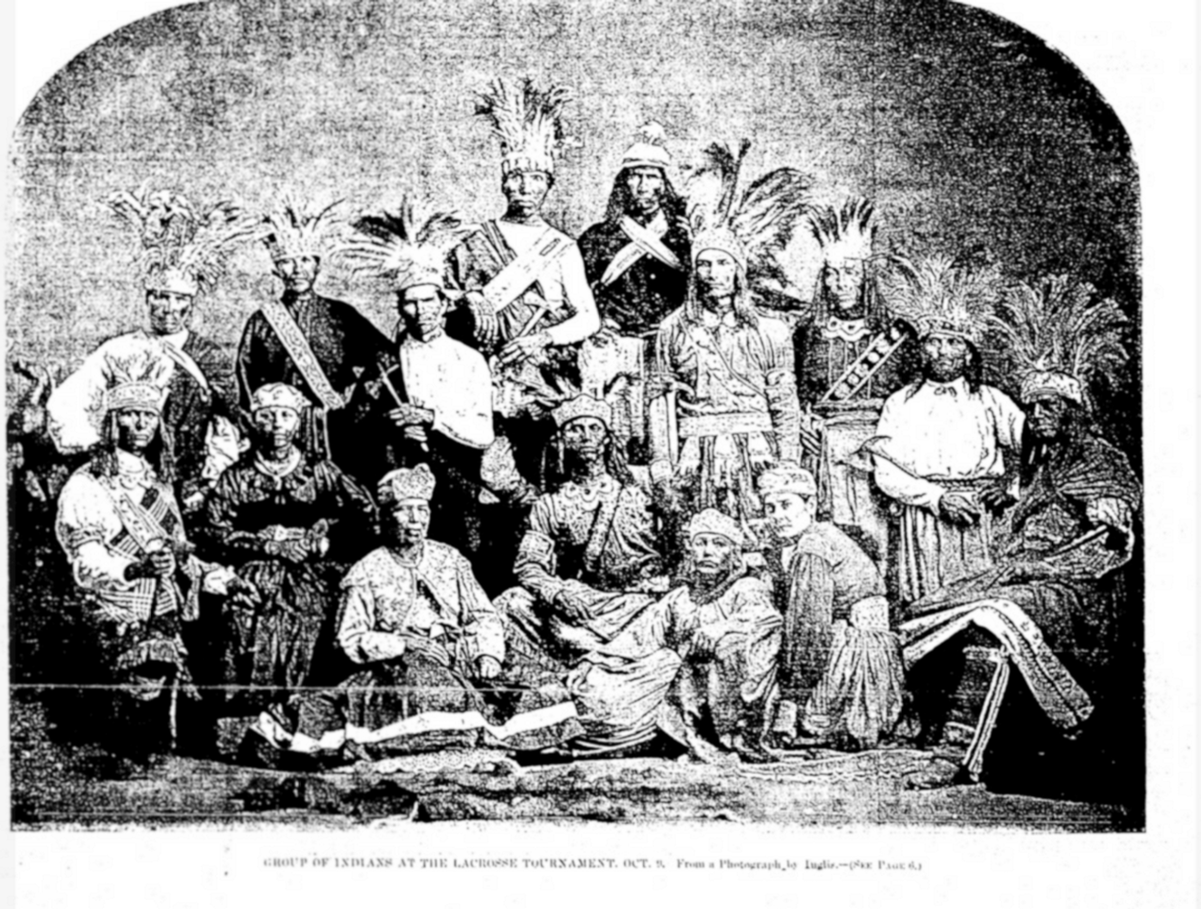


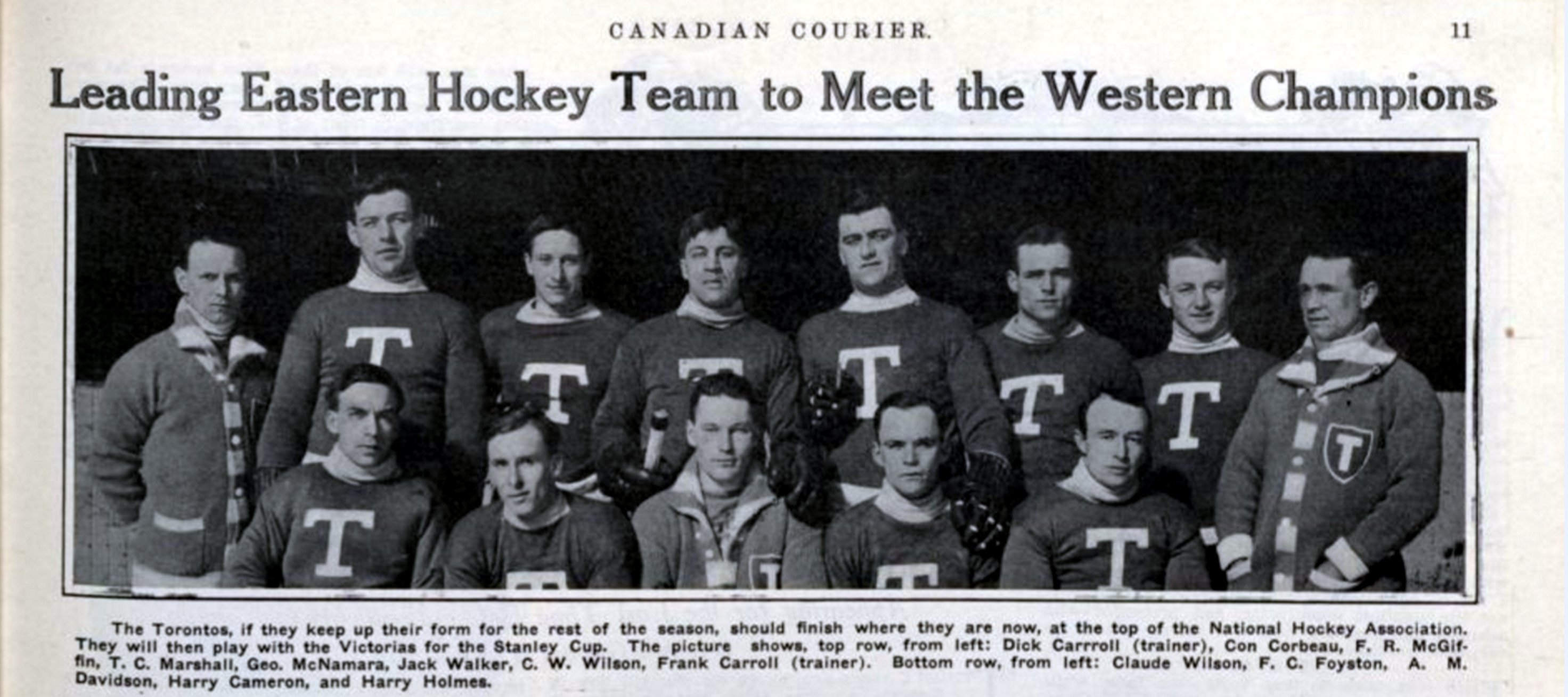


 The same Directory gives us more information, but only if you understand the rather cryptic language used. It lists every head of house (i.e. men) alphabetically for the Township of York East. Leslieville was in York East, but so was Riverside, the Village of Norway, etc. — and the City of Toronto.
 Just as we begin learning French with basic phrases like “Bonjour” or “Merci beaucoup”, we begin with a few basic terms in the language of those who laid out the roads and side roads, farms and subdivisions — surveyors. If you own a home, you want an accurate survey to know where your property begins and ends or you may find yourself tearing down the new fence you just built and/or having a heated argument with your neighbour. So, now and then, surveyors used state-of-the-art equipment, to lay out a pattern of roads and property divisions called “lots”. In the Township of York East, they began by carefully laying out an accurate base line — an imaginary, but crucial east-west line. Then they laid out a second line and a third and a fourth and so on, like rungs on a ladder reach north from the lake — each rung at a equal, pre-determined distance from the base line. The area between the base line and the second line was called “the First Concession”; and between the second and third line it was “the Third Concession”.
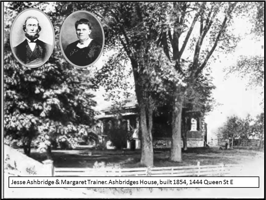 Where Kingston Road bends and goes up the hill towards Woodbine Avenue, Lee Avenue and beyond, it is no longer on that imaginary line but follows an ancient First Nations trail. In fact most of our streets that run diagonally or meander lazily around hills and through valleys, are trails made by the Wendat, Haudenosaunee and Missisauga, and the Nations that went before them. This includes Kingston Road, Dawes Road, Broadview Avenue, Todmorden Road, Bayview Avenue, Rosedale Ravine Road, Davenport Road, and so many more. Some like the Ridge Road in this map have been completely forgotten.


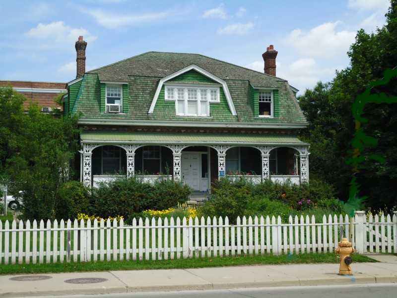

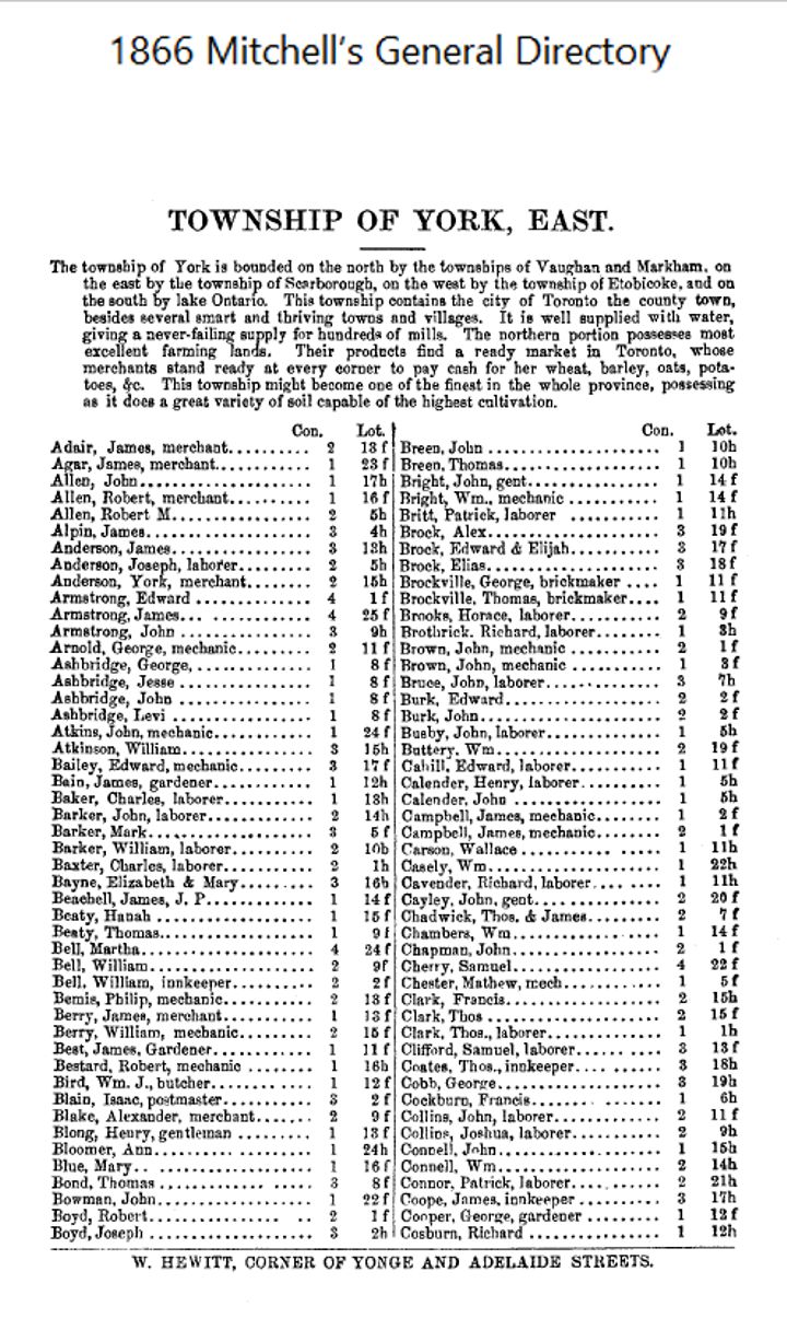


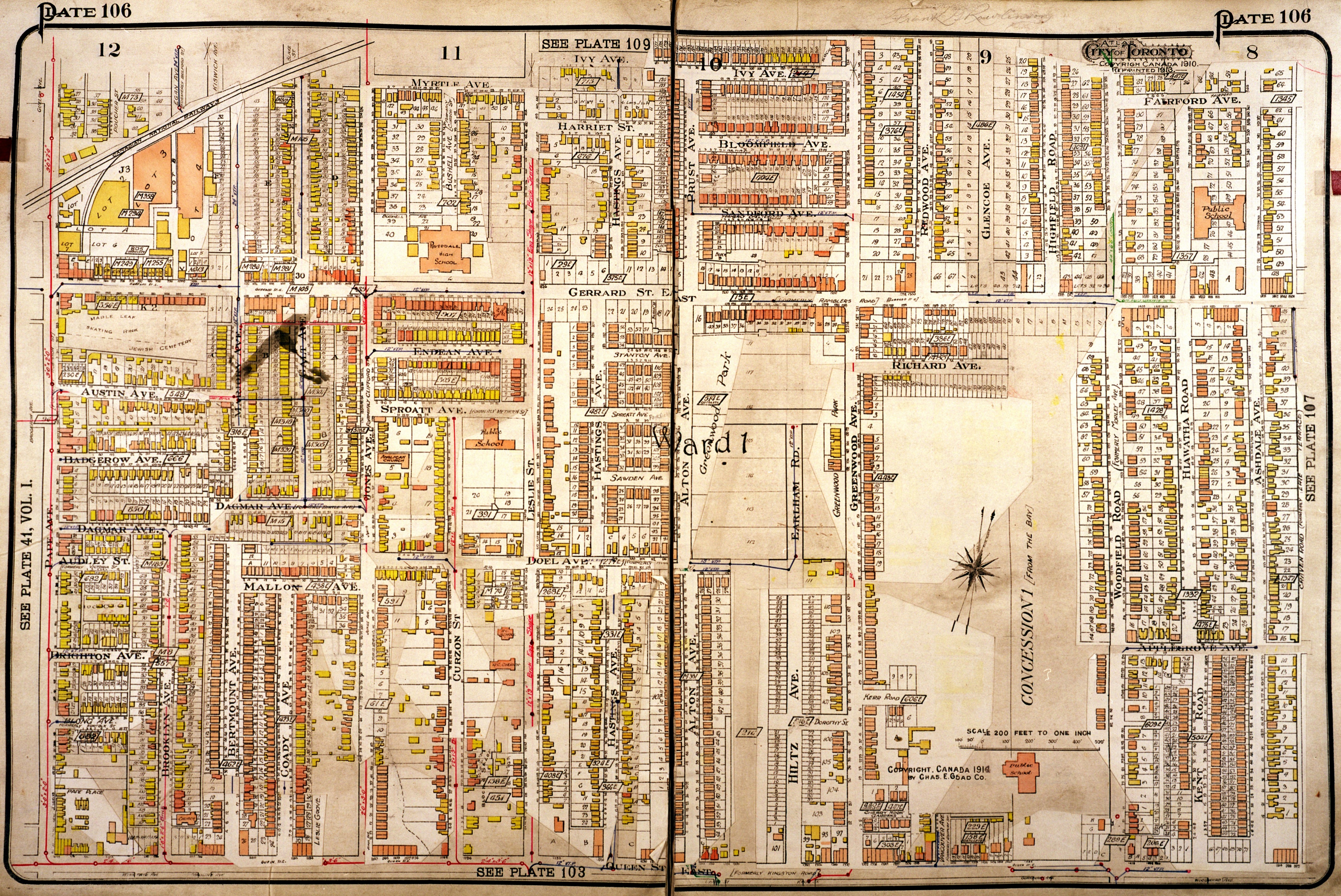

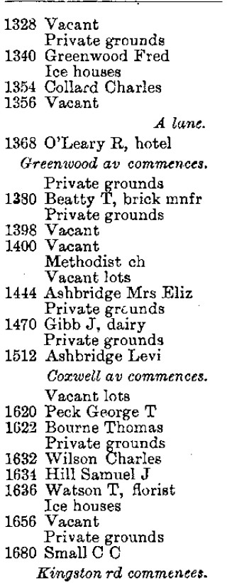


 View of Queen Street East at Greenwood Avenue, 1981


 Greenwood Avenue was widened in 1909. Gerrard and Greenwood was a major streetcar junction with Greenwood cars going north-south to Danforth and Queen and Gerrard cars going east-west.
 We may chuckle now, but it is important, I think, to remember that the architects and builders, be it 1917 or 2017 consider their work “modern” and “state-of-the art”, but certain periods featured such dramatic technological and social change that they stand out.


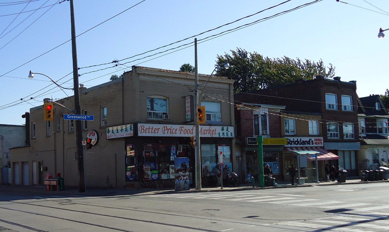

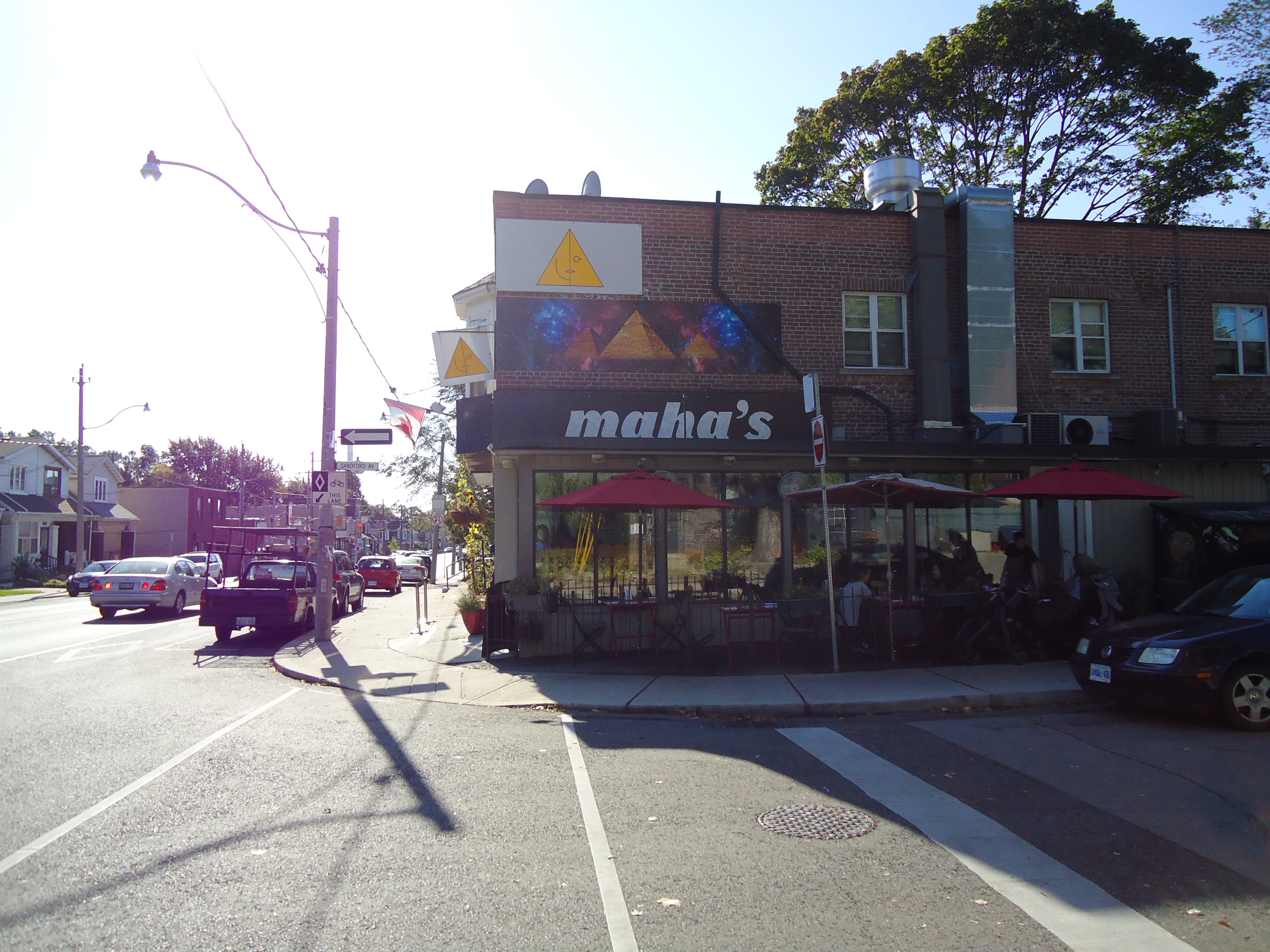


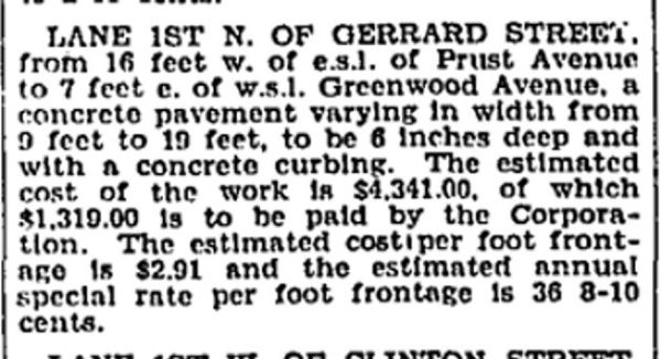


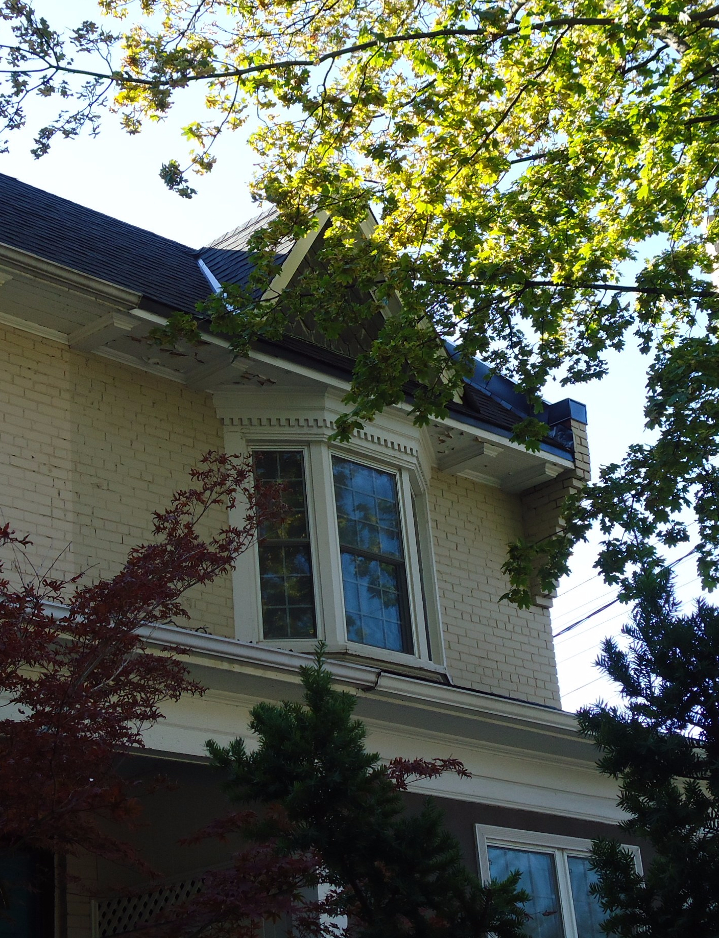

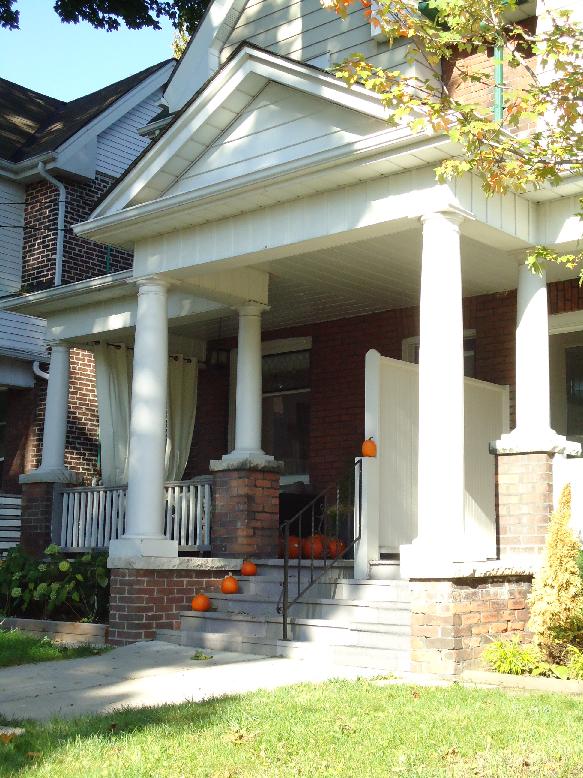


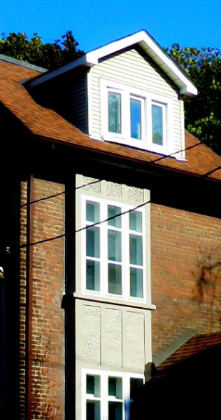
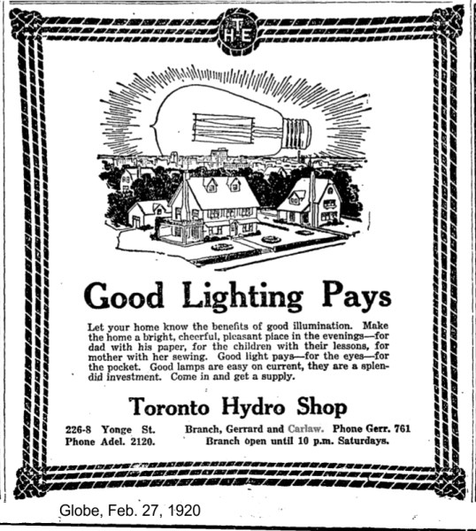


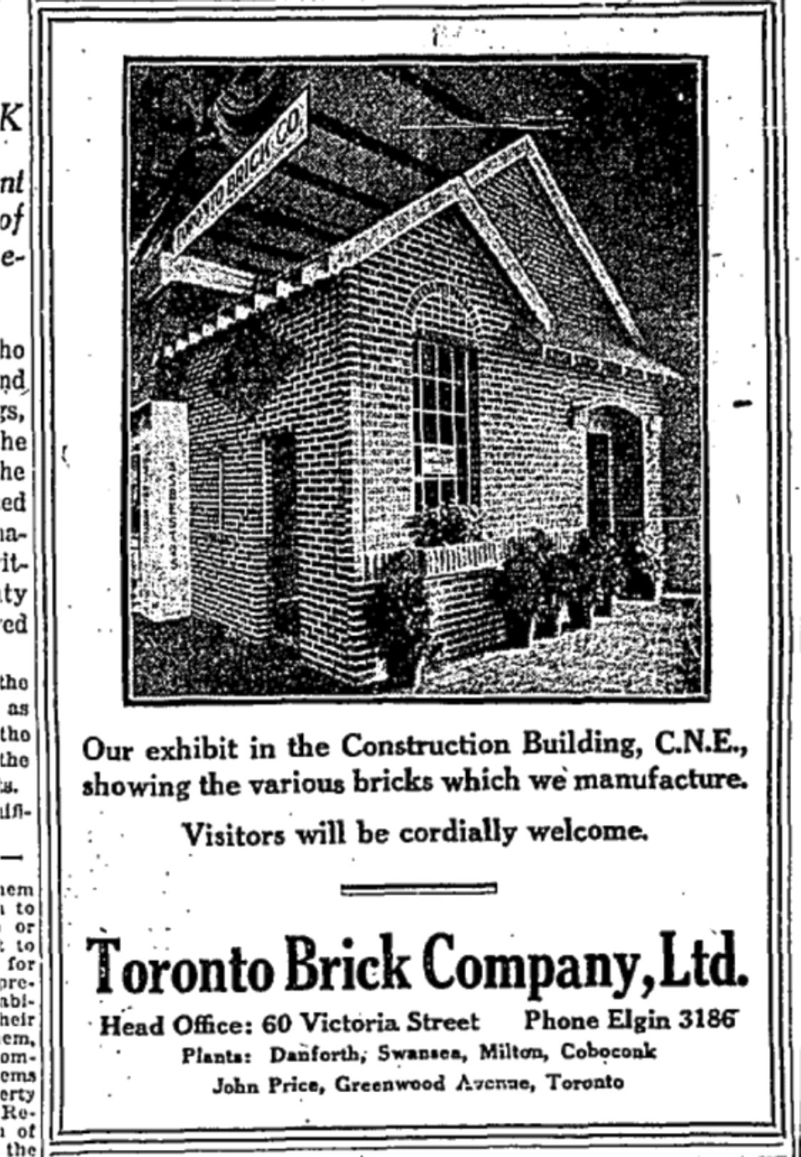
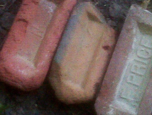

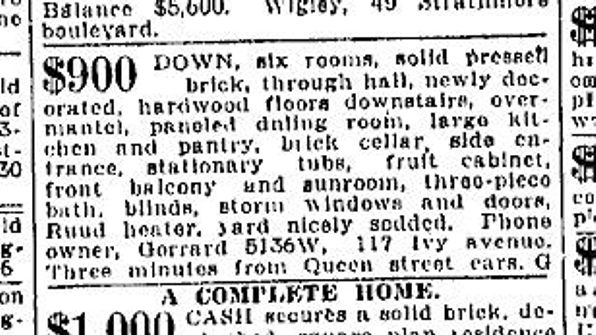
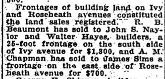


 In the 1860s, the Canadian Land and Emigration Company of London, England bought 360,000 acres (150,000 ha) on the Canadian Shield north east of Peterborough. The Chair of this company was Judge Thomas Haliburton, well known as the author of “Sam Slick” and a politician. They planned on settling what has now been called “The Land Between” with farmers, working under the illusion that if a country could grow big trees, then it must be good farmland. A well-researched local history “Fragments of a Dream”, by Leopolda x L. Dobrzensky (1985), documents the history of the Canadian Land and Emigration Company lands including the village of Haliburton settled by would-be farmers in 1864.

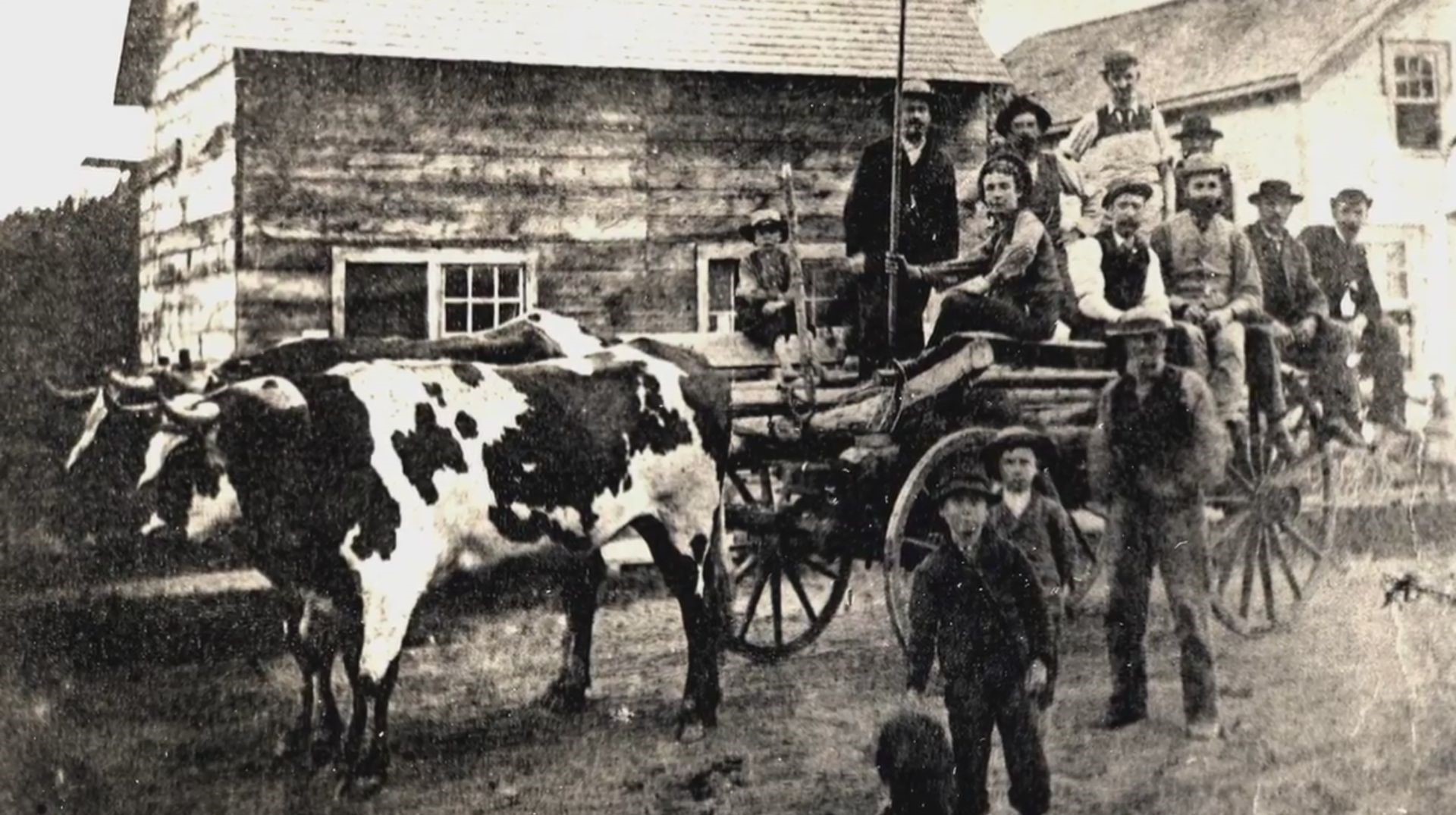

 This 1878 map and pictures show the orchard that would become Prust’s pride and joy. James Richardson was a market gardener and apple grower. His land would become Albert Wagstaff’s quarry and later the TTC Subway Yard. Patrick Norton, James Wallace and Walker Morley would later recall the early days on Greenwood Avenue.

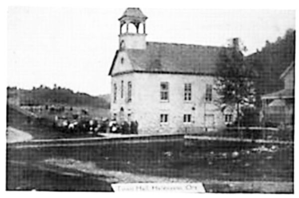

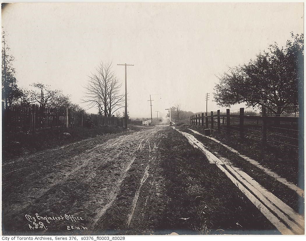


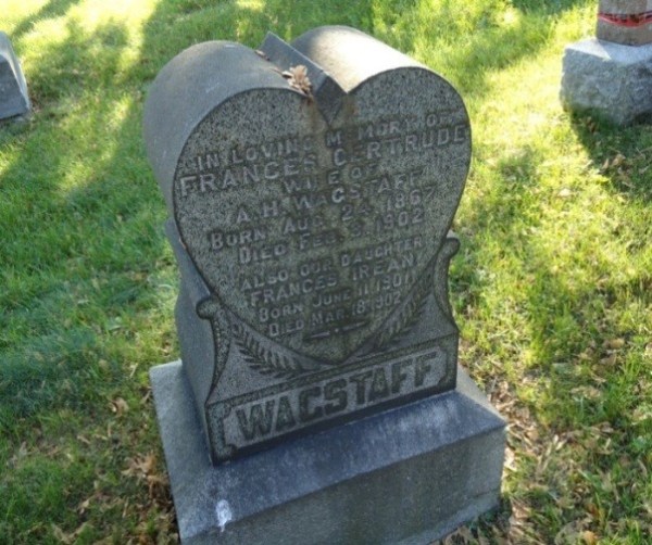


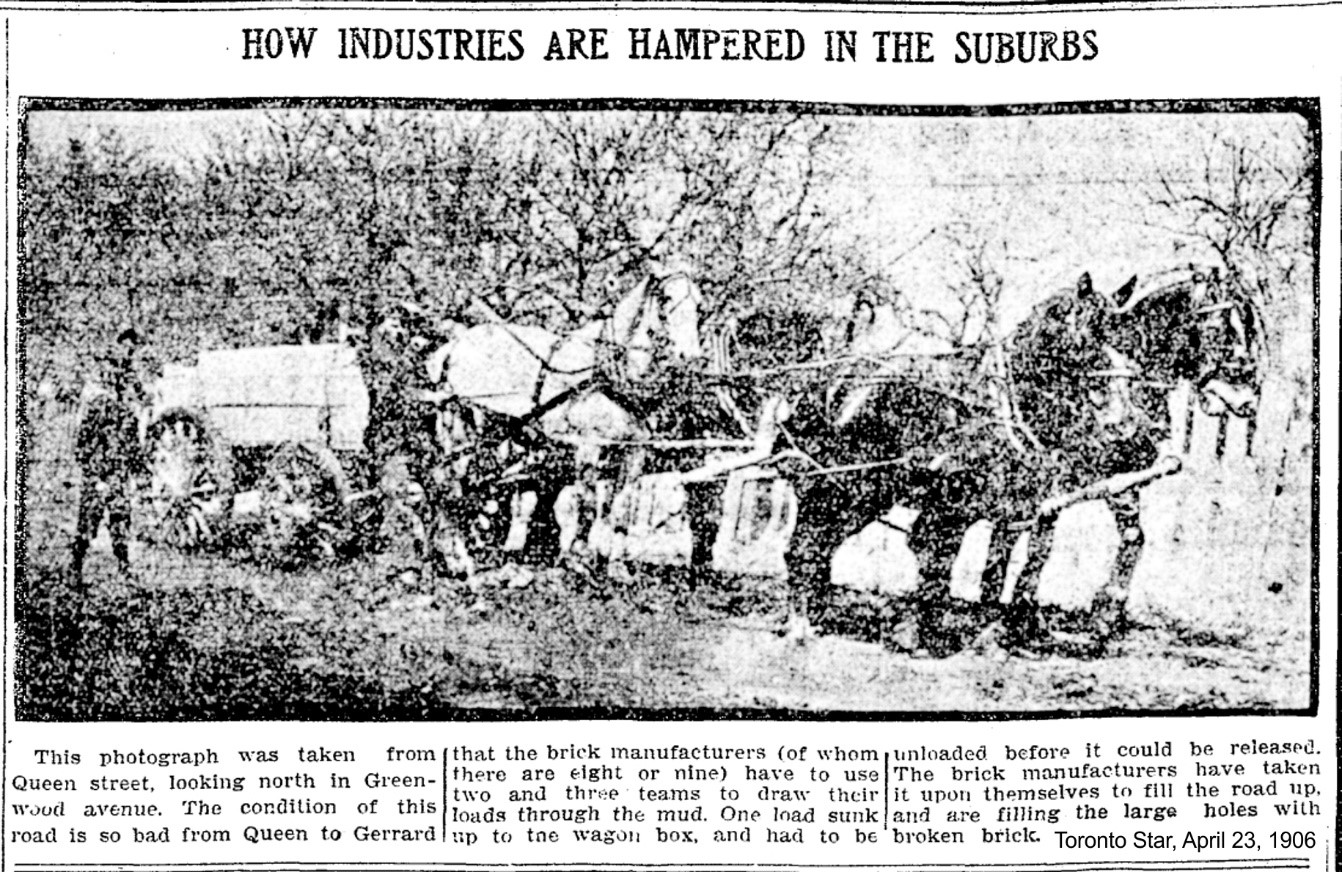
 A curious ad appeared in the Toronto Star, July 7, 1906. The resident of 420 Greenwood Avenue, almost next door to William Prust’s future address, was James Emmerson. [Greenwood Avenue has since been renumbered.]


 This detail from a 1909 Dominion of Canada topographical map shows that much of Lot Ten was still covered with orchards but the brick pits were expanding along Greenwood Avenue. Hastings Creek is clearly marked on the map in blue along with the culvert under the GTR railroad line. Brickyards now extend along Greenwood all the way from Queen. The newly-coined name for the area along Gerrard, “Bricktown”, is well deserved given the intense development of the clay and shale deposits here.

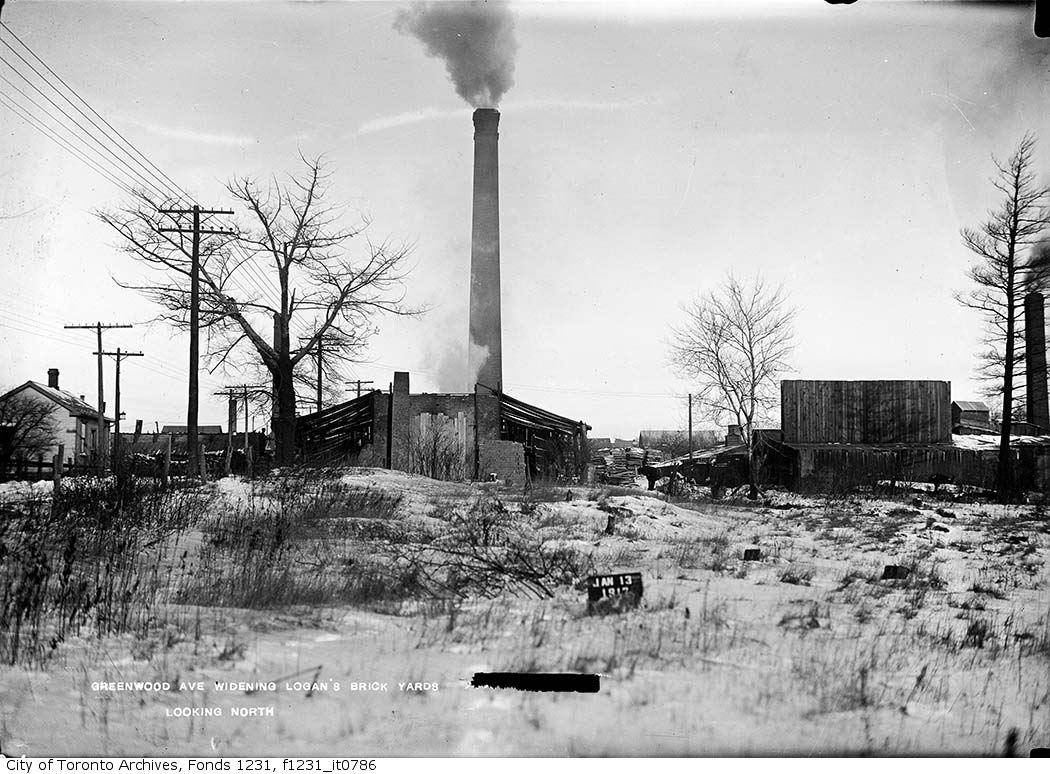 Greenwood Avenue would finally be widened, but not until 1912, leading to a protracted lawsuit with the Logan Brickyard, and a much shorter and certainly more whimsical dispute with William Prust who had to pay part of the cost of the road work through a special assessment payable with his property taxes in 1909 even before the actual work was done. William Prust, having been a municipal official for so many years, knew how to calculate the proper amount that he owed to the City of Toronto and that is what he would pay and not 48 cents more. The Toronto Star article of November 9, 1909 says it all.

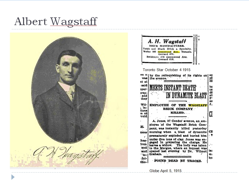
 Thick black smoke from the kilns that burned day and night, all year round, wreathed the brick plant, brick pits, houses and people at the north end of Riverdale Gardens. The clang of heavy machinery from the brick presses and conveyor belts was constant. From time to time, deafening explosions rocked the neighbourhood as workers used dynamite to blast out the shale at the bottom of the quarry. Conveyor belts brought the bits of broken rock to the surface were special equipment thudded into fine powder which made up the basic material of the bricks. Deep ponds at the bottom of the brick pits tempted hot and unwary boys and youths to swim and, all too often drown. Where brick manufacturers had used up the clay, as they had in the Devil’s Hollow just west of Riverdale Gardens, they leased out the gaping craters as garbage dumps or locals simply used them for free. Where dumps appeared so did hordes of rats, clouds of flies and other pests, including thousands and thousands of crickets whose constant trill even competed with the din of the machinery and the roar of dynamite blasting.


 This 1910 Goad’s Atlas map was based on information gathered the year before. It shows the old subdivision number 214 and a new lane running east west north of Gerrard. Gerrard Street has been subdivided to the edge of the Devil’s Hollow. On the west side of Greenwood between the tracks and Gerrard there are only two houses: the one closest to the railway tracks belonged to Bert Wagstaff and the other, a brick duplex, belonged to William Prust.


 Advertisements began appearing in newspapers offering lots and houses. In those days, when a new subdivision opened, no houses were built on it at first. Lots were sold by the foot of frontage. If someone bought a lot with 40 feet of frontage, for example, on Bloomfield Avenue, for $13 a foot, the lot would cost $520, more than most factory labourers made in a year. Lots on nearby Erie Terrace sold for as little as $5 a foot, on lots that were sometimes only 10 feet wide, for a total of $50, affordable to all by the poorest working class families.


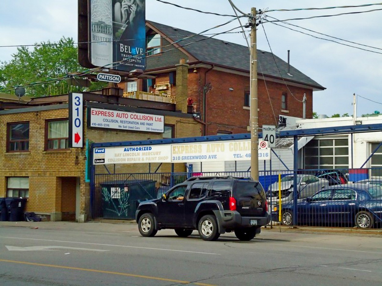


 Ivy, City of Toronto Directory 1912. There is an urban myth that Myrtle, Ivy and Harriet were three local women who could not get along. Therefore, the streets named after them never meet. However. a better explanation, though not as humorous, lies in the wide ravine scoured out by Hastings Creek. The ravine was called the Devil’s Hollow. Note also that Myrtle ended at Leslie – the west bank of the Devil’s Hollow.
 Bloomfield, City of Toronto Directory, 1912
 Cheltenham Avenue, now Sandford. City of Toronto Directory, 1912.
 Prust, City of Toronto Directory, 1912 William Prust had laid out the Prust Avenue and started construction on four houses.
 Gerrard Street north side, City of Toronto Directory, 1912.
 Greenwood Avenue, West side, City of Toronto Directory, 1912
  Greenwood Avenue, east side, City of Toronto Directory, 1912 The eastern side of Greenwood became industrialized at the track where a former brickyard was partially occupied by a lumber yard, Eastern Supply Co. (later Bowden’s). The rest of the abandoned quarry was filled with garbage. The Toronto Community Housing project on Walpole was built on top of that dump. I remember some 35 years ago when I took my recycling to a depot on the old dump site – the Blue Box program had yet to come to Toronto. Incidentally Robert J. Billings was also a brickmaker from Bridgport, Somersetshire, the same place that John and Isaac Price came from. Billings Avenue is named for the family.
 One of the houses on the east side of Greenwood Avenue north of the railway track that would be torn down to allow the widening of the street. A City Engineer took the photo on January 13, 1912.
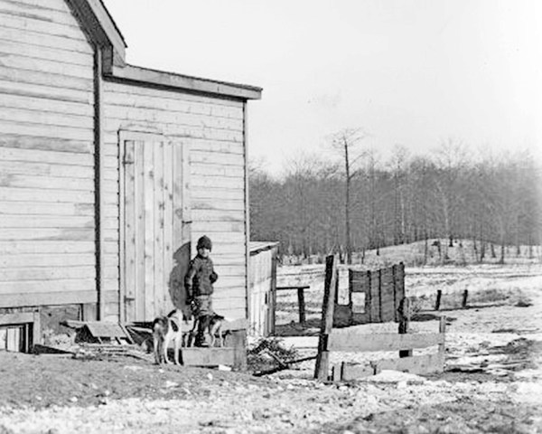
 More applications for building permits appeared in the newspapers such as this one from The Toronto Star, January 4, 1912.


 On December 18, 1912, the first streetcars began running east from Greenwood Avenue to Main Street. Mayor Hocken and City Controllers inaugurated the new Civic Streetcar. The Mayor, Controllers, Alderman and city officials were in the first car. Ordinary citizens were in the others, free of charge for just that day. “No smoking will be allowed on the cars any day.” Globe, Dec. 14, 1912


 How did Ivy Avenue come to be the boundary between a kind of local heaven and a very local hell? Well, it’s a long story, but I always like starting about 12,000 years ago — perhaps the local historian’s equivalent of “once upon a time”. In that long ago time, the ice from the last glacier melted leaving a deep cold lake called “Lake Iroquois” by geologists. It covered all of the area south of Taylor Creek. In time the lake itself disappeared leaving a much smaller Lake Ontario behind. But that’s not all that was left behind.


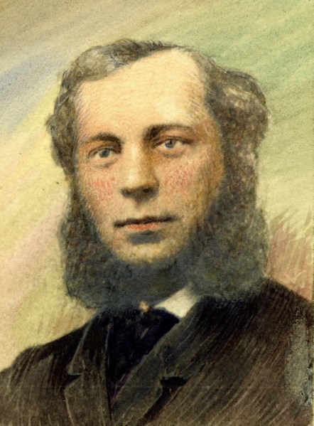


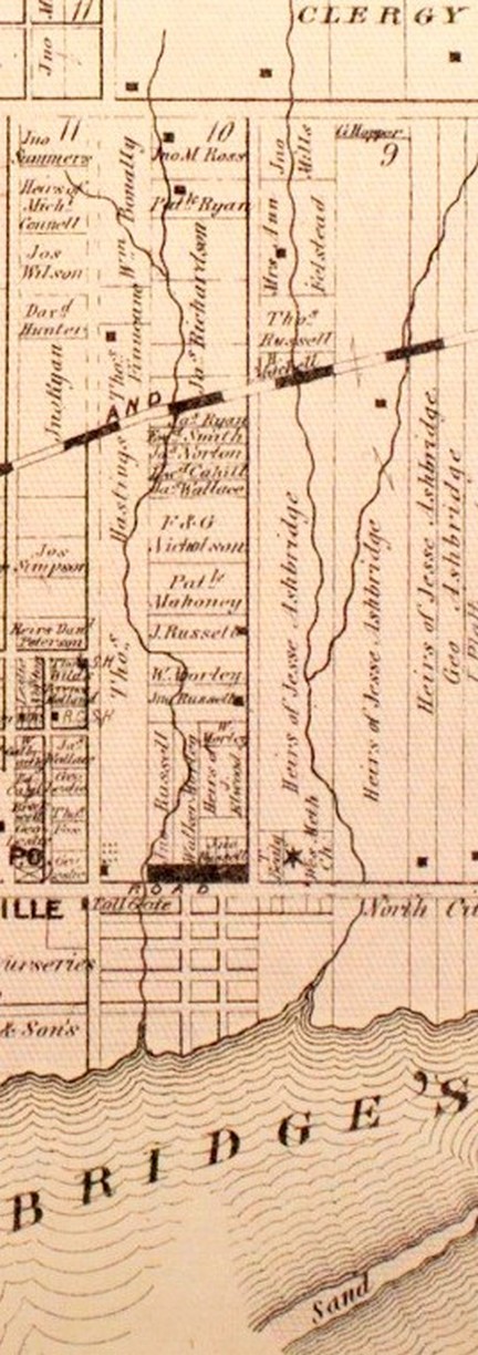


 Behind the decaying Ulster Arms between Greenwood and Coxwell Avenues, lies a neat few streets. Blocky houses, called “four squares” and post-War bungalows line Hertle and Highfield, making this enclave unique. Most of the houses in the surrounding neighbourhood are 25 to 30 years older, having been built between 1912 and 1930. But that is not all that makes this tidy corner of the East End special.


 The neighbourhood had a strong connection to Northern Ireland, the Orange Order, and the 36th Ulster Division which distinguished itself at the Battle of the Somme in World War One. Many who had immigrated to Canada returned to enlist in the 36th Ulster Division and many others enlisted in Canadian regiments to fight overseas.
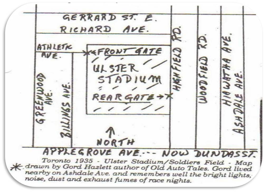

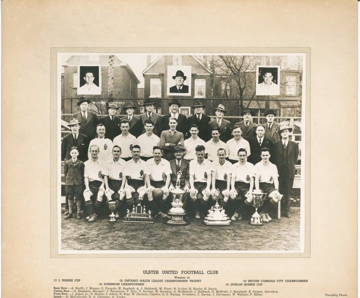


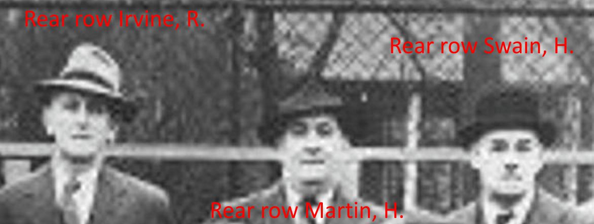


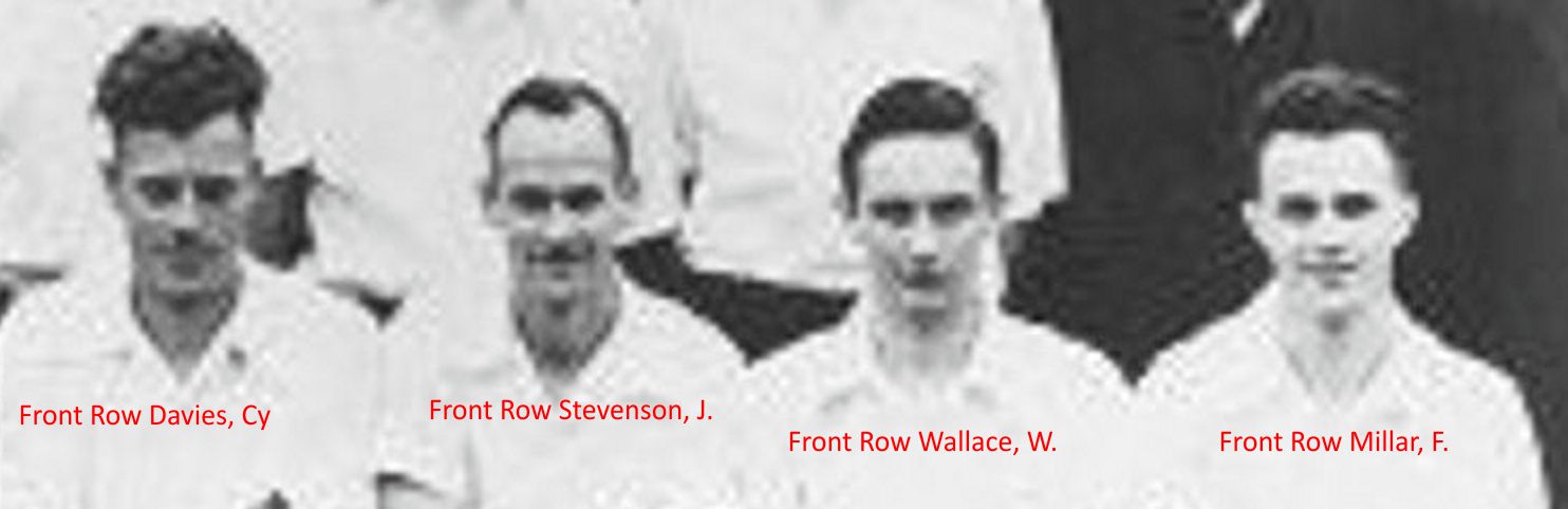


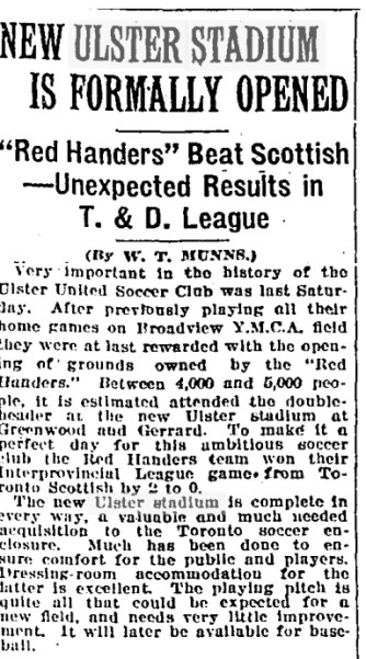


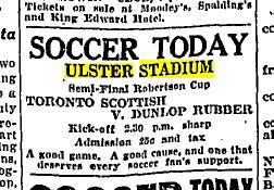
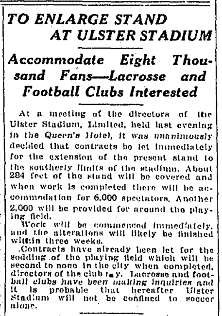


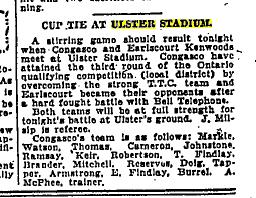

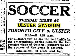

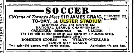


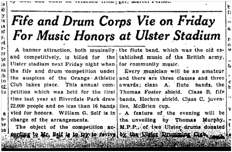


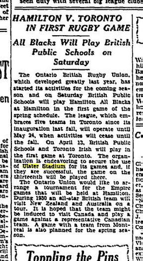

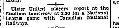
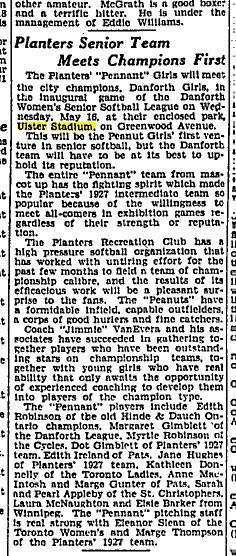


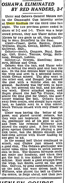


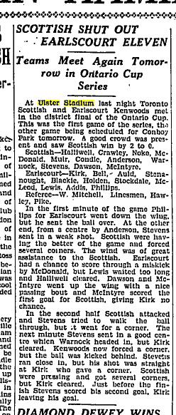


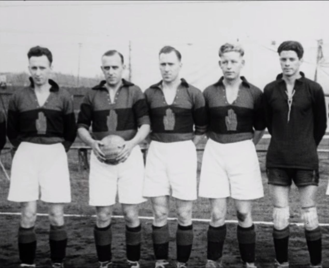
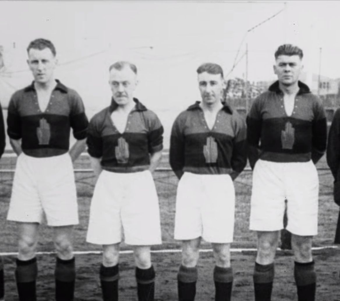
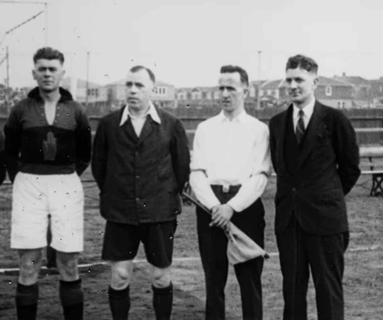


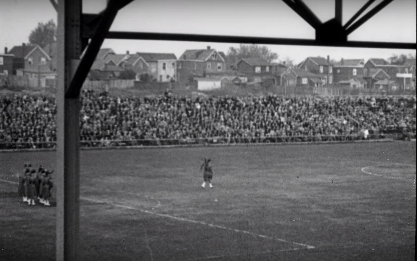
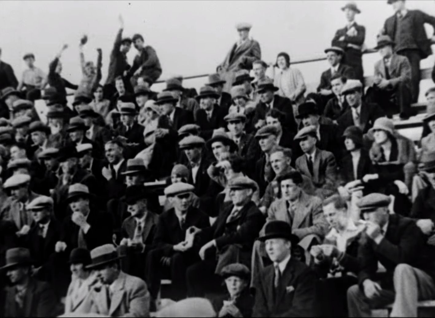


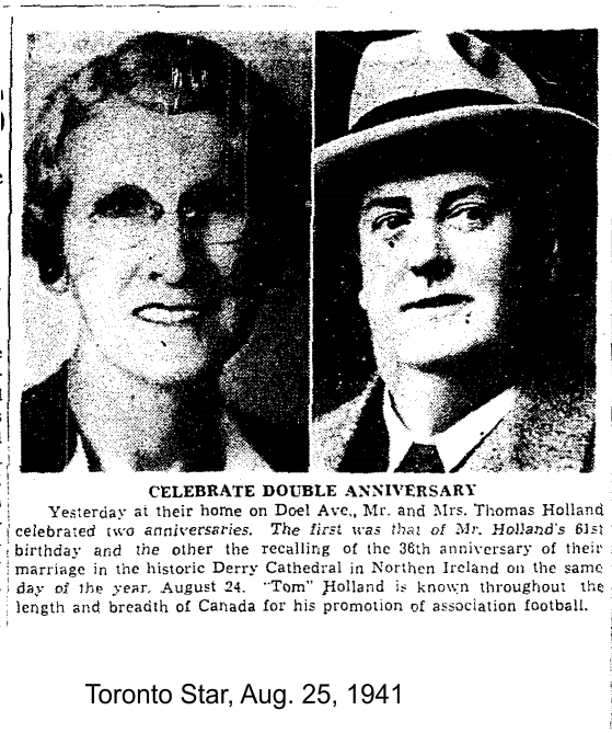
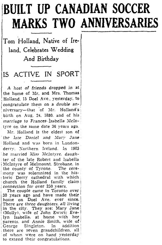


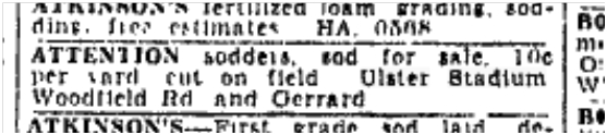
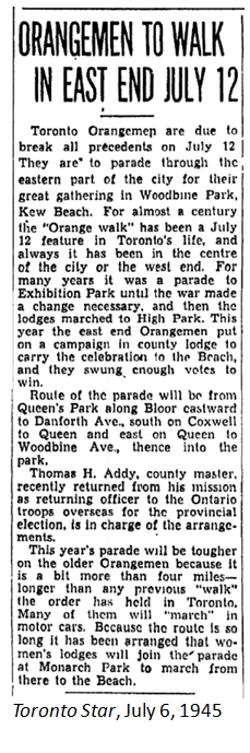


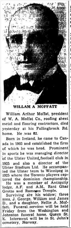


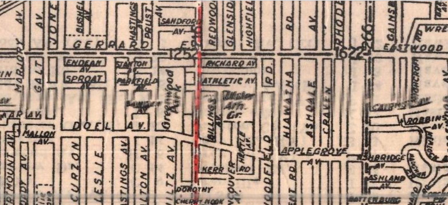


 Let’s go back to the beginning, around 1909 when Applegrove Avenue was a short street running from Morley Avenue, now Woodfield Road, to Ashdale Avenue — a mere two blocks. It ran through the Ashbridge’s large apple orchard, giving an obvious reason for the street name. Applegrove Avenue was 910 feet north of Queen Street East. A large brickyard lay between the west end of Applegrove Avenue and Greenwood Avenue. It did not extend to Coxwell in the east.


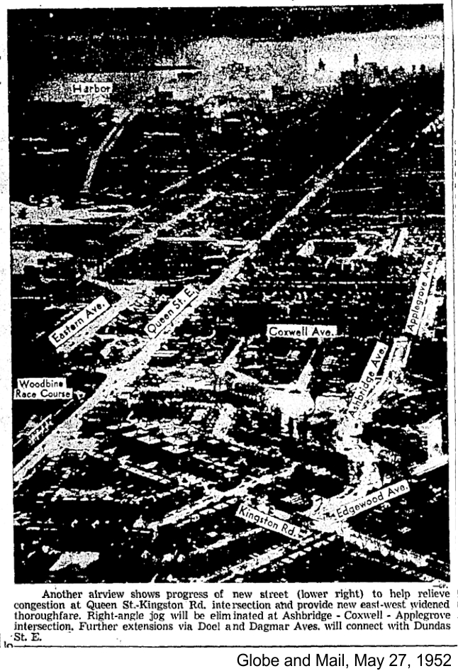

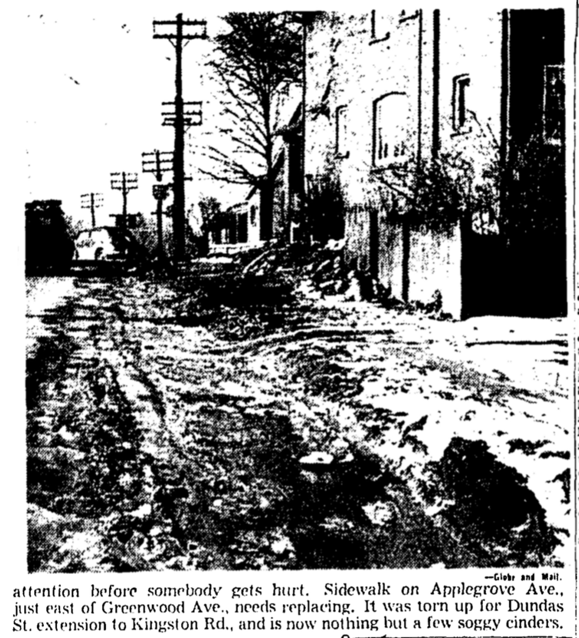

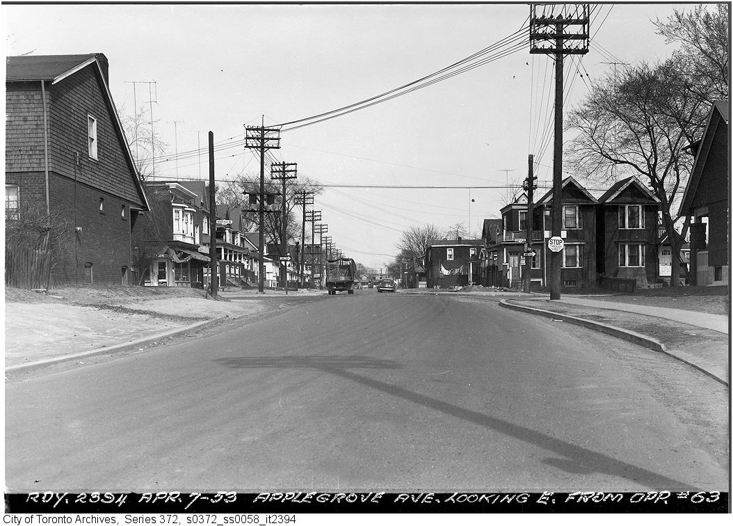


 If it was an apple in the Garden of Eden, would you need a snake to tell you to eat it? No! Canadians love apples! But did you know that commercial apple growing in Ontario got its start in Toronto’s East End?


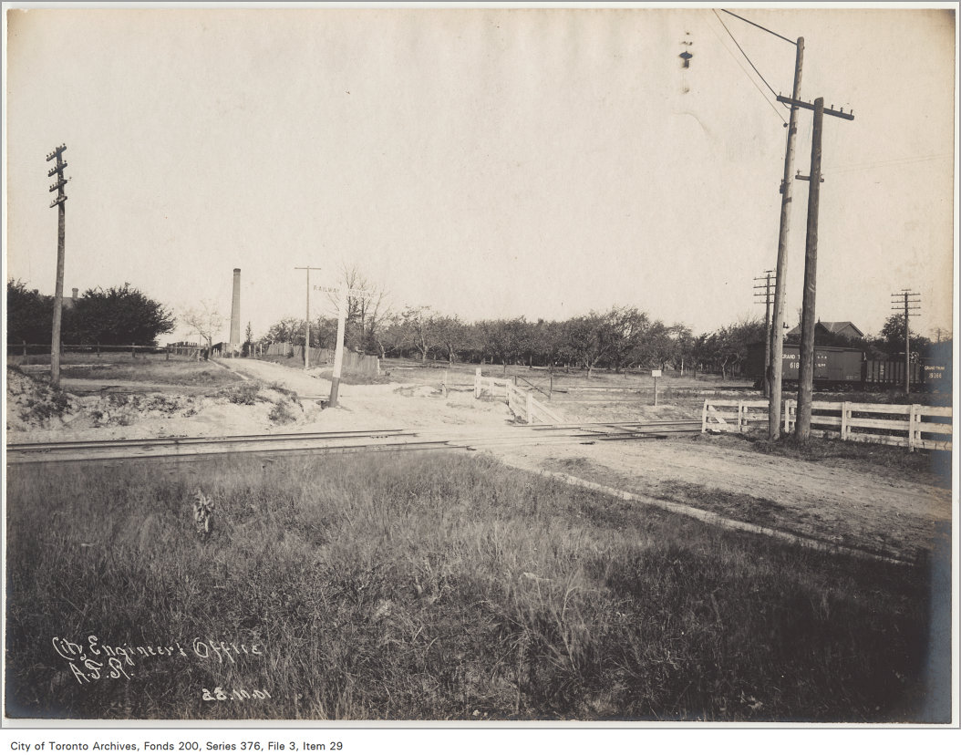

 In 1825 trained Scottish gardener George Leslie sailed to Canada. In 1826 he moved to Toronto to open a seed store downtown. In 1832 he organized a fruit exhibition:
 An ad from a little later in the spring of 1845, assured buyers that the trees would grow in local conditions:


 One Leslie apprentice was Alexander McDonald Allan who married George’s daughter Esther. Allan became editor and owner of the Huron Signal and President of the Ontario Fruit Growers’ Association. Allan pioneered the export of fruit.

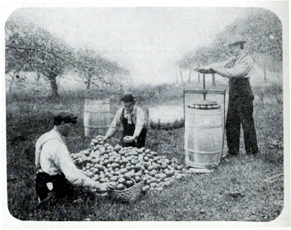

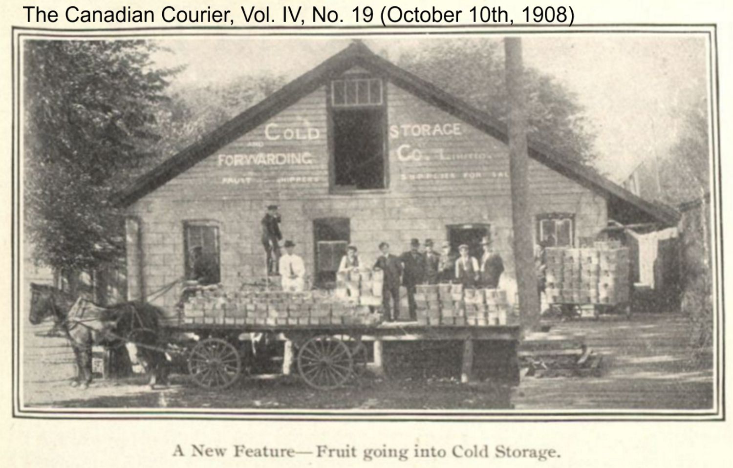


 George Leslie died on June 14, 1893. Gradually the nursery lands were sold off. Now apples come from all over the world, but the species available are few compared to the many in George Leslie’s catalogues. Yet every spring I walk the streets in my neighbourhood looking for the few survivors of those early orchards. And I still snuggle up with an apple and a book and maybe a piece of good Ontario cheddar and think of Astracan Reds, Sweet Boughs, Early Harvests, Early Strawberrys, Early Joes, Golden Sweetings, Keswick Codin, William’s Favorites, Primates, Alexanders, Black Detroits, Duchesses of Oldenberg, Pommes Royal, Fall Pippins, Hawleys, jersey Sweets, Saint Lawrences, Indian Raventips, Baldwins, Bourrassas, Blue Pearmates, Holland Pippins, Mothers, Northern Spys, Peck’s Pleasants, Rambos, Red Canadas, Russets, Greenings, Seek-no-furthers, Talman’s Sweets, Waggoners, Kings of Tomkins County, and more, as I dream.
