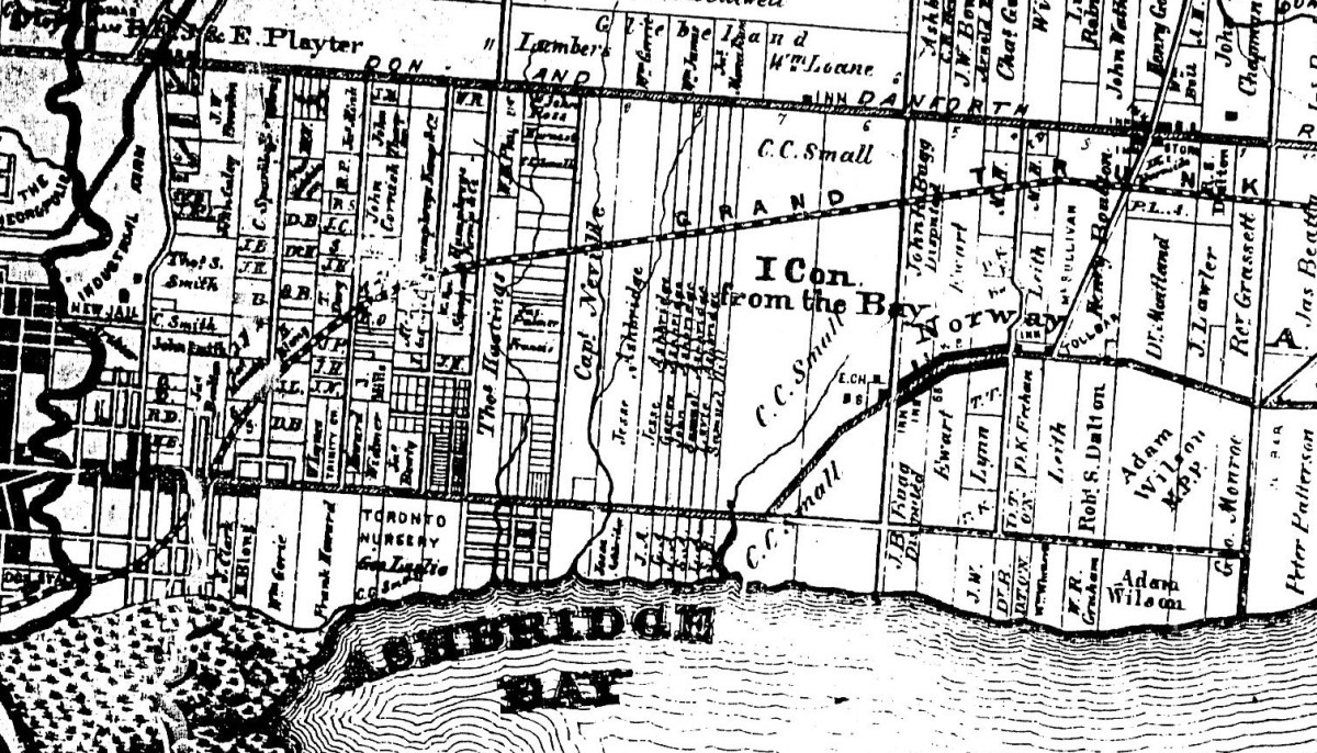
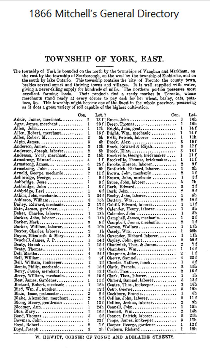
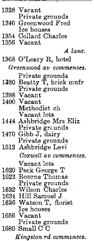
Ever wondered who lived where your home is long, long ago? Well, I can give you some idea because I have directories from the early twentieth century and the nineteenth century. But there are no street addresses in the earlier directories. Look at this example from 1866 for Leslieville.

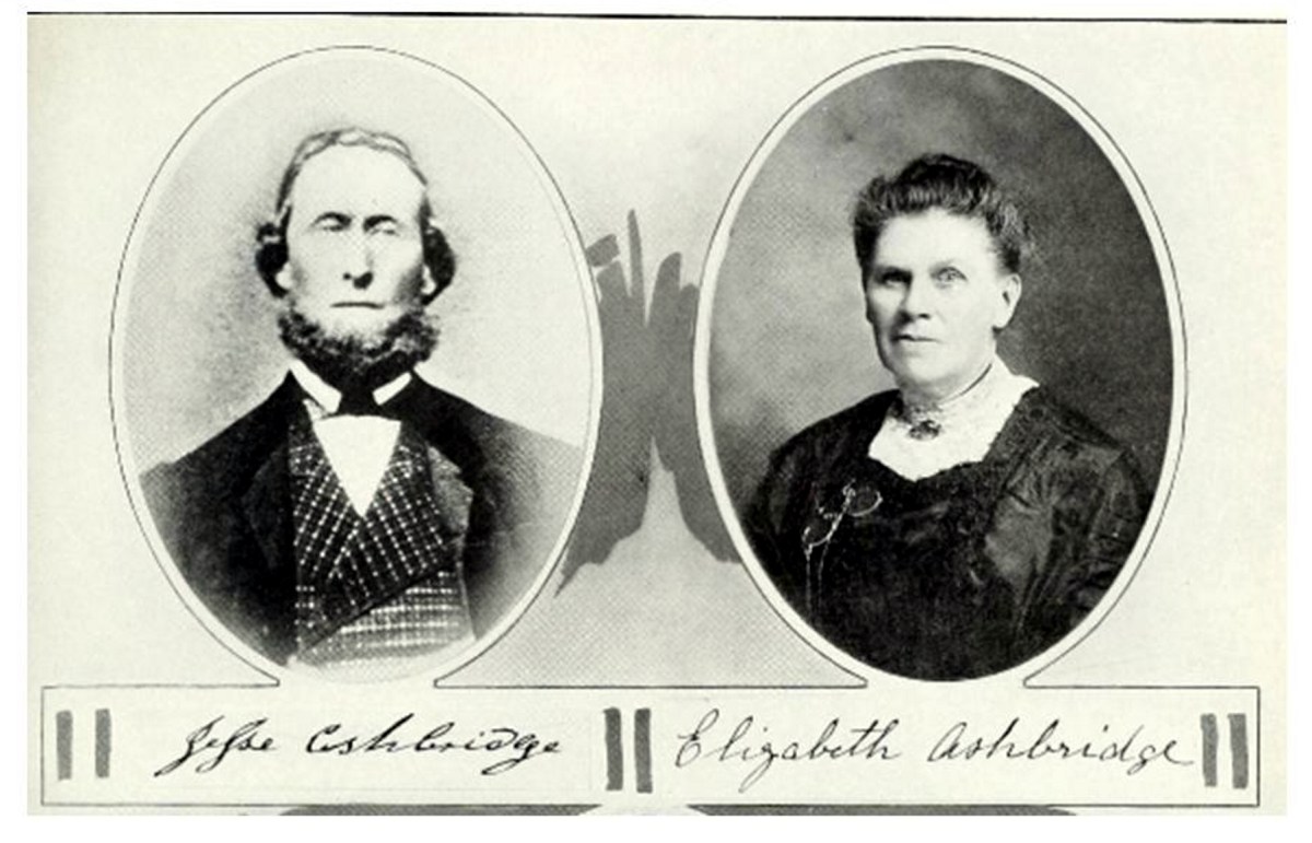
I think you’d agree that there is lots of information here. Who knew that there was a Leslieville Oil Company! They found pockets of natural gas, but no oil. The people are interesting and even more so if you know a little about them. R. Ambrose was a labourer in George Leslie’s Toronto Nursery. Later Ambroses became gardeners on the long-vanished Toronto Golf Club course at Upper Gerrard and Coxwell. The Ashbridge Estate still has a lovely old Ashbridge family home and hosts a flea market in the summer. James Berry was an African American who came north before the end of slavery. The Finucans and others were Irish Catholics who came here during the Potato Famine. William Higgins was Toronto’s first High Constable or chief of police. Henry Lewis was another black merchant. Logan Avenue is named for John Logan, a tall shy market gardener. James Morin built the Duke of York Tavern, in 1870. Alexander Muir wrote “The Maple Leaf Forever”. Pape Avenue is named after the Papes who specialized in growing flowers. Joseph Pape was one of Ontario’s first florists. Samuel Sewell was the patriarch of Leslieville’s black community. Thugs murdered his 15-year-old son, Isaac, ostensibly because he flirted with a white woman, but more probably that motive was piled on another — they robbed him of a substantial amount of money. There are so many stories, but from this you would not really have much idea where they actually lived.
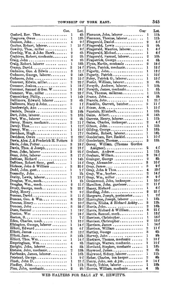
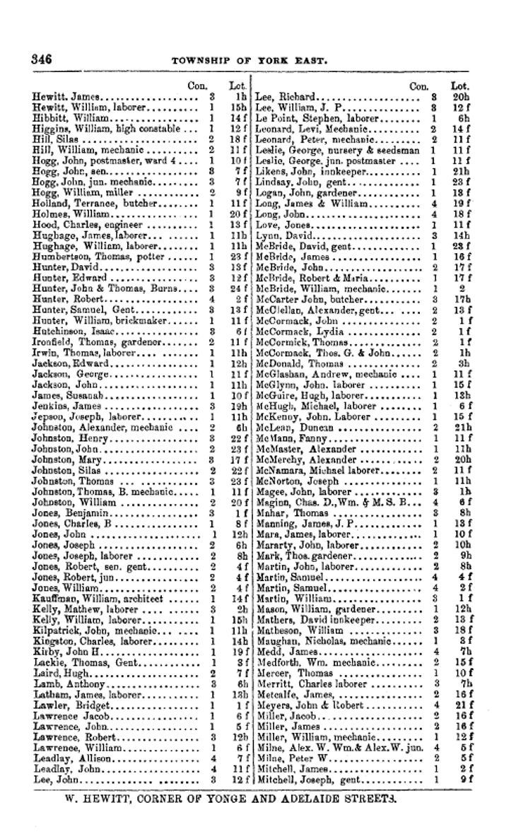
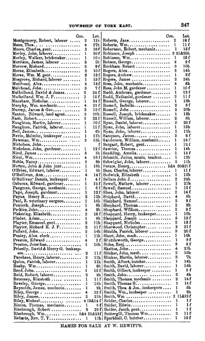
 The same Directory gives us more information, but only if you understand the rather cryptic language used. It lists every head of house (i.e. men) alphabetically for the Township of York East. Leslieville was in York East, but so was Riverside, the Village of Norway, etc. — and the City of Toronto.
Let’s look at a few examples: Ashbridge, Jesse Con 1 Lot 8f; Beaty, Hanah Con 1, Lot 15f (single women and widows were included, especially if they owned property); and Calendar, Henry, laborer, Con. 1, Lot 5h.
With that information we know within a city block or two where these people lived. But how?
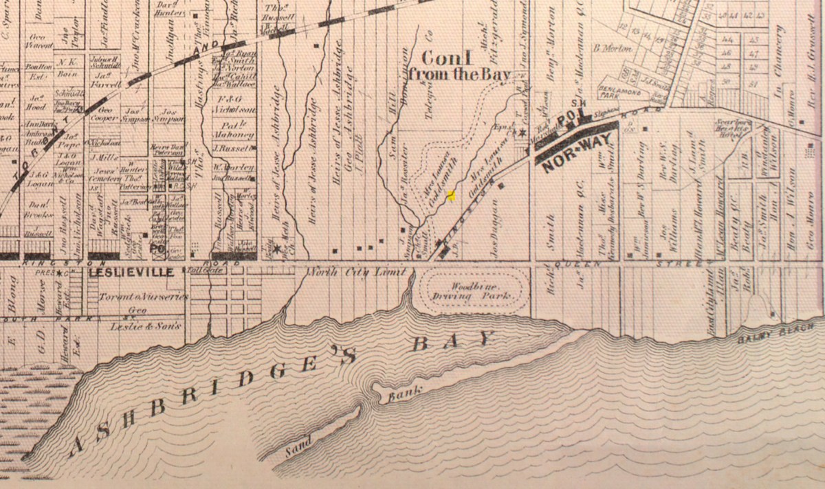
Maps say a lot, but you have to understand the language they are using or at least the basics.
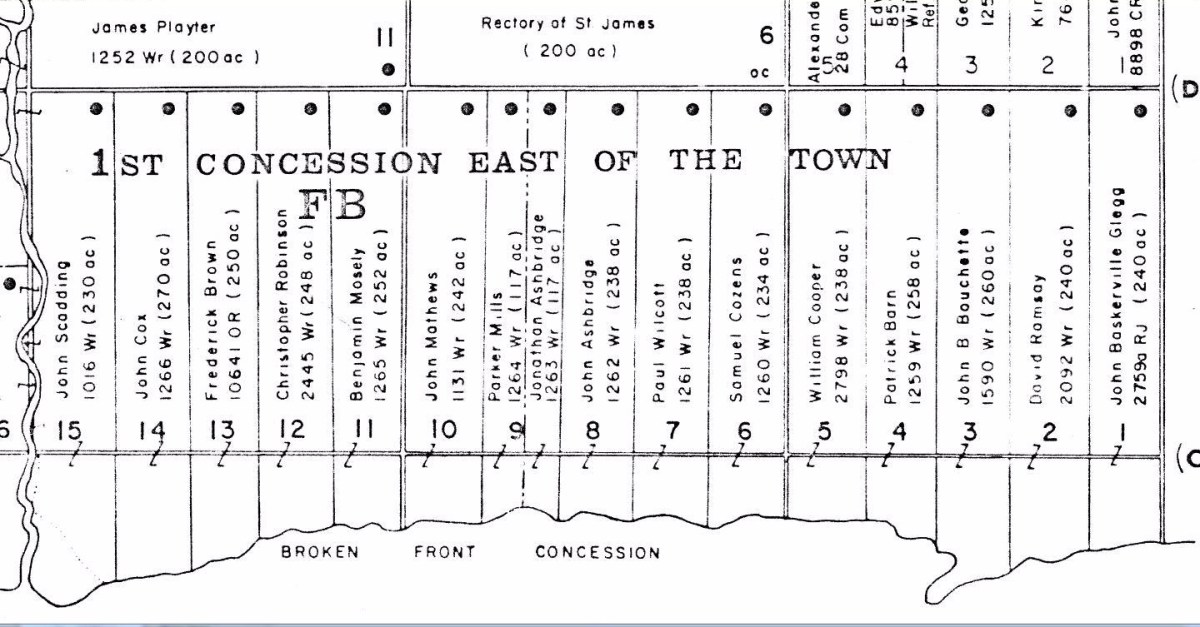
 Just as we begin learning French with basic phrases like “Bonjour” or “Merci beaucoup”, we begin with a few basic terms in the language of those who laid out the roads and side roads, farms and subdivisions — surveyors. If you own a home, you want an accurate survey to know where your property begins and ends or you may find yourself tearing down the new fence you just built and/or having a heated argument with your neighbour. So, now and then, surveyors used state-of-the-art equipment, to lay out a pattern of roads and property divisions called “lots”. In the Township of York East, they began by carefully laying out an accurate base line — an imaginary, but crucial east-west line. Then they laid out a second line and a third and a fourth and so on, like rungs on a ladder reach north from the lake — each rung at a equal, pre-determined distance from the base line. The area between the base line and the second line was called “the First Concession”; and between the second and third line it was “the Third Concession”.
They laid out another set of lines, but these ran north and south, again in pre-determined and equal distances. These lines were known as side lines. Between each sideline and the one to the west of it was a “farm lot” or simply called a “lot” of 200 acres. The lots are number from east to west, beginning at the Victoria Park, the boundary between the old Scarborough Township and the Township of York East.
In this way, the early surveyors laid out the Township of East York as a grid and their orderly lattice of concessions, sideroads, and lots is still with us today. When settlers or contractors “opened up” or built a road along the imaginary line, the road became known as “the First Concession Road” or “Base Line Road”; Second Concession Road; Third Concession Road; etc. In rural areas today, you will often hear, “Oh, so-and-so lives on the Second Concession”, meaning the Second Concession Road.

In our area, the First Concession Road became known as the Kingston Road or the road to Kingston. Parts of it later became known as “Queen Street”.
 Where Kingston Road bends and goes up the hill towards Woodbine Avenue, Lee Avenue and beyond, it is no longer on that imaginary line but follows an ancient First Nations trail. In fact most of our streets that run diagonally or meander lazily around hills and through valleys, are trails made by the Wendat, Haudenosaunee and Missisauga, and the Nations that went before them. This includes Kingston Road, Dawes Road, Broadview Avenue, Todmorden Road, Bayview Avenue, Rosedale Ravine Road, Davenport Road, and so many more. Some like the Ridge Road in this map have been completely forgotten.
Queen Street through the Beach is on the line of the First Concession Road. The roads alone the sidelines became known with numbers in most rural areas, but in our area the sideline roads have names. This Map of the Townships, York, Scarboro, and Etobicoke from ca 1911 by C.H. MacDonald clearly shows the area streets with the numbered lots. People called the area between Queen Street and the bay and lake “the Broken Front” because it was the front of the grid but was not continuous, being cut up with coves and inlets.
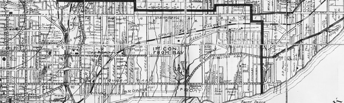
If we take an even more detailed part of the map above and flip it 90 degrees, we can see the names of the sidelines better.

The sideline at the boundary with Scarborough Township is now Victoria Park Avenue. The next sideline, separting Lot 1 and 2, is Willow Avenue. Between Lot 2 and 3 is Beach Avenue, then spelled “Beach Avenue”. Then between Lot 3 and 4 is Main Street which becomes Southwood Drive south of Kingston Road. Sidelines here are not as straight as the first surveyors, mostly military men, would have wished because the steep hill and numerous ravines messed up their neat plan. The side line between Lot 4 and 5 was called “Morton Road” but is now “Norwood Road”. South of Kingston Road it is Lee Avenue.
| Sideline | 1912 | 2017 |
| 1-2 | Willow Ave | Willow Ave |
| 2-3 | Beach Ave | Beech Ave |
| 3-4 | Main Street | Hammersmith Ave, Southwood Rd, Main St |
| 4-5 | Lee Ave, Norwood Rd, Morton Rd | Lee Ave, Norwood Rd, and roughly Westlake Ave |
| 5-6 | Woodbine Ave | Woodbine Ave |
| 6-7 | Roughly along line of Berkeley Ave | Now roughly along Edgewood Rd, then Beaton Ave, Wembley Rd, and Hillingdon Ave |
| 7-8 | Coxwell Ave | Coxwell Ave |
| 8-9 | Morley Ave | Woodfield Rd and closer to the Danforth it is Gillard Ave |
| 9-10 | Greenwood Ave | Greenwood Rd |
| 10-11 | Leslie Street | Leslie Street and north of the CNR tracks Condor Ave |
| 11-12 | Jones Ave | Jones Ave |
| 12-13 | Carlaw Ave | Carlaw Ave |
| 13-14 | DeGrasi St | DeGrassi St and further north near the Danforth it is Hampton Ave |
| 15 | Broadview Ave | Broadview Ave |

Even today our houses sit in numbered subdivisions within the original farm lot.
So let’s decipher our examples. Keep in mind that while the sideline is not mentioned, we don’t really need it. There were very few streets opened up in 1866 and only two major Concession Roads: Queen Street and Danforth Avenue. Kingston Road being a First Nations Trail was “off the grid” and not a concession road in York East.
Ashbridge, Jesse Con 1 Lot 8f means Jesse Ashbridge, living on Queen Street between Woodfield Road and Greenwood Avenue, in Leslieville. “Con 1” is Concession One or the block of land that lies between the Baseline (Queen Street) and the Second Concession Road (Danforth Avenue). “f” is for “front”, meaning the south end of the block of land while “h” is for “hind” or “rear”, meaning on the south side of Danforth Avenue.
Beaty, Hanah Con 1, Lot 15f means Hannah Beatty (typos even back then) lived on Queen Street between Broadview and the Don River — in Riverside.
Calendar, Henry, laborer, Con. 1, Lot 5h is a lot trickier because Kingston Road intersects Lot 5 and though it says “h” for rear, he could be living on Kingston Road or near to Danforth Avenue, somewhere between Norwood Rd. or Westlake Ave. and Woodbine Avenue.

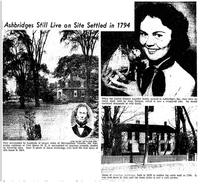
We will follow the Jesse Ashbridge property. Jesse Ashbridge died in 1874 of tuberculosis. His wife Emma Rooney died in 1919. Their son Wellington Ashbridge died in 1943 and Jesse Ashbridge Junior died in 1945. Wellington Ashbridge had two daughters: Dorothy died in 1996 and Winnifred in 2002.


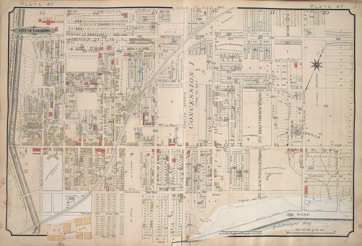
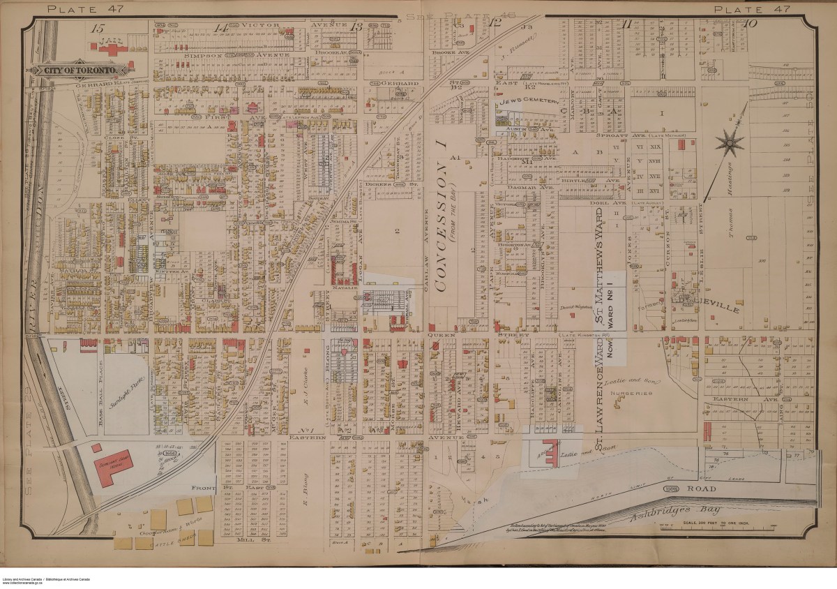


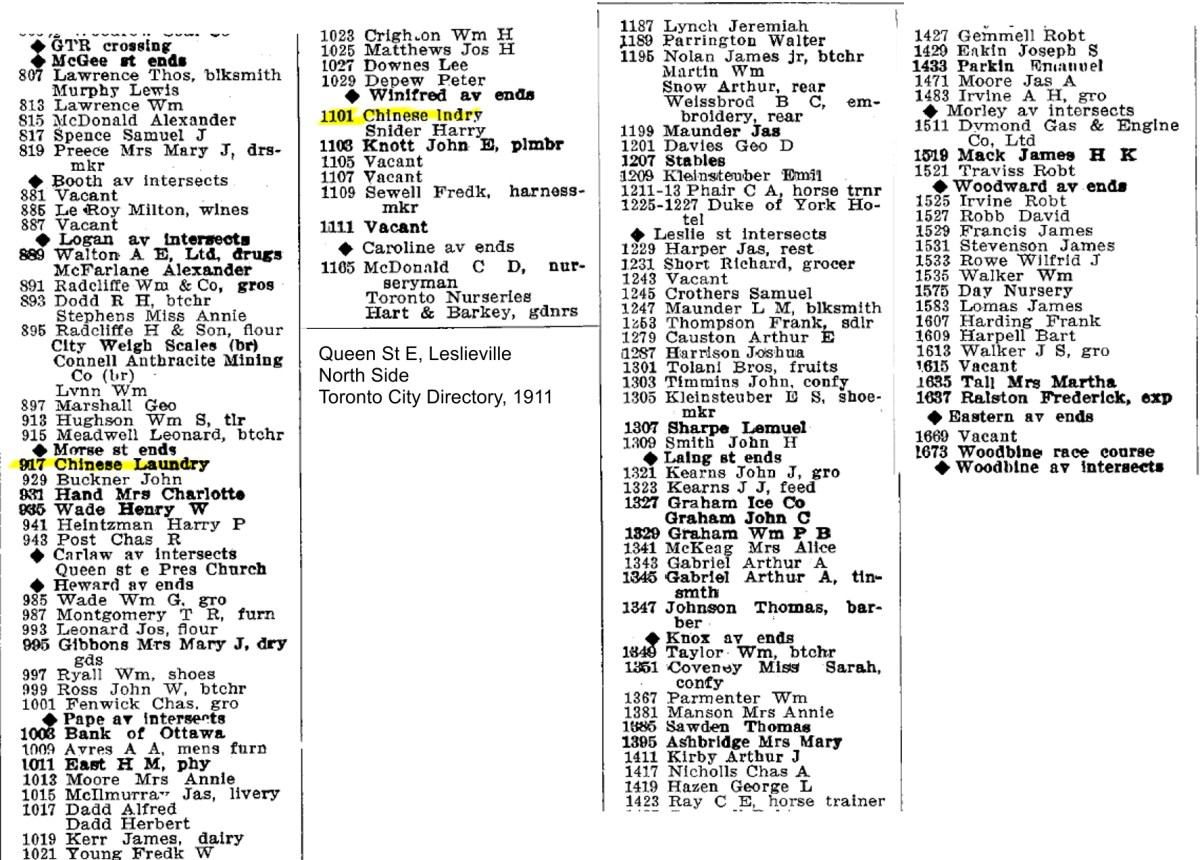
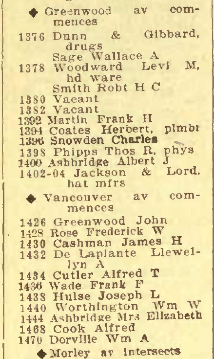
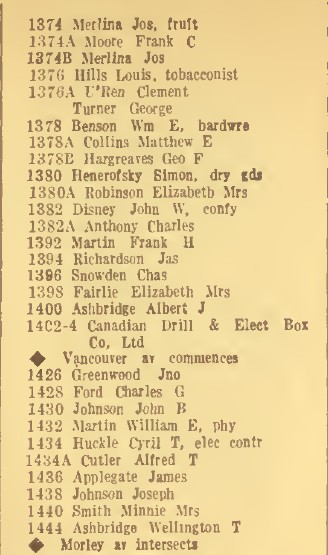
Goad’s Fire Atlas maps have a great deal of detail. For example, take the block of buildings from Vancouver Avenue (formerly Ashport) to Greenwood Avenue, on the north side of Queen Street. When someone planned a subdivision they had to register the plan with the Registry Office and they received a number for their new subdivision. The number 303E is the subdivision number for the storefronts and houses here. There are seven narrow north-south lots, numbered from east to west 1 to 7. 7 is the store on the northeast corner of Greenwood and Queen. The address is also given and for this store it is 1372 Queen Street East. It also tells us the construction of the buildings. Not surprisingly the reddish-brown brick-coloured buildings are brick. The yellowish builds are wooden. The red line in the lower left corner is the water line for a fire hydrant. The fire hydrant is a circle.
So if you wished to research the title for 1372 Queen Street East, you know it is in Concession One, Lot 10, Subdivision Plan 303E, Lot 7. You could also check it in some of the other City Directories.


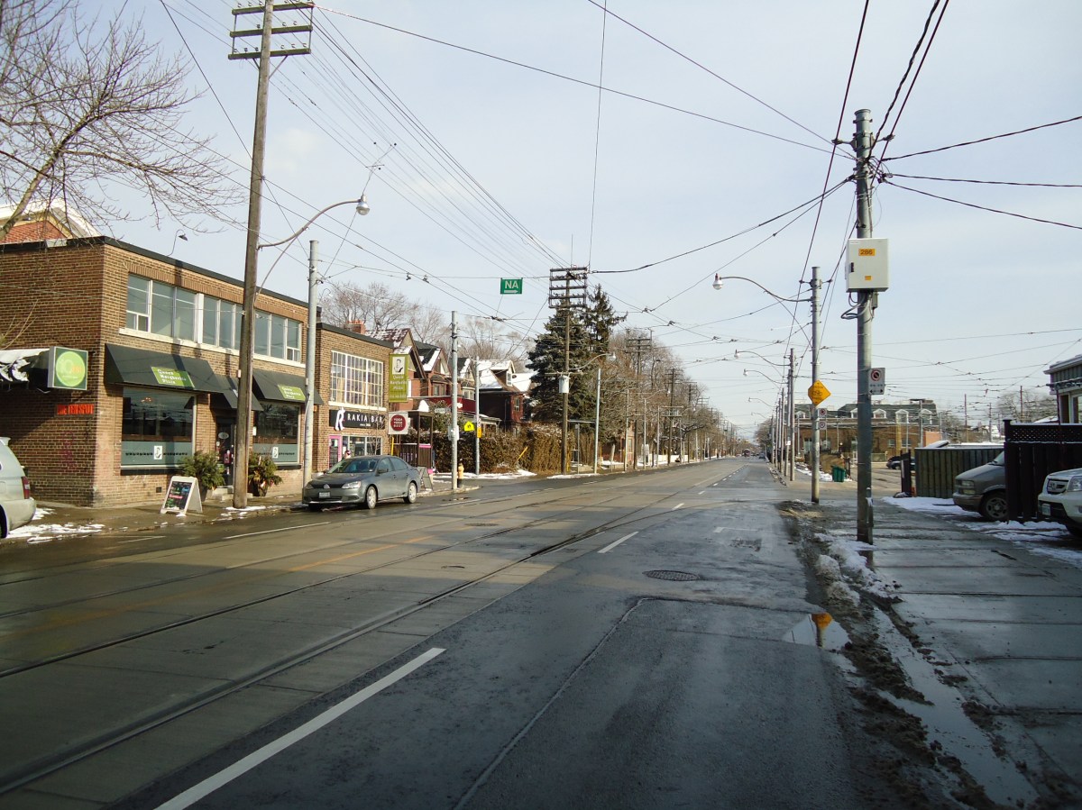
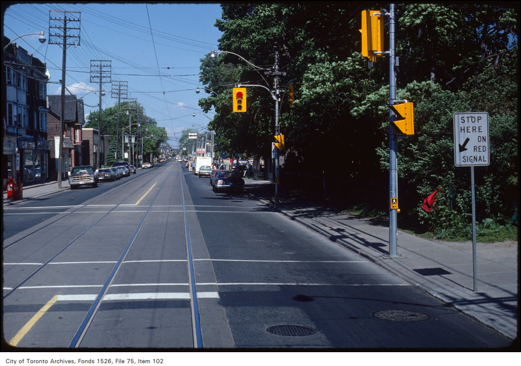 View of Queen Street East at Greenwood Avenue, 1981
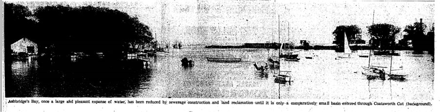
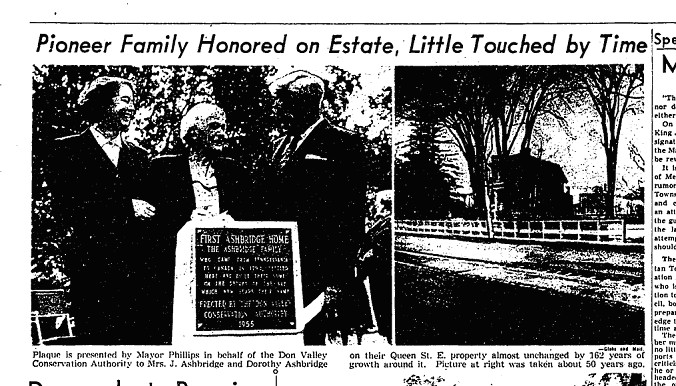
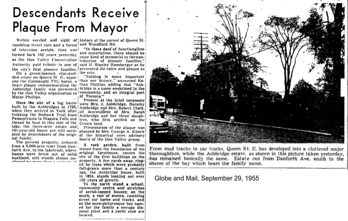
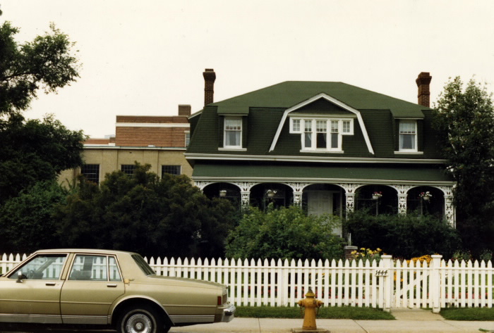
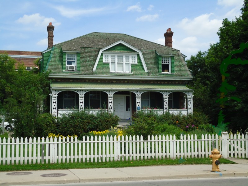
Postscript: The Ashbridge Estate