By Joanne Doucette (liatris52@sympatico.ca)
This posting contains:
- Aerial Photos
- Maps
- Voters list(s)
- City Directories
Aerial Photos
Before and after the construction of Dundas Street East.


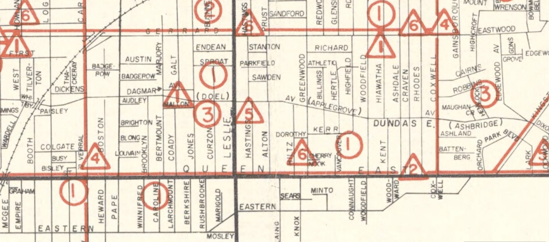
Maps


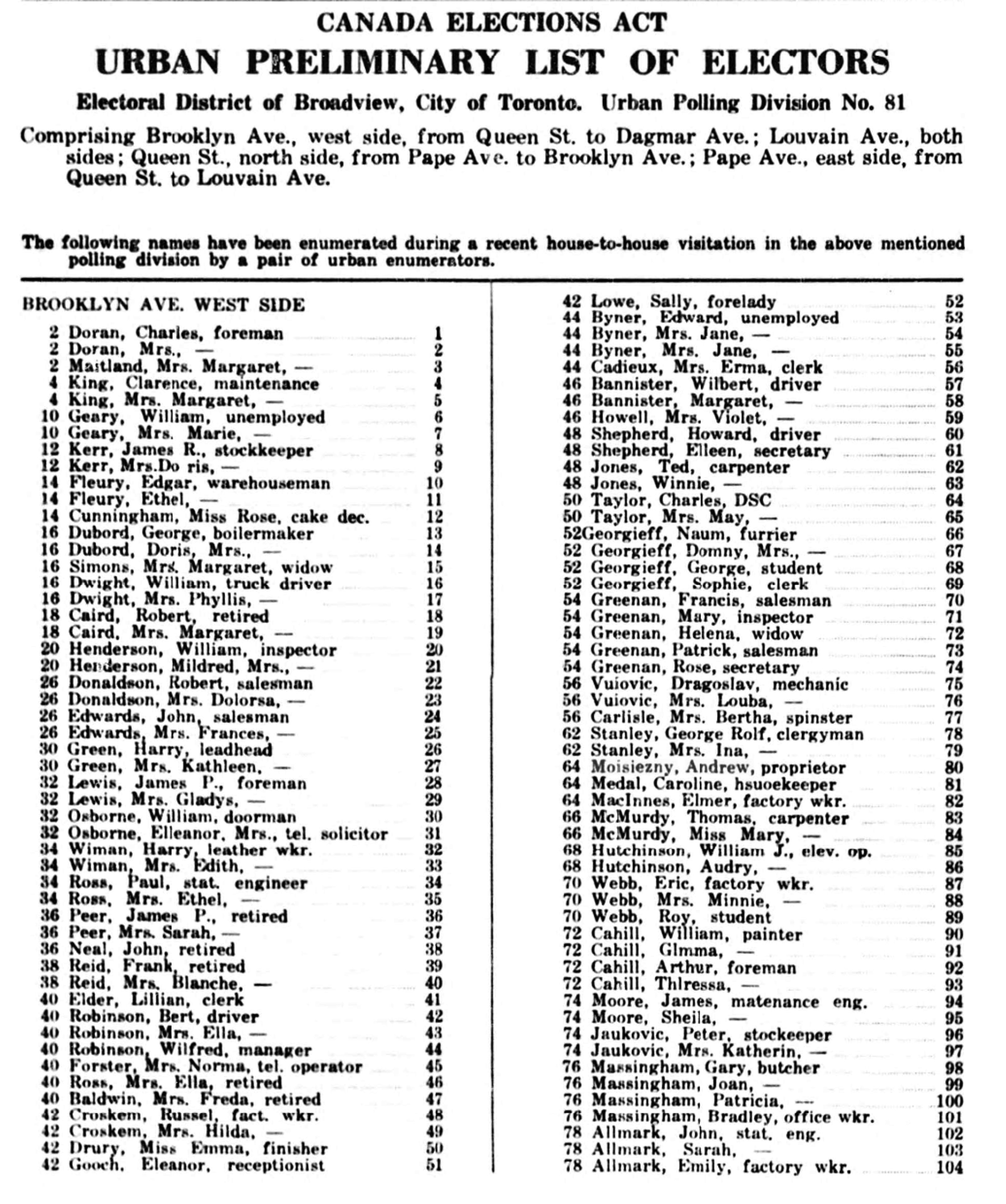
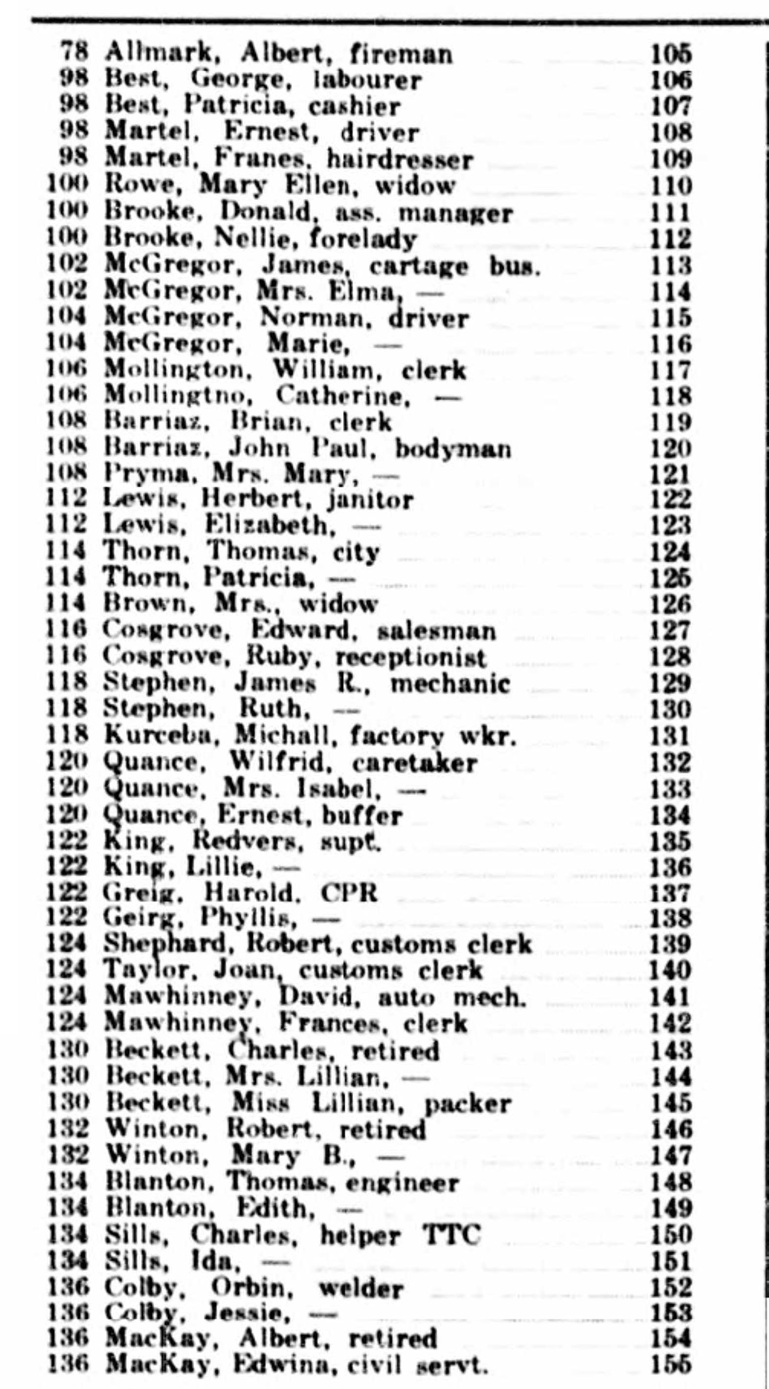
Voters’ Lists


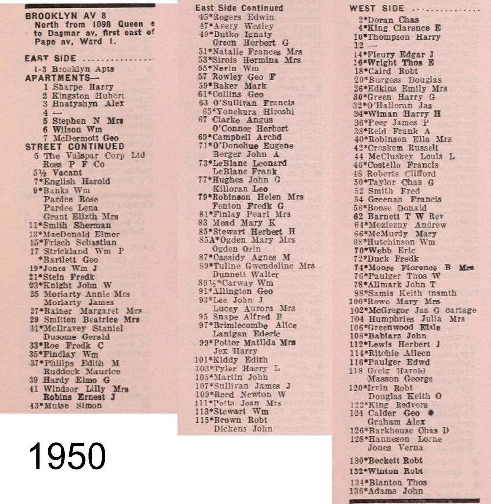
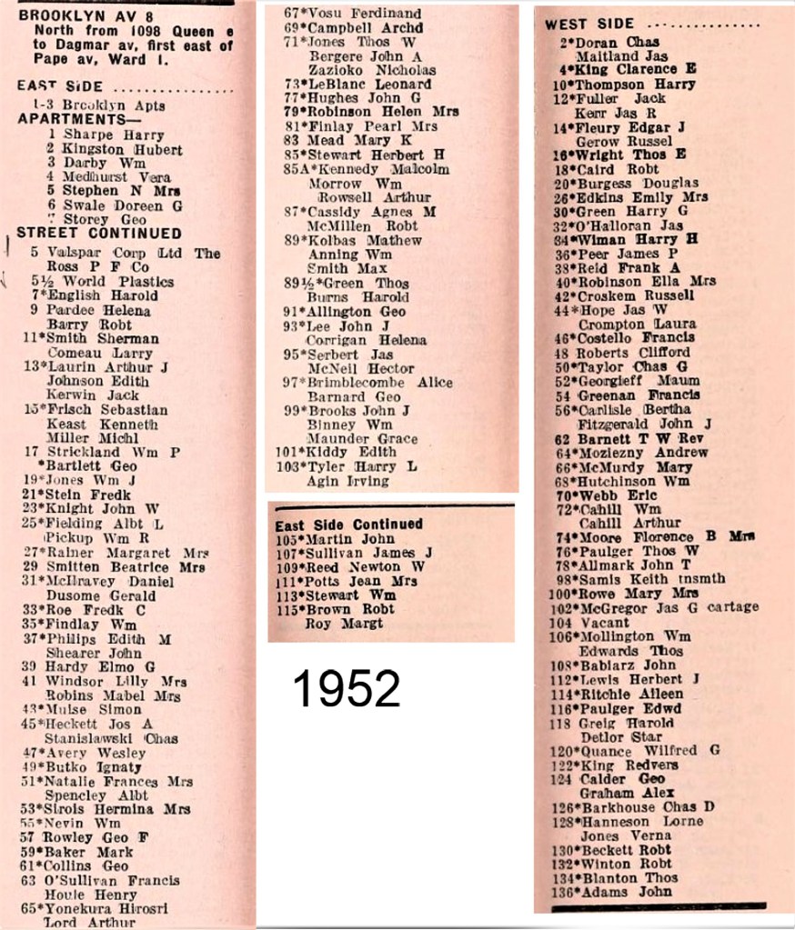
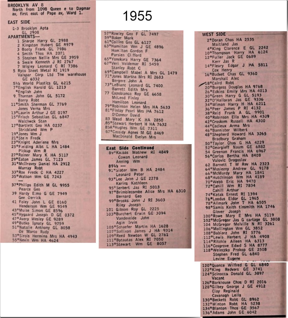
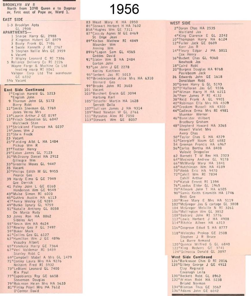
City Directories


By Joanne Doucette (liatris52@sympatico.ca)
This posting contains:
Before and after the construction of Dundas Street East.
