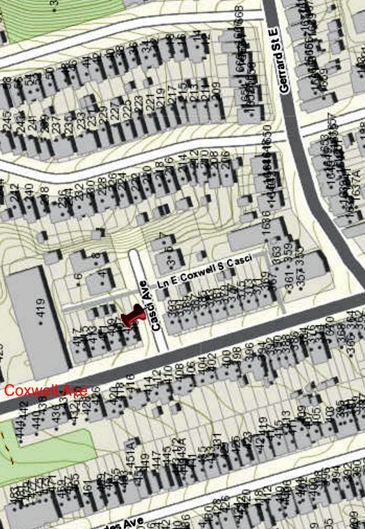
City of Toronto Interactive map Casci Avenue. The contour lines show what an ideal situation this was for a vineyard. The steep south and west facing slopes of the ravine allowed many hours of sunlight to reach Casci’s treasured vines. A branch of Small’s Creek flowed through the ravine, providing clean cool water for irrigation. The east side of the ravine was steep — and still is. But the west side was gentler. Nevertheless, that western slope and the railway embankment sheltered the vineyard from harsh northwesterly winter winds, lengthening the growing season. As far as I can tell, Casci was the first European-Canadian to cultivate this soil so it would have had a thick layer of pine needles and rich soil on top of a sandy subsoil, allowing the drainage vines need to prevent their roots from rotting and fungi attacking the grapes.
